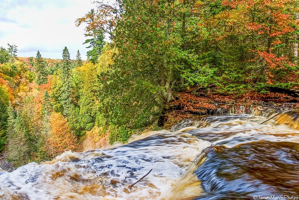
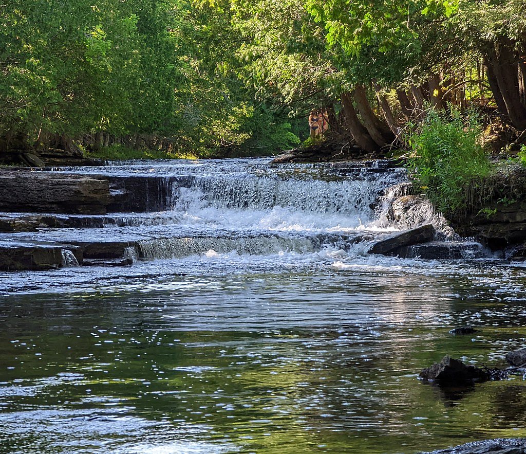
Upper Chocolay Falls
By Armen Suny · Last verified May 2026
Difficulty
Moderate
Trail Length
2.4 miles
Trail Type
Out And Back
Elevation Gain
350 ft
About Upper Chocolay Falls
Upper Chocolay Falls is a tucked-away, scenic cascade on the Chocolay River just outside Marquette, Michigan. Framed by quiet hardwoods, the falls are a pleasant reward for hikers seeking a less-trafficked spot to enjoy the sights and sounds of flowing water in a peaceful woodland setting. The approach follows a 2.4-mile out-and-back route that climbs about 350 feet, so expect a moderately paced hike through shady forest. The route’s moderate rating makes it a good choice for hikers who want a short day-trip with a little workout and a scenic finish — bring sturdy shoes and you’ll be rewarded with a serene waterfall experience away from the crowds.
The Setting
Upper Chocolay Falls sits at 955 feet along the Middle Branch Escanaba River, in the foothills of Michigan.
Nearby Falls Worth Visiting
Laughing Whitefish Falls, the tallest waterfall in Michigan at 100 feet, lies 9.1 miles to the east.
Trail & Hike Details
The Approach
The moderate 2.4-mile out-and-back trail gains 350 feet of elevation on the way to the falls.
Trail Description
This is a 2.4-mile out-and-back trail with roughly 350 feet of elevation gain and a moderate difficulty rating. The path winds through wooded terrain and can include uneven footing, roots, and muddy sections after rain, so robust footwear is recommended. The trail’s length and gain make it suitable for most hikers who are comfortable with a moderate climb; plan on a steady but manageable pace to and from the falls.
What to Expect
Dogs are welcome.
Accessibility
The trail is not wheelchair accessible. Uneven terrain and elevation changes require steady footing.
Frequently Asked Questions
🐶 Are Dogs Allowed at Upper Chocolay Falls?
✅ Dogs are allowed
Are There Any Fees or Permits Required?
🆖 No fees required
🏊 Is There Swimming at Upper Chocolay Falls?
❌ Swimming is not allowed
When to Visit
Spring and early summer are ideal for visiting when water flow is at its peak. Fall offers beautiful foliage, while winter provides a unique frozen waterfall experience.
Seasonal Access
The best time to visit is Spring, Summer, and Fall. Winter access may be limited.
Safety Information
Be cautious of slippery rocks near the waterfall. The trail may be muddy or icy depending on the season. Cell service may be limited in the area.
Current Water Conditions
161 ft³/s
Current discharge — how much water is flowing
About average for this time of year
Based on 57 years of record
1.93 ft
Water depth at gauge
7-Day Discharge Trend
What does this mean for your visit?
Flow is about average for this time of year.
About This Gauge
This gauge is on a nearby waterway and may not reflect exact conditions at the falls.
7-Day Flow Outlook
Based on the USGS gauge MIDDLE BRANCH ESCANABA RIVER NR PRINCETON, MI (19 km away).
Today
Moderate
161 cfs
9/10Tomorrow
Moderate
155 cfs
9/10Mon
Moderate
174 cfs
6/10Tue
Strong
179 cfs
7/10Wed
Strong
192 cfs
7/10Thu
Strong
183 cfs
7/10Fri
Strong
196 cfs
7/10Best window: Today — moderate flow, sunny (trip score 9/10).
Best time of year: this gauge typically runs highest from late March to late June, peaking in April.
How we calculate this
This is a transparent outlook, not a precise forecast. We take the waterfall's current flow strength (how it ranks against its historical normal for today, from the nearest USGS stream gauge), carry that ranking forward along the gauge's seasonal curve, and nudge it for forecast rain. Confidence is highest for the next day or two and falls further out. Always check official conditions and your own judgment before visiting — high flows can be dangerous.
Know when to go.
Get a free email alert when waterfalls near K. I. Sawyer hit peak flow. We only send when conditions are worth the trip — no weekly newsletters, no spam.
Weather Forecast
Location & Access
Getting There
Upper Chocolay Falls is located off a dirt road near the Chocolay River. Access may require navigating unmarked paths or trails, so a map or GPS is recommended.
Get Directions on Google MapsParking
Parking is limited and may involve roadside parking near the trailhead or access point.
Elevation
955 feet above sea level
Coordinates
46.344444° N, -87.251667° W
Visitor Tips & Gear
Bring a map or GPS as the trail may not be well-marked. Wear sturdy shoes, especially after rain, as the trail can be muddy. Bug spray is recommended during warmer months.
As an Amazon Associate, we earn from qualifying purchases.
With 2.4 miles and 350 ft of elevation gain, sturdy boots and trekking poles will help on this moderate trail. Sun exposure on the trail makes good sun protection a must in summer.

Columbia Watertight II Rain Jacket
Packs into its own pocket, seam-sealed, and keeps you dry from spray and surprise rain.

Earth Pak Waterproof Dry Bag
Keeps your phone and gear dry when waterfall mist soaks everything else.

Waterproof Phone Pouch (AiRunTech)
Cheap insurance — take photos right next to the falls without killing your phone.

Timberland Euro Sprint Mid Waterproof
Trusted waterproof boot with premium leather and grippy rubber sole — reliable on rocky, wet trails.

TrailBuddy Trekking Poles
Lightweight aluminum, cork grips, and flip-locks that actually hold — a best-seller for good reason.

Polarized Sunglasses (Knockaround)
Cuts glare off the water so you actually see the falls — and your photos turn out better too.
Where to Stay

Days Inn by Wyndham Marquette

Comfort Suites Marquette

Holiday Inn Marquette by IHG

My Place Hotel-Marquette, MI
Browse vacation cabins and private rentals nearby
Unique outdoor stays — tents, yurts, and treehouses
Rent a campervan or RV for your waterfall road trip
Some links are affiliate links. We may earn a commission at no extra cost to you.
Nearby Campground
Au Train Lake Campground
20 miles away · 34 sites
Overview Located at the south end of AuTrain Lake, this campground is favored by anglers and outdoor enthusiasts. The quiet setting is great for family trips, and visitors can enjoy a variety of recreational opportunities year-round, all less than a day's drive from major urban areas of Michigan and Wisconsin.Recreation The large size of the lake provides miles of prime water skiing, boating, swimming and fishing. Anglers can expect a healthy catch of bass and a variety of perch. Canoeing is also
Book on Recreation.govAdditional Information
Nearby Attractions
Marquette, Michigan offers additional attractions such as Presque Isle Park, Sugarloaf Mountain, and other waterfalls like Dead River Falls.
Wildlife
The area is home to various wildlife, including birds, deer, and small mammals. Be cautious of ticks and other insects during warmer months.
Cities near Upper Chocolay Falls
Nearby Waterfalls
Writing about Upper Chocolay Falls? Embed this waterfall on your site for free.