Photo Credits (4)
About Whitefish Falls
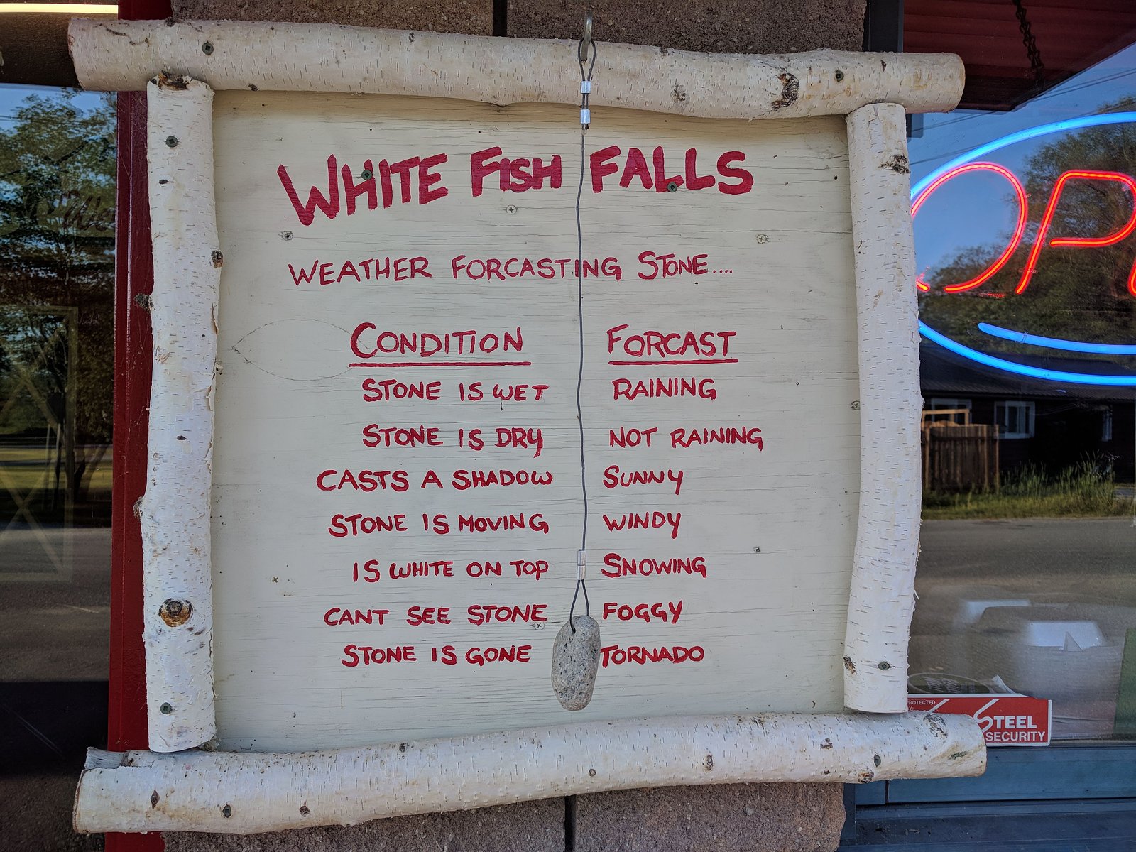
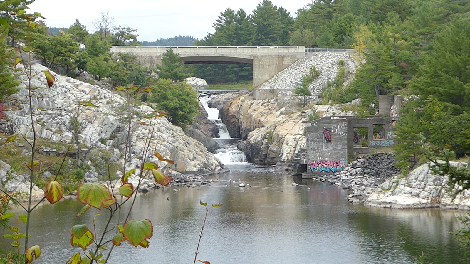
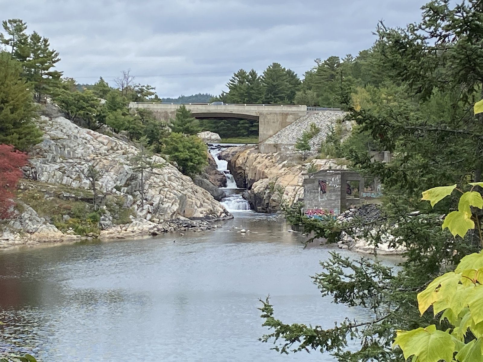
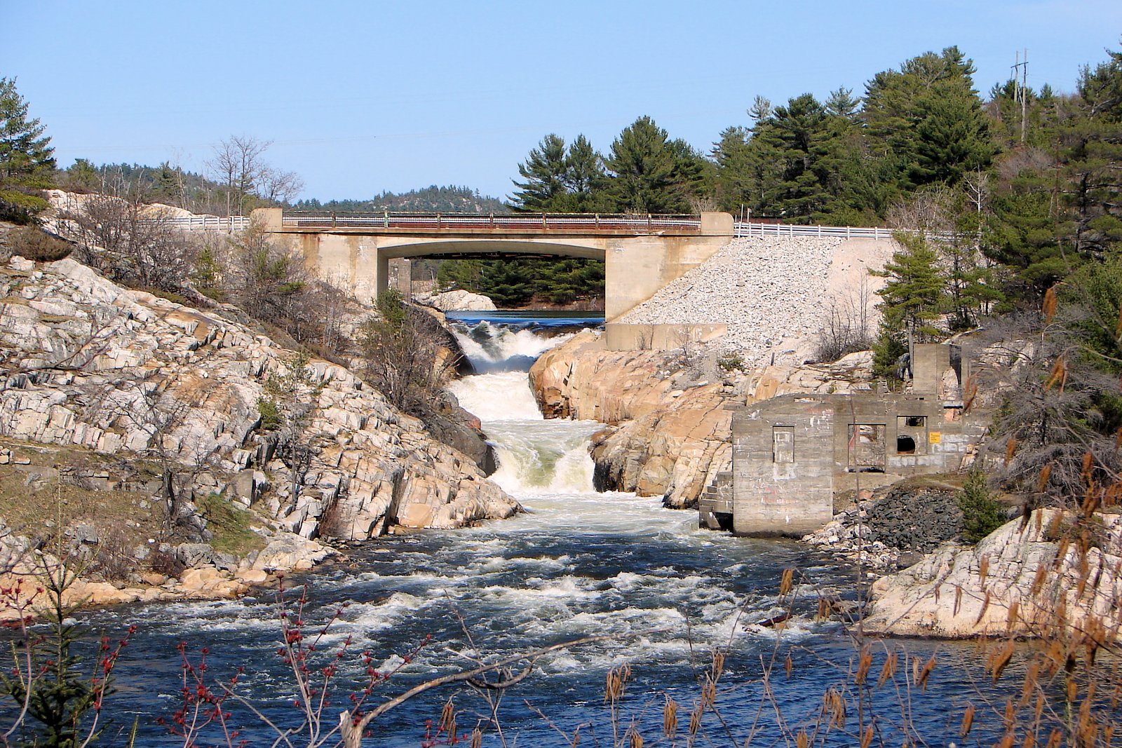
Whitefish Falls (near Chapleau, ON) is a remote northern Ontario waterfall located at approximately 48.3568, -83.6731, on a tributary in the Chapleau area. Exact published information on the falls is limited; reports indicate it is in a sparsely developed, forested region typical of the Chapleau Crown Lands. Access is often via secondary roads or trails and conditions may vary seasonally. Visitors should expect a natural, undeveloped site rather than a maintained park facility.
The Setting
Whitefish Falls sits at 342 metres within Missinaibi Provincial Park, in the foothills of Ontario.
Why This Waterfall Exists
Whitefish Falls flows over hard intrusive rock, primarily granodiorite and tonalite, laid down over 2.5-3.2 billion years ago. These resistant rocks form a durable ledge that water cannot easily wear away, creating the falls where softer material downstream has already eroded.
Trail & Hike Details
Trail Description
Specific trail descriptions for this Whitefish Falls are not well documented. Access may involve a short walk from a roadside pullout, a logging-road approach, or bushwhacking through mixed forest and shoreline. Trails (if present) are likely unmaintained and can be uneven, muddy, and overgrown in places. Expect roots, rocks and possibly wet or boggy sections near the stream.
What to Expect
A natural, undeveloped waterfall in a remote northern Ontario setting. Sparse visitor infrastructure, limited or no signage, and variable trail conditions. Seasonal changes strongly affect flow and access: higher flows in spring (snowmelt) and lower flows in late summer. Mosquitoes and blackflies are common in warmer months; winter approaches may require snowmobile, snowshoe, or ski travel and will present icy/frozen conditions.
Accessibility
Access is likely not wheelchair-accessible. Trails (if any) are probably primitive, uneven and may include natural obstacles. Expect limited or no accessibility features.
Frequently Asked Questions
🐶 Are Dogs Allowed at Whitefish Falls?
❌ Dogs are not allowed
Are There Any Fees or Permits Required?
🆖 No fees required
🏊 Is There Swimming at Whitefish Falls?
❌ Swimming is not allowed
When to Visit
Late spring to early summer for higher flows (after snowmelt) and late summer/early fall for more stable, drier trails. Winter visits are possible but require appropriate winter travel skills and equipment and bring extra caution for ice and extreme cold.
Seasonal Access
The best time to visit is Spring, Summer, Fall, and Winter. Check with Missinaibi Provincial Park for current conditions.
Safety Information
This is a remote, undeveloped site. Hazards include: limited cell coverage, variable and poor road/trail conditions, slippery rocks near the falls, cold water and strong currents, seasonal ice, biting insects in warm months, and potential wildlife encounters. Carry navigation tools, extra supplies, and inform someone about your plans. If traveling on forestry roads, obey gates and posted closures. Be especially cautious in spring when flows and currents can be unexpectedly strong.
Know when to go.
Get a free email alert when waterfalls near Chapleau hit peak flow. We only send when conditions are worth the trip — no weekly newsletters, no spam.
Weather Forecast
Location & Access
Getting There
The falls are located roughly 37 miles (about 60 km) from the town of Chapleau by road as noted; final access likely requires travel on secondary/forestry roads and possibly short off-road walking. Expect limited signage. Use of a high-clearance vehicle or 4x4 may be advisable depending on road conditions. Confirm local road status and ownership before traveling.
Get Directions on Google MapsParking
Parking is likely informal (roadside pullout or small clearing). There is probably no formal parking lot, vault toilets, or other developed amenities. Park well off the travel lane and avoid blocking forestry gates or private driveways.
Elevation
342 metres above sea level
Coordinates
48.356815° N, -83.673086° W
Land Management
Managed by Ontario Parks
Visitor Tips & Gear
• Tell someone your route and expected return time, this area has limited cell coverage. • Check local forestry road status and gate closures before you go. • Wear sturdy footwear and insect protection in spring/summer. • Carry a map, compass/GPS, do not rely solely on phone navigation. • Respect private property and posted signs; some trails/approaches may cross leased land. • Avoid approaching wet or icy rock faces; falls and plunge pools can have undercut banks and strong currents.
Where to Stay
Browse vacation cabins and private rentals nearby
Unique outdoor stays — tents, yurts, and treehouses
Rent a campervan or RV for your waterfall road trip
Some links are affiliate links. We may earn a commission at no extra cost to you.
Additional Information
Nearby Attractions
The town of Chapleau (services, fuel) is the nearest community. The broader region includes extensive Crown lands, provincial parks and wilderness areas popular for fishing, hunting and canoeing; specific nearby named parks should be checked on provincial maps.
Wildlife
Typical northern Ontario wildlife may be present, including moose, black bear, white-tailed deer, wolves, beaver, and a variety of bird species. Take standard precautions for bear and moose encounters, store food securely, and maintain distance from wildlife.
Cities near Whitefish Falls
Other waterfalls named Whitefish Falls
2 other waterfalls share this name across Canada.
Writing about Whitefish Falls? Embed this waterfall on your site for free.