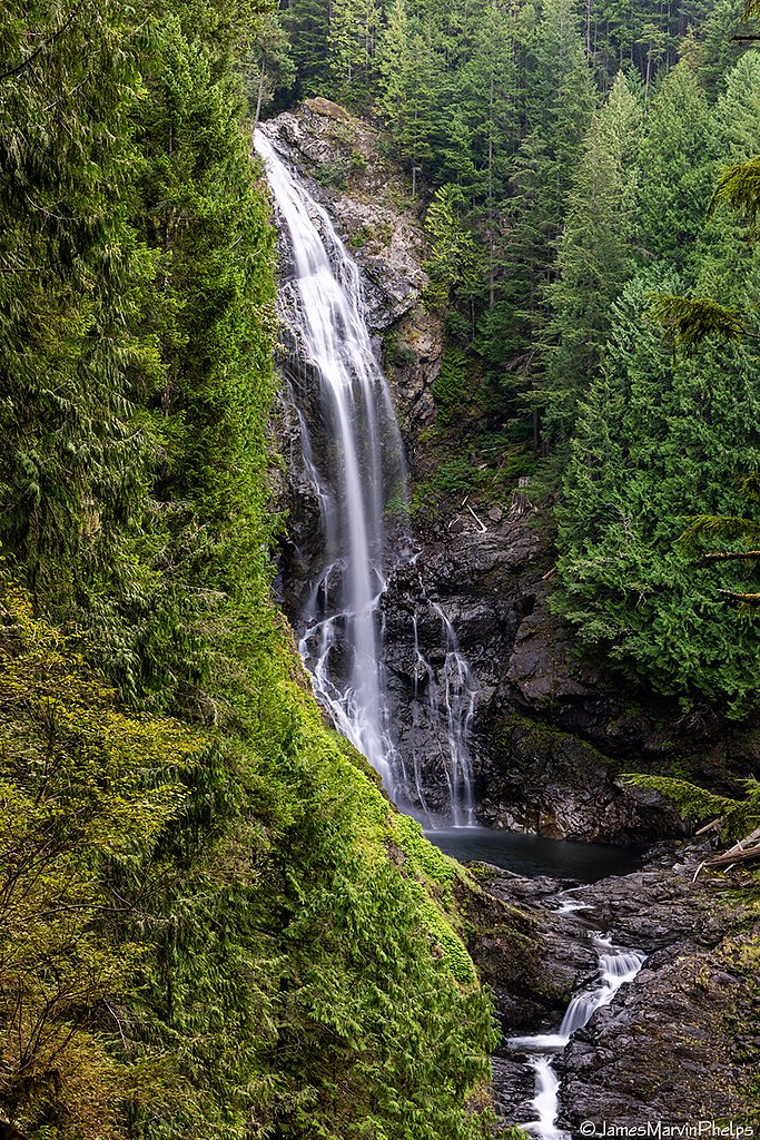
Wallace Falls
Washington • 265 ft
By Armen Suny · Last verified Mar 2026
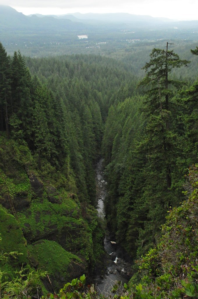
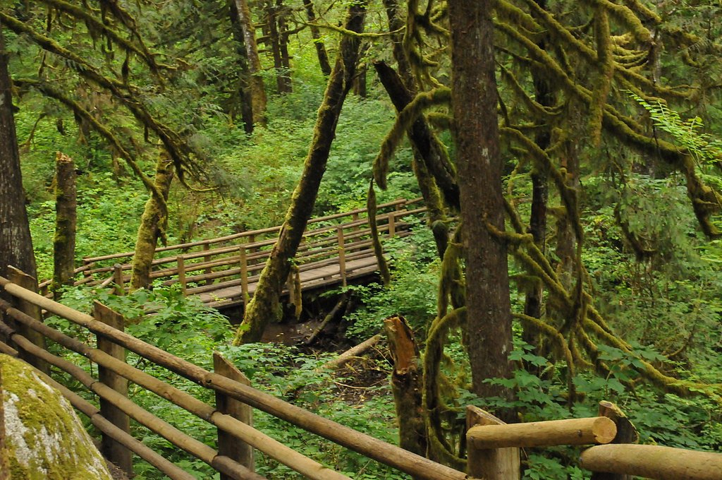
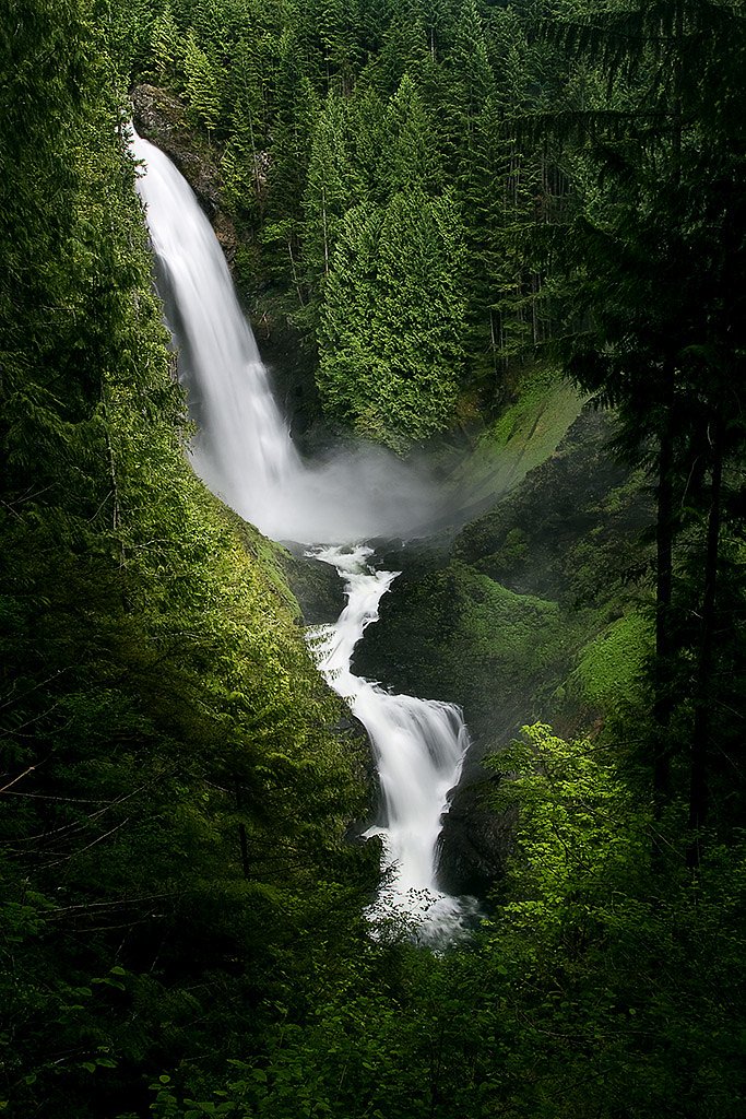

Photo Credits (5)
Difficulty
Moderate
Trail Length
5.6 miles
Trail Type
Out And Back
Elevation Gain
1,300 ft
About Wallace Falls
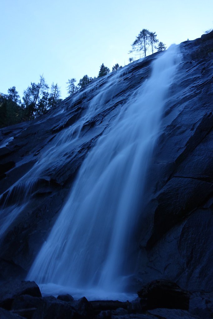
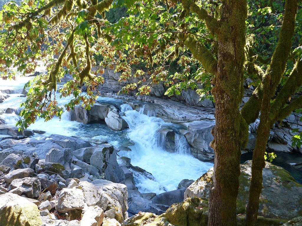
Wallace Falls is a stunning multi-tiered waterfall located in Wallace Falls State Park, Washington. It is one of the most popular waterfalls in the state, offering breathtaking views of the falls and surrounding forested areas.
The Setting
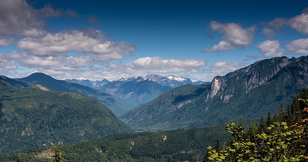
Wallace Falls sits at 1,237 feet within Wallace Falls, fed by the Wallace River, in the foothills of Washington. At 265 feet, it is among the taller waterfalls in Washington.
Height: 265 feet
Nearby Falls Worth Visiting
Bridal Veil Falls (100 ft) lies 6.9 miles to the southeast.
Trail & Hike Details
The Approach
The moderate 5.6-mile out-and-back trail gains 1,300 feet of elevation on the way to the falls.
Trail Description
The trail to Wallace Falls is well-maintained and offers a mix of forested paths and scenic viewpoints. The hike passes through lush evergreen forests, with several viewpoints to see the Lower, Middle, and Upper Falls. The Middle Falls viewpoint is particularly popular for its panoramic views.
What to Expect
The falls plunge 265 feet. Dogs are welcome.
Accessibility
The trail involves steep, uneven terrain with significant elevation change and is not accessible to mobility devices.
Frequently Asked Questions
🐶 Are Dogs Allowed at Wallace Falls?
✅ Dogs are allowed
Are There Any Fees or Permits Required?
🤑 Fee: $10.00
🏊 Is There Swimming at Wallace Falls?
❌ Swimming is not allowed
When to Visit
Spring and early summer are the best times to visit, as the falls are at their fullest due to snowmelt. Fall offers beautiful foliage, while winter provides a quieter experience, though trails may be icy.
Seasonal Access
The best time to visit is Spring, Summer, Fall, and Winter.
Safety Information
The trail can be slippery, especially after rain. Stay on marked trails and avoid getting too close to the edge near the falls. Bring appropriate gear for changing weather conditions.
Current Water Conditions
49 ft³/s
Current discharge — how much water is flowing
Lower than usual for this time of year
Based on 57 years of record
1.94 ft
Water depth at gauge
7-Day Discharge Trend
What does this mean for your visit?
Flow is lower than usual for this time of year.
About This Gauge
7-Day Flow Outlook
Based on the USGS gauge WALLACE RIVER AT GOLD BAR, WA (3 km away).
Today
Low
56 cfs
3/10Tomorrow
Low
56 cfs
4/10Sun
Low
55 cfs
4/10Mon
Low
51 cfs
4/10Tue
Low
50 cfs
4/10Wed
Low
51 cfs
4/10Thu
Low
45 cfs
4/10Best window: Tomorrow — low flow, light rain likely (trip score 4/10).
Best time of year: this gauge typically runs highest from late April to mid June, peaking in May.
How we calculate this
This is a transparent outlook, not a precise forecast. We take the waterfall's current flow strength (how it ranks against its historical normal for today, from the nearest USGS stream gauge), carry that ranking forward along the gauge's seasonal curve, and nudge it for forecast rain. Confidence is highest for the next day or two and falls further out. Always check official conditions and your own judgment before visiting — high flows can be dangerous.
Know when to go.
Get a free email alert when waterfalls near May Creek hit peak flow. We only send when conditions are worth the trip — no weekly newsletters, no spam.
Weather Forecast
Location & Access
Getting There
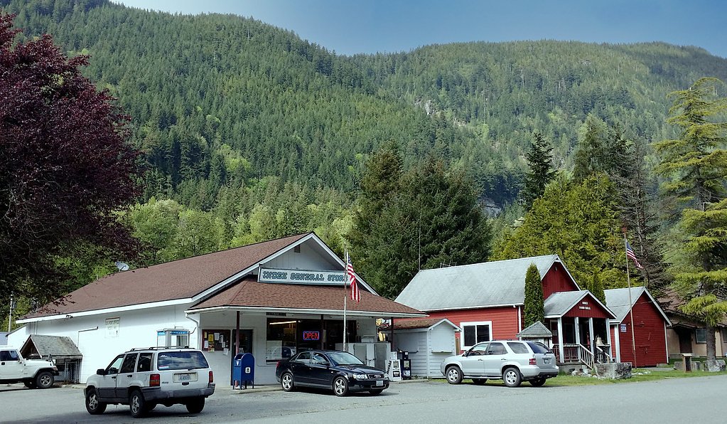
Wallace Falls is located in Wallace Falls State Park, near the town of Gold Bar, Washington. The trailhead is easily accessible via Highway 2, with clear signage directing visitors to the park.
Get Directions on Google MapsParking
There is a designated parking lot at Wallace Falls State Park. Parking can fill up quickly, especially on weekends and holidays, so arriving early is recommended. A Discover Pass is required for parking.
Elevation
1,237 feet above sea level
Coordinates
47.873159° N, -121.649004° W
Land Management
Managed by SPR
Visitor Tips & Gear
Arrive early to secure parking and avoid crowds. Wear sturdy hiking shoes, especially during wet conditions. Bring water and snacks, as there are no facilities along the trail. A Discover Pass is required for parking, so purchase one in advance if needed.
As an Amazon Associate, we earn from qualifying purchases.
With 5.6 miles and 1,300 ft of elevation gain, sturdy boots and trekking poles will help on this moderate trail. Icy conditions are common in winter — traction cleats are a smart addition.

Columbia Watertight II Rain Jacket
Packs into its own pocket, seam-sealed, and keeps you dry from spray and surprise rain.

Polarized Sunglasses (Knockaround)
Cuts glare off the water so you actually see the falls — and your photos turn out better too.

Earth Pak Waterproof Dry Bag
Keeps your phone and gear dry when waterfall mist soaks everything else.

Waterproof Phone Pouch (AiRunTech)
Cheap insurance — take photos right next to the falls without killing your phone.

Timberland Euro Sprint Mid Waterproof
Trusted waterproof boot with premium leather and grippy rubber sole — reliable on rocky, wet trails.

TrailBuddy Trekking Poles
Lightweight aluminum, cork grips, and flip-locks that actually hold — a best-seller for good reason.
Where to Stay

Dutch Cup Motel

Unique Stylish Place Downtown Monroe! #104

Walk to Skykomish River: Wooded Escape w/ Fire Pit

Pacific Bin - Hot Tub, Secluded Forest Getaway
Browse vacation cabins and private rentals nearby
Unique outdoor stays — tents, yurts, and treehouses
Rent a campervan or RV for your waterfall road trip
Some links are affiliate links. We may earn a commission at no extra cost to you.
Nearby Campground
San Juan Campground
13.1 miles away · 0 sites
A nice combination of sun and shade, this campground offers exploration of the North Fork of the Skykomish river when you're not sitting by the campfire roasting marshmallows.
Book on Recreation.govNearby Hot Springs
Hot springs near May Creek, Washington
Garland Mineral Springs
Garland Mineral Springs flows at 84 degrees in the Snoqualmie National Forest, producing water 39.6 degrees above ambient tempe...
Scenic Hot Springs
Scenic Hot Springs delivers genuinely hot water at 122 degrees Fahrenheit at 2,246 feet elevation in the Cascade Mountains near...
Goldmeyer Hot Springs
Goldmeyer Hot Springs emerges at 127 degrees in the central Cascades, producing water 78.9 degrees above ambient temperature at...
Kennedy Hot Spring
Kennedy Hot Spring flows at 100 degrees at 3,520 feet elevation in the Mt. Baker National Forest, emerging 58.7 degrees above a...
Lester Hot Springs
This 120-degree spring sits within the City of Tacoma Watershed at 1,582 feet elevation, emerging 72.3 degrees above ambient in...
Gamma Hot Springs
Gamma Hot Springs produces 140-degree water at 5,397 feet elevation in the Mt. Baker National Forest, emerging 104.6 degrees ab...
Looking for a soak after your hike? Explore more hot springs near May Creek, Washington on SoakingSprings.
Explore Washington springsAdditional Information
Nearby Attractions
Nearby attractions include Stevens Pass, Lake Serene, and Bridal Veil Falls, all offering additional hiking opportunities.
Wildlife
The area is home to a variety of wildlife, including deer, birds, and small mammals. Visitors should be cautious of bears and cougars, though sightings are rare.
Cities near Wallace Falls
Nearby Waterfalls
Other waterfalls named Wallace Falls
2 other waterfalls share this name across the U.S.
Writing about Wallace Falls? Embed this waterfall on your site for free.