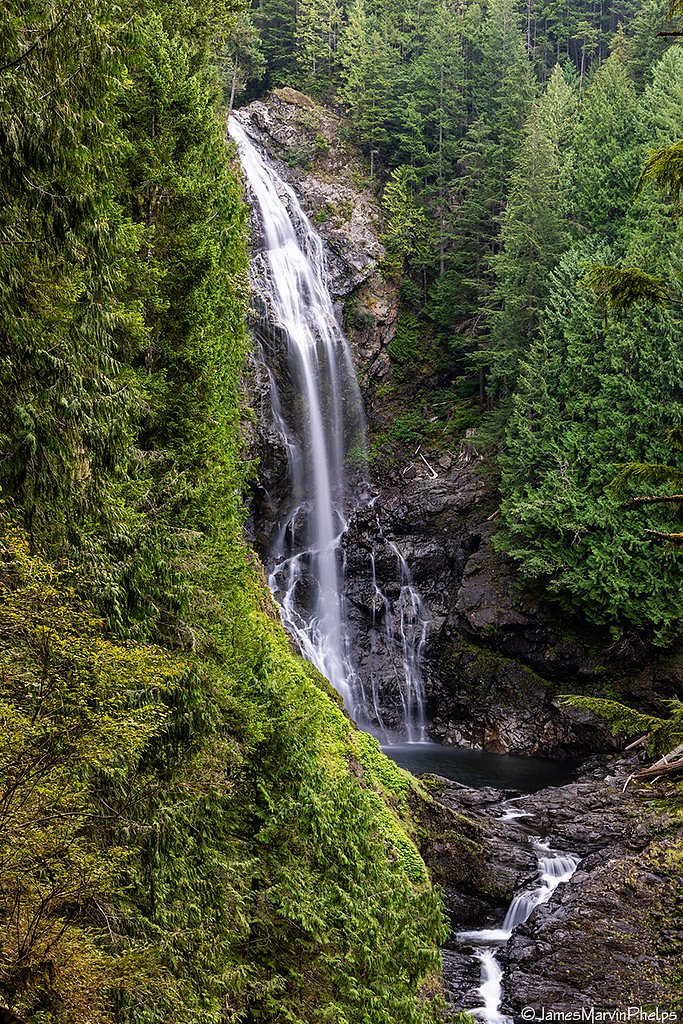
Eagle Falls
By Armen Suny · Last verified Mar 2026
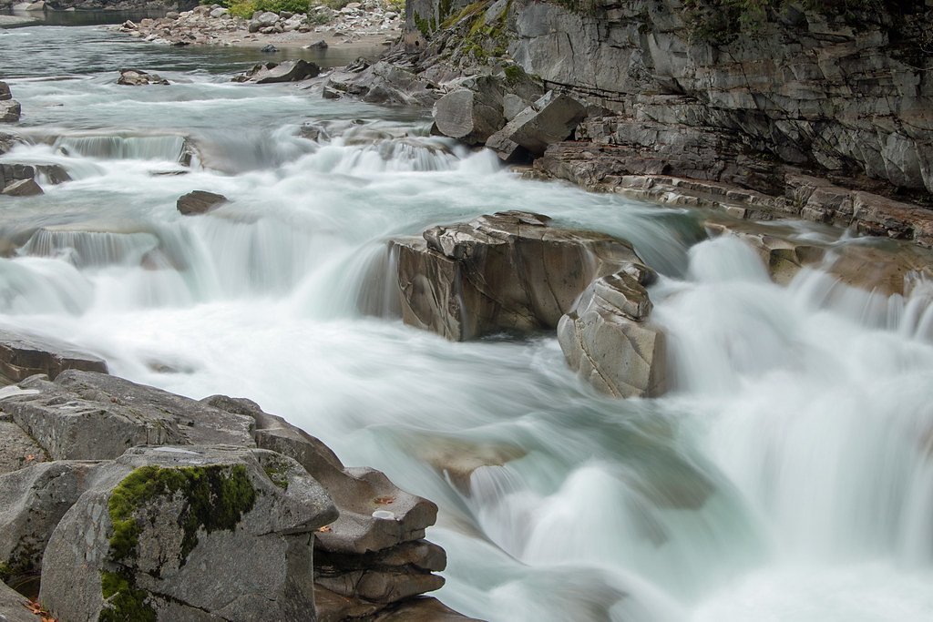
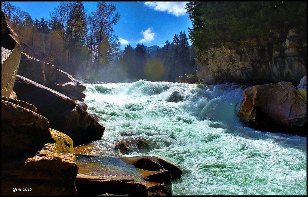
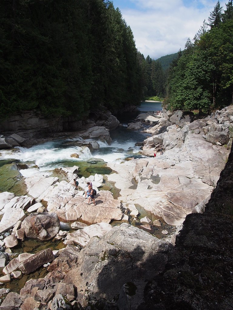
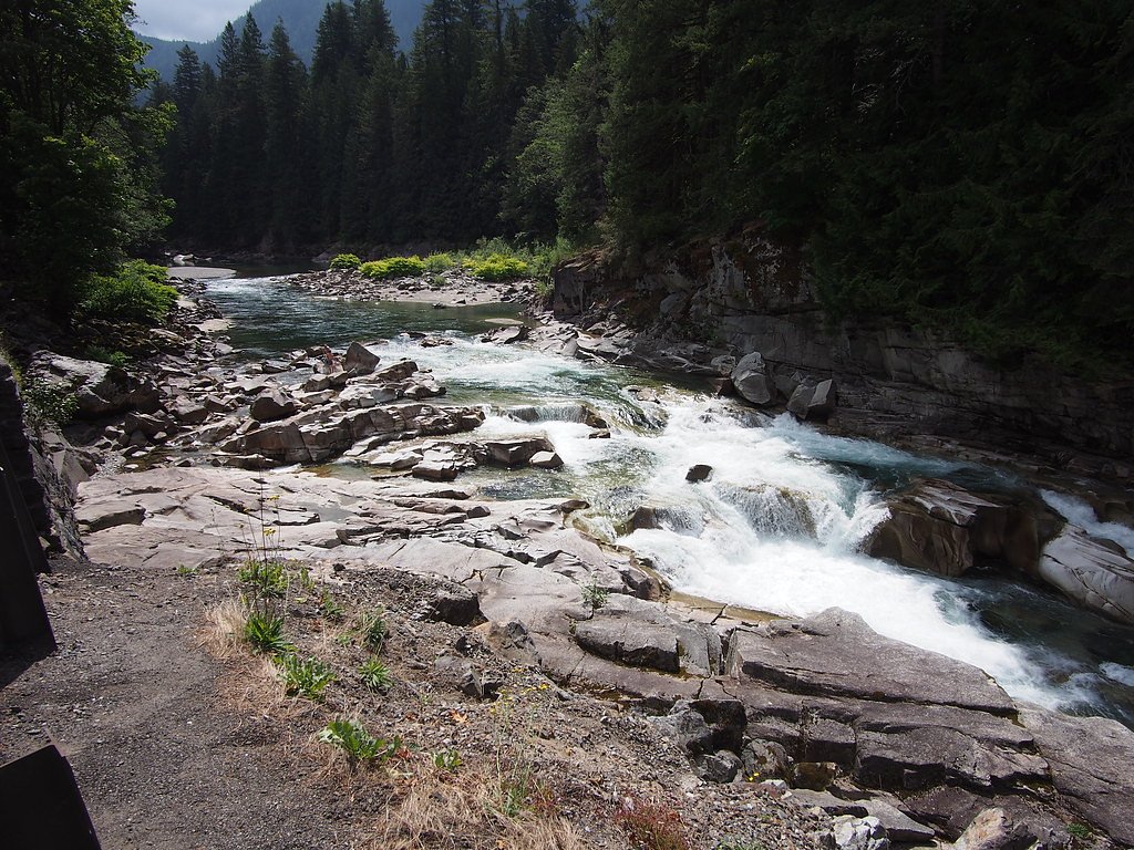
Photo Credits (5)
Difficulty
Moderate
Trail Length
2.4 miles
Trail Type
Out And Back
Elevation Gain
350 ft
About Eagle Falls
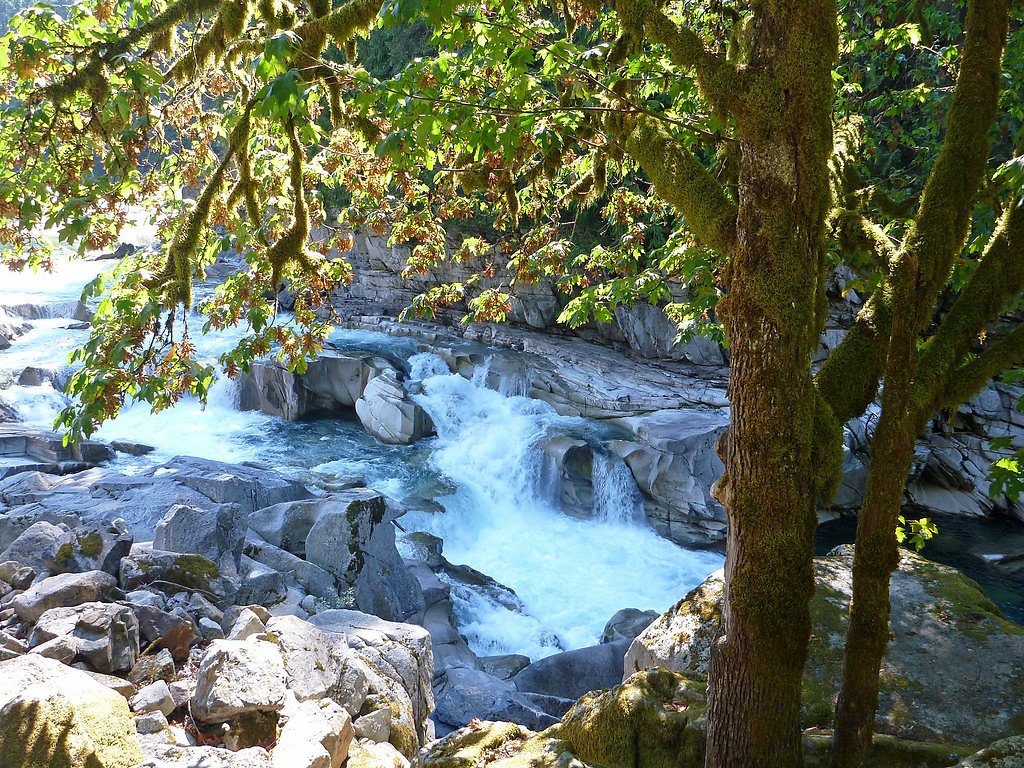
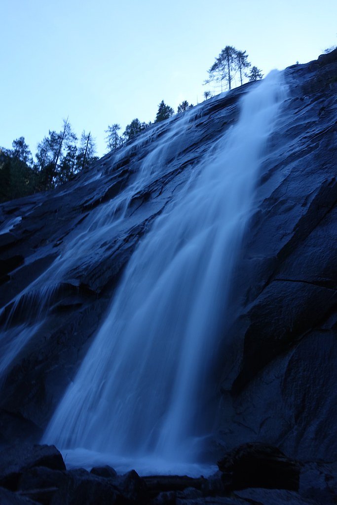
Eagle Falls is the uppermost waterfall on the South Fork Skykomish River, located downstream from the town of Baring. The falls plunge about 25 feet in a broad, high-volume cascade that carves through densely forested slopes, creating an often-photogenic ribbon of roaring water framed by old-growth trees. Nestled within the Snoqualmie National Forest and managed by the U.S. Forest Service, Eagle Falls is a compact but dramatic river attraction that rewards a short hike with a powerful view of the Skykomish watershed.
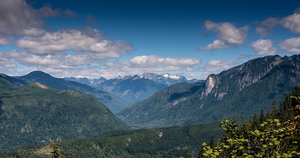
The Setting
Eagle Falls sits at 682 feet within Snoqualmie National Forest, fed by the South Fork Tolt River, in the foothills of Washington.
Nearby Falls Worth Visiting
Wallace Falls (265 ft) lies 8.2 miles to the northwest. Also nearby: Bridal Veil Falls (100 ft, 2.5 mi).
Trail & Hike Details
The Approach
The moderate hike follows Heybrook Lookout Trail (#1070), a 2.4-mile out-and-back trail over natural surface. Expect 350 feet of elevation gain with grades of 12-20%. The trail is developed (Class 3).
USFS Trail
HEYBROOK LOOKOUT TRAIL #1070
Trail Class
Developed
Surface
Avg Grade
USFS Segment
1.12 miTrail Description
The usual approach is an out-and-back route of about 2.4 miles total with roughly 350 feet of elevation gain; difficulty is rated moderate. The access follows the USFS Heybrook Lookout Trail (Trail #1070), which is recorded in GIS at 1.12 miles. The Forest Service lists the trail as Class 3 with a NAT (native material) surface and a typical grade of 12–20%, so expect natural tread, some uneven ground, and short steep pitches. Sturdy footwear is recommended for this relatively brief but occasionally rugged hike.
What to Expect
Dogs are welcome.
Accessibility
The trail is not wheelchair accessible. Uneven terrain and elevation changes require steady footing.
Frequently Asked Questions
🐶 Are Dogs Allowed at Eagle Falls?
✅ Dogs are allowed
Are There Any Fees or Permits Required?
🆖 No fees required
🏊 Is There Swimming at Eagle Falls?
❌ Swimming is not allowed
When to Visit
Spring and early summer are the best times to visit, as the water flow is strongest during this period. Fall offers beautiful foliage, while winter may provide a quieter experience, though conditions can be icy.
Seasonal Access
The best time to visit is Spring, Summer, and Fall. Winter access may be limited. Check with Snoqualmie National Forest for seasonal road closures.
Safety Information
Exercise caution near the water, as the rocks can be slippery and the currents are strong. Avoid swimming or wading in the river. Be mindful of traffic when parking and walking along the highway.
Current Water Conditions
8 ft³/s
Current discharge — how much water is flowing
Much lower than usual for this time of year
Based on 62 years of record
0.80 ft
Water depth at gauge
50°F
WarmVery comfortable
7-Day Discharge Trend
What does this mean for your visit?
Flow is well below normal for this time of year, so the waterfall may be a trickle. Water temperature is very cold at 50 degrees F, expect numbness within minutes. Expect crystal clear visibility.
Water Quality
Water Clarity
Crystal clearExcellent visibility
About This Gauge
This gauge is on a nearby waterway and may not reflect exact conditions at the falls.
7-Day Flow Outlook
Based on the USGS gauge SOUTH FORK TOLT RIVER NEAR INDEX, WA (12 km away).
Today
Barely Flowing
8 cfs
5/10Tomorrow
Barely Flowing
8 cfs
5/10Tue
Barely Flowing
7 cfs
5/10Wed
Barely Flowing
7 cfs
5/10Thu
Barely Flowing
8 cfs
3/10Fri
Low
8 cfs
4/10Sat
Low
8 cfs
4/10Best window: Today — barely flowing flow, sunny (trip score 5/10).
Best time of year: this gauge typically runs highest from late April to late June, peaking in May.
How we calculate this
This is a transparent outlook, not a precise forecast. We take the waterfall's current flow strength (how it ranks against its historical normal for today, from the nearest USGS stream gauge), carry that ranking forward along the gauge's seasonal curve, and nudge it for forecast rain. Confidence is highest for the next day or two and falls further out. Always check official conditions and your own judgment before visiting — high flows can be dangerous.
Know when to go.
Get a free email alert when waterfalls near Baring hit peak flow. We only send when conditions are worth the trip — no weekly newsletters, no spam.
Weather Forecast
Location & Access
Getting There
Eagle Falls is located off Highway 2, approximately 2 miles west of the town of Index, Washington. The falls are easily accessible from the road, with a short walk required to reach the best viewing areas.
Get Directions on Google MapsParking
There is limited roadside parking available near the falls. Visitors should exercise caution when parking and walking along the highway.
Elevation
682 feet above sea level
Coordinates
47.795661° N, -121.513995° W
Land Management
Managed by USFS
Visitor Tips & Gear
Arrive early to secure parking, especially during weekends and peak seasons. Be cautious near the water, as the rocks can be slippery, and the currents are strong. Avoid swimming in the area due to safety concerns.
As an Amazon Associate, we earn from qualifying purchases.
With 2.4 miles and 350 ft of elevation gain, sturdy boots and trekking poles will help on this moderate trail. Sun exposure on the trail makes good sun protection a must in summer.

Polarized Sunglasses (Knockaround)
Cuts glare off the water so you actually see the falls — and your photos turn out better too.

Columbia Watertight II Rain Jacket
Packs into its own pocket, seam-sealed, and keeps you dry from spray and surprise rain.

Earth Pak Waterproof Dry Bag
Keeps your phone and gear dry when waterfall mist soaks everything else.

Waterproof Phone Pouch (AiRunTech)
Cheap insurance — take photos right next to the falls without killing your phone.

Timberland Euro Sprint Mid Waterproof
Trusted waterproof boot with premium leather and grippy rubber sole — reliable on rocky, wet trails.

TrailBuddy Trekking Poles
Lightweight aluminum, cork grips, and flip-locks that actually hold — a best-seller for good reason.
Where to Stay

Moon River Suites #5

Walk to Skykomish River: Wooded Escape w/ Fire Pit

Dutch Cup Motel

Luxury A-Frame with Hot Tub, Fireplace & Firepit
Browse vacation cabins and private rentals nearby
Unique outdoor stays — tents, yurts, and treehouses
Rent a campervan or RV for your waterfall road trip
Some links are affiliate links. We may earn a commission at no extra cost to you.
Nearby Campground
Money Creek Campground
6.7 miles away · 24 sites
Overview Situated on the banks of the South Fork Skykomish River in Mt. Baker-Snoqualmie National Forest, Money Creek campground offers some of the most stunning scenery in the northern Cascade Range in Washington. Scattered beneath a towering canopy of old-growth forest, the sites in this campground are widely spaced and several are at the river's edge, making it an ideal setting for visitors wanting to camp in a private, rustic setting.Recreation In addition to being a prime location for hiking
Book on Recreation.govNearby Hot Springs
Hot springs near Baring, Washington
Garland Mineral Springs
Garland Mineral Springs flows at 84 degrees in the Snoqualmie National Forest, producing water 39.6 degrees above ambient tempe...
Scenic Hot Springs
Scenic Hot Springs delivers genuinely hot water at 122 degrees Fahrenheit at 2,246 feet elevation in the Cascade Mountains near...
Goldmeyer Hot Springs
Goldmeyer Hot Springs emerges at 127 degrees in the central Cascades, producing water 78.9 degrees above ambient temperature at...
Kennedy Hot Spring
Kennedy Hot Spring flows at 100 degrees at 3,520 feet elevation in the Mt. Baker National Forest, emerging 58.7 degrees above a...
Lester Hot Springs
This 120-degree spring sits within the City of Tacoma Watershed at 1,582 feet elevation, emerging 72.3 degrees above ambient in...
Gamma Hot Springs
Gamma Hot Springs produces 140-degree water at 5,397 feet elevation in the Mt. Baker National Forest, emerging 104.6 degrees ab...
Looking for a soak after your hike? Explore more hot springs near Baring, Washington on SoakingSprings.
Explore Washington springsAdditional Information
Nearby Attractions
Nearby attractions include Wallace Falls State Park and the town of Index, which offers rock climbing and other outdoor activities.
Wildlife
The area is home to various bird species, deer, and other small forest animals. Visitors may also see salmon in the river during spawning season.
Cities near Eagle Falls
Nearby Waterfalls
Other waterfalls named Eagle Falls
6 other waterfalls share this name across the U.S.
Writing about Eagle Falls? Embed this waterfall on your site for free.