Photo Credits (1)
Difficulty
Easy
Trail Length
2.4 miles
Trail Type
Out And Back
Elevation Gain
200 ft
About Lee Falls
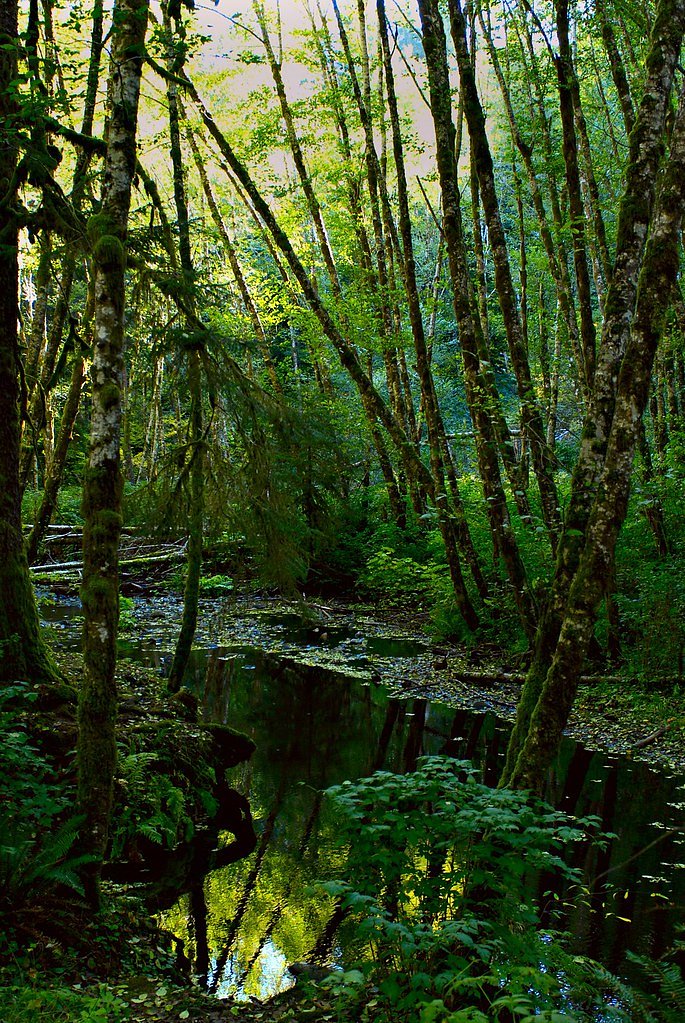
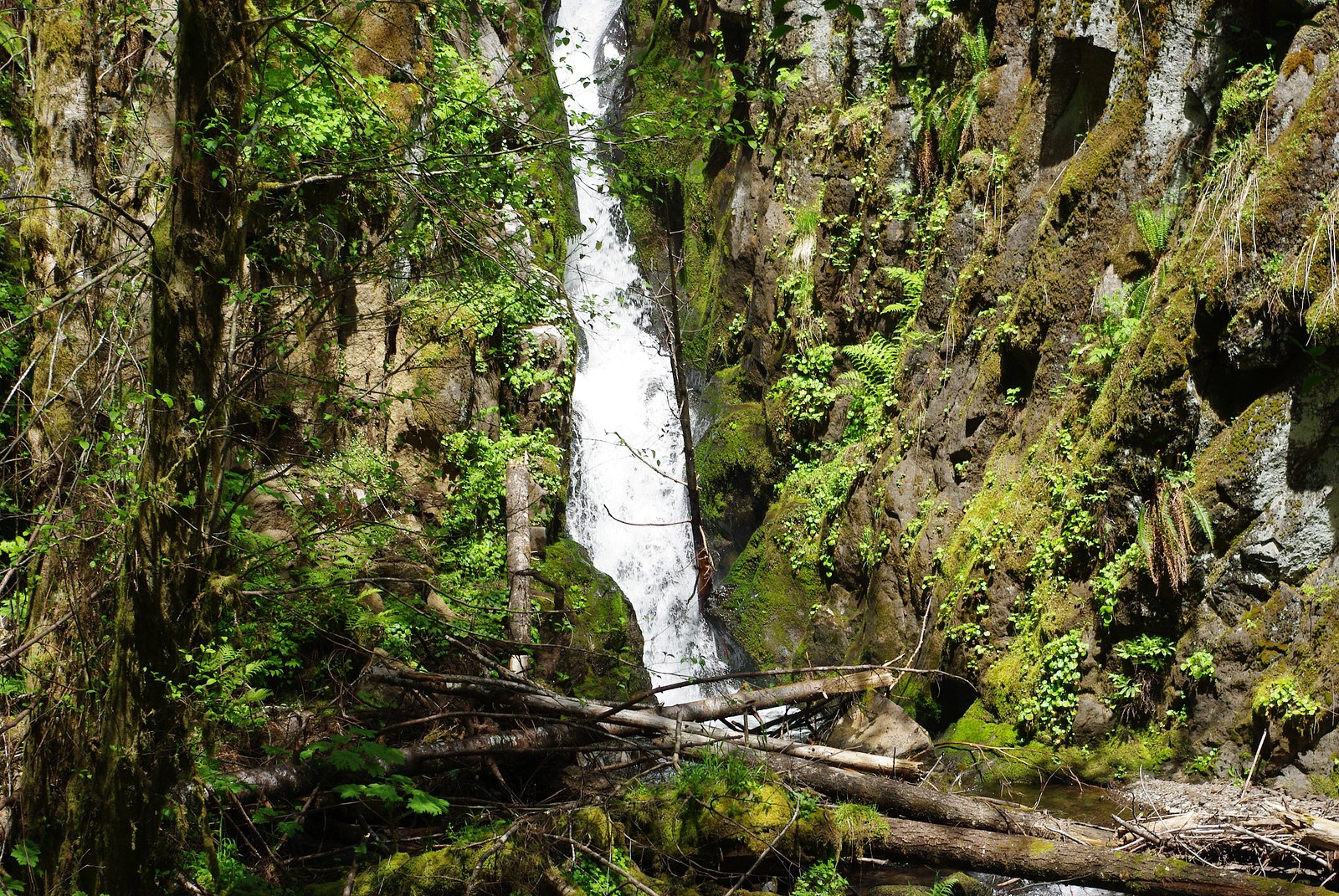
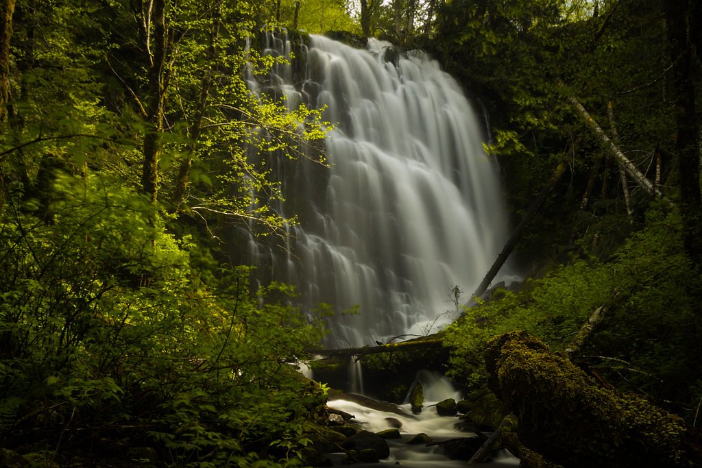
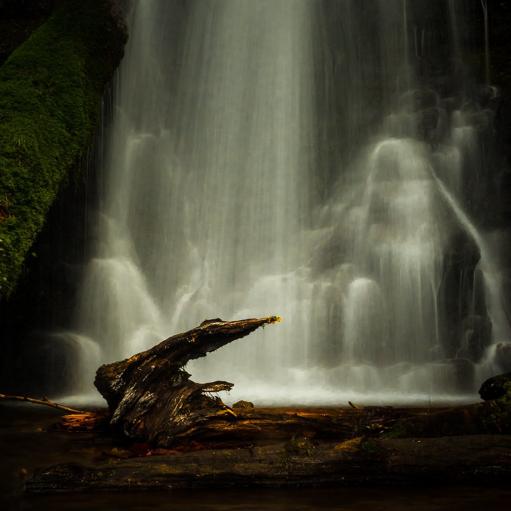
Lee Falls is a quietly scenic waterfall set within the Tualatin River land unit of the Wild and Scenic Rivers system, managed by the Bureau of Land Management (BLM). The fall drops into a small, fern-lined pool and is prized for its tranquil, tucked-away feel — a great short escape for hikers who want a peaceful nature stop without a long backcountry commitment. The BLM management of the area helps preserve the river corridor’s natural character, making Lee Falls a pleasant spot for photography, seasonal stream watching, and a shady rest on warm days. The approach to the falls is inviting and unhurried: an easy out-and-back hike that follows a creek through mixed forest, offering close-up views of riparian vegetation and the sound of running water the whole way. Because the site lies within the Tualatin River WSR unit, visitors should practice Leave No Trace principles to help keep this tucked-away stretch of river corridor pristine for others to enjoy.
The Setting
Lee Falls sits at 374 feet within Tualatin River, fed by the Tualatin River, in the coastal lowlands of Oregon.
Nearby Falls Worth Visiting
University Falls (55 ft) lies 10.7 miles to the northwest.
Trail & Hike Details
The Approach
The easy 2.4-mile out and back trail gains 200 feet of elevation on the way to the falls.
Trail Description
Trail type: out-and-back. Length: approximately 2.4 miles round trip. Elevation gain: about 200 feet. Difficulty: easy. Surface: predominantly dirt and gravel; some sections can become muddy after rain. The route closely follows a creek corridor on a well-defined footpath and ends at the waterfall and its small pool. The trail is mostly gently sloping (roughly a 1.6% average grade) and suitable for most hikers looking for a short, low-effort outing; expect class 1 walking conditions on an established trail.
What to Expect
Dogs are welcome.
Accessibility
The trail is not wheelchair accessible. Uneven terrain and elevation changes require steady footing.
Frequently Asked Questions
🐶 Are Dogs Allowed at Lee Falls?
✅ Dogs are allowed
Are There Any Fees or Permits Required?
🆖 No fees required
🏊 Is There Swimming at Lee Falls?
❌ Swimming is not allowed
When to Visit
Spring and early summer are ideal times to visit, as the waterfall flow is strongest due to seasonal rains. Fall offers beautiful foliage, while summer provides drier trail conditions.
Seasonal Access
The best time to visit is Spring, Summer, and Fall. Winter access may be limited.
Safety Information
Be cautious of slippery rocks near the waterfall. The trail may be muddy or slick after rain, so proper footwear is essential. Cell service may be limited in the area.
Current Water Conditions
169 ft³/s
Current discharge — how much water is flowing
Higher than usual for this time of year
Based on 86 years of record
11.03 ft
Water depth at gauge
53°F
ColdBracing — limit time in water
7-Day Discharge Trend
What does this mean for your visit?
The water is flowing higher than usual for this time of year. Water temperature is a bracing 53 degrees F, limit your time in the water. Expect crystal clear visibility and excellent dissolved oxygen levels. PH is normal at 7.2 and mineral content is typical.
Water Quality
Dissolved Oxygen
ExcellentSupports aquatic life
pH
NormalWithin healthy range (6.5-8.5)
Water Clarity
Crystal clearExcellent visibility
Conductance
Dissolved minerals in the water
About This Gauge
This gauge is on a nearby waterway and may not reflect exact conditions at the falls.
7-Day Flow Outlook
Based on the USGS gauge TUALATIN RIVER NEAR DILLEY, OR (13 km away).
Today
Low
193 cfs
3/10Tomorrow
Low
194 cfs
4/10Mon
Low
203 cfs
4/10Tue
Barely Flowing
186 cfs
5/10Wed
Barely Flowing
179 cfs
5/10Thu
Barely Flowing
209 cfs
3/10Fri
Low
243 cfs
4/10Best window: Tue — barely flowing flow, partly sunny (trip score 5/10).
Best time of year: this gauge typically runs highest from mid December to late February, peaking in January.
How we calculate this
This is a transparent outlook, not a precise forecast. We take the waterfall's current flow strength (how it ranks against its historical normal for today, from the nearest USGS stream gauge), carry that ranking forward along the gauge's seasonal curve, and nudge it for forecast rain. Confidence is highest for the next day or two and falls further out. Always check official conditions and your own judgment before visiting — high flows can be dangerous.
Know when to go.
Get a free email alert when waterfalls near Cherry Grove hit peak flow. We only send when conditions are worth the trip — no weekly newsletters, no spam.
Weather Forecast
Location & Access
Getting There
Lee Falls is located near Gaston, Oregon, and can be accessed via Lee Falls Trailhead. The trailhead is off a gravel road, and directions may require GPS assistance as signage is limited.
Get Directions on Google MapsParking
Parking is available near the trailhead, but it is limited and may require parking along the gravel road. Arrive early to secure a spot.
Hours
Elevation
374 feet above sea level
Coordinates
45.465153° N, -123.284647° W
Land Management
Managed by BLM
Visitor Tips & Gear
Wear sturdy shoes as the trail can be muddy in places. Bring water and snacks, as there are no facilities at the trailhead or along the trail. Arrive early to avoid crowds and secure parking.
As an Amazon Associate, we earn from qualifying purchases.
This easy 2.4 miles hike is straightforward — comfortable trail shoes and plenty of water should do. Sun exposure on the trail makes good sun protection a must in summer.

Polarized Sunglasses (Knockaround)
Cuts glare off the water so you actually see the falls — and your photos turn out better too.

Columbia Watertight II Rain Jacket
Packs into its own pocket, seam-sealed, and keeps you dry from spray and surprise rain.

Earth Pak Waterproof Dry Bag
Keeps your phone and gear dry when waterfall mist soaks everything else.

Waterproof Phone Pouch (AiRunTech)
Cheap insurance — take photos right next to the falls without killing your phone.

JOBY GorillaPod Starter Kit
Wraps around railings and rocks for long-exposure waterfall shots — no flat surface needed.

Osprey Daylite Daypack
Light, organized, and just the right size for a day hike — fits water, snacks, and layers.
Where to Stay

Best Western University Inn and Suites

Larkspur Landing Extended Stay Suites Hillsboro

La Quinta by Wyndham Portland NW

Hampton Inn & Suites Tigard
Browse vacation cabins and private rentals nearby
Unique outdoor stays — tents, yurts, and treehouses
Rent a campervan or RV for your waterfall road trip
Some links are affiliate links. We may earn a commission at no extra cost to you.
Nearby Campground
Dovre Recreation Site
14 miles away · 11 sites
Overview Want to camp? Camping season is generally May-September, with Alder Glen and Elk Bend remaining open through the weekend following General Western Oregon Coast 2nd Season for elk. During months with reduced sunlight, potable water may be turned off. Be prepared to bring your own wash and drinking water. Reserve a site at one of our four campgrounds on recreation.gov or pay when you arrive for non-reserved campsites using the Recreation.gov Mobile App. You must download before you reach t
Book on Recreation.govAdditional Information
Nearby Attractions
Nearby attractions include the Tillamook State Forest and Hagg Lake, which offer additional hiking, fishing, and recreational opportunities.
Wildlife
The area is home to various wildlife, including birds, deer, and small mammals. Be cautious of ticks and other insects.
Cities near Lee Falls
Nearby Waterfalls
Other waterfalls named Lee Falls
2 other waterfalls share this name across the U.S.
Writing about Lee Falls? Embed this waterfall on your site for free.