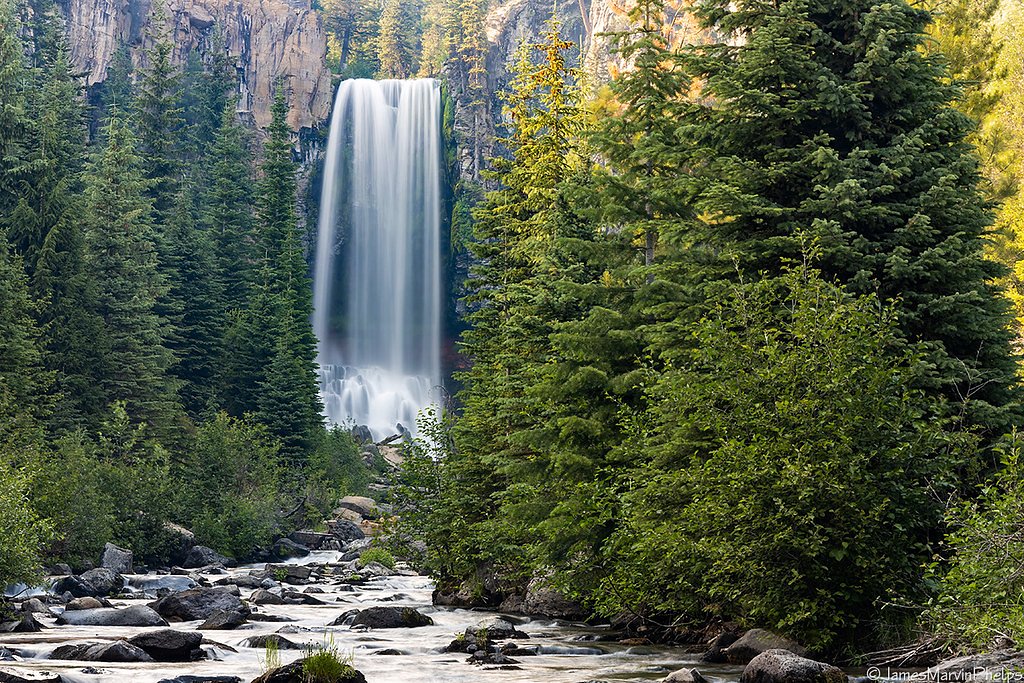
Tumalo Falls
Oregon • 97 ft
By Armen Suny · Last verified Mar 2026
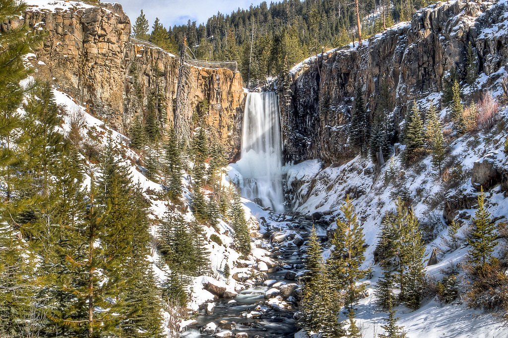
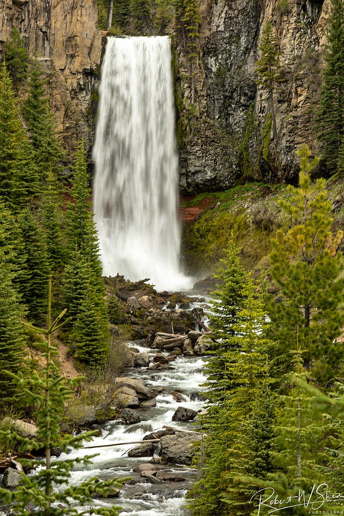

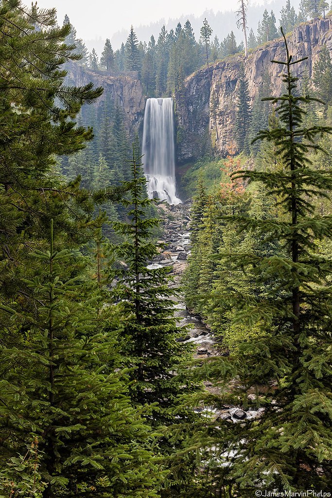

Photo Credits (5)
Difficulty
Easy
Trail Length
0.5 miles
Trail Type
Out And Back
Elevation Gain
100 ft
About Tumalo Falls
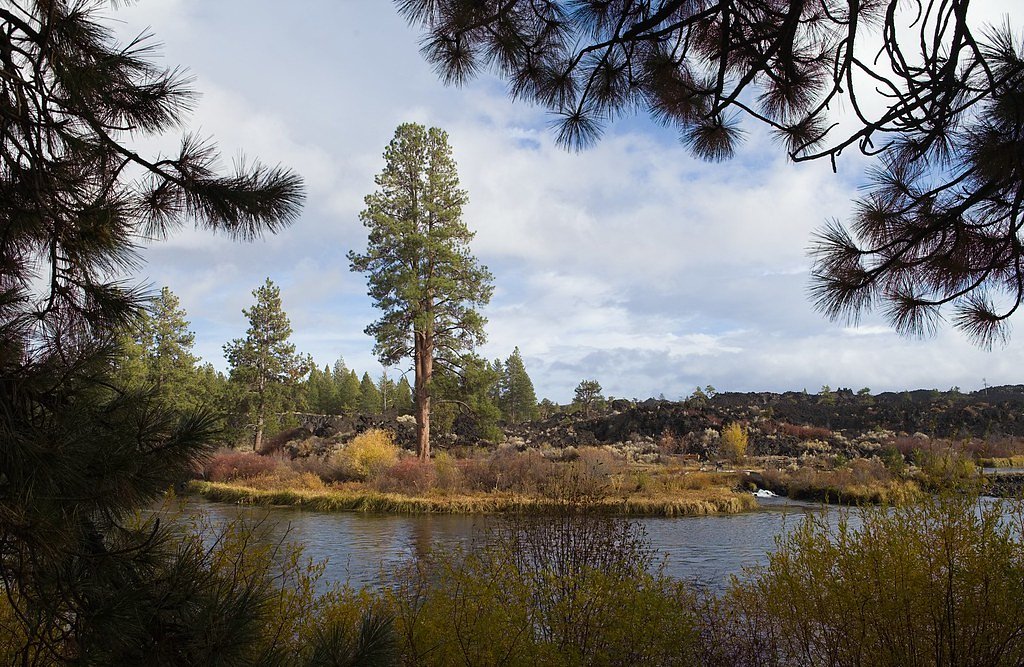
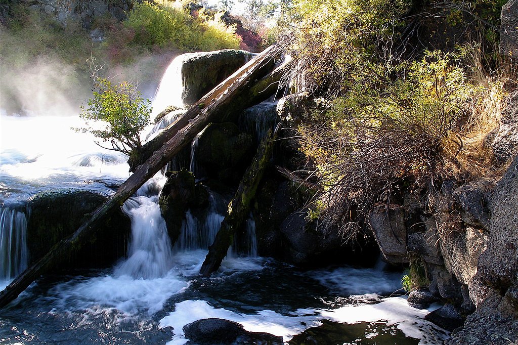
Tumalo Falls is a stunning 97-foot waterfall located in the Deschutes National Forest near Bend, Oregon. It is one of the most popular waterfalls in the region, offering breathtaking views and access to several hiking trails.
The Setting
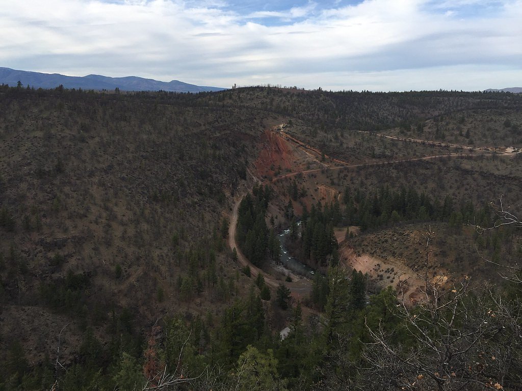
Tumalo Falls sits at 5,082 feet within Deschutes National Forest, fed by the Bridge Creek, in the high mountains of Oregon. The falls drop 97 feet.
Height: 97 feet
Trail & Hike Details
The Approach
The easy hike follows Tumalo Overflow Trail (#26.1), a 0.5-mile out-and-back trail over natural surface. Expect 100 feet of elevation gain. The trail is developed (Class 3).
USFS Trail
TUMALO OVERFLOW TRAIL #26.1
Trail Class
Developed
Surface
USFS Segment
0.29 miTrail Description
The short trail to the Tumalo Falls viewpoint is well-maintained and easy to navigate, making it accessible for most visitors. For those looking for a longer hike, the North Fork Trail continues past the falls and offers access to additional waterfalls and scenic views.
What to Expect
The falls cascade 97 feet. Dogs are welcome.
Accessibility
The trail is short and relatively flat, but the surface may be uneven. Contact the managing agency for accessibility details.
Frequently Asked Questions
🐶 Are Dogs Allowed at Tumalo Falls?
✅ Dogs are allowed
Are There Any Fees or Permits Required?
🤑 Fee: $5.00
🏊 Is There Swimming at Tumalo Falls?
❌ Swimming is not allowed
When to Visit
Spring and early summer are ideal for viewing the waterfall at its fullest flow, but the area is beautiful year-round.
Seasonal Access
The best time to visit is Spring, Summer, Fall, and Winter. Check with Deschutes National Forest for seasonal road closures.
Safety Information
Water temperature is currently 43°F — cold enough to cause numbness quickly. Avoid prolonged water contact and use caution near the falls.
Stay on designated trails and avoid getting too close to the edge of the falls. In winter, icy conditions can make trails slippery. Always check weather and trail conditions before visiting.
Current Water Conditions
18 ft³/s
Current discharge — how much water is flowing
About average for this time of year
Based on 8 years of record
0.23 ft
Water depth at gauge
43°F
Very coldExpect numbness within minutes
7-Day Discharge Trend
What does this mean for your visit?
Flow is about average for this time of year. Water temperature is very cold at 43 degrees F, expect numbness within minutes.
About This Gauge
7-Day Flow Outlook
Based on the USGS gauge BRIDGE CREEK BELOW INTAKE, NEAR BEND, OR (0 km away).
Today
Moderate
17 cfs
5/10Tomorrow
Moderate
19 cfs
5/10Sat
Moderate
18 cfs
5/10Sun
Low
15 cfs
6/10Mon
Low
15 cfs
6/10Tue
Moderate
15 cfs
5/10Wed
Low
15 cfs
6/10Best window: Sun — low flow, mostly sunny (trip score 6/10).
Best time of year: this gauge typically runs highest from early April to mid June, peaking in May.
How we calculate this
This is a transparent outlook, not a precise forecast. We take the waterfall's current flow strength (how it ranks against its historical normal for today, from the nearest USGS stream gauge), carry that ranking forward along the gauge's seasonal curve, and nudge it for forecast rain. Confidence is highest for the next day or two and falls further out. Always check official conditions and your own judgment before visiting — high flows can be dangerous.
Know when to go.
Get a free email alert when waterfalls near Tetherow hit peak flow. We only send when conditions are worth the trip — no weekly newsletters, no spam.
Weather Forecast
Location & Access
Getting There
Tumalo Falls is located about 12 miles west of Bend, Oregon. From Bend, take Skyliners Road west until it ends at the Tumalo Falls Day Use Area. The last few miles of the road may be gravel and can be rough, especially in winter.
Get Directions on Google MapsParking
There is a parking lot at the Tumalo Falls Day Use Area. Parking can fill up quickly during peak seasons, so arriving early is recommended.
Elevation
5,082 feet above sea level
Coordinates
44.033915° N, -121.566830° W
Land Management
Managed by USFS
Visitor Tips & Gear
Arrive early to secure parking, especially during summer weekends. Bring sturdy footwear if you plan to hike beyond the main viewpoint. In winter, check road conditions and consider bringing snowshoes or skis.
As an Amazon Associate, we earn from qualifying purchases.
For this easy 0.5 miles trail, lightweight trail shoes and a water bottle are usually sufficient. Icy conditions are common in winter — traction cleats are a smart addition.

Columbia Watertight II Rain Jacket
Packs into its own pocket, seam-sealed, and keeps you dry from spray and surprise rain.

Polarized Sunglasses (Knockaround)
Cuts glare off the water so you actually see the falls — and your photos turn out better too.

Earth Pak Waterproof Dry Bag
Keeps your phone and gear dry when waterfall mist soaks everything else.

Waterproof Phone Pouch (AiRunTech)
Cheap insurance — take photos right next to the falls without killing your phone.

Kahtoola MICROspikes
Cult-favorite traction cleats that grip ice and wet rock — essential for winter waterfall hikes.

JOBY GorillaPod Starter Kit
Wraps around railings and rocks for long-exposure waterfall shots — no flat surface needed.
Where to Stay

Loft home with private hot tub deck grill fireplace & 10 SHARC passes

Cabin with Private Hot Tub Near the Deschutes River - Free SHARC access

2 Tennis Village..

Paper Birch - Unit 10
Browse vacation cabins and private rentals nearby
Unique outdoor stays — tents, yurts, and treehouses
Rent a campervan or RV for your waterfall road trip
Some links are affiliate links. We may earn a commission at no extra cost to you.
Nearby Campground
Little Fawn Campground
12.4 miles away · 8 sites
Overview Little Fawn Group Camp, 37 miles southwest of the town of Bend, is located on the southeastern shores of Elk Lake. Recreation Elk Lake provides the opportunity for boating, windsurfing, water skiing, fishing and swimming. A nice beach and large day-use area provide plenty of shoreline for swimming. A boat ramp is located within the campground. Facilities Little Fawn Group Camp offers all single-family camp sites and on a First Come First Serve. The campground accommodates tent and RV cam
Book on Recreation.govNearby Hot Springs
Hot springs near Tetherow, Oregon
Paulina Springs
Paulina Springs emerges at 70°F within Newberry National Volcanic Monument in Deschutes County, flowing at 6,338 feet elevation...
Belknap Springs
Belknap Springs flows at 160°F along the McKenzie River in the Cascade Range, emerging just 510 feet from North Belknap Springs...
Foley Springs
Foley Springs emerges at 178°F in the Cascade Range of Lane County, making it one of Oregon's hottest thermal features with rec...

East Lake Hot Springs
East Lake Hot Springs emerges at 144°F on the shore of East Lake within the Newberry Volcano caldera, flowing 103.8°F above the...

Cougar Reservoir Hot Springs
Cougar Reservoir Hot Springs, widely known as Terwilliger Hot Springs, flows at 111 degrees Fahrenheit with roadside access req...

Bigelow Hot Springs
Bigelow Hot Springs, also called Deer Creek Hot Springs, emerges at 142°F just 400 feet from Deer Creek Road in the Willamette ...
Looking for a soak after your hike? Explore more hot springs near Tetherow, Oregon on SoakingSprings.
Explore Oregon springsAdditional Information
Nearby Attractions
Nearby attractions include the Cascade Lakes Scenic Byway, Mount Bachelor, and the city of Bend, which offers dining and shopping options.
Wildlife
The area is home to a variety of wildlife, including deer, birds, and small mammals. Be cautious of bears and other larger animals.
Cities near Tumalo Falls
Nearby Waterfalls
Writing about Tumalo Falls? Embed this waterfall on your site for free.