
Photo Credits (5)
Difficulty
Easy
Trail Length
1.0 miles
Trail Type
Out And Back
Elevation Gain
100 ft
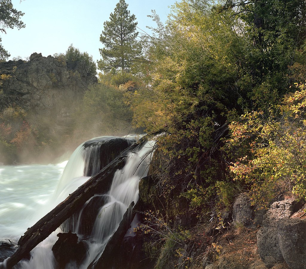
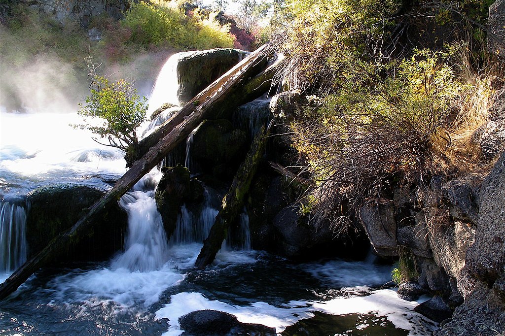
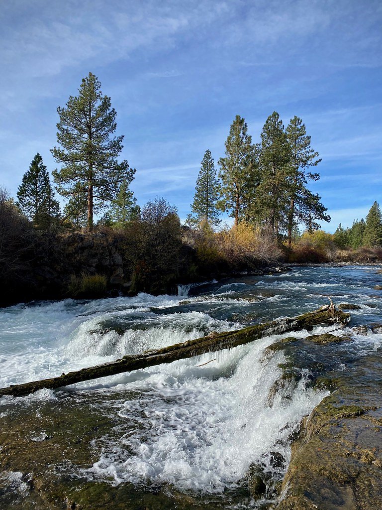
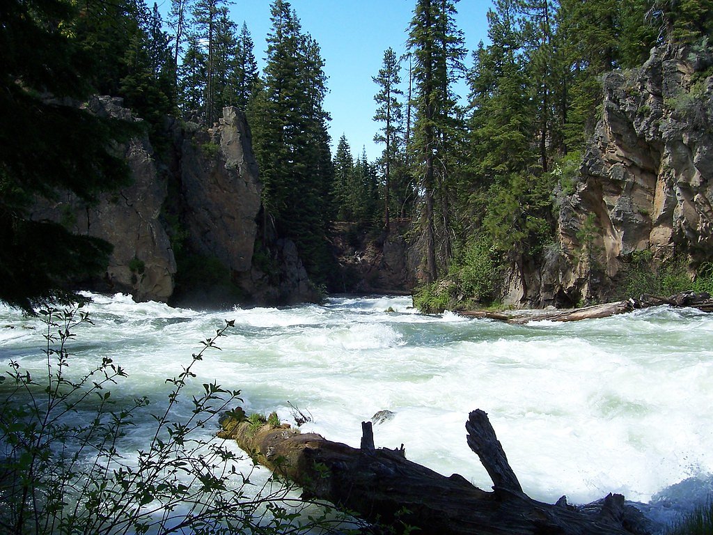
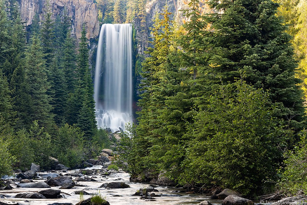
About Dillon Falls
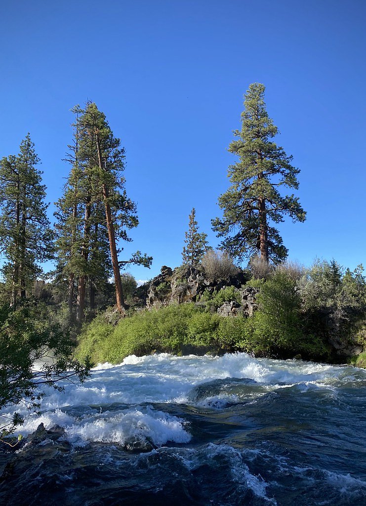
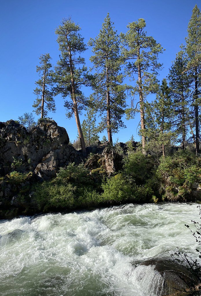
Dillon Falls are a stretch of powerful rapids on the Deschutes River just outside Bend, Oregon, tucked into the pine and lava-formed landscape of the Deschutes National Forest. Managed by the U.S. Forest Service, the falls are better described as a dramatic, coursing cascade than a single vertical drop, and they sit amid rugged lava rock outcrops that frame scenic river views. Unlike the nearby Benham Falls, Dillon Falls are not widely documented and can be hard to see from a distance, which makes the short trails here especially valuable for getting a closer look. The feature takes its name from Leander Dillon, a local homesteader. Access is typically via the USFS DILLON SANDLADDER (Trail #2.12), which brings you to viewpoints that reveal the river’s churning character. The setting’s compact scale and striking geology make Dillon Falls a rewarding quick stop for hikers and photographers exploring the Deschutes River corridor — an intimate, slightly tucked-away contrast to more developed cascade viewpoints in the area.
The Setting
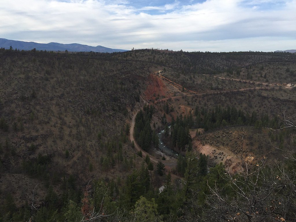
Dillon Falls sits at 4,003 feet within Deschutes National Forest, fed by the Bridge Creek, in the mountains of Oregon.
Trail & Hike Details
The Approach
The easy hike follows Dillon Sandladder (#2.12), a 1.0-mile out-and-back trail over natural surface. Expect 100 feet of elevation gain. The trail is developed (Class 3).
USFS Trail
DILLON SANDLADDER #2.12
Trail Class
Developed
Surface
USFS Segment
0.39 miTrail Description
The most common route to viewpoints of Dillon Falls is an easy, out-and-back hike of roughly 1.0 miles with about 100 feet of elevation gain. The U.S. Forest Service lists the access as DILLON SANDLADDER, Trail #2.12 (GIS length 0.39 miles) with a native-material tread and a Class 3 trail rating; the surface is natural dirt/rock and the route is short but can be uneven. Expect a mostly gentle grade suitable for most visitors, though the native surface and occasional rock steps mean sturdy shoes are recommended for steady footing.
What to Expect
Dogs are welcome.
Accessibility
The trail is not wheelchair accessible. Uneven terrain and elevation changes require steady footing.
Frequently Asked Questions
🐶 Are Dogs Allowed at Dillon Falls?
✅ Dogs are allowed
Are There Any Fees or Permits Required?
🤑 Fee: $0.00
Permit required
A Northwest Forest Pass or similar permit may be required for parking at the trailhead.
🏊 Is There Swimming at Dillon Falls?
❌ Swimming is not allowed
When to Visit
Spring and summer are the best times to visit, as the weather is pleasant and the river flow is typically strong. Fall offers beautiful foliage, while winter may provide a quieter experience, though access could be limited by snow.
Seasonal Access
The best time to visit is Spring, Summer, Fall, and Winter. Check with Deschutes National Forest for seasonal road closures.
Safety Information
Water temperature is currently 43°F — cold enough to cause numbness quickly. Avoid prolonged water contact and use caution near the falls.
Stay on designated trails and avoid getting too close to the river's edge, as the currents are strong and the rocks can be slippery. Be cautious of uneven terrain.
Current Water Conditions
15 ft³/s
Current discharge — how much water is flowing
About average for this time of year
Based on 8 years of record
0.20 ft
Water depth at gauge
43°F
Very coldExpect numbness within minutes
7-Day Discharge Trend
What does this mean for your visit?
Flow is about average for this time of year. Water temperature is very cold at 43 degrees F, expect numbness within minutes.
About This Gauge
This gauge is on a nearby waterway and may not reflect exact conditions at the falls.
7-Day Flow Outlook
Based on the USGS gauge BRIDGE CREEK BELOW INTAKE, NEAR BEND, OR (15 km away).
Today
Low
18 cfs
3/10Tomorrow
Barely Flowing
15 cfs
5/10Mon
Barely Flowing
14 cfs
5/10Tue
Barely Flowing
13 cfs
5/10Wed
Barely Flowing
13 cfs
5/10Thu
Barely Flowing
14 cfs
3/10Fri
Barely Flowing
13 cfs
5/10Best window: Tomorrow — barely flowing flow, mostly sunny (trip score 5/10).
Best time of year: this gauge typically runs highest from early April to mid June, peaking in May.
How we calculate this
This is a transparent outlook, not a precise forecast. We take the waterfall's current flow strength (how it ranks against its historical normal for today, from the nearest USGS stream gauge), carry that ranking forward along the gauge's seasonal curve, and nudge it for forecast rain. Confidence is highest for the next day or two and falls further out. Always check official conditions and your own judgment before visiting — high flows can be dangerous.
Know when to go.
Get a free email alert when waterfalls near Seventh Mountain hit peak flow. We only send when conditions are worth the trip — no weekly newsletters, no spam.
Weather Forecast
Location & Access
Getting There
Dillon Falls is located about 8 miles southwest of Bend, Oregon, within the Deschutes National Forest. Visitors can access the falls via the Dillon Falls Trailhead, which is off Forest Road 41 (also known as Century Drive).
Get Directions on Google MapsParking
There is a parking area at the Dillon Falls Trailhead, which provides access to the falls and nearby trails. Parking is typically free, but it may require a Northwest Forest Pass or similar permit.
Elevation
4,003 feet above sea level
Coordinates
43.957468° N, -121.411564° W
Land Management
Managed by USFS
Visitor Tips & Gear
Wear sturdy shoes as the trail may have uneven surfaces near the lava rocks. Bring water and sunscreen, especially in summer. Arrive early during peak seasons to secure parking.
As an Amazon Associate, we earn from qualifying purchases.
This easy 1.0 miles hike is straightforward — comfortable trail shoes and plenty of water should do. Icy conditions are common in winter — traction cleats are a smart addition.

Columbia Watertight II Rain Jacket
Packs into its own pocket, seam-sealed, and keeps you dry from spray and surprise rain.

Polarized Sunglasses (Knockaround)
Cuts glare off the water so you actually see the falls — and your photos turn out better too.

Earth Pak Waterproof Dry Bag
Keeps your phone and gear dry when waterfall mist soaks everything else.

Waterproof Phone Pouch (AiRunTech)
Cheap insurance — take photos right next to the falls without killing your phone.

Kahtoola MICROspikes
Cult-favorite traction cleats that grip ice and wet rock — essential for winter waterfall hikes.

JOBY GorillaPod Starter Kit
Wraps around railings and rocks for long-exposure waterfall shots — no flat surface needed.
Where to Stay

Cabin with Private Hot Tub Near the Deschutes River - Free SHARC access

Cozy mountain studio near skiing & town with fast WiFi shared pools & patio

2 Tennis Village..

Paper Birch - Unit 10
Browse vacation cabins and private rentals nearby
Unique outdoor stays — tents, yurts, and treehouses
Rent a campervan or RV for your waterfall road trip
Some links are affiliate links. We may earn a commission at no extra cost to you.
Nearby Campground
BIG RIVER
10.5 miles away · 13 sites
Overview Big River Campground is located along the Deschutes River south of the town of Sunriver. Large, open group sites offer a perfect setting for family reunions or group gatherings. Recreation Popular activities in the area include hiking, fishing and rafting in the summer months and cross-country skiing and snowshoeing in the winter. Big River provides the perfect place to launch a canoe or kayak into the Deschutes River. Only non-motorized boating is permitted on the river, and the water i
Book on Recreation.govNearby Hot Springs
Hot springs near Seventh Mountain, Oregon
Paulina Springs
Paulina Springs emerges at 70°F within Newberry National Volcanic Monument in Deschutes County, flowing at 6,338 feet elevation...

East Lake Hot Springs
East Lake Hot Springs emerges at 144°F on the shore of East Lake within the Newberry Volcano caldera, flowing 103.8°F above the...
Belknap Springs
Belknap Springs flows at 160°F along the McKenzie River in the Cascade Range, emerging just 510 feet from North Belknap Springs...
Foley Springs
Foley Springs emerges at 178°F in the Cascade Range of Lane County, making it one of Oregon's hottest thermal features with rec...

Cougar Reservoir Hot Springs
Cougar Reservoir Hot Springs, widely known as Terwilliger Hot Springs, flows at 111 degrees Fahrenheit with roadside access req...

Bigelow Hot Springs
Bigelow Hot Springs, also called Deer Creek Hot Springs, emerges at 142°F just 400 feet from Deer Creek Road in the Willamette ...
Looking for a soak after your hike? Explore more hot springs near Seventh Mountain, Oregon on SoakingSprings.
Explore Oregon springsAdditional Information
Nearby Attractions
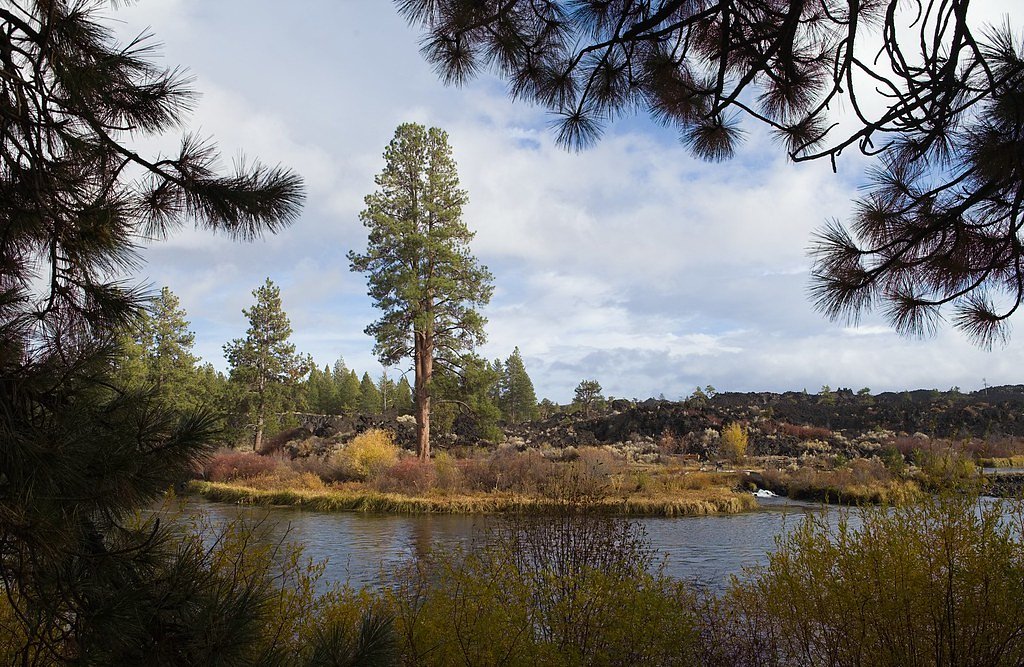
Nearby attractions include Benham Falls, Lava Lands Visitor Center, and the Deschutes River Trail.
Wildlife
The area is home to various wildlife, including deer, birds, and small mammals. Visitors may also see fish in the river.
Cities near Dillon Falls
Nearby Waterfalls
Other waterfalls named Dillon Falls
1 other waterfall shares this name across the U.S.
Writing about Dillon Falls? Embed this waterfall on your site for free.