Difficulty
Moderate
Trail Length
5.5 miles
Trail Type
Out And Back
Elevation Gain
700 ft
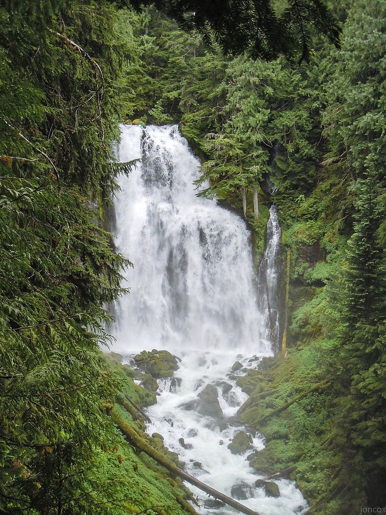
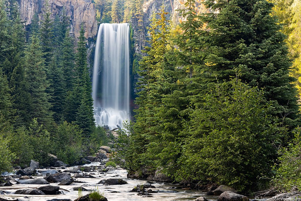
About Upper Chush Falls
Upper Chush Falls is a stunning waterfall located in the Deschutes National Forest near Sisters, Oregon. It is part of the Whychus Creek drainage and offers visitors a serene and scenic experience with cascading water surrounded by lush forest and volcanic landscapes.
The Setting
Upper Chush Falls sits at 5,594 feet within Deschutes National Forest, fed by the M F Tumalo Creek, in the high mountains of Oregon.
Trail & Hike Details
The Approach
The moderate hike follows Chush Falls (#4080), a 5.5-mile out-and-back trail over natural surface. Expect 700 feet of elevation gain. The trail is developed (Class 3).
USFS Trail
CHUSH FALLS #4080
Trail Class
Developed
Surface
USFS Segment
1.45 miTrail Description
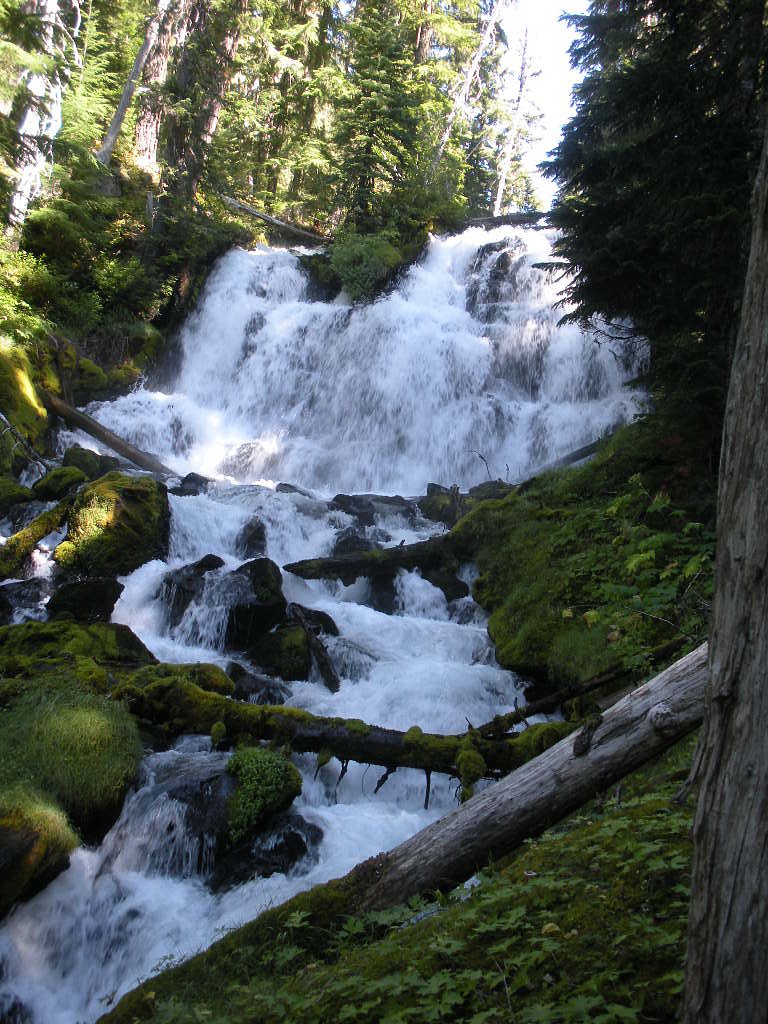
The trail to Upper Chush Falls follows Whychus Creek through a mix of forested areas and open volcanic terrain. The path is well-marked but includes some rocky and uneven sections. The final approach to the falls may require navigating over rocks or roots.
What to Expect
Dogs are welcome.
Accessibility
The trail is not wheelchair accessible. Uneven terrain and elevation changes require steady footing.
Frequently Asked Questions
🐶 Are Dogs Allowed at Upper Chush Falls?
✅ Dogs are allowed
Are There Any Fees or Permits Required?
🆖 No fees required
🏊 Is There Swimming at Upper Chush Falls?
❌ Swimming is not allowed
When to Visit
Spring and early summer are ideal for visiting, as the waterfall flow is strongest due to snowmelt. Fall offers beautiful foliage, while summer provides warm weather for hiking.
Seasonal Access
The best time to visit is Spring, Summer, and Fall. Access roads and trails may close during winter due to snow. Check with Deschutes National Forest for seasonal road closures.
Safety Information
Water temperature is currently 43°F — cold enough to cause numbness quickly. Avoid prolonged water contact and use caution near the falls.
Be cautious on rocky sections of the trail, especially near the falls, as they can be slippery. Check weather conditions before your visit, and carry a map or GPS device as cell service may be limited.
Current Water Conditions
19 ft³/s
Current discharge — how much water is flowing
About average for this time of year
Based on 8 years of record
3.99 ft
Water depth at gauge
43°F
Very coldExpect numbness within minutes
7-Day Discharge Trend
What does this mean for your visit?
Flow is about average for this time of year. Water temperature is very cold at 43 degrees F, expect numbness within minutes.
About This Gauge
This gauge is on a nearby waterway and may not reflect exact conditions at the falls.
7-Day Flow Outlook
Based on the USGS gauge M F TUMALO CREEK BLW PROWELL SPRINGS, NR BEND, OR (12 km away).
Today
Moderate
20 cfs
6/10Tomorrow
Moderate
19 cfs
6/10Mon
Moderate
16 cfs
9/10Tue
Moderate
16 cfs
8/10Wed
Moderate
15 cfs
8/10Thu
Moderate
15 cfs
6/10Fri
Moderate
14 cfs
6/10Best window: Mon — moderate flow, mostly sunny (trip score 9/10).
Best time of year: this gauge typically runs highest from late May to late August, peaking in June.
How we calculate this
This is a transparent outlook, not a precise forecast. We take the waterfall's current flow strength (how it ranks against its historical normal for today, from the nearest USGS stream gauge), carry that ranking forward along the gauge's seasonal curve, and nudge it for forecast rain. Confidence is highest for the next day or two and falls further out. Always check official conditions and your own judgment before visiting — high flows can be dangerous.
Know when to go.
Get a free email alert when waterfalls near Black Butte Ranch hit peak flow. We only send when conditions are worth the trip — no weekly newsletters, no spam.
Weather Forecast
Location & Access
Getting There
To reach Upper Chush Falls, visitors typically drive to the Whychus Creek Trailhead, which is accessible via gravel roads. From there, a hike is required to reach the falls.
Get Directions on Google MapsParking
Parking is available at the Whychus Creek Trailhead, but spaces may be limited during peak seasons.
Elevation
5,594 feet above sea level
Coordinates
44.142847° N, -121.684762° W
Land Management
Managed by USFS
Visitor Tips & Gear
Start early in the day to avoid crowds and ensure parking availability. Wear sturdy hiking shoes due to rocky terrain, and bring plenty of water, especially in summer. Check trail conditions before visiting, as snow or fallen trees may impact access.
This trail sits at 5,594 ft above sea level
Elevated TrailUV radiation is roughly 22% stronger at this elevation than at sea level, and the dry air accelerates dehydration. Extra sun protection and fluids go a long way.
As an Amazon Associate, we earn from qualifying purchases.

Coppertone Sport SPF 50 Sunscreen
UV intensity jumps ~4% per 1,000 ft — at this elevation you can burn in half the time.

Sun Bum SPF 30 Lip Balm (3-Pack)
Lips have almost no natural UV protection and burn fast in thin, dry mountain air.

Liquid I.V. Electrolyte Packets
You lose moisture ~2x faster at elevation — electrolytes help you absorb water efficiently.

ROCKNIGHT Polarized UV400 Sunglasses
High-altitude glare off rock and water is intense — UV400 lenses block 99%+ of UVA/UVB.
As an Amazon Associate, we earn from qualifying purchases.
With 5.5 miles and 700 ft of elevation gain, sturdy boots and trekking poles will help on this moderate trail. Sun exposure on the trail makes good sun protection a must in summer.

Columbia Watertight II Rain Jacket
Packs into its own pocket, seam-sealed, and keeps you dry from spray and surprise rain.

Earth Pak Waterproof Dry Bag
Keeps your phone and gear dry when waterfall mist soaks everything else.

Waterproof Phone Pouch (AiRunTech)
Cheap insurance — take photos right next to the falls without killing your phone.

Timberland Euro Sprint Mid Waterproof
Trusted waterproof boot with premium leather and grippy rubber sole — reliable on rocky, wet trails.

TrailBuddy Trekking Poles
Lightweight aluminum, cork grips, and flip-locks that actually hold — a best-seller for good reason.

Sawyer Squeeze Water Filter
The backcountry standard — filters 99.9% of bacteria and weighs just 3 oz.
Where to Stay

Loft home with private hot tub deck grill fireplace & 10 SHARC passes

Sisters Inn & Suites

Paper Birch - Unit 10

Cabin with Private Hot Tub Near the Deschutes River - Free SHARC access
Browse vacation cabins and private rentals nearby
Unique outdoor stays — tents, yurts, and treehouses
Rent a campervan or RV for your waterfall road trip
Some links are affiliate links. We may earn a commission at no extra cost to you.
Nearby Campground
Alder Springs Campground
11.6 miles away · 0 sites
This small, rustic site is right on the side of the historic McKenzie Pass Highway. Surrounded by towering Douglas fir trees, this is a perfect spot to be on a warm day.Access to Linton Lake Trailhead in the Three Sisters Wilderness is immediately across the highway from the campground.
Book on Recreation.govNearby Hot Springs
Hot springs near Black Butte Ranch, Oregon
Belknap Springs
Belknap Springs flows at 160°F along the McKenzie River in the Cascade Range, emerging just 510 feet from North Belknap Springs...
Foley Springs
Foley Springs emerges at 178°F in the Cascade Range of Lane County, making it one of Oregon's hottest thermal features with rec...

Bigelow Hot Springs
Bigelow Hot Springs, also called Deer Creek Hot Springs, emerges at 142°F just 400 feet from Deer Creek Road in the Willamette ...

Cougar Reservoir Hot Springs
Cougar Reservoir Hot Springs, widely known as Terwilliger Hot Springs, flows at 111 degrees Fahrenheit with roadside access req...
Paulina Springs
Paulina Springs emerges at 70°F within Newberry National Volcanic Monument in Deschutes County, flowing at 6,338 feet elevation...

East Lake Hot Springs
East Lake Hot Springs emerges at 144°F on the shore of East Lake within the Newberry Volcano caldera, flowing 103.8°F above the...
Looking for a soak after your hike? Explore more hot springs near Black Butte Ranch, Oregon on SoakingSprings.
Explore Oregon springsAdditional Information
Nearby Attractions
Nearby attractions include Whychus Creek Overlook, Proxy Falls, and the town of Sisters, Oregon.
Wildlife
The area is home to a variety of wildlife, including deer, birds, and small mammals. Be cautious of potential encounters with bears or cougars.
Cities near Upper Chush Falls
Nearby Waterfalls
Writing about Upper Chush Falls? Embed this waterfall on your site for free.