
Photo Credits (5)
Difficulty
Easy
Trail Length
0.6 miles
Trail Type
Out And Back
Elevation Gain
80 ft
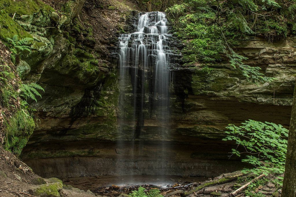
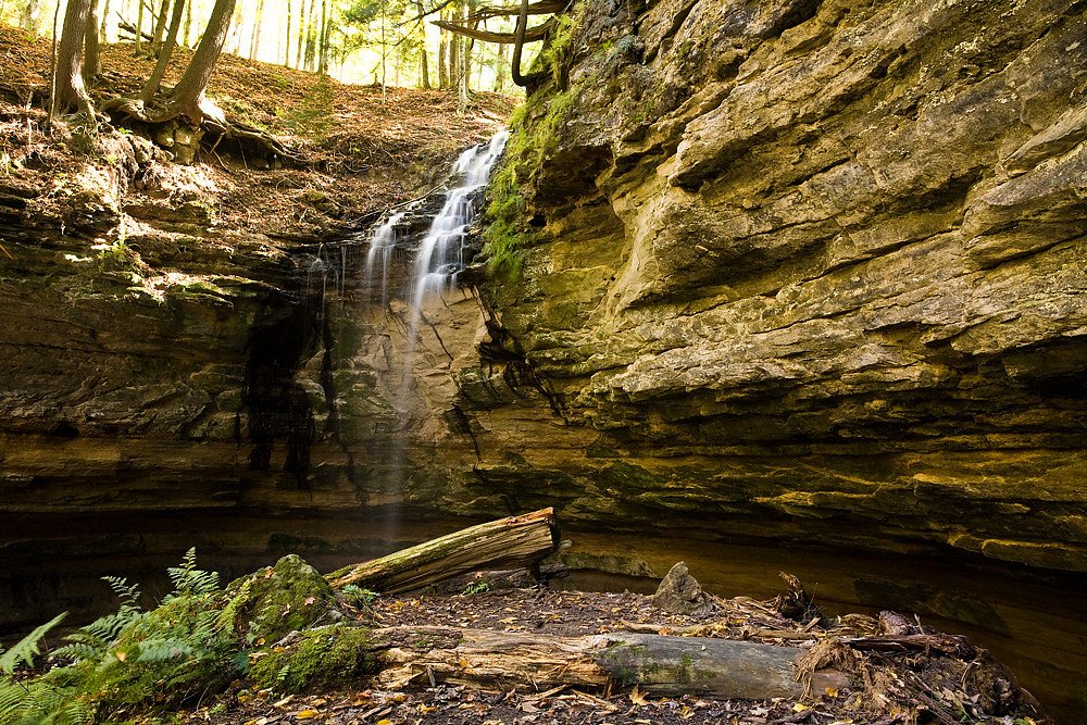
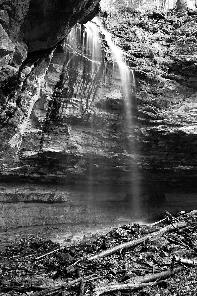
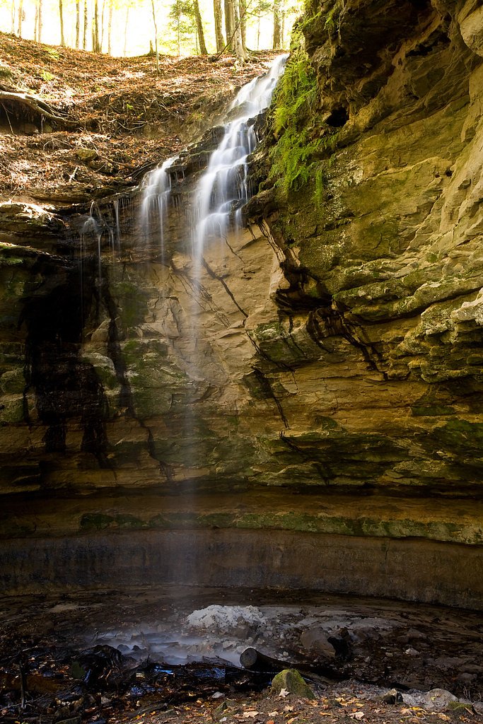
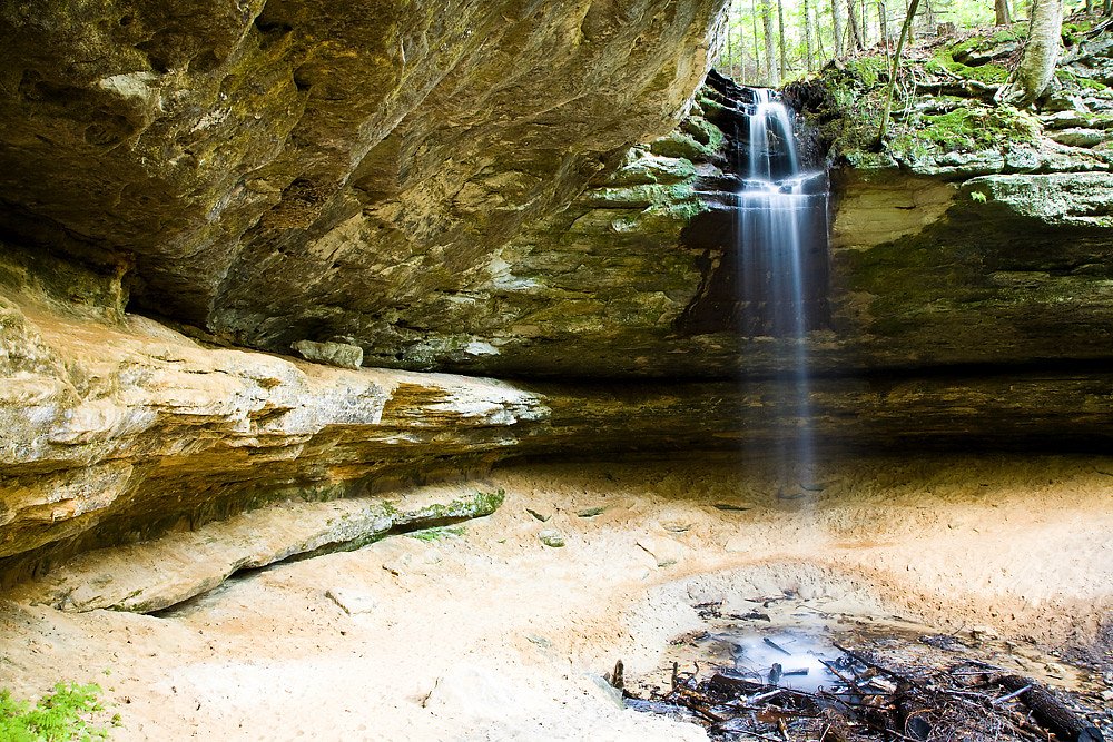
About Tannery Falls
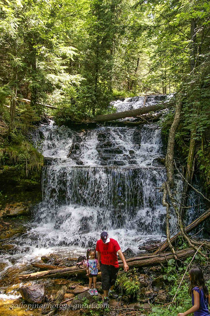
Tannery Falls — sometimes called the Rudy M. Olson Memorial Falls — is a compact but dramatic cascade just outside Munising, Michigan. Tannery Creek tumbles about 40 feet into an impressive sandstone canyon, and a small cave sits behind the falling water, creating a photogenic recess that rewards those who explore the rim. The falls are fed by the creek as it moves from a nearby residential area into the canyon, producing a tranquil, scenic pocket of Upper Peninsula wilderness. The site is reached by a short, easy approach and makes a great half-day stop when exploring the Munising area. For campers, the nearest established camping is at the Munising Ranger District campground about 1.85 km away, making it simple to pair an overnight stay with a morning or evening visit to the falls. Tannery Falls’ sandstone walls and cave offer striking geology and quiet views — just be prepared for wet, slippery rock near the water’s edge and practice caution when exploring tight canyon spaces.
The Setting
Tannery Falls sits at 719 feet in the foothills of Michigan. The falls drop 40 feet.
Height: 40 feet
Nearby Falls Worth Visiting
Munising Falls (50 ft) lies 0.6 miles to the northeast. Also nearby: Wagner Falls (20 ft, 2.1 mi) and Alger Falls (15 ft, 1.8 mi).
Trail & Hike Details
The Approach
The easy 0.6-mile out-and-back trail gains 80 feet of elevation on the way to the falls.
Trail Description
Length: 0.6 miles (out-and-back); Elevation gain: ~80 feet; Difficulty: Easy. The trail to Tannery Falls is a short 0.6-mile out-and-back route with about an 80-foot climb overall, so it’s accessible for most hikers. The path passes through wooded terrain and can include uneven footing; after rain the route and the canyon rim can become muddy or slippery, so sturdy footwear and caution are recommended. The trail leads to viewpoints above the 40-foot drop and the cave behind the falls — allow extra time to enjoy the canyon and photographs.
What to Expect
The falls drop 40 feet. Dogs are welcome.
Accessibility
The trail is short and relatively flat, but the surface may be uneven. Contact the managing agency for accessibility details.
Frequently Asked Questions
🐶 Are Dogs Allowed at Tannery Falls?
✅ Dogs are allowed
Are There Any Fees or Permits Required?
🆖 No fees required
🏊 Is There Swimming at Tannery Falls?
❌ Swimming is not allowed
When to Visit
Spring and early summer are the best times to visit, as the waterfall is typically at its fullest due to snowmelt and rainfall.
Seasonal Access
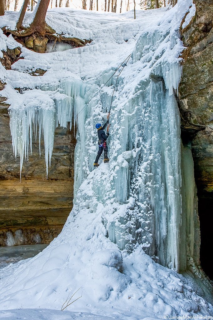
The best time to visit is Spring, Summer, and Fall. Winter access may be limited.
Safety Information
The trail can be slippery after rain, and the area around the waterfall may have loose rocks. Exercise caution and stay on marked paths.
Know when to go.
Get a free email alert when waterfalls near Munising hit peak flow. We only send when conditions are worth the trip — no weekly newsletters, no spam.
Weather Forecast
Location & Access
Getting There
Tannery Falls is located near Munising, Michigan. To reach the falls, visitors typically park near the Munising Falls Visitor Center and follow local signage. The trailhead is not always clearly marked, so using a GPS or map is recommended.
Get Directions on Google MapsParking
Limited parking is available near the trailhead. Visitors may need to park along the roadside during busy times.
Elevation
719 feet above sea level
Coordinates
46.415650° N, -86.626912° W
Visitor Tips & Gear
Visit early in the day to avoid crowds and ensure parking availability. Wear sturdy shoes, as the trail can be muddy. Bring a camera to capture the beauty of the falls.
As an Amazon Associate, we earn from qualifying purchases.
For this easy 0.6 miles trail, lightweight trail shoes and a water bottle are usually sufficient. Sun exposure on the trail makes good sun protection a must in summer.

Polarized Sunglasses (Knockaround)
Cuts glare off the water so you actually see the falls — and your photos turn out better too.

Columbia Watertight II Rain Jacket
Packs into its own pocket, seam-sealed, and keeps you dry from spray and surprise rain.

Earth Pak Waterproof Dry Bag
Keeps your phone and gear dry when waterfall mist soaks everything else.

Waterproof Phone Pouch (AiRunTech)
Cheap insurance — take photos right next to the falls without killing your phone.

JOBY GorillaPod Starter Kit
Wraps around railings and rocks for long-exposure waterfall shots — no flat surface needed.

Osprey Daylite Daypack
Light, organized, and just the right size for a day hike — fits water, snacks, and layers.
Where to Stay

Comfort Inn & Suites Munising-Lakefront

Quality Inn & Suites Munising

North Star Hotel Pictured Rocks

Boarders Inn & Suites by Cobblestone Hotels - Munising
Browse vacation cabins and private rentals nearby
Unique outdoor stays — tents, yurts, and treehouses
Rent a campervan or RV for your waterfall road trip
Some links are affiliate links. We may earn a commission at no extra cost to you.
Nearby Campground
Munising Ranger District
1.1 miles away · 0 sites
Munising Ranger District is located on the northern part of the west side of the Hiawatha National Forest. Stop by for up-to-date information and suggestions for your trip.
Book on Recreation.govAdditional Information
Nearby Attractions
Other nearby waterfalls include Munising Falls and Wagner Falls. The Pictured Rocks National Lakeshore offers stunning views and hiking opportunities.
Wildlife
The area is home to various wildlife, including birds, deer, and small mammals. Be cautious of insects, especially mosquitoes, during warmer months.
Cities near Tannery Falls
Nearby Waterfalls

Other waterfalls named Tannery Falls
1 other waterfall shares this name across the U.S.
Writing about Tannery Falls? Embed this waterfall on your site for free.