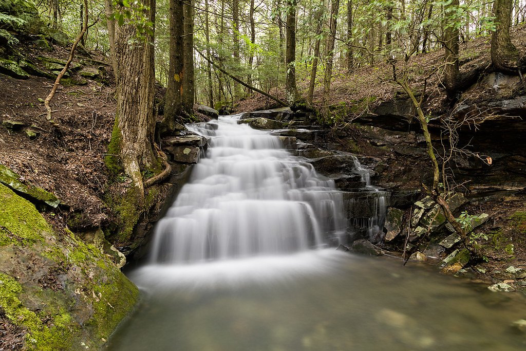
Stinging Fork Falls
Tennessee • 30 ft
By Armen Suny · Last verified Mar 2026
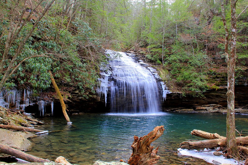
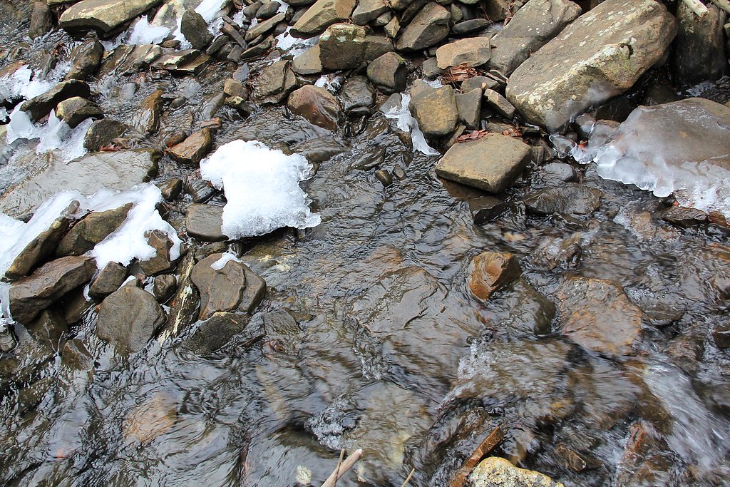
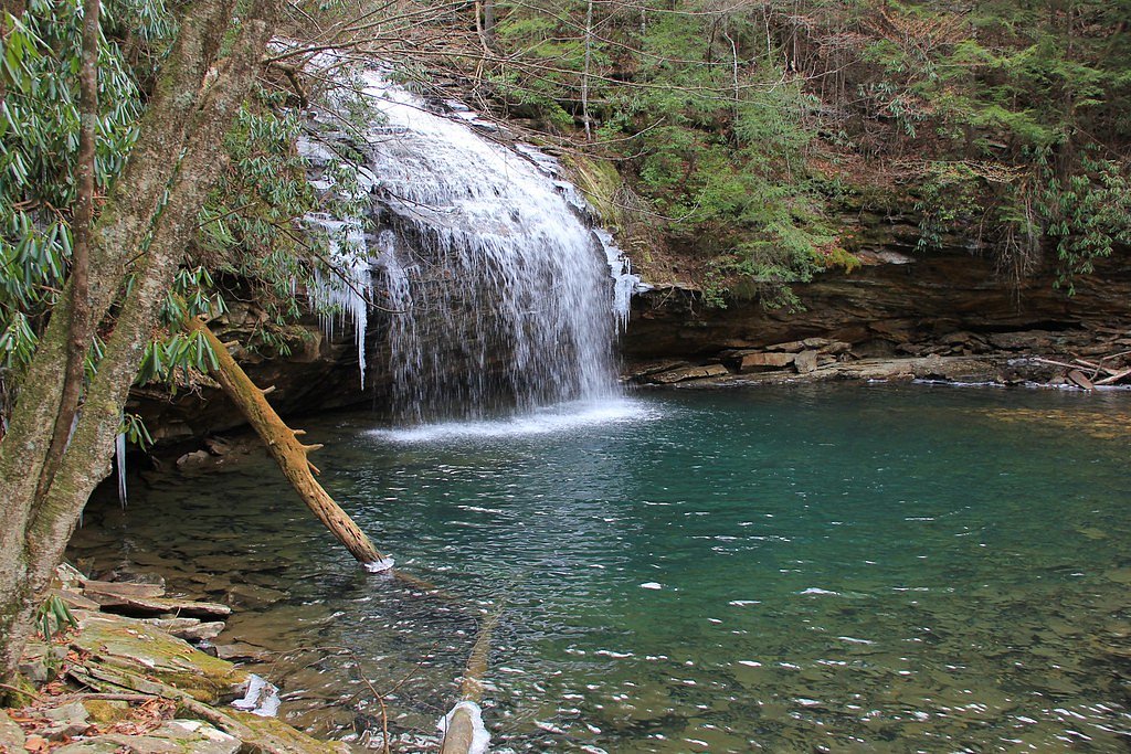
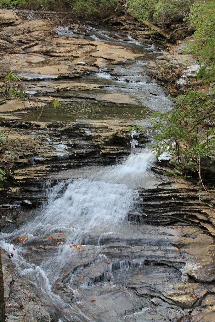

Photo Credits (5)
Difficulty
Moderate
Trail Length
2.0 miles
Trail Type
Out And Back
Elevation Gain
300 ft
About Stinging Fork Falls
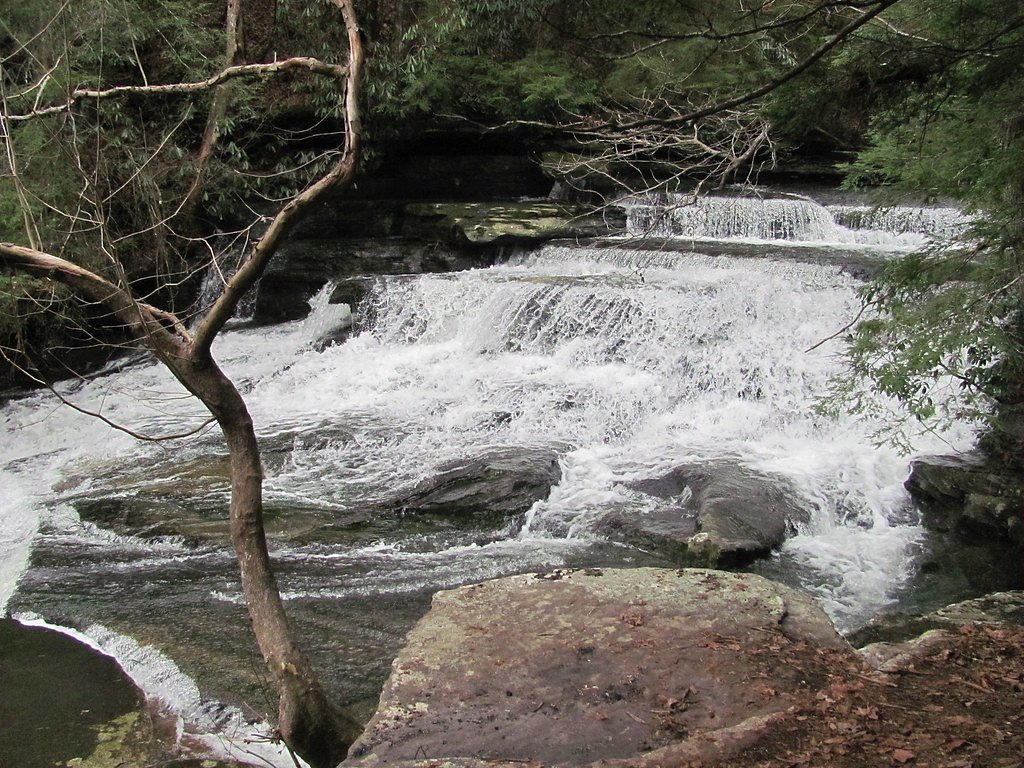
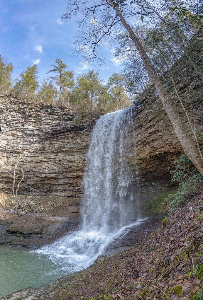
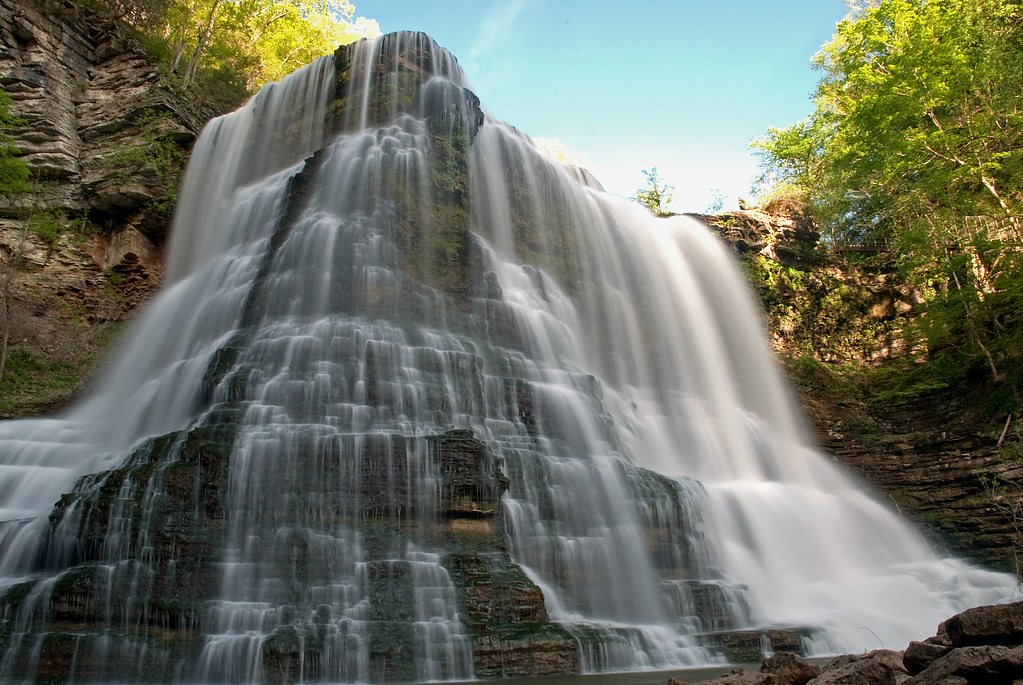
Stinging Fork Falls is a 30-foot cascade tucked into the Stinging Fork Falls State Natural Area near Spring City in Rhea County, Tennessee. Designated a Tennessee Class II Natural‑Scientific State Scenic Area, the site is managed by OTHS and lies within the Cumberland Trail land unit. The falls drop into a small, tree‑lined gorge and a peaceful plunge pool, making it a favorite short outing for photographers and day hikers seeking a scenic pay‑off for a relatively brief walk. The maintained trail from the parking area runs about 1 mile one‑way (2.0 miles round trip) with roughly 300 feet of elevation change and terminates at the bottom of the falls. A future segment of the Cumberland Trail is planned to connect directly to Stinging Fork Falls, which will open up longer route options. Come prepared with sturdy footwear for the rocky descent into the gorge and enjoy a compact, scenic hike managed as part of the Cumberland Trail unit by OTHS.
The Setting
Stinging Fork Falls sits at 1,411 feet within Cumberland Trail, fed by the Basses Creek, in the foothills of Tennessee. The falls drop 30 feet.
Height: 30 feet
Nearby Falls Worth Visiting
Upper Piney Falls (80 ft) lies 3.6 miles to the east. Also nearby: Laurel Falls (80 ft, 9.5 mi) and Lower Piney Falls (40 ft, 3.5 mi).
Trail & Hike Details
The Approach
The moderate 2.0-mile out-and-back trail gains 300 feet of elevation on the way to the falls.
Trail Description
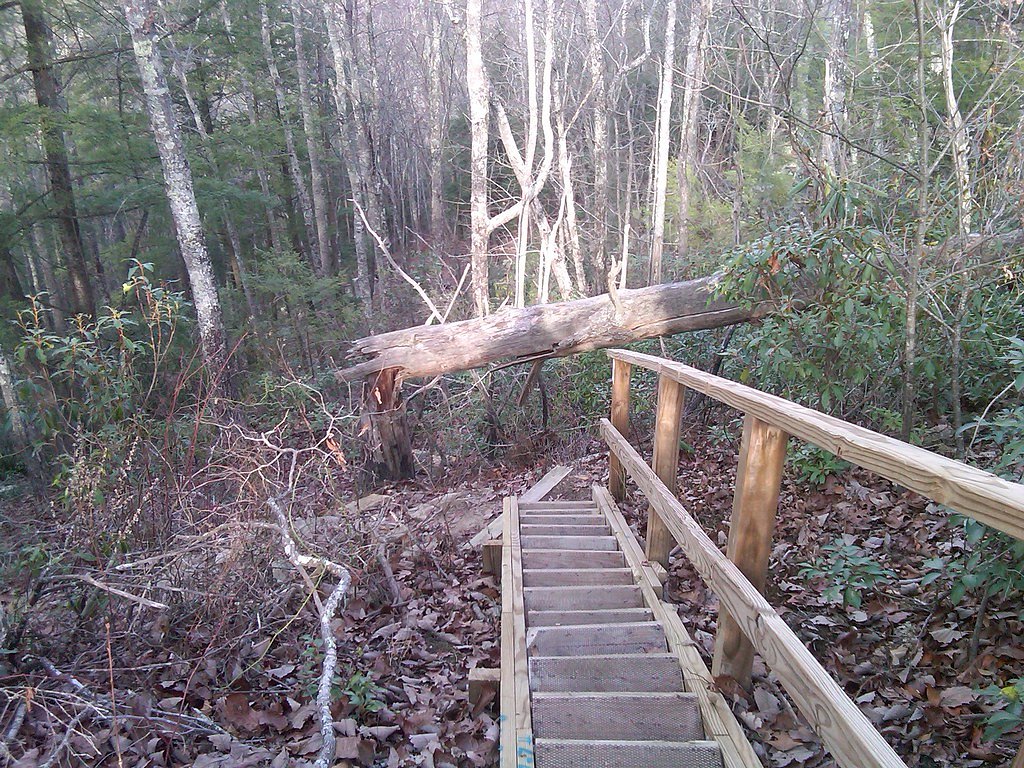
Out-and-back, 2.0 miles round trip (≈1.0 mile each way) with about 300 feet of elevation gain; rated moderate. The trail is a narrow, often rocky and uneven singletrack that drops into a small gorge before reaching the base of the 30‑foot waterfall (the trail terminates at the falls). Average grade on the ascent is roughly 5–6% given the one‑mile climb back to the parking area. Expect rocky footing and some short, steeper pitches on the return; the route is best suited to hikers comfortable on uneven terrain. Managed by OTHS as part of the Cumberland Trail land unit, the path currently serves as a short out‑and‑back destination, with a planned Cumberland Trail segment intended to provide a direct connection in the future.
What to Expect
The falls drop 30 feet. Dogs are welcome.
Accessibility
The trail is not wheelchair accessible. Uneven terrain and elevation changes require steady footing.
Frequently Asked Questions
🐶 Are Dogs Allowed at Stinging Fork Falls?
✅ Dogs are allowed
Are There Any Fees or Permits Required?
🆖 No fees required
🏊 Is There Swimming at Stinging Fork Falls?
❌ Swimming is not allowed
When to Visit
Spring and early summer are ideal times to visit, as the waterfall flow is typically strongest after seasonal rains. Fall offers beautiful foliage, while winter provides a quieter experience with potential ice formations around the falls.
Seasonal Access
The best time to visit is Spring, Summer, Fall, and Winter.
Safety Information
The trail can be slippery, especially after rain. Wear appropriate footwear and exercise caution near the waterfall and on steep sections of the trail. Watch for snakes and avoid venturing too close to the edge of the gorge.
Current Water Conditions
1 ft³/s
Current discharge — how much water is flowing
Lower than usual for this time of year
Based on 13 years of record
2.32 ft
Water depth at gauge
7-Day Discharge Trend
What does this mean for your visit?
Flow is lower than usual for this time of year.
About This Gauge
This gauge is on a nearby waterway and may not reflect exact conditions at the falls.
7-Day Flow Outlook
Based on the USGS gauge BASSES CREEK AT LAKE TANSI NR CROSSVILLE,TN (18 km away).
Today
Low
1 cfs
3/10Tomorrow
Low
1 cfs
3/10Sat
Low
1 cfs
3/10Sun
Low
1 cfs
3/10Mon
Low
1 cfs
3/10Tue
Low
1 cfs
3/10Wed
Low
1 cfs
3/10Best window: Today — low flow, mostly sunny then slight chance showers and thunderstorms (trip score 3/10).
Best time of year: this gauge typically runs highest from mid February to late March, peaking in December.
How we calculate this
This is a transparent outlook, not a precise forecast. We take the waterfall's current flow strength (how it ranks against its historical normal for today, from the nearest USGS stream gauge), carry that ranking forward along the gauge's seasonal curve, and nudge it for forecast rain. Confidence is highest for the next day or two and falls further out. Always check official conditions and your own judgment before visiting — high flows can be dangerous.
Know when to go.
Get a free email alert when waterfalls near Spring City hit peak flow. We only send when conditions are worth the trip — no weekly newsletters, no spam.
Weather Forecast
Location & Access
Getting There
Stinging Fork Falls is located off Shut-In Gap Road near Spring City, Tennessee. Visitors can access the trailhead via a small parking area at the entrance to the Stinging Fork Falls State Natural Area.
Get Directions on Google MapsParking
There is a small parking area available at the trailhead. Parking is free but may be limited during peak times.
Elevation
1,411 feet above sea level
Coordinates
35.721127° N, -84.927073° W
Land Management
Managed by OTHS
Visitor Tips & Gear
Arrive early to secure parking, especially during weekends or peak seasons. Bring plenty of water and wear sturdy hiking shoes. Be cautious on the descent to the falls, as the trail can be steep and slippery.
As an Amazon Associate, we earn from qualifying purchases.
With 2.0 miles and 300 ft of elevation gain, sturdy boots and trekking poles will help on this moderate trail. Icy conditions are common in winter — traction cleats are a smart addition.

Columbia Watertight II Rain Jacket
Packs into its own pocket, seam-sealed, and keeps you dry from spray and surprise rain.

Polarized Sunglasses (Knockaround)
Cuts glare off the water so you actually see the falls — and your photos turn out better too.

Earth Pak Waterproof Dry Bag
Keeps your phone and gear dry when waterfall mist soaks everything else.

Waterproof Phone Pouch (AiRunTech)
Cheap insurance — take photos right next to the falls without killing your phone.

Timberland Euro Sprint Mid Waterproof
Trusted waterproof boot with premium leather and grippy rubber sole — reliable on rocky, wet trails.

TrailBuddy Trekking Poles
Lightweight aluminum, cork grips, and flip-locks that actually hold — a best-seller for good reason.
Where to Stay

Grand Hotel

Holiday Inn Express & Suites Crossville by IHG

Comfort Inn Harriman

Comfort Suites Crossville
Browse vacation cabins and private rentals nearby
Unique outdoor stays — tents, yurts, and treehouses
Rent a campervan or RV for your waterfall road trip
Some links are affiliate links. We may earn a commission at no extra cost to you.
Additional Information
Nearby Attractions
Other nearby attractions include Piney Falls State Natural Area and Watts Bar Lake, both offering additional hiking and outdoor activities.
Wildlife
The area is home to a variety of wildlife, including birds, deer, and small mammals. Visitors may also encounter snakes, so caution is advised.
Cities near Stinging Fork Falls
Nearby Waterfalls
Writing about Stinging Fork Falls? Embed this waterfall on your site for free.