
Photo Credits (5)
Difficulty
Moderate
Trail Length
1.5 miles
Trail Type
Out And Back
Elevation Gain
300 ft
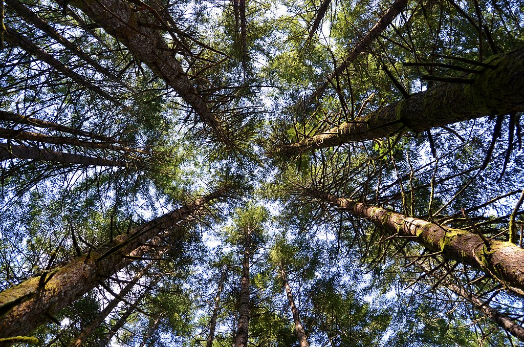
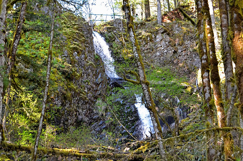
About Stasel Falls
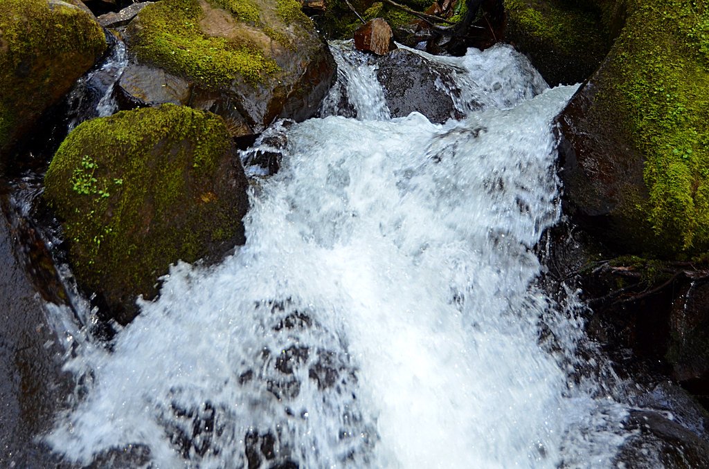
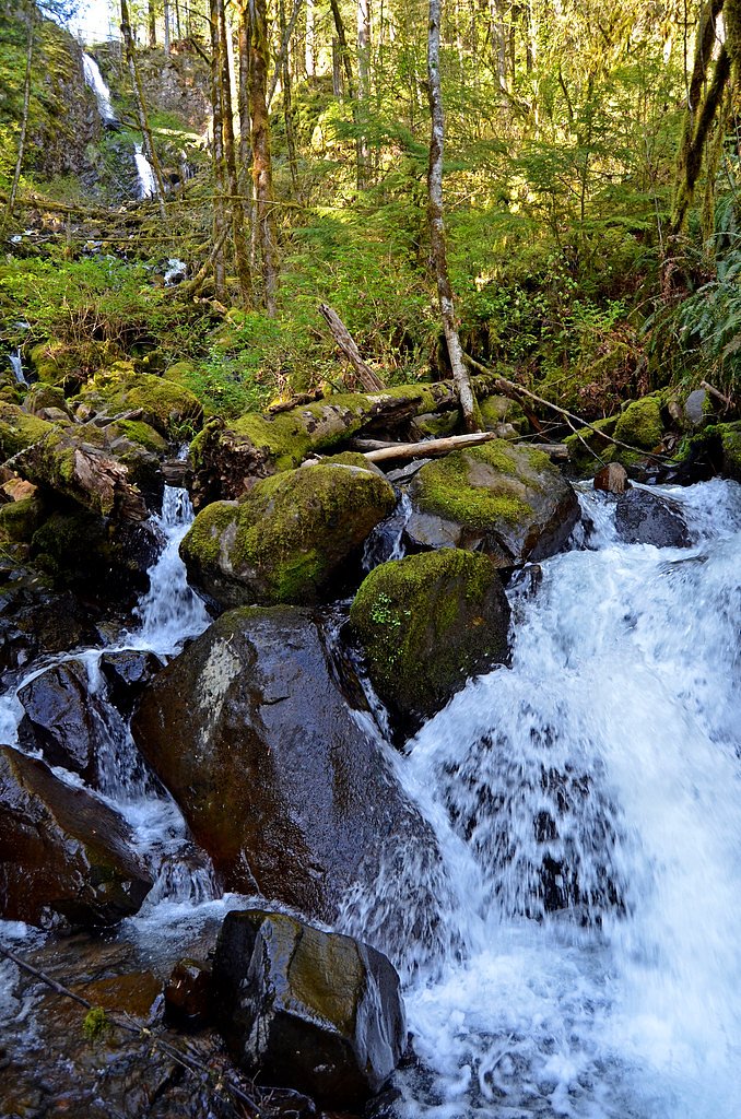
Stasel Falls is an impressive, 125-foot cascade tucked into private land near Oregon’s Santiam State Forest. The waterfall drops in two nearly equal tiers—each roughly 60 feet—and sits in the same drainage as well-known neighbors Shellburg Falls and Lower Shellburg Falls. Because Stasel Falls is located on private property, it is not open to the public; visitors should respect landowner rights and posted closures rather than attempting to approach the falls. Though the falls themselves aren’t accessible, the setting gives a good sense of the steep, forested terrain and layered cascades found throughout the Santiam area. Hikers and waterfall fans who want to experience public viewpoints in the region will find several legal trail options to Shellburg and Lower Shellburg Falls; consider those maintained routes for a safe, permitted outing rather than attempting to reach Stasel Falls directly.
The Setting
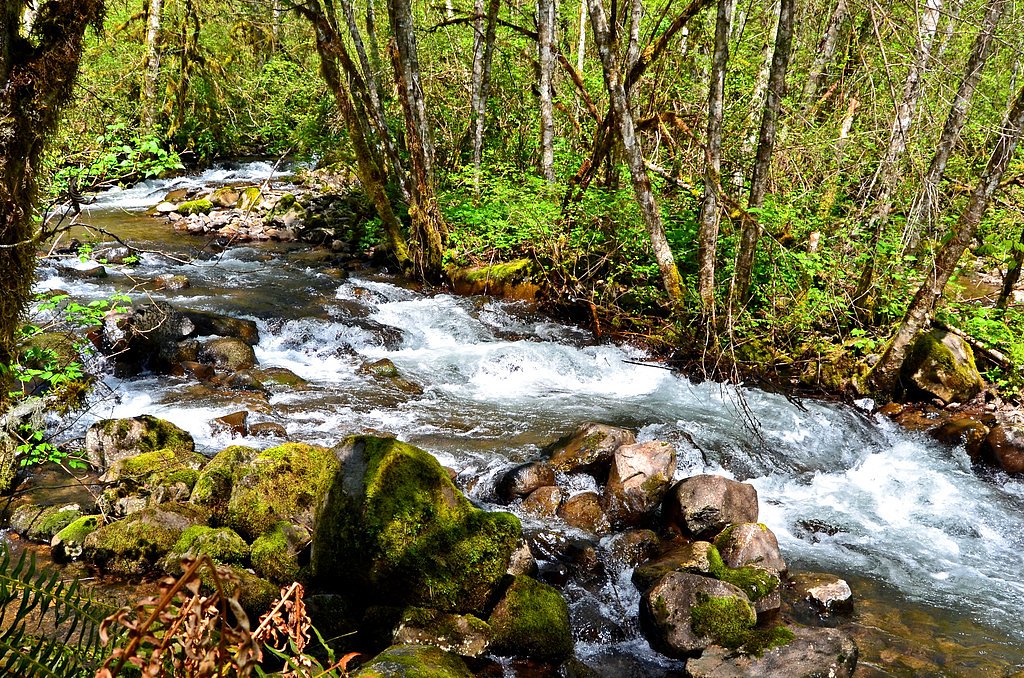
Stasel Falls sits at 1,335 feet along the Little North Santiam River, in the foothills of Oregon.
Nearby Falls Worth Visiting
Shellburg Falls (100 ft) lies 0.5 miles to the northwest. Also nearby: Stout Creek Falls (34 ft, 1.4 mi).
Trail & Hike Details
The Approach
The moderate 1.5-mile out-and-back trail gains 300 feet of elevation on the way to the falls.
Trail Description
Note on access: Stasel Falls sits on private property and is not publicly accessible—there is no USFS trail number for reaching the falls. Some trip reports describe a roughly 1.5-mile out-and-back route with about 300 feet of elevation gain, rated moderate. Those accounts note narrow, uneven tread with some steep sections and muddy conditions after rain; treat any unofficial routes as private or unmaintained and obey signage and landowner restrictions.
What to Expect
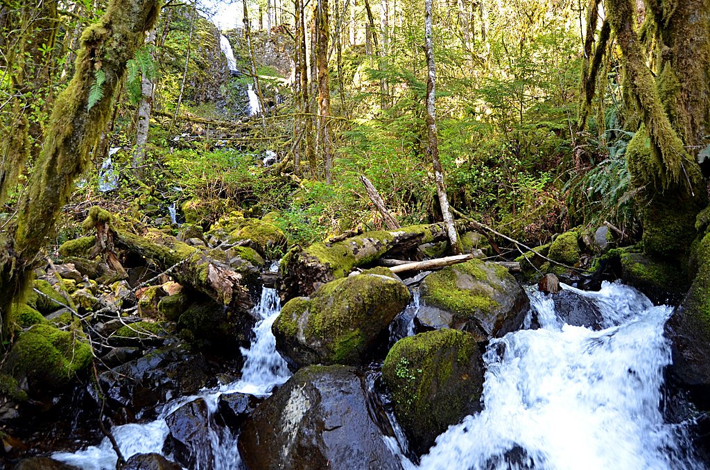
Visitors can expect a peaceful hike through a forested area leading to a picturesque waterfall. The area is relatively secluded, making it a great spot for those seeking solitude. The waterfall flows year-round but may be more impressive during the rainy season.
Accessibility
The trail is not wheelchair accessible. Uneven terrain and elevation changes require steady footing.
Frequently Asked Questions
🐶 Are Dogs Allowed at Stasel Falls?
❌ Dogs are not allowed
Are There Any Fees or Permits Required?
🆖 No fees required
🏊 Is There Swimming at Stasel Falls?
❌ Swimming is not allowed
When to Visit
Spring and early summer are ideal times to visit, as the waterfall is likely to have a stronger flow due to seasonal rains.
Seasonal Access
The best time to visit is Spring, Summer, and Fall. Winter access may be limited.
Safety Information
The trail may be slippery and muddy, especially after rain. Visitors should exercise caution near the waterfall and avoid climbing on wet rocks. Cell service may be limited, so plan accordingly.
Current Water Conditions
242 ft³/s
Current discharge — how much water is flowing
About average for this time of year
Based on 94 years of record
3.48 ft
Water depth at gauge
60°F
ColdBracing — limit time in water
7-Day Discharge Trend
What does this mean for your visit?
Flow is about average for this time of year. Water temperature is a bracing 60 degrees F, limit your time in the water. Expect excellent dissolved oxygen levels. PH is normal at 7.6 and mineral content is typical.
Water Quality
Dissolved Oxygen
ExcellentSupports aquatic life
pH
NormalWithin healthy range (6.5-8.5)
Conductance
Dissolved minerals in the water
About This Gauge
7-Day Flow Outlook
Based on the USGS gauge LITTLE NORTH SANTIAM RIVER NEAR MEHAMA, OR (3 km away).
Today
Roaring
261 cfs
6/10Tomorrow
Roaring
260 cfs
6/10Tue
Roaring
228 cfs
8/10Wed
Roaring
205 cfs
8/10Thu
Roaring
214 cfs
6/10Fri
Roaring
201 cfs
9/10Sat
Roaring
190 cfs
9/10Best window: Fri — roaring flow, mostly sunny (trip score 9/10).
Best time of year: this gauge typically runs highest from early January to late January, peaking in January.
How we calculate this
This is a transparent outlook, not a precise forecast. We take the waterfall's current flow strength (how it ranks against its historical normal for today, from the nearest USGS stream gauge), carry that ranking forward along the gauge's seasonal curve, and nudge it for forecast rain. Confidence is highest for the next day or two and falls further out. Always check official conditions and your own judgment before visiting — high flows can be dangerous.
Know when to go.
Get a free email alert when waterfalls near Lyons hit peak flow. We only send when conditions are worth the trip — no weekly newsletters, no spam.
Weather Forecast
Location & Access
Getting There
Stasel Falls is located in the Tillamook State Forest, Oregon. Access typically involves driving on forest roads, which may be unpaved and rough in some areas. Directions can vary, so it is recommended to use a GPS or detailed map to locate the trailhead.
Get Directions on Google MapsParking
Parking is limited and may be located along the side of the forest road near the trailhead. Visitors should ensure their vehicle is parked safely and does not block the road.
Elevation
1,335 feet above sea level
Coordinates
44.808674° N, -122.600567° W
Visitor Tips & Gear
Wear sturdy hiking shoes and bring a map or GPS as the trail may not be well-marked. Be cautious of slippery rocks near the waterfall. Cell service may be limited in the area.
As an Amazon Associate, we earn from qualifying purchases.
With 1.5 miles and 300 ft of elevation gain, sturdy boots and trekking poles will help on this moderate trail. Sun exposure on the trail makes good sun protection a must in summer.

Polarized Sunglasses (Knockaround)
Cuts glare off the water so you actually see the falls — and your photos turn out better too.

Columbia Watertight II Rain Jacket
Packs into its own pocket, seam-sealed, and keeps you dry from spray and surprise rain.

Earth Pak Waterproof Dry Bag
Keeps your phone and gear dry when waterfall mist soaks everything else.

Waterproof Phone Pouch (AiRunTech)
Cheap insurance — take photos right next to the falls without killing your phone.

Timberland Euro Sprint Mid Waterproof
Trusted waterproof boot with premium leather and grippy rubber sole — reliable on rocky, wet trails.

TrailBuddy Trekking Poles
Lightweight aluminum, cork grips, and flip-locks that actually hold — a best-seller for good reason.
Where to Stay

The 1908 Bungalow

Oregon Garden Resort

La Quinta by Wyndham Salem OR

Howard Johnson by Wyndham Salem
Browse vacation cabins and private rentals nearby
Unique outdoor stays — tents, yurts, and treehouses
Rent a campervan or RV for your waterfall road trip
Some links are affiliate links. We may earn a commission at no extra cost to you.
Nearby Campground
Aquila Vista Recreation Site
13.2 miles away · 1 sites
Overview Aquila Vista is closed until further notice to remove wildfire burned danger trees. Aquila Vista is available for overnight group camping for groups up to 30 people and 20 vehicles. The season, when it reopens, will be mid-May through mid-October. The site is located in the heart of the forest next to a large beaver pond. There is plenty of hiking and natural beauty to see at Aquila Vista including a small waterfall. Amenities include vault toilet, two group picnic shelters with multiple
Book on Recreation.govNearby Hot Springs
Hot springs near Lyons, Oregon

Bagby Hot Springs
Bagby Hot Springs flows at 136°F deep in Mount Hood National Forest at 2,272 feet elevation, requiring a 3,720-foot hike from F...

Breitenbush Hot Springs
Breitenbush Hot Springs emerges at 198°F along the Breitenbush River, ranking as one of Oregon's hottest thermal features with ...

Austin Hot Springs
Austin Hot Springs discharges at 186°F along the Clackamas River at 1,680 feet elevation, emerging just 310 feet from Clackamas...

Bigelow Hot Springs
Bigelow Hot Springs, also called Deer Creek Hot Springs, emerges at 142°F just 400 feet from Deer Creek Road in the Willamette ...
Foley Springs
Foley Springs emerges at 178°F in the Cascade Range of Lane County, making it one of Oregon's hottest thermal features with rec...
Belknap Springs
Belknap Springs flows at 160°F along the McKenzie River in the Cascade Range, emerging just 510 feet from North Belknap Springs...
Looking for a soak after your hike? Explore more hot springs near Lyons, Oregon on SoakingSprings.
Explore Oregon springsAdditional Information
Nearby Attractions
Other waterfalls and hiking trails in the Tillamook State Forest, such as University Falls and Wilson River Trail.
Wildlife
The area is home to a variety of wildlife, including birds, deer, and small mammals. Visitors should be aware of the possibility of encountering bears or cougars and take appropriate precautions.
Cities near Stasel Falls
Nearby Waterfalls

Writing about Stasel Falls? Embed this waterfall on your site for free.