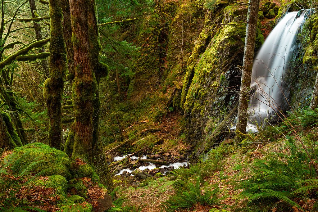
Shellburg Falls
Oregon • 100 ft
By Armen Suny · Last verified Mar 2026
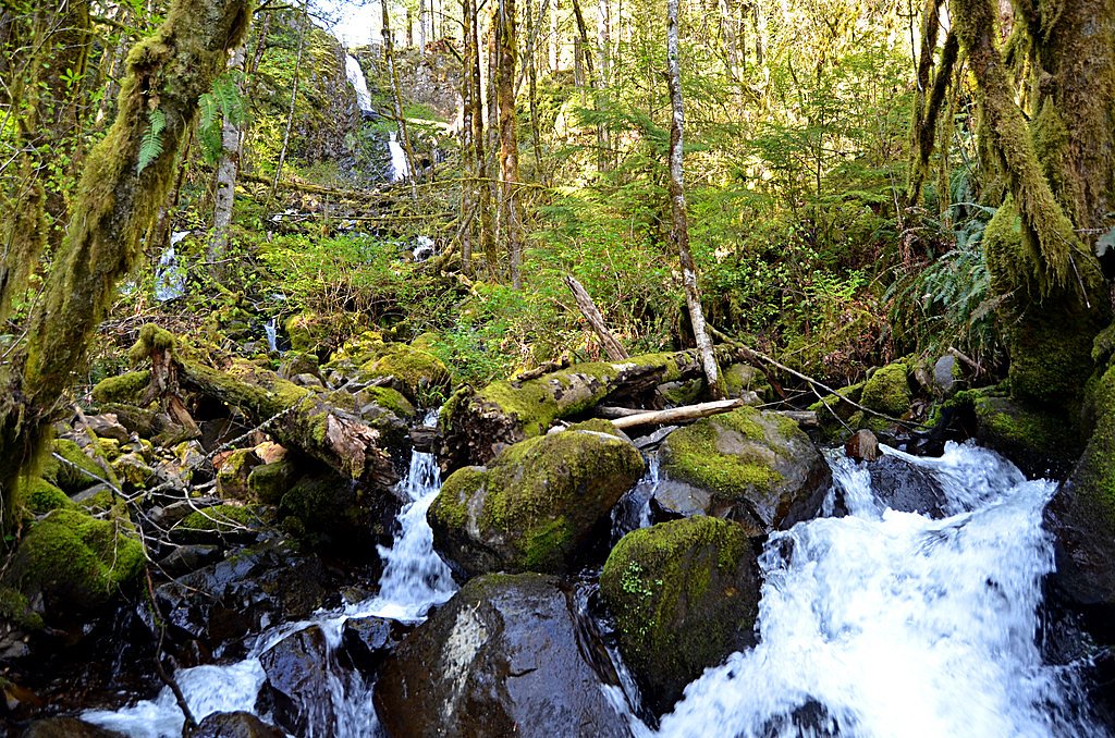
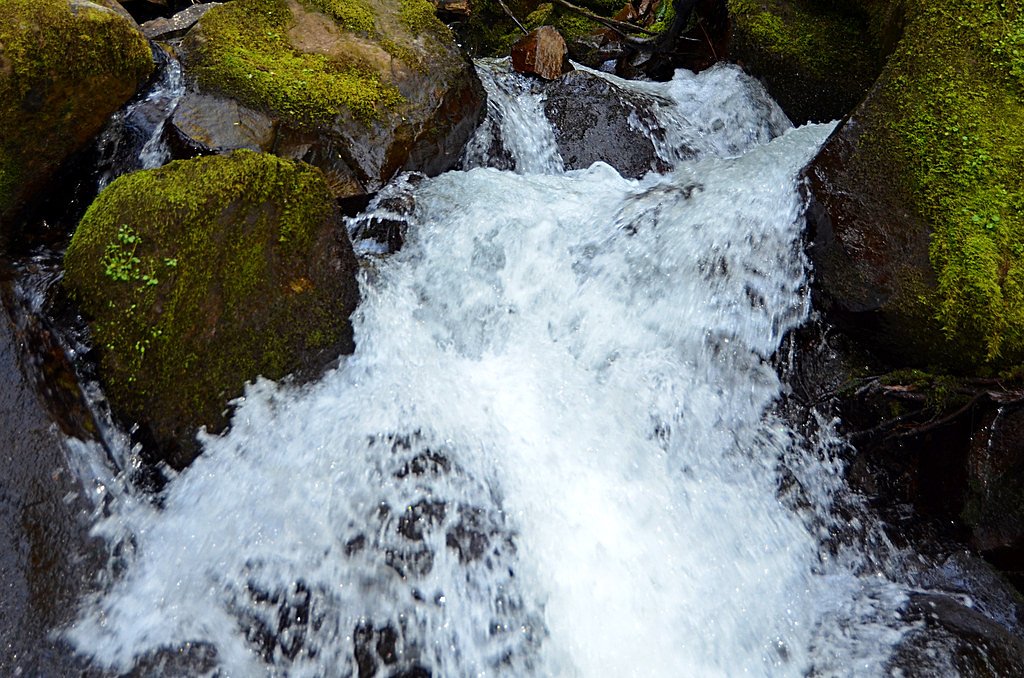
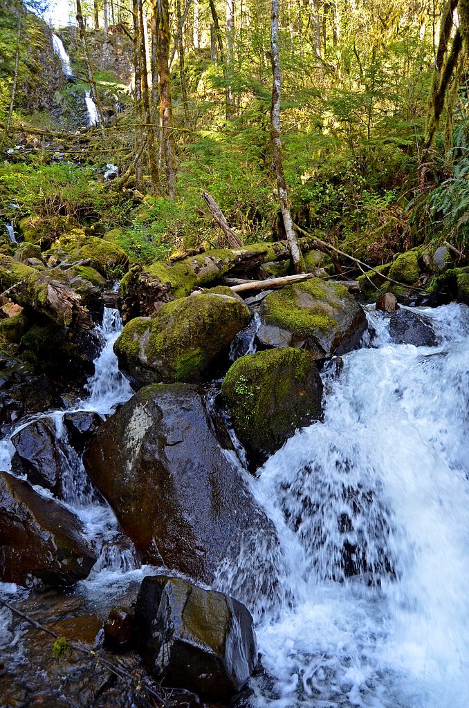
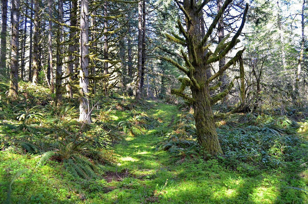
Photo Credits (5)
Difficulty
Moderate
Trail Length
2.8 miles
Trail Type
Out And Back
Elevation Gain
400 ft
About Shellburg Falls
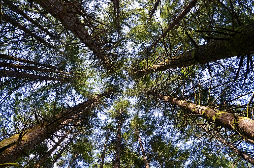
Shellburg Falls drops a dramatic 100 feet into the Stout Creek canyon inside Oregon’s Santiam State Forest, about 2.5 miles north of Lyons. The slender ribbon of water—roughly 10 feet wide on average—sits upstream from Lower Shellburg Falls and is only about half a mile from Stasel Falls, making this stretch of creek a rewarding short-cascade hop for waterfall seekers. Tucked into a lush, forested canyon, the falls offer striking vertical relief and a close-up, intimate feel that photographers and day-hikers appreciate. The site and surrounding lands are owned by SDNR and administered as part of the Forest Development Fund (Board of Forestry), designated as an SRMA and managed by SLB. Whether you come for a focused waterfall outing or to stitch together a route visiting nearby Stasel and Lower Shellburg, Shellburg Falls is an accessible highlight of the Santiam State Forest canyonlands and a memorable stop along the Stout Creek corridor.
The Setting
Shellburg Falls sits at 1,332 feet within Forest Development Fund (Board Of Forestry), fed by the North Santiam River, in the foothills of Oregon. At 100 feet, it is among the taller waterfalls in Oregon.
Height: 100 feet
Trail & Hike Details
The Approach
The moderate 2.8-mile out-and-back trail gains 400 feet of elevation on the way to the falls.
Trail Description
The Shellburg Falls trail is a 2.8-mile out-and-back with about 400 feet of elevation gain and is rated moderate. The path is generally well-maintained, running over dirt and gravel surfaces through a densely wooded corridor of Douglas-fir and maple; expect moderate grades on the approach that climb the canyon rim. Hikers will find clear viewpoints of the 100-foot drop and, in some spots near the brink, the chance to get a close, immersive look at the cascade. Trail type: out-and-back. Surface: dirt and gravel. Elevation gain: ~400 ft. Difficulty/class: moderate.
What to Expect
The falls cascade 100 feet. Dogs are welcome.
Accessibility
The trail is not wheelchair accessible. Uneven terrain and elevation changes require steady footing.
Frequently Asked Questions
🐶 Are Dogs Allowed at Shellburg Falls?
✅ Dogs are allowed
Are There Any Fees or Permits Required?
🆖 No fees required
🏊 Is There Swimming at Shellburg Falls?
❌ Swimming is not allowed
When to Visit
Spring and early summer are ideal times to visit, as the waterfall is at its fullest due to seasonal rainfall. Fall offers beautiful foliage, while winter may bring icy conditions, so caution is advised.
Seasonal Access
The best time to visit is Spring, Summer, and Fall. Winter access may be limited.
Safety Information
The trail can be slippery, especially near the waterfall and during wet weather. Stay on marked paths and exercise caution when walking behind the falls. Be prepared for changing weather conditions.
Current Water Conditions
1,460 ft³/s
Current discharge — how much water is flowing
About average for this time of year
Based on 109 years of record
3.54 ft
Water depth at gauge
7-Day Discharge Trend
What does this mean for your visit?
Flow is about average for this time of year.
About This Gauge
7-Day Flow Outlook
Based on the USGS gauge NORTH SANTIAM RIVER AT MEHAMA, OR (3 km away).
Today
Roaring
1577 cfs
6/10Tomorrow
Roaring
1615 cfs
6/10Tue
Roaring
1528 cfs
8/10Wed
Roaring
1442 cfs
8/10Thu
Roaring
1433 cfs
6/10Fri
Roaring
1426 cfs
9/10Sat
Roaring
1309 cfs
9/10Best window: Fri — roaring flow, mostly sunny (trip score 9/10).
Best time of year: this gauge typically runs highest from mid November to late January, peaking in November.
How we calculate this
This is a transparent outlook, not a precise forecast. We take the waterfall's current flow strength (how it ranks against its historical normal for today, from the nearest USGS stream gauge), carry that ranking forward along the gauge's seasonal curve, and nudge it for forecast rain. Confidence is highest for the next day or two and falls further out. Always check official conditions and your own judgment before visiting — high flows can be dangerous.
Know when to go.
Get a free email alert when waterfalls near Lyons hit peak flow. We only send when conditions are worth the trip — no weekly newsletters, no spam.
Weather Forecast
Location & Access
Getting There
Shellburg Falls is located approximately 25 miles east of Salem, Oregon. From Highway 22, take Fern Ridge Road and follow signs to the Shellburg Falls Trailhead. The trailhead is accessible via a gravel road.
Get Directions on Google MapsParking
There is a small parking area near the trailhead, but it can fill up quickly, especially on weekends. Arrive early to secure a spot.
Elevation
1,332 feet above sea level
Coordinates
44.812606° N, -122.608603° W
Land Management
Managed by SLB
Visitor Tips & Gear
Wear sturdy, waterproof footwear, especially during the rainy season. Bring a camera to capture the stunning views behind the waterfall. Arrive early to avoid crowds and secure parking. Check for any trail closures or restrictions before visiting.
As an Amazon Associate, we earn from qualifying purchases.
With 2.8 miles and 400 ft of elevation gain, sturdy boots and trekking poles will help on this moderate trail. Sun exposure on the trail makes good sun protection a must in summer.

Polarized Sunglasses (Knockaround)
Cuts glare off the water so you actually see the falls — and your photos turn out better too.

Columbia Watertight II Rain Jacket
Packs into its own pocket, seam-sealed, and keeps you dry from spray and surprise rain.

Earth Pak Waterproof Dry Bag
Keeps your phone and gear dry when waterfall mist soaks everything else.

Waterproof Phone Pouch (AiRunTech)
Cheap insurance — take photos right next to the falls without killing your phone.

Timberland Euro Sprint Mid Waterproof
Trusted waterproof boot with premium leather and grippy rubber sole — reliable on rocky, wet trails.

TrailBuddy Trekking Poles
Lightweight aluminum, cork grips, and flip-locks that actually hold — a best-seller for good reason.
Where to Stay

The 1908 Bungalow

Oregon Garden Resort

La Quinta by Wyndham Salem OR

Howard Johnson by Wyndham Salem
Browse vacation cabins and private rentals nearby
Unique outdoor stays — tents, yurts, and treehouses
Rent a campervan or RV for your waterfall road trip
Some links are affiliate links. We may earn a commission at no extra cost to you.
Nearby Campground
ELKHORN VALLEY RECREATION SITE
7.6 miles away · 23 sites
Overview Elkhorn Valley Recreation Site is closed due to heavy wildfire damage. Nearby Attractions:Canyon Creek Recreation Site is located downstream from Elkhorn Valley and is open for day use including swimming, fishing, and picnicking. Fishermen's Bend Recreation Site, along Hwy 22 closer to Mill City, is open to day use where you can picnic, hold events and gatherings, relax, cool off, fish and put in a non-motorized boat. Along Forest Road 2209 in the Willamette National Forest the sites Thr
Book on Recreation.govNearby Hot Springs
Hot springs near Lyons, Oregon

Bagby Hot Springs
Bagby Hot Springs flows at 136°F deep in Mount Hood National Forest at 2,272 feet elevation, requiring a 3,720-foot hike from F...

Breitenbush Hot Springs
Breitenbush Hot Springs emerges at 198°F along the Breitenbush River, ranking as one of Oregon's hottest thermal features with ...

Austin Hot Springs
Austin Hot Springs discharges at 186°F along the Clackamas River at 1,680 feet elevation, emerging just 310 feet from Clackamas...

Bigelow Hot Springs
Bigelow Hot Springs, also called Deer Creek Hot Springs, emerges at 142°F just 400 feet from Deer Creek Road in the Willamette ...
Foley Springs
Foley Springs emerges at 178°F in the Cascade Range of Lane County, making it one of Oregon's hottest thermal features with rec...
Belknap Springs
Belknap Springs flows at 160°F along the McKenzie River in the Cascade Range, emerging just 510 feet from North Belknap Springs...
Looking for a soak after your hike? Explore more hot springs near Lyons, Oregon on SoakingSprings.
Explore Oregon springsAdditional Information
Nearby Attractions
Nearby attractions include Silver Falls State Park, which features several other waterfalls, and the town of Silverton, known for its charming downtown and Oregon Garden.
Wildlife
The area is home to a variety of wildlife, including deer, squirrels, and numerous bird species. Keep an eye out for woodpeckers and owls.
Cities near Shellburg Falls
Nearby Waterfalls

Writing about Shellburg Falls? Embed this waterfall on your site for free.