Ayers Creek Falls
By Armen Suny · Last verified May 2026
Difficulty
Moderate
Trail Length
2.4 miles
Trail Type
Out And Back
Elevation Gain
350 ft
About Ayers Creek Falls
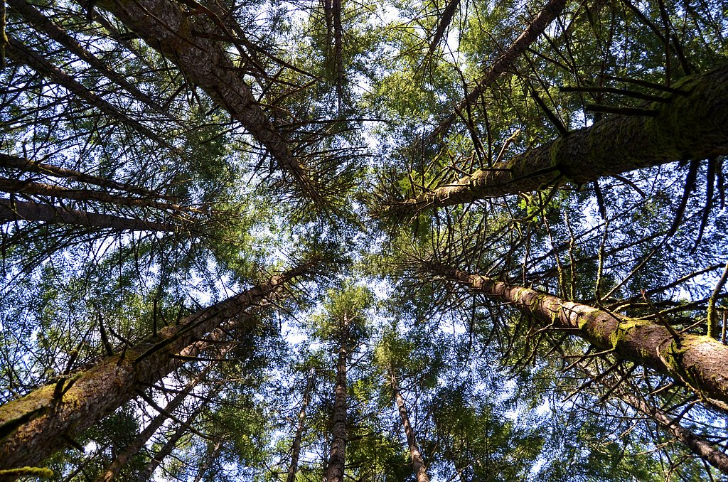
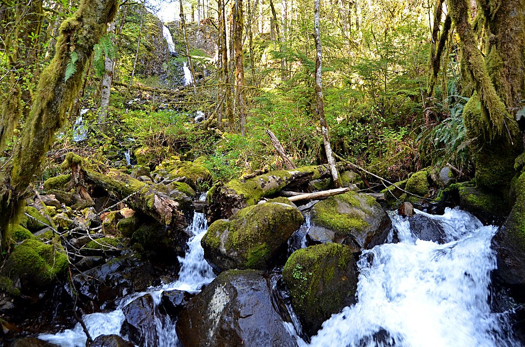
Ayers Creek Falls tumbles along Ayers Creek on the outer edge of Santiam State Forest near Mehama in Marion County, Oregon, where the west foothills form a transition zone where Mount Hood National Forest meets the Middle Santiam Wilderness. The waterfall is formed on Ayers Creek — the smallest tributary of Stout Creek — and is one of several tucked-away cascades in this forested stretch. Framed by dense green timber and a rocky canyon, the viewpoint feels intimate and quiet compared with larger, more-visited falls, making it a lovely stop for hikers exploring the Santiam foothills. The outing is a pleasant, moderate hike rather than a developed day‑use area, appealing to those who prefer softer tread and a backcountry atmosphere. Expect mossy scenery and shaded forest as you descend into the canyon for the best views; bring a map or GPS and plan for natural trail conditions rather than formal facilities. Its off-the-beaten-path character rewards visitors looking for a tranquil waterfall experience in the foothills where public forestlands meet wilderness country.
The Setting
Ayers Creek Falls sits at 1,444 feet along the Little North Santiam River, in the foothills of Oregon.
Nearby Falls Worth Visiting
Shellburg Falls (100 ft) lies 1.0 miles to the west. Also nearby: Stout Creek Falls (34 ft, 0.7 mi).
Trail & Hike Details
The Approach
The moderate 2.4-mile out-and-back trail gains 350 feet of elevation on the way to the falls.
Trail Description
Distance: 2.4 miles round trip (out-and-back). Elevation gain: approximately 350 feet. Difficulty: moderate. Trail type: out-and-back. Available sources do not list an official USFS trail name or number for the Ayers Creek Falls route, nor do they provide formal USFS surface, grade, or trail-class data. On-the-ground route conditions follow unpaved forest paths and natural tread through west-foothill timber: expect dirt and root-covered surfaces, occasional rocky sections and short, steeper pitches as the trail drops into the canyon. Footing can be uneven and slipperier when wet; plan for typical backcountry conditions and use maps or GPS for navigation. There are no listed developed facilities or nearby campgrounds within 10 km, so come prepared for a day hike with basic backcountry precautions.
What to Expect
Expect a quiet and secluded waterfall surrounded by natural beauty. The area may have dense vegetation and a tranquil atmosphere, making it ideal for those seeking solitude.
Accessibility
The trail is not wheelchair accessible. Uneven terrain and elevation changes require steady footing.
Frequently Asked Questions
🐶 Are Dogs Allowed at Ayers Creek Falls?
❌ Dogs are not allowed
Are There Any Fees or Permits Required?
🆖 No fees required
🏊 Is There Swimming at Ayers Creek Falls?
❌ Swimming is not allowed
When to Visit
Spring and early summer may be the best times to visit, as water flow is typically higher during these seasons.
Seasonal Access
The best time to visit is Spring, Summer, Fall, and Winter.
Safety Information
Visitors should exercise caution due to potentially unmarked trails, slippery rocks, and uneven terrain. Check weather conditions and avoid visiting during heavy rain or storms.
Current Water Conditions
136 ft³/s
Current discharge — how much water is flowing
About average for this time of year
Based on 94 years of record
3.11 ft
Water depth at gauge
63°F
CoolRefreshing for swimming
7-Day Discharge Trend
What does this mean for your visit?
Flow is about average for this time of year. Water temperature is a refreshing 63 degrees F, good for a quick swim. Expect excellent dissolved oxygen levels. PH is normal at 7.6 and mineral content is typical.
Water Quality
Dissolved Oxygen
ExcellentSupports aquatic life
pH
NormalWithin healthy range (6.5-8.5)
Conductance
Dissolved minerals in the water
About This Gauge
7-Day Flow Outlook
Based on the USGS gauge LITTLE NORTH SANTIAM RIVER NEAR MEHAMA, OR (2 km away).
Today
Roaring
155 cfs
6/10Tomorrow
Roaring
150 cfs
6/10Mon
Roaring
130 cfs
8/10Tue
Roaring
118 cfs
8/10Wed
Roaring
110 cfs
9/10Thu
Roaring
115 cfs
6/10Fri
Roaring
117 cfs
6/10Best window: Wed — roaring flow, partly sunny (trip score 9/10).
Best time of year: this gauge typically runs highest from early January to late January, peaking in January.
How we calculate this
This is a transparent outlook, not a precise forecast. We take the waterfall's current flow strength (how it ranks against its historical normal for today, from the nearest USGS stream gauge), carry that ranking forward along the gauge's seasonal curve, and nudge it for forecast rain. Confidence is highest for the next day or two and falls further out. Always check official conditions and your own judgment before visiting — high flows can be dangerous.
Know when to go.
Get a free email alert when waterfalls near Lyons hit peak flow. We only send when conditions are worth the trip — no weekly newsletters, no spam.
Weather Forecast
Location & Access
Getting There
Ayers Creek Falls is located in Oregon, but specific directions to the site are not widely documented. Visitors may need to rely on local maps or GPS coordinates to locate the falls.
Get Directions on Google MapsParking
Parking availability is unclear, but visitors should prepare for limited or informal parking options near the trailhead or access point.
Elevation
1,444 feet above sea level
Coordinates
44.811838° N, -122.588389° W
Visitor Tips & Gear
Bring a detailed map or GPS device as the location is not well-marked. Wear sturdy footwear and be prepared for uneven terrain. Check local conditions before visiting.
As an Amazon Associate, we earn from qualifying purchases.
With 2.4 miles and 350 ft of elevation gain, sturdy boots and trekking poles will help on this moderate trail. Icy conditions are common in winter — traction cleats are a smart addition.

Columbia Watertight II Rain Jacket
Packs into its own pocket, seam-sealed, and keeps you dry from spray and surprise rain.

Earth Pak Waterproof Dry Bag
Keeps your phone and gear dry when waterfall mist soaks everything else.

Waterproof Phone Pouch (AiRunTech)
Cheap insurance — take photos right next to the falls without killing your phone.

Timberland Euro Sprint Mid Waterproof
Trusted waterproof boot with premium leather and grippy rubber sole — reliable on rocky, wet trails.

TrailBuddy Trekking Poles
Lightweight aluminum, cork grips, and flip-locks that actually hold — a best-seller for good reason.

Kahtoola MICROspikes
Cult-favorite traction cleats that grip ice and wet rock — essential for winter waterfall hikes.
Where to Stay

The 1908 Bungalow

Oregon Garden Resort

La Quinta by Wyndham Salem OR

Howard Johnson by Wyndham Salem
Browse vacation cabins and private rentals nearby
Unique outdoor stays — tents, yurts, and treehouses
Rent a campervan or RV for your waterfall road trip
Some links are affiliate links. We may earn a commission at no extra cost to you.
Nearby Campground
Aquila Vista Recreation Site
12.8 miles away · 1 sites
Overview Aquila Vista is closed until further notice to remove wildfire burned danger trees. Aquila Vista is available for overnight group camping for groups up to 30 people and 20 vehicles. The season, when it reopens, will be mid-May through mid-October. The site is located in the heart of the forest next to a large beaver pond. There is plenty of hiking and natural beauty to see at Aquila Vista including a small waterfall. Amenities include vault toilet, two group picnic shelters with multiple
Book on Recreation.govNearby Hot Springs
Hot springs near Lyons, Oregon

Bagby Hot Springs
Bagby Hot Springs flows at 136°F deep in Mount Hood National Forest at 2,272 feet elevation, requiring a 3,720-foot hike from F...

Breitenbush Hot Springs
Breitenbush Hot Springs emerges at 198°F along the Breitenbush River, ranking as one of Oregon's hottest thermal features with ...

Austin Hot Springs
Austin Hot Springs discharges at 186°F along the Clackamas River at 1,680 feet elevation, emerging just 310 feet from Clackamas...

Bigelow Hot Springs
Bigelow Hot Springs, also called Deer Creek Hot Springs, emerges at 142°F just 400 feet from Deer Creek Road in the Willamette ...
Foley Springs
Foley Springs emerges at 178°F in the Cascade Range of Lane County, making it one of Oregon's hottest thermal features with rec...
Belknap Springs
Belknap Springs flows at 160°F along the McKenzie River in the Cascade Range, emerging just 510 feet from North Belknap Springs...
Looking for a soak after your hike? Explore more hot springs near Lyons, Oregon on SoakingSprings.
Explore Oregon springsAdditional Information
Nearby Attractions
Other natural attractions in Oregon, such as nearby waterfalls or hiking trails, may be worth exploring.
Wildlife
The area may host a variety of wildlife, including birds and small mammals. Visitors should be cautious and respectful of the natural habitat.
Cities near Ayers Creek Falls
Nearby Waterfalls


Writing about Ayers Creek Falls? Embed this waterfall on your site for free.