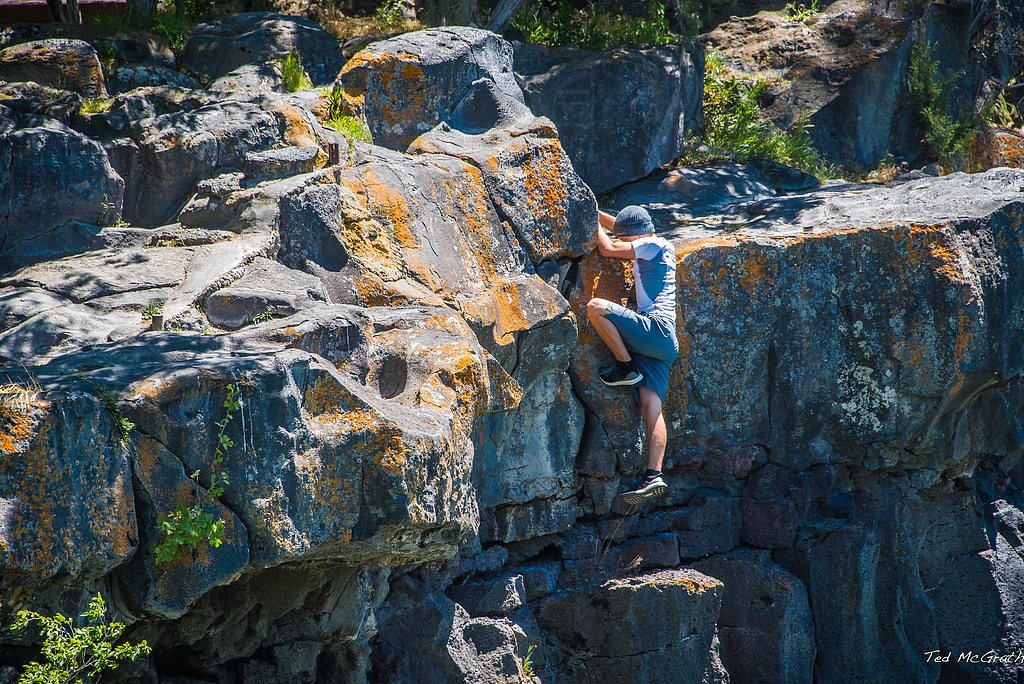
Shadow Falls
By Armen Suny · Last verified May 2026
Photo Credits (1)
Difficulty
Moderate
Trail Length
2.4 miles
Trail Type
Out And Back
Elevation Gain
350 ft
About Shadow Falls
Shadow Falls is a picturesque waterfall located in the Idaho Panhandle National Forests. It is surrounded by lush forest and offers a serene and peaceful environment for visitors. The waterfall cascades over a rocky cliff into a small pool below, making it a popular spot for nature enthusiasts.
The Setting
Shadow Falls sits at 3,350 feet within Coeur d'Alene National Forest, in the mountains of Idaho.
Trail & Hike Details
The Approach
The moderate hike follows Shadow Falls (#513), a 2.4-mile out-and-back trail over natural surface. Expect 350 feet of elevation gain with grades of 12-20%. The trail is highly developed (Class 4).
USFS Trail
SHADOW FALLS #513
Trail Class
Highly Developed
Surface
Avg Grade
USFS Segment
0.13 miTrail Description
The trail to Shadow Falls is short and relatively flat, making it accessible for most visitors. It winds through a dense forest with plenty of shade, leading to a viewing area near the base of the waterfall. The trail may be muddy or slippery after rain, so proper footwear is recommended.
What to Expect
Dogs are welcome.
Accessibility
The trail is not wheelchair accessible. Uneven terrain and elevation changes require steady footing.
Frequently Asked Questions
🐶 Are Dogs Allowed at Shadow Falls?
✅ Dogs are allowed
Are There Any Fees or Permits Required?
🆖 No fees required
🏊 Is There Swimming at Shadow Falls?
❌ Swimming is not allowed
When to Visit
Spring and early summer are the best times to visit, as the waterfall is most active due to snowmelt. Fall offers beautiful foliage, while summer provides warm weather for hiking.
Seasonal Access
The best time to visit is Spring, Summer, and Fall. Winter access may be limited. Check with Coeur d'Alene National Forest for seasonal road closures.
Safety Information
Watch for slippery rocks near the waterfall and stay on marked trails. Be prepared for changing weather conditions, as the area can experience sudden rain or temperature drops.
Current Water Conditions
123 ft³/s
Current discharge — how much water is flowing
Much lower than usual for this time of year
Based on 75 years of record
1.40 ft
Water depth at gauge
7-Day Discharge Trend
What does this mean for your visit?
Flow is well below normal for this time of year, so the waterfall may be a trickle.
About This Gauge
This gauge is on a nearby waterway and may not reflect exact conditions at the falls.
7-Day Flow Outlook
Based on the USGS gauge NF COEUR D ALENE R AB SHOSHONE CK NR PRICHARD ID (11 km away).
Today
Moderate
133 cfs
5/10Tomorrow
Moderate
129 cfs
5/10Mon
Moderate
133 cfs
5/10Tue
Moderate
127 cfs
5/10Wed
Moderate
113 cfs
8/10Thu
Moderate
110 cfs
8/10Fri
Moderate
115 cfs
5/10Best window: Wed — moderate flow, mostly sunny (trip score 8/10).
Best time of year: this gauge typically runs highest from mid March to early June, peaking in May.
How we calculate this
This is a transparent outlook, not a precise forecast. We take the waterfall's current flow strength (how it ranks against its historical normal for today, from the nearest USGS stream gauge), carry that ranking forward along the gauge's seasonal curve, and nudge it for forecast rain. Confidence is highest for the next day or two and falls further out. Always check official conditions and your own judgment before visiting — high flows can be dangerous.
Know when to go.
Get a free email alert when waterfalls near Kellogg hit peak flow. We only send when conditions are worth the trip — no weekly newsletters, no spam.
Weather Forecast
Location & Access
Getting There
Shadow Falls is located near Clark Fork, Idaho, in the Idaho Panhandle National Forests. To reach the trailhead, take Forest Road 278 (also known as Lightning Creek Road) and follow signs for the Shadow Falls trail. The road may be rough in some areas, so a high-clearance vehicle is recommended.
Get Directions on Google MapsParking
There is a small parking area near the trailhead, but space may be limited during peak seasons.
Elevation
3,350 feet above sea level
Coordinates
47.760167° N, -116.106918° W
Land Management
Managed by USFS
Visitor Tips & Gear
Arrive early to secure parking, especially during weekends or holidays. Bring insect repellent during the summer months, as mosquitoes may be present. Be cautious on the trail if it has rained recently, as it can become slippery.
As an Amazon Associate, we earn from qualifying purchases.
With 2.4 miles and 350 ft of elevation gain, sturdy boots and trekking poles will help on this moderate trail. Sun exposure on the trail makes good sun protection a must in summer.

Polarized Sunglasses (Knockaround)
Cuts glare off the water so you actually see the falls — and your photos turn out better too.

Columbia Watertight II Rain Jacket
Packs into its own pocket, seam-sealed, and keeps you dry from spray and surprise rain.

Earth Pak Waterproof Dry Bag
Keeps your phone and gear dry when waterfall mist soaks everything else.

Waterproof Phone Pouch (AiRunTech)
Cheap insurance — take photos right next to the falls without killing your phone.

Timberland Euro Sprint Mid Waterproof
Trusted waterproof boot with premium leather and grippy rubber sole — reliable on rocky, wet trails.

TrailBuddy Trekking Poles
Lightweight aluminum, cork grips, and flip-locks that actually hold — a best-seller for good reason.
Where to Stay

Stardust Motel Wallace

The Brooks Hotel Restaurant and Lounge

Lakeside Cabin

FairBridge Inn & Suites Kellogg
Browse vacation cabins and private rentals nearby
Unique outdoor stays — tents, yurts, and treehouses
Rent a campervan or RV for your waterfall road trip
Some links are affiliate links. We may earn a commission at no extra cost to you.
Nearby Campground
BIG HANK
4.3 miles away · 30 sites
Overview Big Hank Campground is located along the North Fork of the Coeur d'Alene River in Idaho Panhandle National Forest. Shore fishing is a large draw, along with local hiking and biking trails. The campground also provides an excellent base camp for hunters during season. Wildlife like mule deer, moose, osprey and calliope hummingbirds are often spotted.Recreation Tubing on the river is a popular summertime activity, as is cutthroat fishing. Whitewater rafting enthusiasts enjoy the class I-II
Book on Recreation.govAdditional Information
Nearby Attractions
Other nearby attractions include the nearby Lightning Creek area and the Scotchman Peak Trail for more adventurous hikers.
Wildlife
The area is home to a variety of wildlife, including deer, birds, and occasionally black bears. Be cautious and carry bear spray if hiking in the region.
Cities near Shadow Falls
Nearby Waterfalls
Other waterfalls named Shadow Falls
3 other waterfalls share this name across the U.S.
Writing about Shadow Falls? Embed this waterfall on your site for free.