Photo Credits (5)
Difficulty
Moderate
Trail Length
2.4 miles
Trail Type
Out And Back
Elevation Gain
350 ft
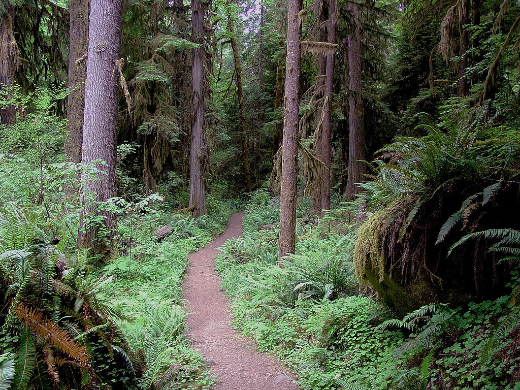
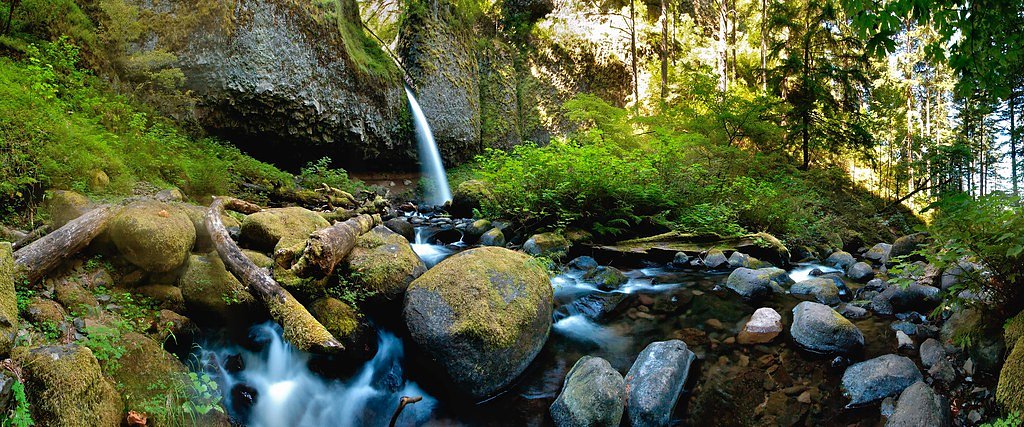
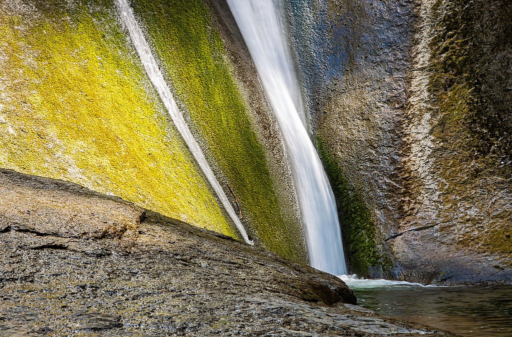
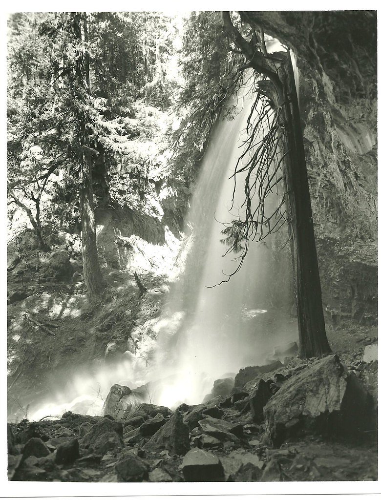
About Shadow Falls
Shadow Falls is a serene and lesser-known waterfall located in Oregon, surrounded by lush forest and offering a peaceful retreat for nature enthusiasts. The waterfall cascades over a rocky ledge into a small pool below, creating a tranquil atmosphere.
The Setting
Shadow Falls sits at 2,188 feet within Umpqua National Forest, fed by the Rock Creek, in the hills of Oregon.
Nearby Falls Worth Visiting
Wolf Creek Falls (75 ft) lies 4.6 miles to the north. Also nearby: Grotto Falls (25 ft, 9.4 mi).
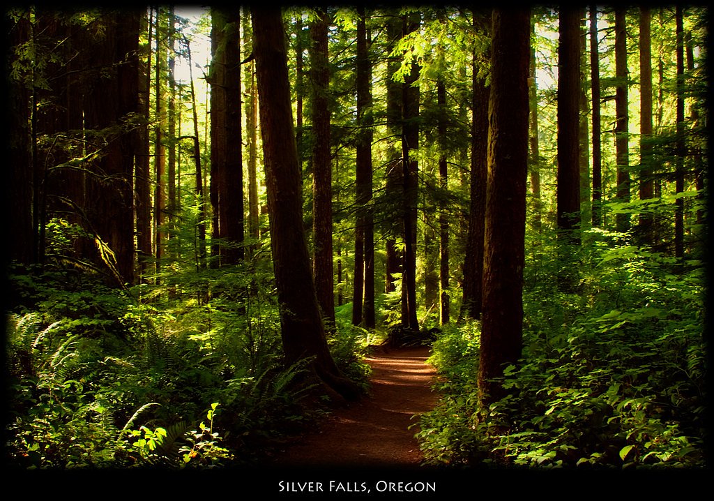
Trail & Hike Details
The Approach
The moderate hike follows Shadow Falls (#1504), a 2.4-mile out-and-back trail over natural surface. Expect 350 feet of elevation gain with grades of 12-20%. The trail is highly developed (Class 4).
USFS Trail
SHADOW FALLS #1504
Trail Class
Highly Developed
Surface
Avg Grade
USFS Segment
0.59 miTrail Description
The trail to Shadow Falls is a short and relatively easy hike through a forested area. The path is well-shaded and features gentle terrain, making it suitable for most visitors. The trail may be muddy during wet seasons, so proper footwear is recommended.
What to Expect
Dogs are welcome.
Accessibility
The trail is not wheelchair accessible. Uneven terrain and elevation changes require steady footing.
Frequently Asked Questions
🐶 Are Dogs Allowed at Shadow Falls?
✅ Dogs are allowed
Are There Any Fees or Permits Required?
🆖 No fees required
🏊 Is There Swimming at Shadow Falls?
❌ Swimming is not allowed
When to Visit
Spring and early summer are the best times to visit, as the waterfall flow is typically strongest during these seasons.
Seasonal Access
The best time to visit is Spring, Summer, and Fall. Winter access may be limited. Check with Umpqua National Forest for seasonal road closures.
Safety Information
The trail may be slippery during wet conditions, and visitors should exercise caution near the waterfall. Always stay on marked trails to avoid getting lost.
Current Water Conditions
55 ft³/s
Current discharge — how much water is flowing
About average for this time of year
Based on 21 years of record
1.65 ft
Water depth at gauge
64°F
CoolRefreshing for swimming
7-Day Discharge Trend
What does this mean for your visit?
Flow is about average for this time of year. Water temperature is a refreshing 64 degrees F, good for a quick swim.
About This Gauge
This gauge is on a nearby waterway and may not reflect exact conditions at the falls.
7-Day Flow Outlook
Based on the USGS gauge ROCK CREEK NEAR GLIDE, OR (22 km away).
Today
Roaring
62 cfs
6/10Tomorrow
Roaring
62 cfs
6/10Tue
Roaring
55 cfs
9/10Wed
Roaring
52 cfs
9/10Thu
Roaring
50 cfs
9/10Fri
Roaring
53 cfs
6/10Sat
Roaring
55 cfs
6/10Best window: Tue — roaring flow, partly sunny (trip score 9/10).
Best time of year: this gauge typically runs highest from mid March to early April, peaking in January.
How we calculate this
This is a transparent outlook, not a precise forecast. We take the waterfall's current flow strength (how it ranks against its historical normal for today, from the nearest USGS stream gauge), carry that ranking forward along the gauge's seasonal curve, and nudge it for forecast rain. Confidence is highest for the next day or two and falls further out. Always check official conditions and your own judgment before visiting — high flows can be dangerous.
Know when to go.
Get a free email alert when waterfalls near Glide hit peak flow. We only send when conditions are worth the trip — no weekly newsletters, no spam.
Weather Forecast
Location & Access
Getting There
Shadow Falls is located in Oregon, but specific directions to the trailhead may vary depending on the source. It is recommended to consult local maps or AllTrails for the most accurate route.
Get Directions on Google MapsParking
Parking availability is not well-documented, but there may be a small parking area near the trailhead. Visitors should prepare for limited parking options.
Elevation
2,188 feet above sea level
Coordinates
43.152465° N, -122.949526° W
Land Management
Managed by USFS
Visitor Tips & Gear
Visit early in the day to avoid crowds and ensure parking availability. Wear sturdy shoes, especially during the rainy season, as the trail may be slippery. Bring water and snacks, as there are no facilities nearby.
As an Amazon Associate, we earn from qualifying purchases.
With 2.4 miles and 350 ft of elevation gain, sturdy boots and trekking poles will help on this moderate trail. Sun exposure on the trail makes good sun protection a must in summer.

Polarized Sunglasses (Knockaround)
Cuts glare off the water so you actually see the falls — and your photos turn out better too.

Columbia Watertight II Rain Jacket
Packs into its own pocket, seam-sealed, and keeps you dry from spray and surprise rain.

Earth Pak Waterproof Dry Bag
Keeps your phone and gear dry when waterfall mist soaks everything else.

Waterproof Phone Pouch (AiRunTech)
Cheap insurance — take photos right next to the falls without killing your phone.

Timberland Euro Sprint Mid Waterproof
Trusted waterproof boot with premium leather and grippy rubber sole — reliable on rocky, wet trails.

TrailBuddy Trekking Poles
Lightweight aluminum, cork grips, and flip-locks that actually hold — a best-seller for good reason.
Where to Stay

Hampton Inn & Suites Roseburg

Holiday Inn Express & Suites Roseburg North by IHG

Terraluna Inn

Umpqua Valley Hotel
Browse vacation cabins and private rentals nearby
Unique outdoor stays — tents, yurts, and treehouses
Rent a campervan or RV for your waterfall road trip
Some links are affiliate links. We may earn a commission at no extra cost to you.
Nearby Campground
Susan Creek Campground
10.4 miles away · 29 sites
Overview Susan Creek Campground is well known for its beautiful setting along the emerald-green waters of the North Umpqua Wild and Scenic River. Nestled under the canopy of a mature forest, the campsites are surrounded by trees up to seven feet in diameter. It is a short drive from the Umpqua National Forest, which boasts incredible glacial-cut mountain slopes across 984,602 acres of forest. The campground features 29 campsites, all sites are reservation only until further notice.Reservations ca
Book on Recreation.govNearby Hot Springs
Hot springs near Glide, Oregon

Umpqua Hot Springs
Umpqua Hot Springs flows at 117°F from multiple geothermal sources along the North Umpqua River in Lane County, forming cascadi...

Annie Spring
Annie Spring flows at 77°F within Crater Lake National Park at 5,983 feet elevation, discharging 1.71 cubic feet per second at ...
Kitson Hot Springs
Kitson Hot Springs flows at 109°F within Willamette National Forest at 1,664 feet elevation, positioned just 17 meters from For...

Mccredie Springs
McCredie Springs flows at 163°F along Salt Creek in the Willamette National Forest, creating one of western Oregon's most popul...
Wall Creek Warm Springs
Wall Creek Warm Springs flows at 106°F deep within Willamette National Forest at 2,362 feet elevation on the western Cascades s...
Eagle Point Spring
Eagle Point Spring flows at 95°F in Klamath County, emerging 45.6°F above the 49.4°F ambient temperature in a climate receiving...
Looking for a soak after your hike? Explore more hot springs near Glide, Oregon on SoakingSprings.
Explore Oregon springsAdditional Information
Nearby Attractions
Other nearby hiking trails and waterfalls in the region may be worth exploring.
Wildlife
The area is home to various birds, small mammals, and forest wildlife. Visitors should be cautious of ticks and other insects.
Cities near Shadow Falls
Nearby Waterfalls
Other waterfalls named Shadow Falls
3 other waterfalls share this name across the U.S.
Writing about Shadow Falls? Embed this waterfall on your site for free.