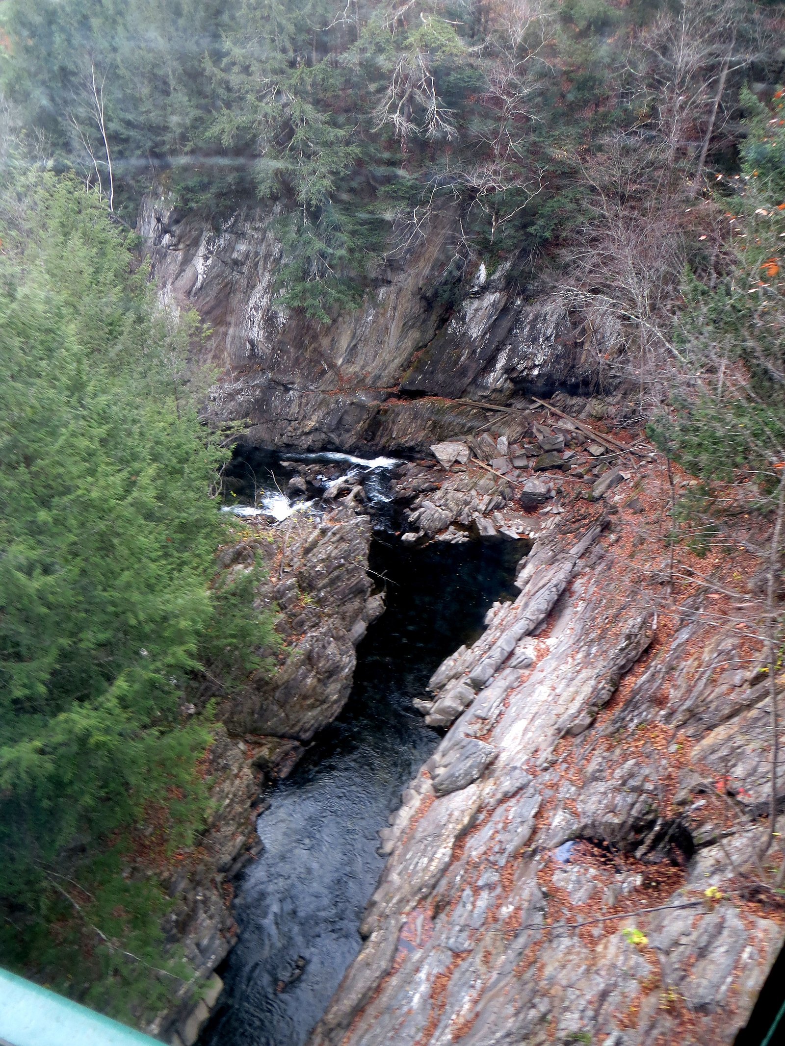
Saxtons River Falls
By Armen Suny · Last verified Mar 2026
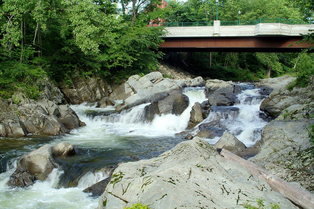
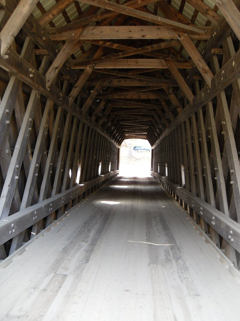
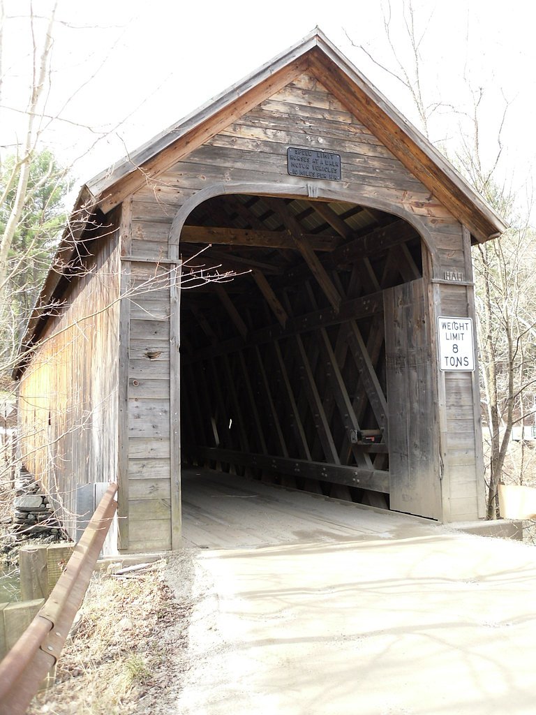
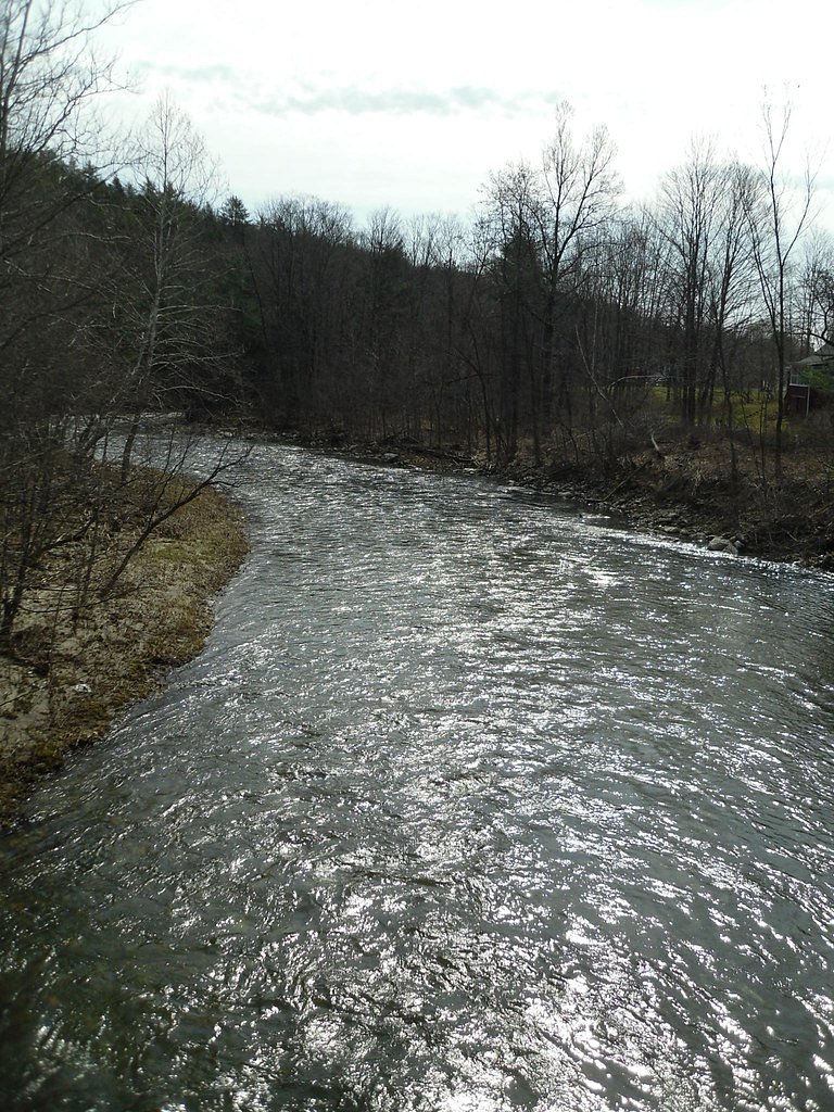
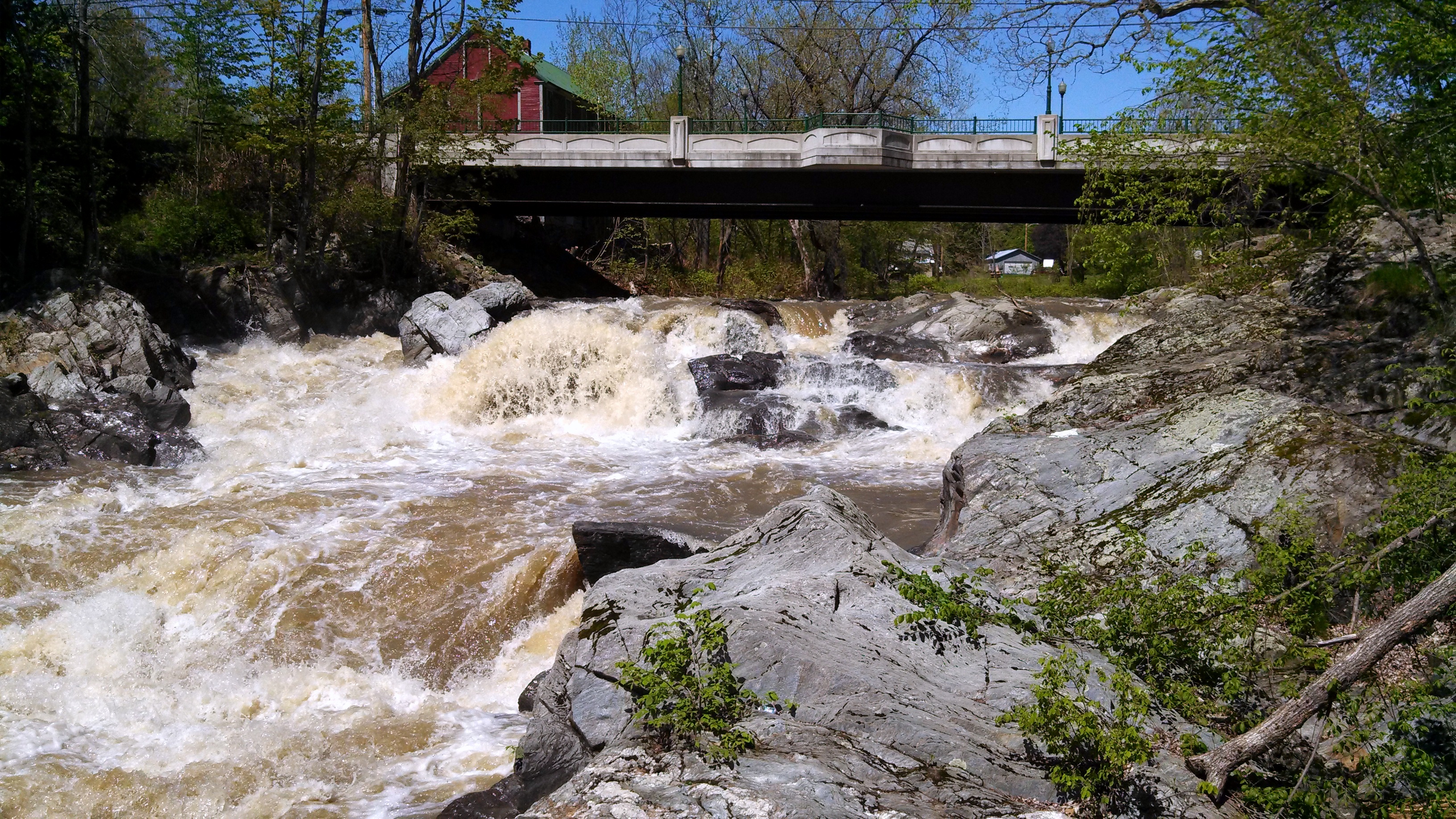
Photo Credits (5)
Difficulty
Moderate
Trail Length
2.4 miles
Trail Type
Out And Back
Elevation Gain
350 ft
About Saxtons River Falls
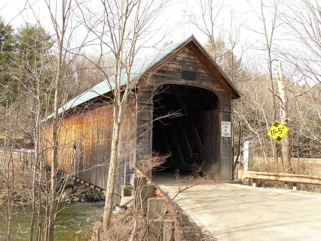
Saxtons River Falls is a small, picturesque cascade tucked into the village of Saxtons River, Vermont. The falls are formed by the Saxtons River as it threads through town, offering a tranquil spot for a quick stop while exploring the village — popular with locals for its scenic charm and easy roadside access. The setting is intimate rather than a remote wilderness destination, making it ideal for a short visit or photography session. For context, Vermont is also home to larger, more industrial-era drops such as Great Falls (often called Bellows Falls) on the Connecticut River between Walpole, New Hampshire, and Bellows Falls, Vermont; that waterfall plunges about 52 feet and helped spur the growth of the adjacent village to harness water power. Saxtons River Falls provides a much quieter, small-scale contrast to those better-known regional cataracts while still giving visitors a pleasing taste of Vermont’s riverine scenery.
The Setting
Saxtons River Falls sits at 456 feet along the Williams River, in the coastal lowlands of Vermont.
Trail & Hike Details
The Approach
The moderate 2.4-mile out-and-back trail gains 350 feet of elevation on the way to the falls.
Trail Description
There is no formal USFS trail to Saxtons River Falls. The falls are primarily viewed from nearby village roads and bridges, so access involves short, easy walks from roadside parking or sidewalks rather than a maintained backcountry trail. No USFS trail name/number or official trail surface/grade/class is listed for this site; expect brief strolls on paved village streets and small, unmarked footpaths to reach viewpoints. Be respectful of private property and local signage while approaching the river.
What to Expect
Visitors can expect a charming, small waterfall set in a quaint Vermont village. The falls are not large but are a peaceful and scenic spot to enjoy the sound of rushing water and the surrounding natural beauty.
Accessibility
The trail is not wheelchair accessible. Uneven terrain and elevation changes require steady footing.
Frequently Asked Questions
🐶 Are Dogs Allowed at Saxtons River Falls?
❌ Dogs are not allowed
Are There Any Fees or Permits Required?
🆖 No fees required
🏊 Is There Swimming at Saxtons River Falls?
❌ Swimming is not allowed
When to Visit
Spring and early summer are ideal for visiting Saxtons River Falls, as the water flow is typically strongest during these seasons.
Seasonal Access
The best time to visit is Spring, Summer, and Fall. Winter access may be limited.
Safety Information
Exercise caution near the riverbanks, as they may be slippery. Avoid visiting during heavy rain or flooding conditions.
Current Water Conditions
82 ft³/s
Current discharge — how much water is flowing
About average for this time of year
Based on 39 years of record
2.53 ft
Water depth at gauge
7-Day Discharge Trend
What does this mean for your visit?
Flow is about average for this time of year.
About This Gauge
7-Day Flow Outlook
Based on the USGS gauge WILLIAMS RIVER NEAR ROCKINGHAM VT (6 km away).
Today
Low
84 cfs
5/10Tomorrow
Moderate
86 cfs
4/10Wed
Moderate
87 cfs
4/10Thu
Moderate
71 cfs
8/10Fri
Moderate
70 cfs
4/10Sat
Moderate
75 cfs
4/10Sun
Moderate
70 cfs
4/10Best window: Thu — moderate flow, sunny (trip score 8/10).
Best time of year: this gauge typically runs highest from early March to mid May, peaking in April.
How we calculate this
This is a transparent outlook, not a precise forecast. We take the waterfall's current flow strength (how it ranks against its historical normal for today, from the nearest USGS stream gauge), carry that ranking forward along the gauge's seasonal curve, and nudge it for forecast rain. Confidence is highest for the next day or two and falls further out. Always check official conditions and your own judgment before visiting — high flows can be dangerous.
Know when to go.
Get a free email alert when waterfalls near Saxtons River hit peak flow. We only send when conditions are worth the trip — no weekly newsletters, no spam.
Weather Forecast
Location & Access
Getting There
Saxtons River Falls is located in the village of Saxtons River, Vermont. The falls can be accessed from Main Street, and they are visible from nearby bridges and roads. There is no formal trail to the falls, but they are easily reachable on foot from the village center.
Get Directions on Google MapsParking
Parking is available in the village of Saxtons River, with street parking or small public parking areas nearby.
Elevation
456 feet above sea level
Coordinates
43.137742° N, -72.509622° W
Visitor Tips & Gear
Visit during the spring or after heavy rains for the best water flow. Be cautious near the riverbanks, as they may be slippery. Bring a camera to capture the picturesque scenery.
As an Amazon Associate, we earn from qualifying purchases.
With 2.4 miles and 350 ft of elevation gain, sturdy boots and trekking poles will help on this moderate trail. Sun exposure on the trail makes good sun protection a must in summer.

Polarized Sunglasses (Knockaround)
Cuts glare off the water so you actually see the falls — and your photos turn out better too.

Columbia Watertight II Rain Jacket
Packs into its own pocket, seam-sealed, and keeps you dry from spray and surprise rain.

Earth Pak Waterproof Dry Bag
Keeps your phone and gear dry when waterfall mist soaks everything else.

Waterproof Phone Pouch (AiRunTech)
Cheap insurance — take photos right next to the falls without killing your phone.

Timberland Euro Sprint Mid Waterproof
Trusted waterproof boot with premium leather and grippy rubber sole — reliable on rocky, wet trails.

TrailBuddy Trekking Poles
Lightweight aluminum, cork grips, and flip-locks that actually hold — a best-seller for good reason.
Where to Stay

Manchester View

Seesaw's Lodge

Brook Road Inn

The Upper Pass Lodge
Browse vacation cabins and private rentals nearby
Unique outdoor stays — tents, yurts, and treehouses
Rent a campervan or RV for your waterfall road trip
Some links are affiliate links. We may earn a commission at no extra cost to you.
Nearby Campground
Townshend Lake Recreation Area
11.3 miles away · 3 sites
Overview Townshend Lake is a flood control project operated by the U.S. Army Corps of Engineers, serving communities within the West River Valley, and those downstream. In addition to protection from floods, the lake provides many recreational opportunities, including picnicking, hiking, and fishing. Recreation Townshend Lake offers ample recreation opportunities. A boat ramp provides access for canoeing, kayaking and small motor boats (10hp or less). The lake is stocked once a year with Rainbow
Book on Recreation.govNearby Hot Springs
Hot springs near Saxtons River, Vermont
Sand Spring
Sand Spring surfaces at 75°F in Williamstown, Massachusetts — one of the few thermal features in New England. At just 670 feet ...

Lebanon Spring
Lebanon Spring discharges at 72°F at 663 feet elevation in Columbia County, flowing 24 degrees above ambient air temperature ju...
Looking for a soak after your hike? Explore more hot springs near Saxtons River, Vermont on SoakingSprings.
Explore Vermont springsAdditional Information
Nearby Attractions
The village of Saxtons River offers charming shops, cafes, and historic buildings. Nearby hiking trails and scenic drives in the surrounding area provide additional opportunities for outdoor exploration.
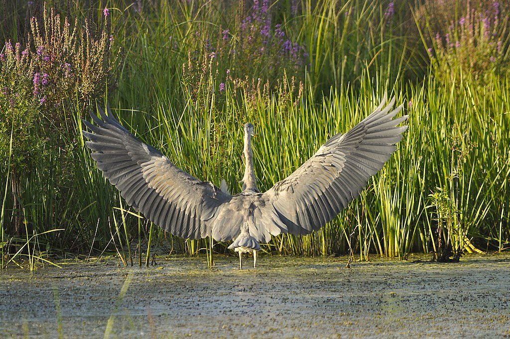
Wildlife
The area around the falls may feature common Vermont wildlife such as birds, squirrels, and deer.
Cities near Saxtons River Falls
Nearby Waterfalls
Writing about Saxtons River Falls? Embed this waterfall on your site for free.