Photo Credits (1)
Difficulty
Easy
Trail Length
0.6 miles
Trail Type
Out And Back
Elevation Gain
100 ft
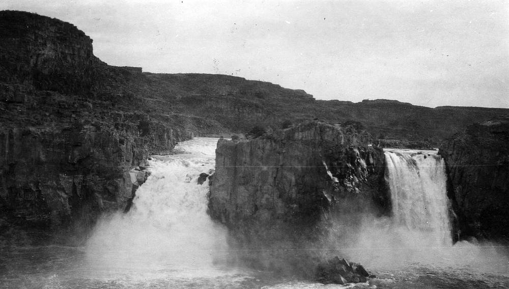
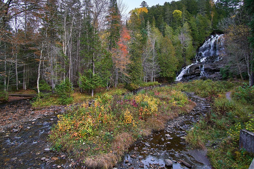
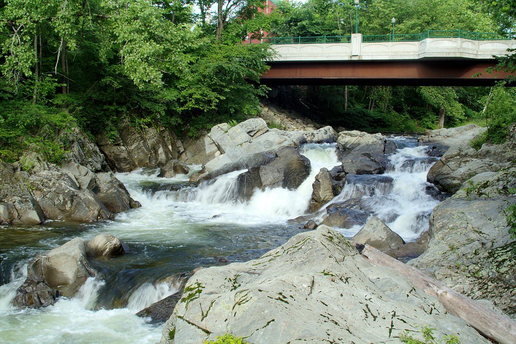
About Fay Falls
Fay Falls is a quietly scenic drop tucked into the forested hills of the White Mountains in New Hampshire, offering a peaceful escape without the crowds. The cascade sits on privately owned conservation land within the Galloway, J.P. unit (designation: CONE) that is overseen by a local nonprofit manager, so visitors will often find a more intimate, natural experience than at busier state-run sites. Towering trees and mossy ledges frame the falls, making it a lovely spot for quick photos, a picnic on a nearby log, or a short nature stop while exploring the region. The falls are ideal for families and casual hikers looking for an easy outing; the nearest established camping is Surry Mountain Lake Beach, about 7.2 km away, making Fay Falls a convenient day trip or evening visit after setting up camp. As the site is on private conservation land, please follow any posted guidance and leave no trace to help preserve the area’s quiet character.
The Setting
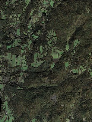
Fay Falls sits at 873 feet within Galloway, J.P., fed by the Ashuelot River, in the foothills of New Hampshire.
Trail & Hike Details
The Approach
The easy 0.6-mile out and back trail gains 100 feet of elevation on the way to the falls.
Trail Description
The trail to Fay Falls is a short 0.6-mile out-and-back with roughly 100 feet of elevation gain and is rated easy, suitable for most visitors including families. The path passes through wooded terrain and is generally short and accessible; it can become muddy or slippery after rain, so sturdy shoes are recommended. No USFS trail number is listed for this access; expect a simple, natural route rather than developed trail infrastructure.
What to Expect
Dogs are welcome.
Accessibility
The trail is short and relatively flat, but the surface may be uneven. Contact the managing agency for accessibility details.
Frequently Asked Questions
🐶 Are Dogs Allowed at Fay Falls?
✅ Dogs are allowed
Are There Any Fees or Permits Required?
🆖 No fees required
🏊 Is There Swimming at Fay Falls?
❌ Swimming is not allowed
When to Visit
Spring and early summer are the best times to visit Fay Falls, as the water flow is typically strongest during these seasons. Fall offers beautiful foliage, while winter may provide a unique view of the falls frozen over, though trail conditions may be more challenging.
Seasonal Access
The best time to visit is Spring, Summer, and Fall. Winter access may be limited.
Safety Information
Exercise caution near the waterfall, as rocks can be slippery. Be prepared for changing weather conditions, especially in the mountains. Always stay on marked trails to avoid getting lost.
Current Water Conditions
147 ft³/s
Current discharge — how much water is flowing
Higher than usual for this time of year
5.80 ft
Water depth at gauge
7-Day Discharge Trend
What does this mean for your visit?
The water is flowing higher than usual for this time of year.
About This Gauge
This gauge is on a nearby waterway and may not reflect exact conditions at the falls.
7-Day Flow Outlook
Based on the USGS gauge ASHUELOT RIVER BELOW SURRY MT DAM, NEAR KEENE, NH (8 km away).
Today
Strong
147 cfs
9/10Tomorrow
Roaring
179 cfs
6/10Tue
Roaring
158 cfs
6/10Wed
Strong
147 cfs
10/10Thu
Roaring
179 cfs
6/10Fri
Roaring
178 cfs
6/10Sat
Roaring
162 cfs
6/10Best window: Wed — strong flow, sunny (trip score 10/10).
Best time of year: this gauge typically runs highest from mid March to late May, peaking in April.
How we calculate this
This is a transparent outlook, not a precise forecast. We take the waterfall's current flow strength (how it ranks against its historical normal for today, from the nearest USGS stream gauge), carry that ranking forward along the gauge's seasonal curve, and nudge it for forecast rain. Confidence is highest for the next day or two and falls further out. Always check official conditions and your own judgment before visiting — high flows can be dangerous.
Know when to go.
Get a free email alert when waterfalls near North Westminster hit peak flow. We only send when conditions are worth the trip — no weekly newsletters, no spam.
Weather Forecast
Location & Access
Getting There
Fay Falls is located near the town of Albany, New Hampshire, within the White Mountain National Forest. Access is typically via a short hike from a nearby trailhead. Specific directions to the trailhead may vary, so it is recommended to consult a reliable map or GPS.
Get Directions on Google MapsParking
Parking is available at a small lot near the trailhead. Space may be limited, especially during peak seasons.
Hours
Elevation
873 feet above sea level
Coordinates
43.029247° N, -72.403421° W
Land Management
Managed by NGO
Visitor Tips & Gear
Visit early in the day to avoid crowds and secure parking. Bring bug spray during the summer months, as mosquitoes and other insects may be present. Be cautious of slippery rocks near the waterfall.
As an Amazon Associate, we earn from qualifying purchases.
For this easy 0.6 miles trail, lightweight trail shoes and a water bottle are usually sufficient. Sun exposure on the trail makes good sun protection a must in summer.

Polarized Sunglasses (Knockaround)
Cuts glare off the water so you actually see the falls — and your photos turn out better too.

Columbia Watertight II Rain Jacket
Packs into its own pocket, seam-sealed, and keeps you dry from spray and surprise rain.

Earth Pak Waterproof Dry Bag
Keeps your phone and gear dry when waterfall mist soaks everything else.

Waterproof Phone Pouch (AiRunTech)
Cheap insurance — take photos right next to the falls without killing your phone.

JOBY GorillaPod Starter Kit
Wraps around railings and rocks for long-exposure waterfall shots — no flat surface needed.

Osprey Daylite Daypack
Light, organized, and just the right size for a day hike — fits water, snacks, and layers.
Where to Stay

Riverside Hotel, an Ascend Collection Hotel

Courtyard Keene Downtown

Hampton Inn & Suites Keene

Comfort Inn & Suites Brattleboro I-91
Browse vacation cabins and private rentals nearby
Unique outdoor stays — tents, yurts, and treehouses
Rent a campervan or RV for your waterfall road trip
Some links are affiliate links. We may earn a commission at no extra cost to you.
Nearby Campground
SURRY MOUNTAIN LAKE BEACH
4.5 miles away · 3 sites
Overview Surry Mountain Lake Beach is a U.S. Army Corps of Engineers day use facility located on the Ashuelot River in Surry, New Hampshire.Recreation Swimming, sunbathing, picnicking, paddling and fishing are just a few of the favorite activities enjoyed at Surry Mountain Lake Beach. A boat ramp is available for small boats, kayaks and canoes. There are picnic tables and grills located throughout the park, as well as a playground.Facilities Surry Mountain Lake Beach has restrooms with flush toil
Book on Recreation.govNearby Hot Springs
Hot springs near North Westminster, New Hampshire
Sand Spring
Sand Spring surfaces at 75°F in Williamstown, Massachusetts — one of the few thermal features in New England. At just 670 feet ...

Lebanon Spring
Lebanon Spring discharges at 72°F at 663 feet elevation in Columbia County, flowing 24 degrees above ambient air temperature ju...
Looking for a soak after your hike? Explore more hot springs near North Westminster, New Hampshire on SoakingSprings.
Explore New Hampshire springsAdditional Information
Nearby Attractions
Nearby attractions include the Kancamagus Highway, Sabbaday Falls, and the many hiking trails of the White Mountain National Forest.
Wildlife
The area is home to a variety of wildlife, including birds, squirrels, and occasionally deer. Be cautious of ticks during warmer months.
Cities near Fay Falls
Nearby Waterfalls
Writing about Fay Falls? Embed this waterfall on your site for free.