
Photo Credits (2)
Difficulty
Moderate
Trail Length
2.4 miles
Trail Type
Out And Back
Elevation Gain
350 ft
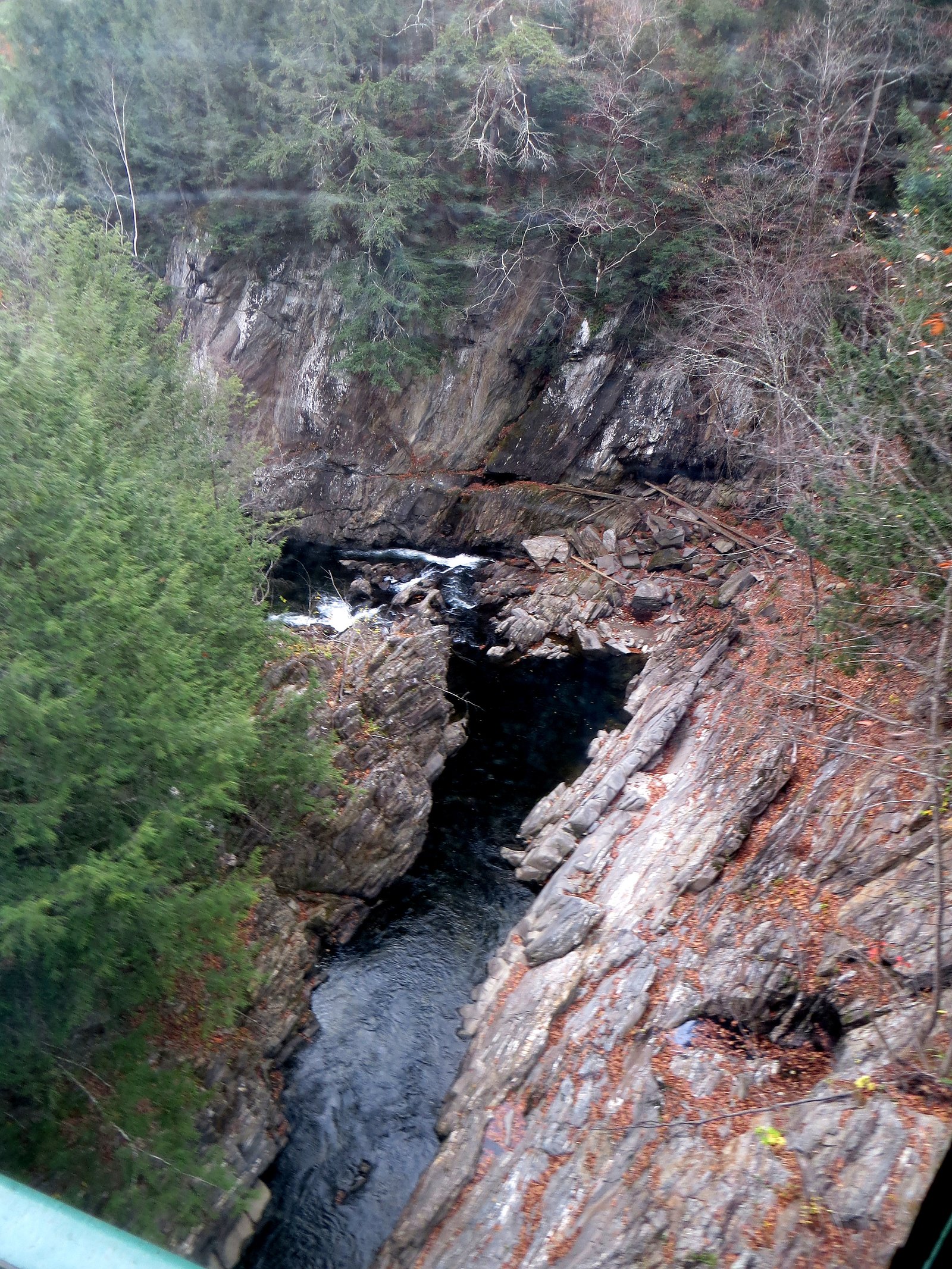
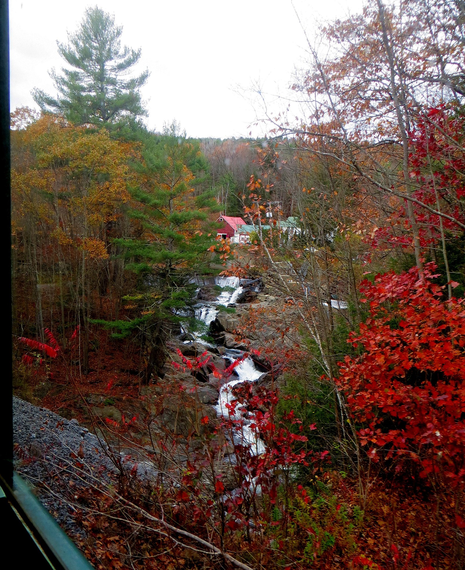
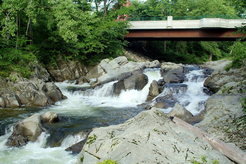
About Sokoki Falls
Sokoki Falls is a small, picturesque waterfall tucked into Vermont’s forested hills, offering a quiet spot to pause and enjoy rushing water framed by mature trees. Its intimate cascade and shady pools make it a favorite short-getaway for photographers, birdwatchers, and hikers looking for a peaceful nature stop without a long approach. The falls are reached via a roughly 2.4-mile out-and-back hike that gains about 350 feet and is generally rated moderate. The trail weaves through classic Vermont woods and opens to the stream and falls near the end of the route; bring sturdy footwear and allow extra time if you plan to linger and explore the rocky shoreline.
The Setting
Sokoki Falls sits at 417 feet along the Williams River, in the coastal lowlands of Vermont.
Trail & Hike Details
The Approach
The moderate 2.4-mile out-and-back trail gains 350 feet of elevation on the way to the falls.
Trail Description
Trail type: out-and-back; Length: 2.4 miles; Elevation gain: ~350 feet; Difficulty: Moderate. The route follows natural forest paths and is not heavily developed—trail surface and grade details are not specified in available data, and hikers should expect uneven terrain in places. Consult local resources for current conditions and be prepared with proper footwear and navigation for a short, moderately strenuous woodland hike.
What to Expect
Visitors can expect a tranquil natural setting with a small waterfall surrounded by forest. The area may be less crowded compared to other popular waterfalls in Vermont.
Accessibility
The trail is not wheelchair accessible. Uneven terrain and elevation changes require steady footing.
Frequently Asked Questions
🐶 Are Dogs Allowed at Sokoki Falls?
❌ Dogs are not allowed
Are There Any Fees or Permits Required?
🆖 No fees required
🏊 Is There Swimming at Sokoki Falls?
❌ Swimming is not allowed
When to Visit
Spring and early summer are typically the best times to visit Sokoki Falls, as water flow is likely to be higher due to snowmelt and rainfall.
Seasonal Access
The best time to visit is Spring, Summer, and Fall. Winter access may be limited.
Safety Information
Visitors should be cautious of slippery rocks and uneven terrain near the falls. Always stay on marked trails and avoid getting too close to the water's edge.
Current Water Conditions
95 ft³/s
Current discharge — how much water is flowing
About average for this time of year
Based on 39 years of record
2.60 ft
Water depth at gauge
7-Day Discharge Trend
What does this mean for your visit?
Flow is about average for this time of year.
About This Gauge
7-Day Flow Outlook
Based on the USGS gauge WILLIAMS RIVER NEAR ROCKINGHAM VT (3 km away).
Today
Moderate
95 cfs
8/10Tomorrow
Moderate
97 cfs
4/10Wed
Moderate
99 cfs
6/10Thu
Moderate
80 cfs
8/10Fri
Moderate
79 cfs
4/10Sat
Moderate
84 cfs
6/10Sun
Moderate
76 cfs
5/10Best window: Today — moderate flow, sunny (trip score 8/10).
Best time of year: this gauge typically runs highest from early March to mid May, peaking in April.
How we calculate this
This is a transparent outlook, not a precise forecast. We take the waterfall's current flow strength (how it ranks against its historical normal for today, from the nearest USGS stream gauge), carry that ranking forward along the gauge's seasonal curve, and nudge it for forecast rain. Confidence is highest for the next day or two and falls further out. Always check official conditions and your own judgment before visiting — high flows can be dangerous.
Know when to go.
Get a free email alert when waterfalls near Saxtons River hit peak flow. We only send when conditions are worth the trip — no weekly newsletters, no spam.
Weather Forecast
Location & Access
Getting There
Sokoki Falls is located in Vermont, but specific directions to the falls are not widely documented. Visitors are encouraged to consult local maps or guides for the most accurate route.
Get Directions on Google MapsParking
Parking availability near Sokoki Falls is unclear. Visitors should plan ahead and look for nearby public parking areas or trailheads.
Elevation
417 feet above sea level
Coordinates
43.208608° N, -72.517071° W
Visitor Tips & Gear
Wear sturdy footwear and bring a map or GPS device, as trail information is limited. Check weather conditions before visiting.
As an Amazon Associate, we earn from qualifying purchases.
With 2.4 miles and 350 ft of elevation gain, sturdy boots and trekking poles will help on this moderate trail. Sun exposure on the trail makes good sun protection a must in summer.

Polarized Sunglasses (Knockaround)
Cuts glare off the water so you actually see the falls — and your photos turn out better too.

Columbia Watertight II Rain Jacket
Packs into its own pocket, seam-sealed, and keeps you dry from spray and surprise rain.

Earth Pak Waterproof Dry Bag
Keeps your phone and gear dry when waterfall mist soaks everything else.

Waterproof Phone Pouch (AiRunTech)
Cheap insurance — take photos right next to the falls without killing your phone.

Timberland Euro Sprint Mid Waterproof
Trusted waterproof boot with premium leather and grippy rubber sole — reliable on rocky, wet trails.

TrailBuddy Trekking Poles
Lightweight aluminum, cork grips, and flip-locks that actually hold — a best-seller for good reason.
Where to Stay

Manchester View

Best Western Springfield Hotel

Seesaw's Lodge

Brook Road Inn
Browse vacation cabins and private rentals nearby
Unique outdoor stays — tents, yurts, and treehouses
Rent a campervan or RV for your waterfall road trip
Some links are affiliate links. We may earn a commission at no extra cost to you.
Nearby Campground
Stoughton Pond Rec Area
11.9 miles away · 1 sites
Overview Stoughton Pond Recreation Area is a day use area located to the north of North Springfield Lake. Stoughton Pond is located off State Route 106 on Stoughton Pond Road in Perkinsville, Vermont. Recreation Stoughton Pond Recreation Area offers plenty of activities for visitors of all ages. Many people enjoy canoeing, kayaking, boating and fishing. The state of Vermont Department of Fish and Game annually stock the pond with rainbow trout, and the pond also offers excellent bass fishing. A b
Book on Recreation.govNearby Hot Springs
Hot springs near Saxtons River, Vermont
Looking for a soak after your hike? Explore more hot springs near Saxtons River, Vermont on SoakingSprings.
Explore Vermont springsAdditional Information
Nearby Attractions
Vermont offers many natural attractions, including other waterfalls, hiking trails, and scenic drives.
Wildlife
The area around Sokoki Falls may feature typical Vermont wildlife, such as birds, deer, and small mammals.
Cities near Sokoki Falls
Nearby Waterfalls
Writing about Sokoki Falls? Embed this waterfall on your site for free.