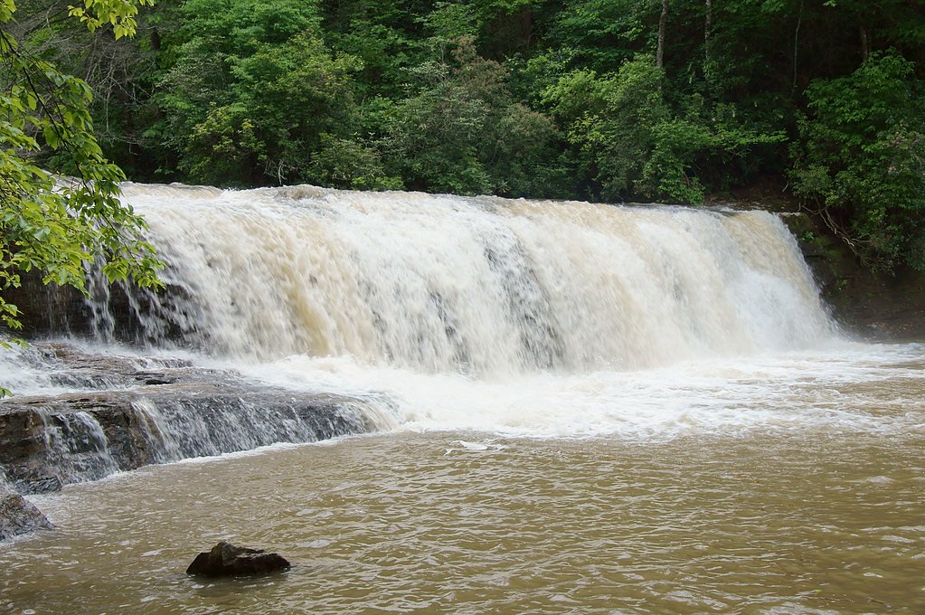
Maidenhair Falls
By Armen Suny · Last verified May 2026

Photo Credits (2)
Difficulty
Moderate
Trail Length
2.0 miles
Trail Type
Out And Back
Elevation Gain
300 ft
About Maidenhair Falls
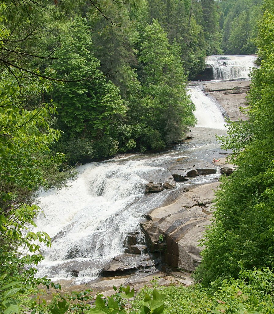
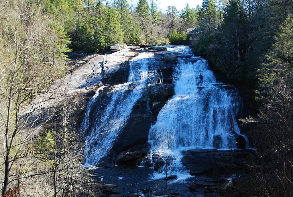
Maidenhair Falls tumbles through a pocket of lush forest in North Carolina, its name honoring the delicate maidenhair ferns that carpet the moist rock ledges around the cascade. The setting feels quietly secluded—towering trees and verdant undergrowth make it a refreshing escape for a short hike or a peaceful afternoon of photography and nature watching. The hike to the falls is an approachable outing: a roughly 2.0-mile out-and-back with about 300 feet of elevation gain, rated moderate. If you want to extend your visit, Kuykendall Group Camp is nearby (about 7.36 km away), making this a pleasant day trip or overnight base for exploring the area.
The Setting
Maidenhair Falls sits at 2,339 feet along the Davidson River, in the hills of North Carolina.
Nearby Falls Worth Visiting
Triple Falls (125 ft) lies 4.8 miles to the east. Also nearby: High Falls (125 ft, 5.0 mi) and Hooker Falls (12 ft, 4.4 mi).
Trail & Hike Details
The Approach
The moderate 2.0-mile out-and-back trail gains 300 feet of elevation on the way to the falls.
Trail Description
This is a 2.0-mile out-and-back trail with approximately 300 feet of elevation gain and a moderate difficulty rating. The route winds through dense, shaded forest and alternates between natural dirt tread, exposed roots and some rocky, uneven sections; the grade is generally gentle to moderate, but short pitches and rock steps require steady footing. The trail is well worth a steady pace; expect the path to become muddy after rain and to have occasional slick rocks near the falls. Pack sturdy shoes and trekking poles if you prefer extra stability—this is a short but active woodland hike rather than a flat promenade.
What to Expect
Visitors can expect a tranquil hike through a forested area, leading to a beautiful waterfall surrounded by lush vegetation. The area is typically quiet, making it a great spot for nature enthusiasts.
Accessibility
The trail is not wheelchair accessible. Uneven terrain and elevation changes require steady footing.
Frequently Asked Questions
🐶 Are Dogs Allowed at Maidenhair Falls?
❌ Dogs are not allowed
Are There Any Fees or Permits Required?
🆖 No fees required
🏊 Is There Swimming at Maidenhair Falls?
❌ Swimming is not allowed
When to Visit
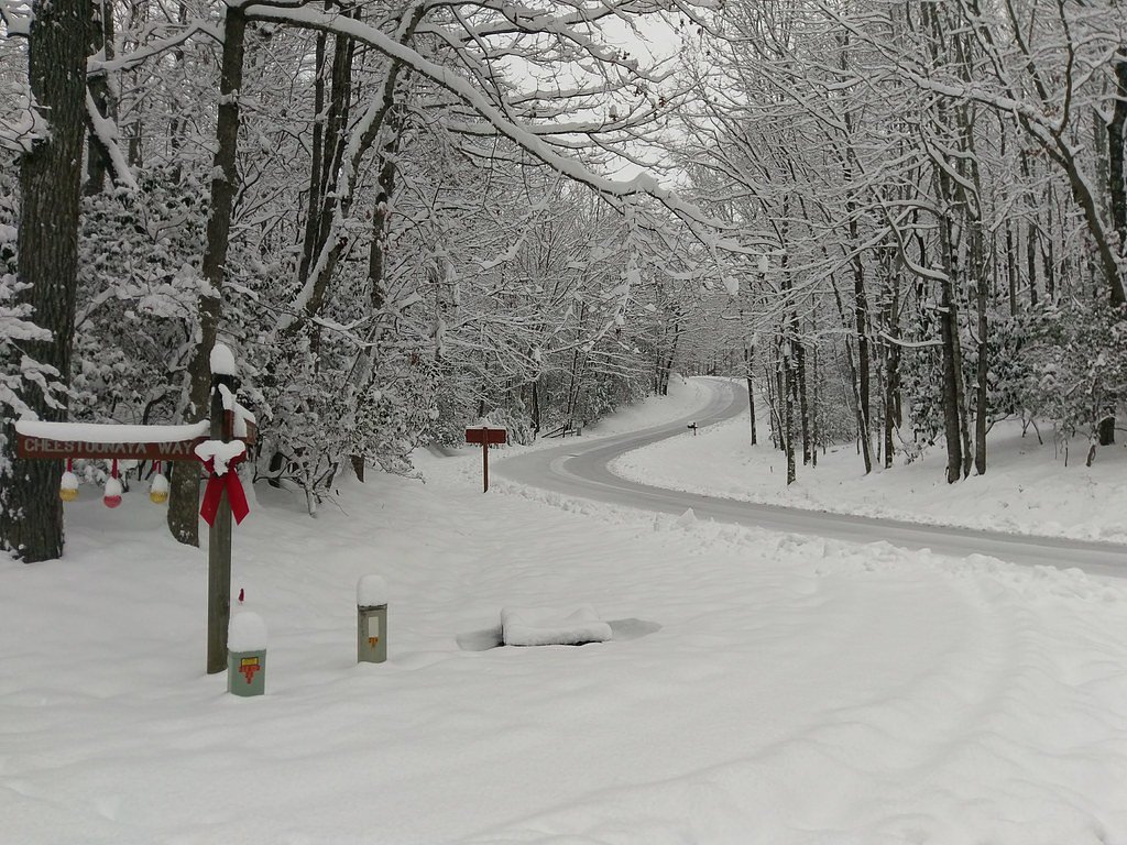
Spring and early summer are ideal for visiting, as the waterfall flow is typically strongest during these seasons. Fall offers beautiful foliage, while winter may bring icy conditions.
Seasonal Access
The best time to visit is Spring, Summer, and Fall. Winter access may be limited.
Safety Information
Visitors should exercise caution on rocky or slippery sections of the trail. Be aware of weather conditions, as rain can make the trail muddy and hazardous. Carry a map or GPS device, as cell service may be limited.
Current Water Conditions
44 ft³/s
Current discharge — how much water is flowing
Much lower than usual for this time of year
Based on 102 years of record
0.63 ft
Water depth at gauge
71°F
WarmVery comfortable
7-Day Discharge Trend
What does this mean for your visit?
Flow is well below normal for this time of year, so the waterfall may be a trickle. The water is a comfortable 71 degrees F, pleasant for swimming.
About This Gauge
This gauge is on a nearby waterway and may not reflect exact conditions at the falls.
7-Day Flow Outlook
Based on the USGS gauge DAVIDSON RIVER NEAR BREVARD, NC (8 km away).
Today
Moderate
51 cfs
6/10Tomorrow
Strong
52 cfs
7/10Wed
Strong
52 cfs
7/10Thu
Strong
50 cfs
7/10Fri
Strong
50 cfs
7/10Sat
Strong
47 cfs
7/10Sun
Strong
47 cfs
7/10Best window: Tomorrow — strong flow, patchy fog then chance showers and thunderstorms (trip score 7/10).
Best time of year: this gauge typically runs highest from mid February to late April, peaking in March.
How we calculate this
This is a transparent outlook, not a precise forecast. We take the waterfall's current flow strength (how it ranks against its historical normal for today, from the nearest USGS stream gauge), carry that ranking forward along the gauge's seasonal curve, and nudge it for forecast rain. Confidence is highest for the next day or two and falls further out. Always check official conditions and your own judgment before visiting — high flows can be dangerous.
Know when to go.
Get a free email alert when waterfalls near Brevard hit peak flow. We only send when conditions are worth the trip — no weekly newsletters, no spam.
Weather Forecast
Location & Access
Getting There
Maidenhair Falls is located within a forested area in North Carolina. Access typically involves a hike through a wooded trail. Specific directions may vary depending on the trailhead used.
Get Directions on Google MapsParking
Parking availability is limited and may be located at a nearby trailhead. Visitors should check local resources for the most accurate parking information.
Elevation
2,339 feet above sea level
Coordinates
35.197615° N, -82.702070° W
Visitor Tips & Gear
Wear sturdy hiking shoes due to uneven terrain. Bring water and snacks, as there are no facilities along the trail. Check weather conditions before visiting, as the trail may be slippery after rain.
As an Amazon Associate, we earn from qualifying purchases.
With 2.0 miles and 300 ft of elevation gain, sturdy boots and trekking poles will help on this moderate trail. Sun exposure on the trail makes good sun protection a must in summer.

Polarized Sunglasses (Knockaround)
Cuts glare off the water so you actually see the falls — and your photos turn out better too.

Columbia Watertight II Rain Jacket
Packs into its own pocket, seam-sealed, and keeps you dry from spray and surprise rain.

Earth Pak Waterproof Dry Bag
Keeps your phone and gear dry when waterfall mist soaks everything else.

Waterproof Phone Pouch (AiRunTech)
Cheap insurance — take photos right next to the falls without killing your phone.

Timberland Euro Sprint Mid Waterproof
Trusted waterproof boot with premium leather and grippy rubber sole — reliable on rocky, wet trails.

TrailBuddy Trekking Poles
Lightweight aluminum, cork grips, and flip-locks that actually hold — a best-seller for good reason.
Where to Stay

Holiday Inn Express - Brevard by IHG

Comfort Inn & Suites Brevard North

Hampton Inn Brevard

Airstream w Bathtub, River, & Hot Tub
Browse vacation cabins and private rentals nearby
Unique outdoor stays — tents, yurts, and treehouses
Rent a campervan or RV for your waterfall road trip
Some links are affiliate links. We may earn a commission at no extra cost to you.
Nearby Campground
KUYKENDALL GROUP CAMP
4.6 miles away · 1 sites
Overview Large groups enjoy this cozy mountain campground in the Pisgah National Forest of western North Carolina. Ample opportunities for recreation exist in the area, including hiking, picnicking, scenic driving, swimming, fishing, mountain biking and more.Recreation This is a great place for campers to simply relax in the woods and listen to the sound of the creek. Visitors can also explore the area's numerous hiking trails, check out crystal clear waterfalls or fish for trout in the creek and
Book on Recreation.govNearby Hot Springs
Hot springs near Brevard, North Carolina

Looking for a soak after your hike? Explore more hot springs near Brevard, North Carolina on SoakingSprings.
Explore North Carolina springsAdditional Information
Nearby Attractions
Nearby attractions may include other hiking trails and scenic spots within the surrounding forest or park area.
Wildlife
The area is home to a variety of wildlife, including birds, deer, and small mammals. Visitors should be cautious of snakes and other potentially hazardous animals.
Cities near Maidenhair Falls
Nearby Waterfalls
Other waterfalls named Maidenhair Falls
2 other waterfalls share this name across the U.S.
Writing about Maidenhair Falls? Embed this waterfall on your site for free.