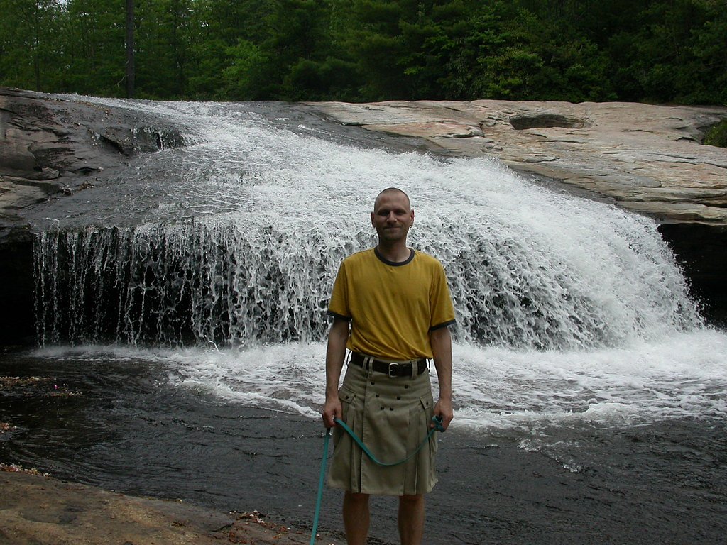
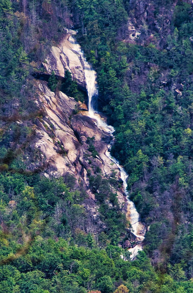
Connestee Falls
By Armen Suny · Last verified Mar 2026
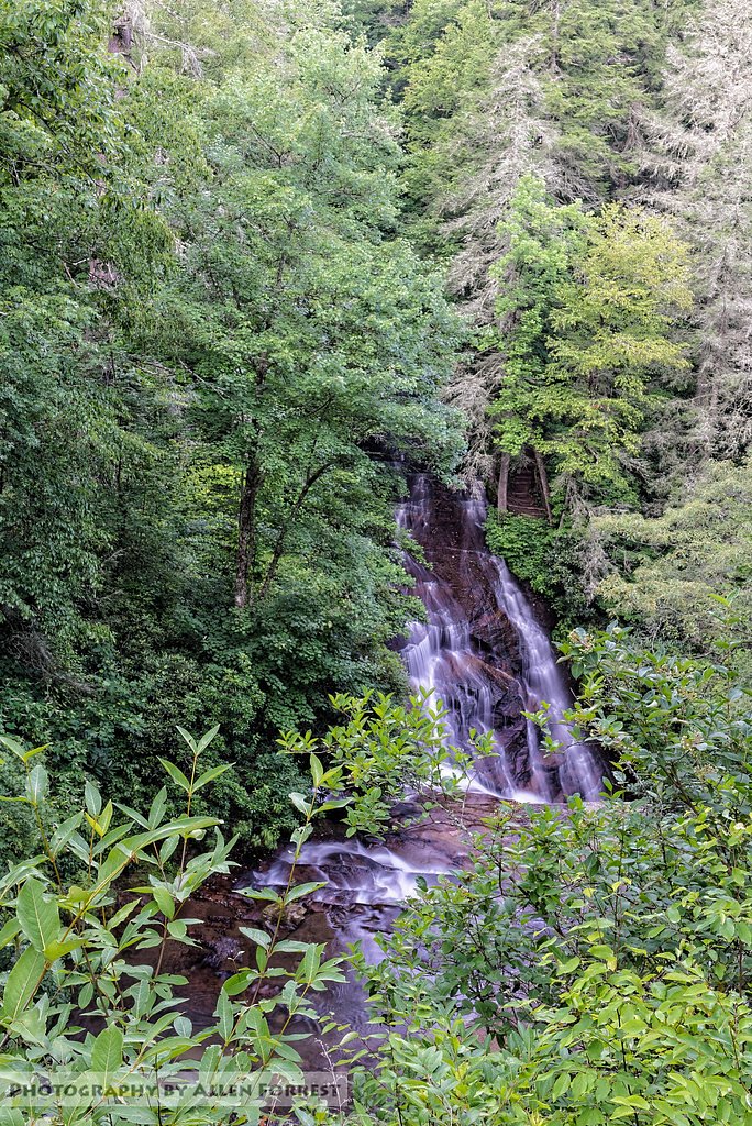
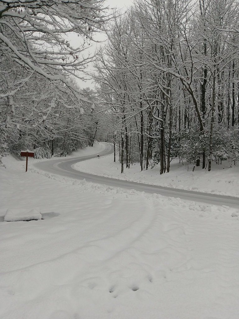

Photo Credits (5)
Difficulty
Easy
Trail Length
0.2 miles
Trail Type
Out And Back
Elevation Gain
50 ft
About Connestee Falls
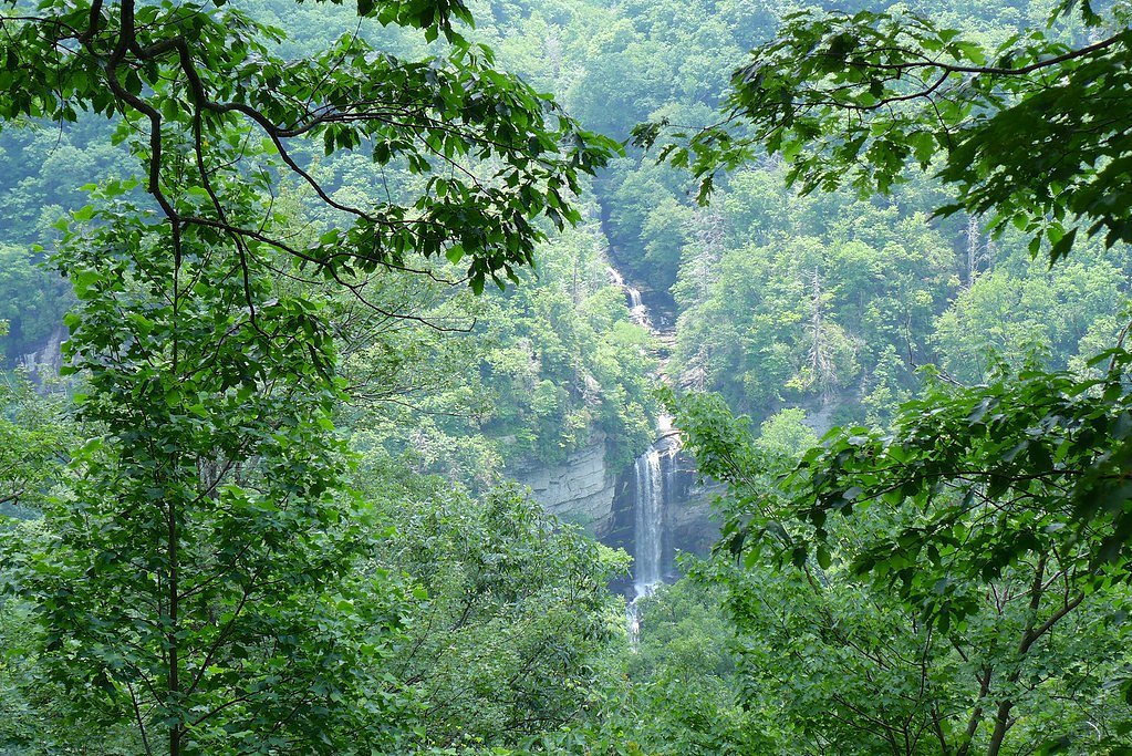
Connestee Falls sits just outside Brevard, North Carolina, where Connestee Falls and Batson Creek Falls combine into a photogenic double cascade tucked into a narrow, tree‑lined gorge. The tiers of water framed by lush woodland create a compact yet dramatic scene that draws photographers, families, and anyone looking for a quick nature fix without a long hike. The approach to the falls is refreshingly short and visitor-friendly: a well-maintained path leads to a dedicated viewing platform, so you can soak in the view and then continue exploring the Brevard area. For overnight plans, the Kuykendall Group Camp is about 7.57 km away, offering a nearby option for campers who want to extend their time in the forest.
The Setting
Connestee Falls sits at 2,533 feet along the French Broad River, in the hills of North Carolina.
Nearby Falls Worth Visiting
Raven Cliff Falls, the tallest waterfall in South Carolina at 420 feet, lies 5.7 miles to the southeast. Also nearby: Bridal Veil Falls (120 ft, 6.3 mi).
Trail & Hike Details
The Approach
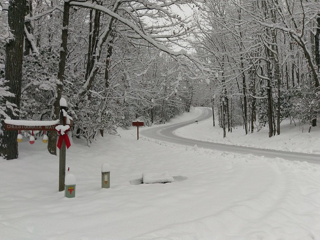
The easy 0.2-mile out-and-back trail gains 50 feet of elevation on the way to the falls.
Trail Description
This is an easy, family-friendly out-and-back: 0.2 miles (0.32 km) round trip with roughly 50 feet (15 m) of elevation gain. The short trail leads directly to a viewing platform and is well maintained, making it accessible for most visitors, including those hiking with children. Trail type: out-and-back; difficulty: easy; length: 0.2 miles; elevation gain: 50 ft.
What to Expect
Dogs are welcome.
Accessibility
The trail is short and relatively flat, but the surface may be uneven. Contact the managing agency for accessibility details.
Frequently Asked Questions
🐶 Are Dogs Allowed at Connestee Falls?
✅ Dogs are allowed
Are There Any Fees or Permits Required?
🆖 No fees required
🏊 Is There Swimming at Connestee Falls?
❌ Swimming is not allowed
When to Visit
Spring and fall are particularly beautiful due to blooming flowers and vibrant autumn foliage, but the falls can be enjoyed year-round.
Seasonal Access
The best time to visit is Spring, Summer, Fall, and Winter.
Safety Information
Stay on designated paths and do not attempt to climb or approach the falls. The rocks can be slippery, and the water flow may be strong. Exercise caution, especially after rain.
Current Water Conditions
94 ft³/s
Current discharge — how much water is flowing
Much lower than usual for this time of year
Based on 92 years of record
2.09 ft
Water depth at gauge
7-Day Discharge Trend
What does this mean for your visit?
Flow is well below normal for this time of year, so the waterfall may be a trickle.
About This Gauge
This gauge is on a nearby waterway and may not reflect exact conditions at the falls.
7-Day Flow Outlook
Based on the USGS gauge FRENCH BROAD RIVER AT ROSMAN, NC (9 km away).
Today
Moderate
108 cfs
4/10Tomorrow
Moderate
108 cfs
4/10Tue
Moderate
109 cfs
4/10Wed
Low
92 cfs
6/10Thu
Low
81 cfs
6/10Fri
Moderate
96 cfs
4/10Sat
Moderate
100 cfs
4/10Best window: Wed — low flow, sunny (trip score 6/10).
Best time of year: this gauge typically runs highest from mid February to early May, peaking in March.
How we calculate this
This is a transparent outlook, not a precise forecast. We take the waterfall's current flow strength (how it ranks against its historical normal for today, from the nearest USGS stream gauge), carry that ranking forward along the gauge's seasonal curve, and nudge it for forecast rain. Confidence is highest for the next day or two and falls further out. Always check official conditions and your own judgment before visiting — high flows can be dangerous.
Know when to go.
Get a free email alert when waterfalls near Brevard hit peak flow. We only send when conditions are worth the trip — no weekly newsletters, no spam.
Weather Forecast
Location & Access
Getting There
Connestee Falls is located off U.S. Highway 276, near the town of Brevard, North Carolina. The falls can be accessed via a short walk from a designated viewing platform.
Get Directions on Google MapsParking
There is a small parking area near the falls, but availability may be limited during peak seasons.
Elevation
2,533 feet above sea level
Coordinates
35.163727° N, -82.731517° W
Visitor Tips & Gear
Visit early in the day to avoid crowds, especially during weekends and peak seasons. Wear sturdy shoes as the path may be slippery after rain.
As an Amazon Associate, we earn from qualifying purchases.
For this easy 0.2 miles trail, lightweight trail shoes and a water bottle are usually sufficient. Icy conditions are common in winter — traction cleats are a smart addition.

Columbia Watertight II Rain Jacket
Packs into its own pocket, seam-sealed, and keeps you dry from spray and surprise rain.

Polarized Sunglasses (Knockaround)
Cuts glare off the water so you actually see the falls — and your photos turn out better too.

Earth Pak Waterproof Dry Bag
Keeps your phone and gear dry when waterfall mist soaks everything else.

Waterproof Phone Pouch (AiRunTech)
Cheap insurance — take photos right next to the falls without killing your phone.

Kahtoola MICROspikes
Cult-favorite traction cleats that grip ice and wet rock — essential for winter waterfall hikes.

JOBY GorillaPod Starter Kit
Wraps around railings and rocks for long-exposure waterfall shots — no flat surface needed.
Where to Stay

Holiday Inn Express - Brevard by IHG

Comfort Inn & Suites Brevard North

Hampton Inn Brevard

Airstream w Bathtub, River, & Hot Tub
Browse vacation cabins and private rentals nearby
Unique outdoor stays — tents, yurts, and treehouses
Rent a campervan or RV for your waterfall road trip
Some links are affiliate links. We may earn a commission at no extra cost to you.
Nearby Campground
KUYKENDALL GROUP CAMP
4.7 miles away · 1 sites
Overview Large groups enjoy this cozy mountain campground in the Pisgah National Forest of western North Carolina. Ample opportunities for recreation exist in the area, including hiking, picnicking, scenic driving, swimming, fishing, mountain biking and more.Recreation This is a great place for campers to simply relax in the woods and listen to the sound of the creek. Visitors can also explore the area's numerous hiking trails, check out crystal clear waterfalls or fish for trout in the creek and
Book on Recreation.govAdditional Information
Nearby Attractions
Nearby attractions include Dupont State Recreational Forest, Looking Glass Falls, and the town of Brevard, known for its charming shops and restaurants.
Wildlife
The area is home to various bird species, deer, and other small forest animals. Keep an eye out for wildlife during your visit.
Cities near Connestee Falls
Nearby Waterfalls
Writing about Connestee Falls? Embed this waterfall on your site for free.