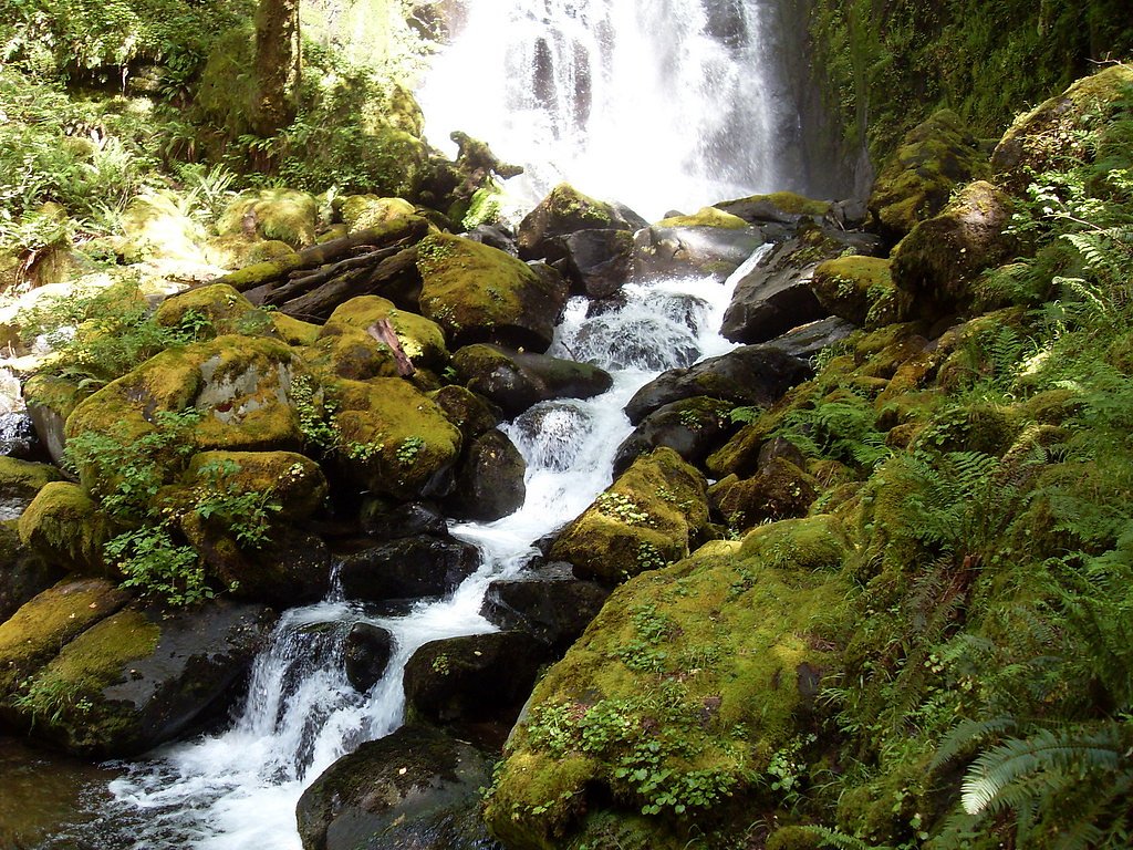
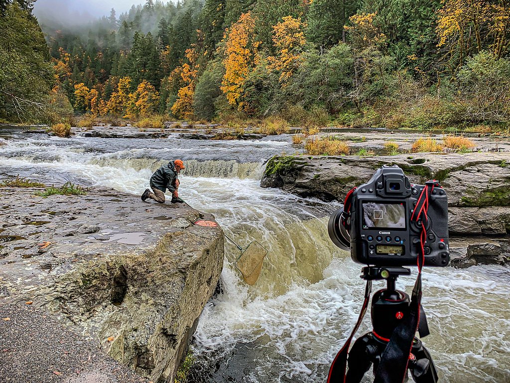
Lower Kentucky Falls
By Armen Suny · Last verified May 2026
Photo Credits (1)
Difficulty
Moderate
Trail Length
4.4 miles
Trail Type
Out And Back
Elevation Gain
800 ft
About Lower Kentucky Falls
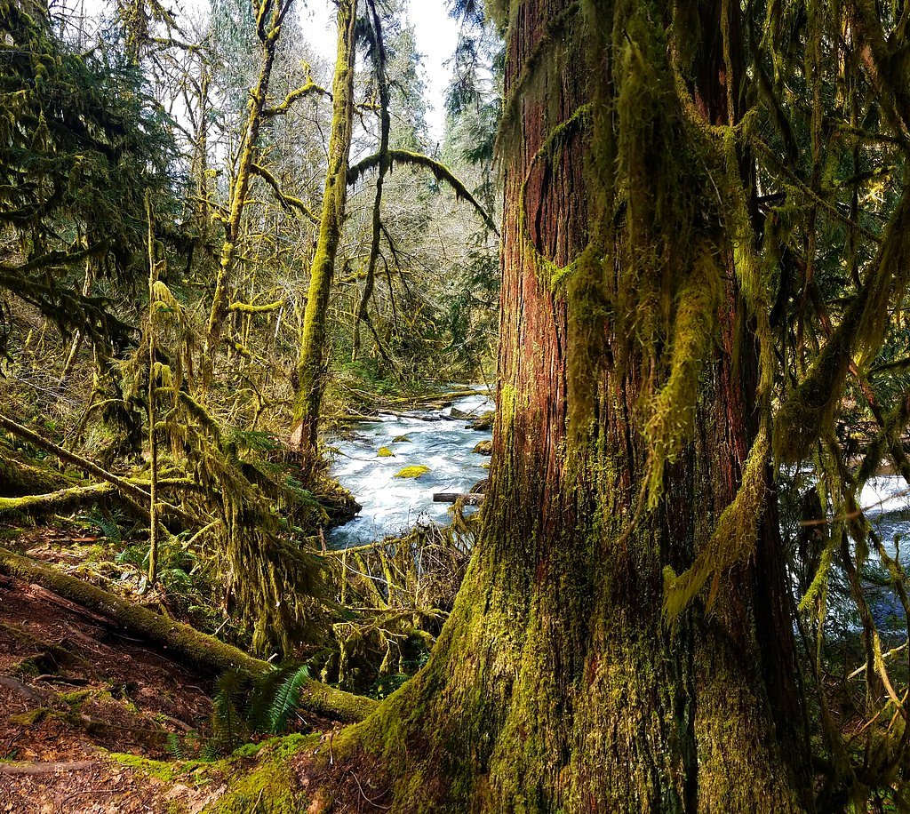
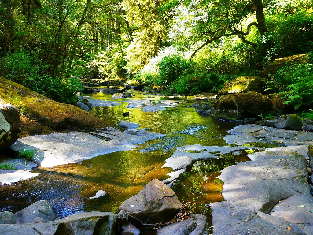
Lower Kentucky Falls is a stunning waterfall located in the Siuslaw National Forest in Oregon. It is part of the Kentucky Falls Trail, which also features Upper Kentucky Falls and North Fork Falls. The waterfall is surrounded by lush forest and is a popular destination for hikers seeking a serene and picturesque experience.
The Setting
Lower Kentucky Falls sits at 1,017 feet within Siuslaw National Forest, fed by the Lake Creek, in the foothills of Oregon.
Trail & Hike Details
The Approach
The moderate hike follows Kentucky Falls (#1376), a 4.4-mile out-and-back trail over natural surface. Expect 800 feet of elevation gain with grades of 12-20%. The trail is developed (Class 3).
USFS Trail
KENTUCKY FALLS #1376
Trail Class
Developed
Surface
Avg Grade
USFS Segment
1.91 miTrail Description
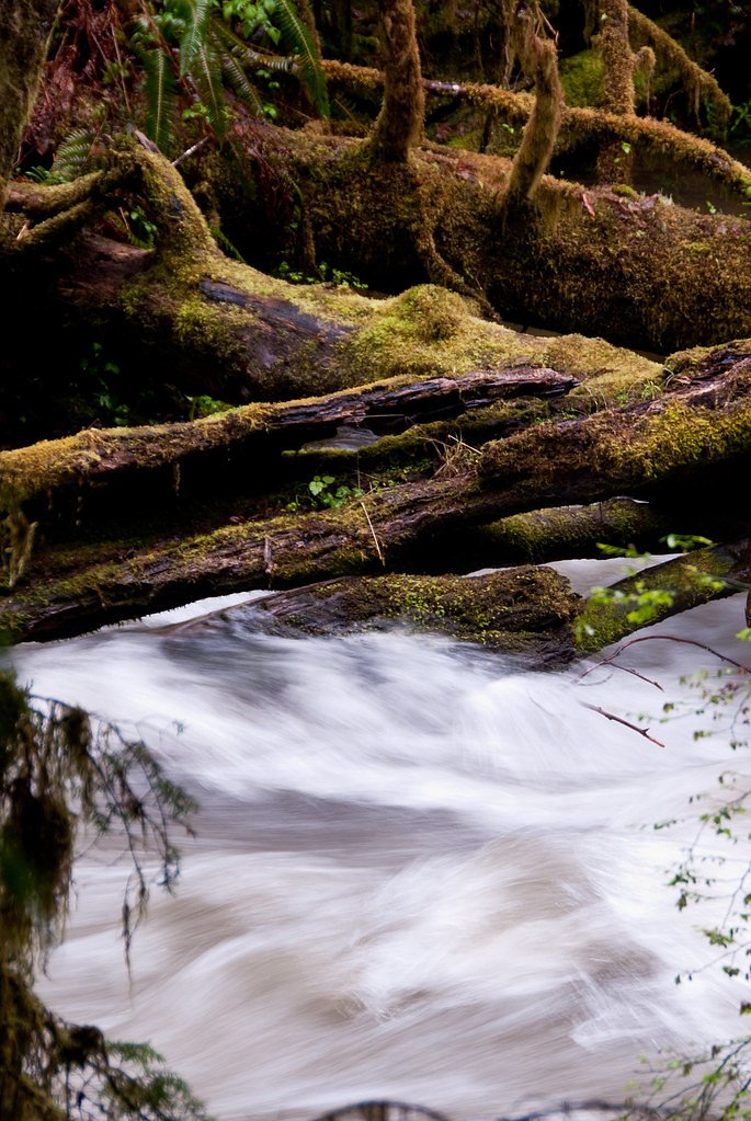
The trail to Lower Kentucky Falls is a well-maintained path that winds through old-growth forest, offering scenic views of the lush surroundings. The trail descends gradually, with some steeper sections, leading to a viewpoint where visitors can enjoy the beauty of the waterfall. The trail also passes by Upper Kentucky Falls and North Fork Falls, making it a rewarding hike with multiple waterfalls to see.
What to Expect
Dogs are welcome.
Accessibility
The trail is not wheelchair accessible. Uneven terrain and elevation changes require steady footing.
Frequently Asked Questions
🐶 Are Dogs Allowed at Lower Kentucky Falls?
✅ Dogs are allowed
Are There Any Fees or Permits Required?
🆖 No fees required
🏊 Is There Swimming at Lower Kentucky Falls?
❌ Swimming is not allowed
When to Visit
Spring and early summer are ideal times to visit, as the waterfall is typically at its fullest due to seasonal rainfall. Fall offers beautiful foliage, while winter provides a quieter experience, though the trail may be muddy or icy.
Seasonal Access
The best time to visit is Spring, Summer, Fall, and Winter. Check with Siuslaw National Forest for seasonal road closures.
Safety Information
The trail can be slippery, especially after rain. Watch your footing and stay on the marked path. Be cautious of falling branches and other natural hazards.
Current Water Conditions
121 ft³/s
Current discharge — how much water is flowing
Much higher than usual for this time of year
Based on 1 years of record
9.87 ft
Water depth at gauge
64°F
CoolRefreshing for swimming
7-Day Discharge Trend
What does this mean for your visit?
The water is flowing much higher than usual, expect an impressive display. Water temperature is a refreshing 64 degrees F, good for a quick swim.
About This Gauge
This gauge is on a nearby waterway and may not reflect exact conditions at the falls.
7-Day Flow Outlook
Based on the USGS gauge LAKE CREEK AT SWISSHOME, OR (14 km away).
Today
Roaring
138 cfs
6/10Tomorrow
Roaring
134 cfs
6/10Mon
Roaring
126 cfs
6/10Tue
Roaring
112 cfs
9/10Wed
Roaring
102 cfs
9/10Thu
Roaring
107 cfs
6/10Fri
Roaring
108 cfs
6/10Best window: Tue — roaring flow, partly sunny (trip score 9/10).
Best time of year: this gauge typically runs highest from mid March to mid April, peaking in March.
How we calculate this
This is a transparent outlook, not a precise forecast. We take the waterfall's current flow strength (how it ranks against its historical normal for today, from the nearest USGS stream gauge), carry that ranking forward along the gauge's seasonal curve, and nudge it for forecast rain. Confidence is highest for the next day or two and falls further out. Always check official conditions and your own judgment before visiting — high flows can be dangerous.
Know when to go.
Get a free email alert when waterfalls near Mapleton hit peak flow. We only send when conditions are worth the trip — no weekly newsletters, no spam.
Weather Forecast
Location & Access
Getting There
Lower Kentucky Falls is accessed via the Kentucky Falls Trailhead, located off Forest Service Road 23. The trailhead is approximately 30 miles from Mapleton, Oregon. The road to the trailhead may be rough and unpaved in sections, so a high-clearance vehicle is recommended.
Get Directions on Google MapsParking
There is a small parking area at the Kentucky Falls Trailhead. Parking is free, but space may be limited, especially during peak seasons.
Elevation
1,017 feet above sea level
Coordinates
43.931270° N, -123.815720° W
Land Management
Managed by USFS
Visitor Tips & Gear
Wear sturdy hiking shoes, as the trail can be muddy and slippery, especially after rain. Bring plenty of water and snacks, as there are no facilities along the trail. Cell service is limited in the area, so plan accordingly.
As an Amazon Associate, we earn from qualifying purchases.
With 4.4 miles and 800 ft of elevation gain, sturdy boots and trekking poles will help on this moderate trail. Icy conditions are common in winter — traction cleats are a smart addition.

Columbia Watertight II Rain Jacket
Packs into its own pocket, seam-sealed, and keeps you dry from spray and surprise rain.

Polarized Sunglasses (Knockaround)
Cuts glare off the water so you actually see the falls — and your photos turn out better too.

Earth Pak Waterproof Dry Bag
Keeps your phone and gear dry when waterfall mist soaks everything else.

Waterproof Phone Pouch (AiRunTech)
Cheap insurance — take photos right next to the falls without killing your phone.

Timberland Euro Sprint Mid Waterproof
Trusted waterproof boot with premium leather and grippy rubber sole — reliable on rocky, wet trails.

TrailBuddy Trekking Poles
Lightweight aluminum, cork grips, and flip-locks that actually hold — a best-seller for good reason.
Where to Stay

Park Motel and Cabins

Quality Inn Florence

The Florentine Waterfront Hotel

Ocean Breeze Motel
Browse vacation cabins and private rentals nearby
Unique outdoor stays — tents, yurts, and treehouses
Rent a campervan or RV for your waterfall road trip
Some links are affiliate links. We may earn a commission at no extra cost to you.
Nearby Campground
Whittaker Creek Recreation Site
8.5 miles away · 31 sites
Overview Overnight camping is closed until further notice. Day-use recreation areas remain open for public use.Reserve a site at Whittaker Creek on recreation.gov or pay when you arrive for non-reserved campsites using the Recreation.gov Mobile App. You must download before you reach the site since there is no cell reception in the drainage. Whittaker Creek Recreation Site is a Bureau of Land Management (BLM) campground and day use area. The campground has 30 sites. Campground amenities include v
Book on Recreation.govAdditional Information
Nearby Attractions
Nearby attractions include Sweet Creek Falls and the Oregon Dunes National Recreation Area.
Wildlife
The area is home to a variety of wildlife, including deer, birds, and small mammals. Keep an eye out for banana slugs and other forest creatures along the trail.
Cities near Lower Kentucky Falls
Nearby Waterfalls

Writing about Lower Kentucky Falls? Embed this waterfall on your site for free.