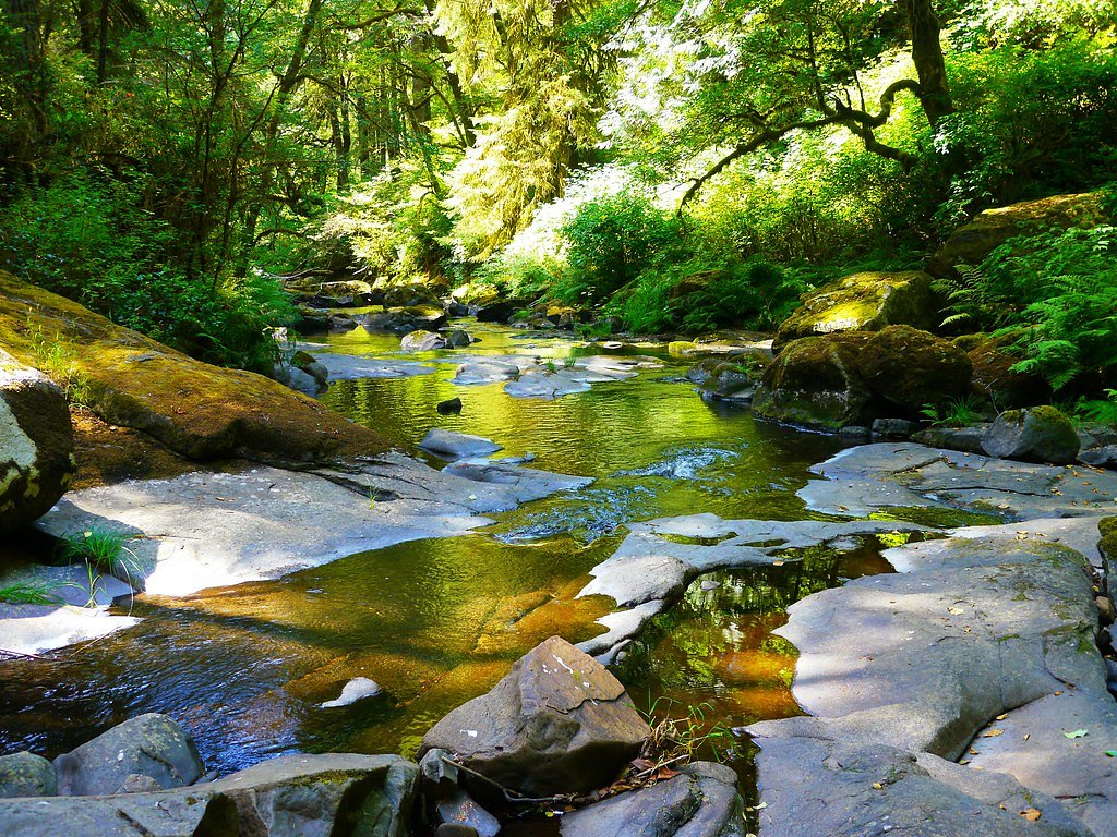
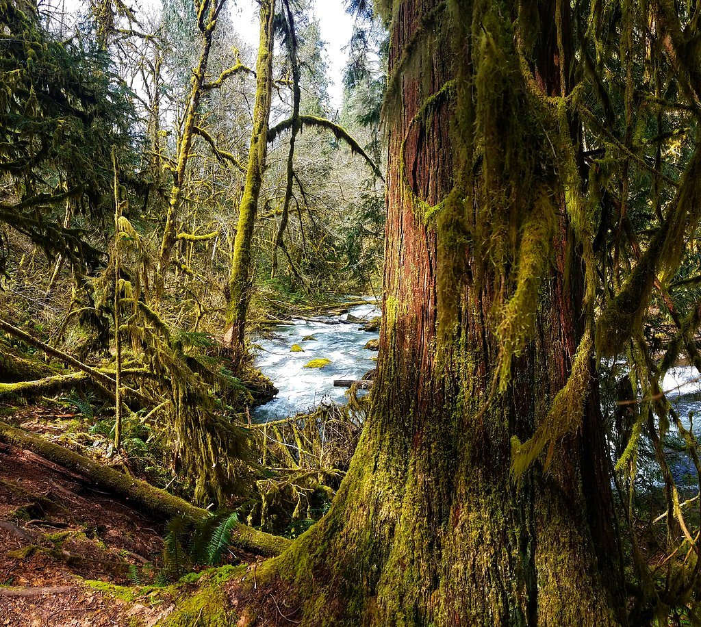
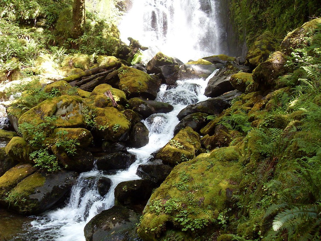
Sweet Creek Falls
By Armen Suny · Last verified Mar 2026
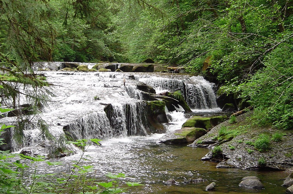
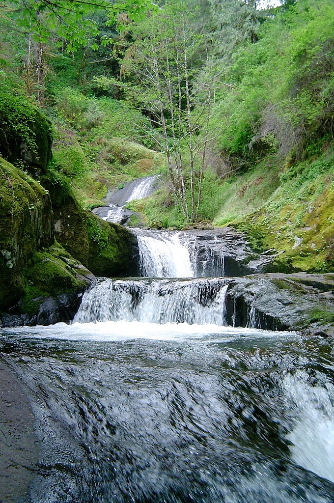
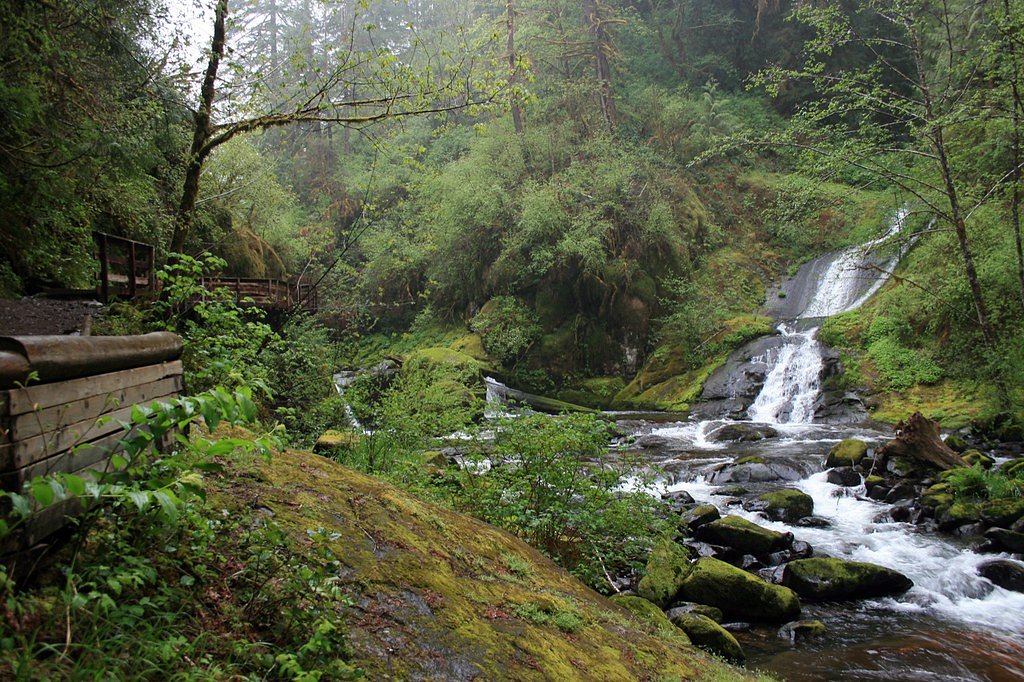
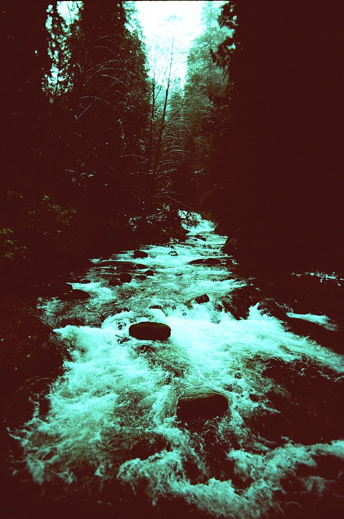

Photo Credits (5)
Difficulty
Easy
Trail Length
2.2 miles
Trail Type
Out And Back
Elevation Gain
250 ft
About Sweet Creek Falls
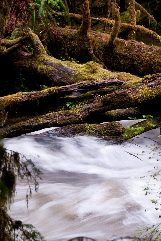
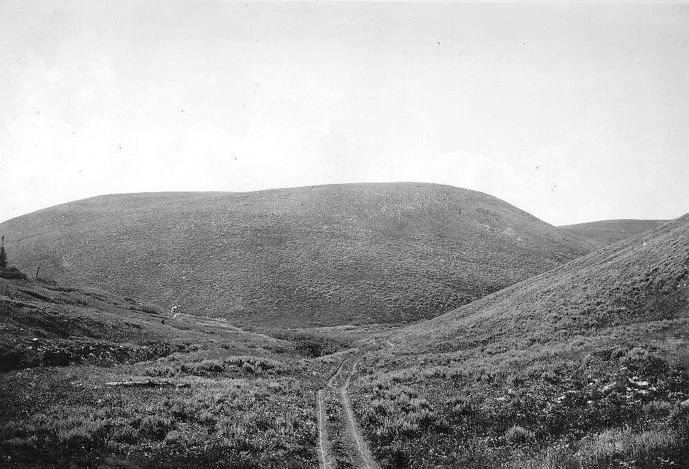
Sweet Creek Falls is a picturesque waterfall located near Mapleton, Oregon, known for its lush surroundings and a series of smaller cascades leading up to the main falls. The area is part of the Siuslaw National Forest and offers a serene hiking experience through moss-covered trees and ferns.
The Setting
Sweet Creek Falls sits at 427 feet within Siuslaw National Forest, fed by the Siuslaw River, in the coastal lowlands of Oregon.
Trail & Hike Details
The Approach
The easy hike follows Sweet Creek (#1319), a 2.2-mile out-and-back trail over imported compacted material. Expect 250 feet of elevation gain with grades of 12-20%. The trail is highly developed (Class 4).
USFS Trail
SWEET CREEK #1319
Trail Class
Highly Developed
Surface
Avg Grade
USFS Segment
2.15 miTrail Description
The Sweet Creek Falls Trail is a well-maintained path that follows Sweet Creek, offering views of multiple smaller cascades before reaching the main waterfall. The trail is shaded, with wooden bridges and railings in some sections for safety.
What to Expect
Dogs are welcome.
Accessibility
The trail is not wheelchair accessible. Uneven terrain and elevation changes require steady footing.
Frequently Asked Questions
🐶 Are Dogs Allowed at Sweet Creek Falls?
✅ Dogs are allowed
Are There Any Fees or Permits Required?
🆖 No fees required
🏊 Is There Swimming at Sweet Creek Falls?
❌ Swimming is not allowed
When to Visit
Spring and early summer are ideal for visiting, as the water flow is typically strongest during these seasons.
Seasonal Access
The best time to visit is Spring, Summer, and Fall. Winter access may be limited. Check with Siuslaw National Forest for seasonal road closures.
Safety Information
Exercise caution near the water, as rocks can be slippery. Be aware of changing weather conditions, and avoid the trail during heavy rain or storms.
Current Water Conditions
221 ft³/s
Current discharge — how much water is flowing
Much lower than usual for this time of year
Based on 51 years of record
3.33 ft
Water depth at gauge
67°F
CoolRefreshing for swimming
7-Day Discharge Trend
What does this mean for your visit?
Flow is well below normal for this time of year, so the waterfall may be a trickle. Water temperature is a refreshing 67 degrees F, good for a quick swim.
About This Gauge
This gauge is on a nearby waterway and may not reflect exact conditions at the falls.
7-Day Flow Outlook
Based on the USGS gauge SIUSLAW RIVER NEAR MAPLETON, OR (13 km away).
Today
Strong
239 cfs
8/10Tomorrow
Strong
262 cfs
7/10Sun
Strong
248 cfs
8/10Mon
Strong
236 cfs
8/10Tue
Moderate
214 cfs
9/10Wed
Moderate
203 cfs
9/10Thu
Strong
211 cfs
8/10Best window: Tue — moderate flow, mostly sunny (trip score 9/10).
Best time of year: this gauge typically runs highest from mid December to late January, peaking in December.
How we calculate this
This is a transparent outlook, not a precise forecast. We take the waterfall's current flow strength (how it ranks against its historical normal for today, from the nearest USGS stream gauge), carry that ranking forward along the gauge's seasonal curve, and nudge it for forecast rain. Confidence is highest for the next day or two and falls further out. Always check official conditions and your own judgment before visiting — high flows can be dangerous.
Know when to go.
Get a free email alert when waterfalls near Mapleton hit peak flow. We only send when conditions are worth the trip — no weekly newsletters, no spam.
Weather Forecast
Location & Access
Getting There
Sweet Creek Falls is located approximately 10 miles southeast of Mapleton, Oregon. From Highway 126, take Sweet Creek Road and follow signs to the trailhead.
Get Directions on Google MapsParking
There is a designated parking area at the trailhead, but it may fill up during peak seasons. Arrive early to secure a spot.
Elevation
427 feet above sea level
Coordinates
43.946509° N, -123.903165° W
Land Management
Managed by USFS
Visitor Tips & Gear
Wear sturdy, non-slip shoes as the trail can be muddy or slippery, especially after rain. Arrive early during weekends or holidays to avoid crowds. Bring a camera to capture the scenic beauty.
As an Amazon Associate, we earn from qualifying purchases.
This easy 2.2 miles hike is straightforward — comfortable trail shoes and plenty of water should do. Sun exposure on the trail makes good sun protection a must in summer.

Polarized Sunglasses (Knockaround)
Cuts glare off the water so you actually see the falls — and your photos turn out better too.

Columbia Watertight II Rain Jacket
Packs into its own pocket, seam-sealed, and keeps you dry from spray and surprise rain.

Earth Pak Waterproof Dry Bag
Keeps your phone and gear dry when waterfall mist soaks everything else.

Waterproof Phone Pouch (AiRunTech)
Cheap insurance — take photos right next to the falls without killing your phone.

JOBY GorillaPod Starter Kit
Wraps around railings and rocks for long-exposure waterfall shots — no flat surface needed.

Osprey Daylite Daypack
Light, organized, and just the right size for a day hike — fits water, snacks, and layers.
Where to Stay

Quality Inn Florence

Park Motel and Cabins

The Florentine Waterfront Hotel

Ocean Breeze Motel
Browse vacation cabins and private rentals nearby
Unique outdoor stays — tents, yurts, and treehouses
Rent a campervan or RV for your waterfall road trip
Some links are affiliate links. We may earn a commission at no extra cost to you.
Nearby Campground
North Fork Siuslaw Campground
10.9 miles away · 0 sites
North Fork Siuslaw Campground is a dispersed site with 7 campsites.
Book on Recreation.govAdditional Information
Nearby Attractions
Other nearby attractions include the Siuslaw River, Mapleton, and the Oregon Dunes National Recreation Area.
Wildlife
The area is home to a variety of wildlife, including birds, deer, and small mammals. Keep an eye out for banana slugs and other forest creatures.
Cities near Sweet Creek Falls
Nearby Waterfalls

Writing about Sweet Creek Falls? Embed this waterfall on your site for free.