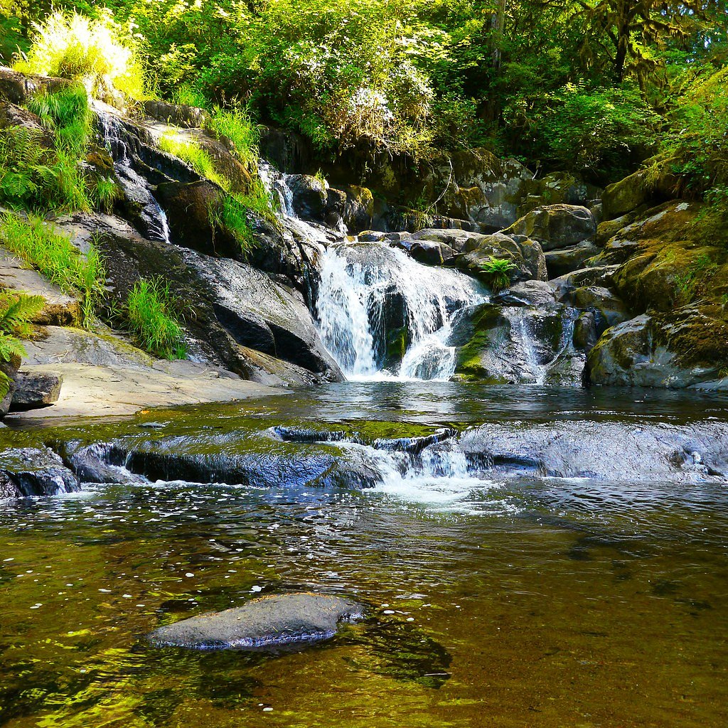
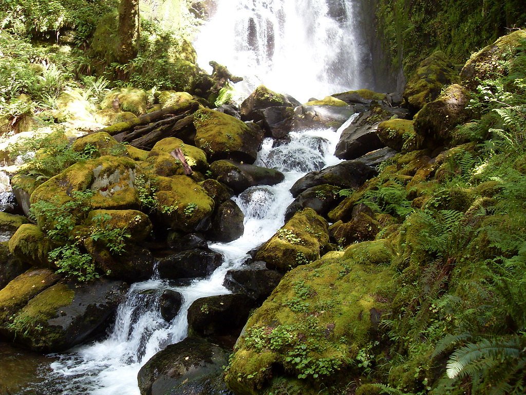
Beaver Creek Falls
By Armen Suny · Last verified Mar 2026
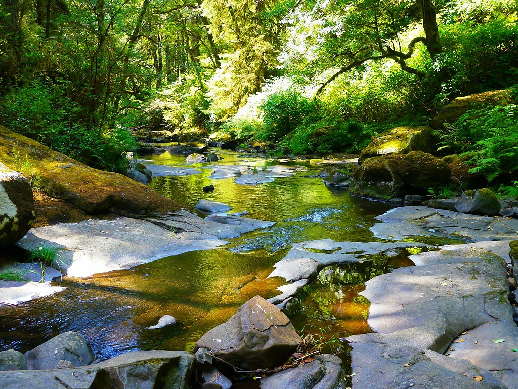
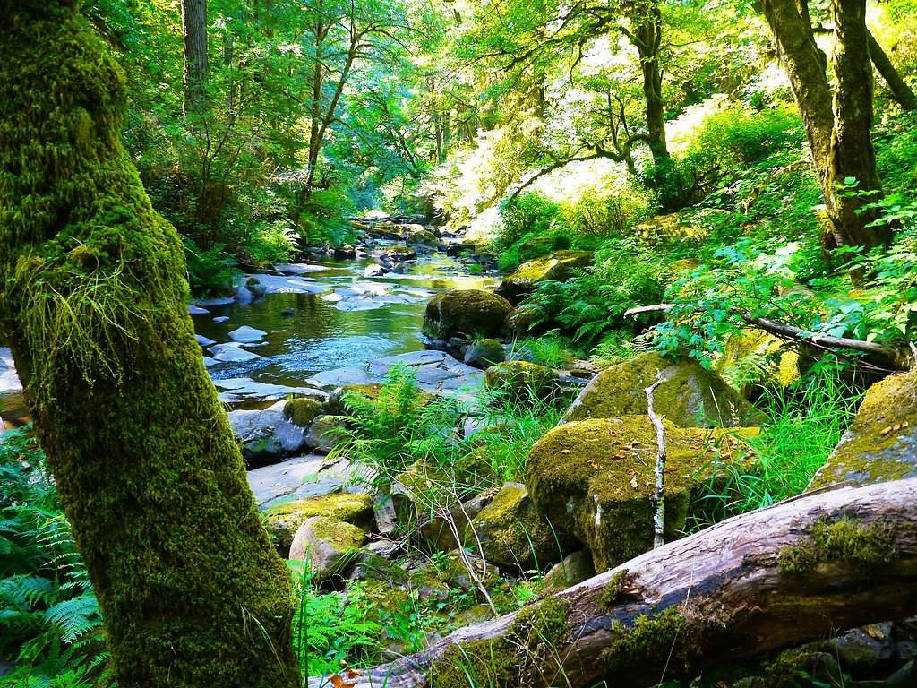
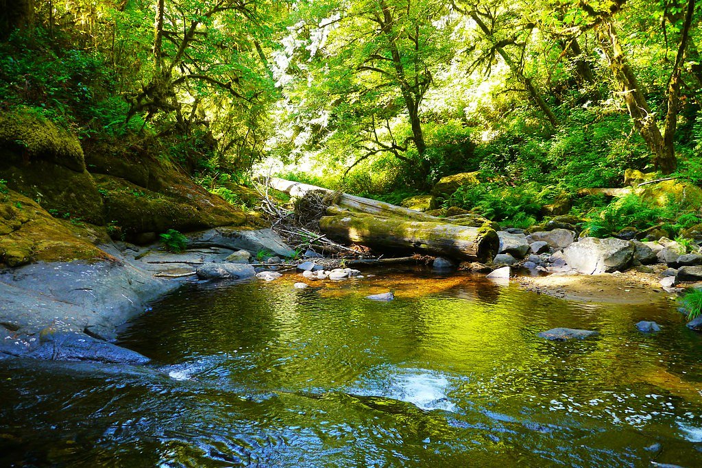
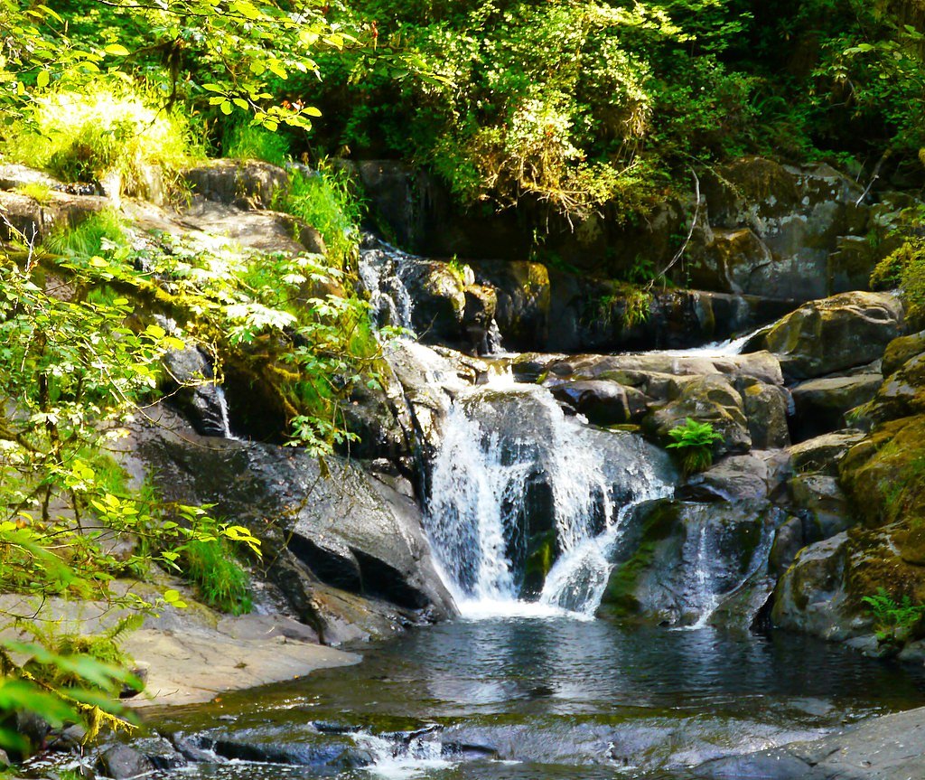

Photo Credits (5)
Difficulty
Moderate
Trail Length
2.4 miles
Trail Type
Out And Back
Elevation Gain
350 ft
About Beaver Creek Falls
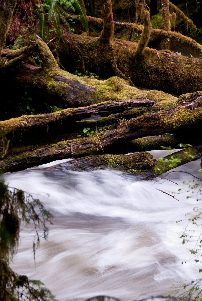
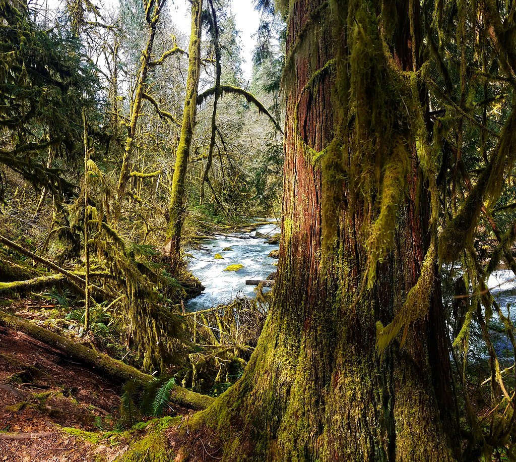
Tucked into the mossy, coastal forests of Lane County, Beaver Creek Falls is a quietly beautiful cascade managed by the U.S. Forest Service within Siuslaw National Forest. The falls are notable for the way Beaver and Sweet Creeks meet — the two streams intertwine as they drop, creating a compact, scenic cascade that rewards photographers and hikers who make the short trek in. The outing is ideal for those seeking a brisk forest escape rather than a long backcountry expedition. The route to the falls follows the Sweet Creek Trail (USFS Trail #1319) and is maintained by the Forest Service; its compacted surface and forested setting make for an inviting, up-close experience with the creek and waterfall.
The Setting
Beaver Creek Falls sits at 610 feet within Siuslaw National Forest, fed by the Siuslaw River, in the foothills of Oregon.
Trail & Hike Details
The Approach
The moderate hike follows Sweet Creek (#1319), a 2.4-mile out-and-back trail over imported compacted material. Expect 350 feet of elevation gain with grades of 12-20%. The trail is highly developed (Class 4).
USFS Trail
SWEET CREEK #1319
Trail Class
Highly Developed
Surface
Avg Grade
USFS Segment
2.15 miTrail Description
Sweet Creek Trail (USFS Trail #1319) is an out-and-back route listed at about 2.4 miles round-trip (USFS GIS records 2.15 miles) with roughly 350 feet of elevation gain and a moderate difficulty rating. The tread is an imported, compacted material designed for durable foot travel; the trail is classified as Class 4 by the USFS and includes sustained grades typically in the 12–20% range, so expect some relatively steep stretches. Managed by the U.S. Forest Service in Siuslaw National Forest, the trail leads through dense coastal forest to the waterfall at the confluence of Beaver and Sweet Creeks.
What to Expect
Dogs are welcome.
Accessibility
The trail is not wheelchair accessible. Uneven terrain and elevation changes require steady footing.
Frequently Asked Questions
🐶 Are Dogs Allowed at Beaver Creek Falls?
✅ Dogs are allowed
Are There Any Fees or Permits Required?
🤑 Fee: $5.00
🏊 Is There Swimming at Beaver Creek Falls?
❌ Swimming is not allowed
When to Visit
Spring and early summer are the best times to visit, as the waterfall is most impressive with higher water flow.
Seasonal Access
The best time to visit is Spring, Summer, and Fall. Winter access may be limited. Check with Siuslaw National Forest for seasonal road closures.
Safety Information
Exercise caution near the waterfall, as rocks may be slippery. Be aware of changing weather conditions and avoid visiting during heavy rain or storms.
Current Water Conditions
231 ft³/s
Current discharge — how much water is flowing
Lower than usual for this time of year
Based on 51 years of record
3.36 ft
Water depth at gauge
66°F
CoolRefreshing for swimming
7-Day Discharge Trend
What does this mean for your visit?
Flow is lower than usual for this time of year. Water temperature is a refreshing 66 degrees F, good for a quick swim.
About This Gauge
This gauge is on a nearby waterway and may not reflect exact conditions at the falls.
7-Day Flow Outlook
Based on the USGS gauge SIUSLAW RIVER NEAR MAPLETON, OR (13 km away).
Today
Roaring
263 cfs
6/10Tomorrow
Roaring
258 cfs
6/10Mon
Roaring
228 cfs
8/10Tue
Roaring
213 cfs
9/10Wed
Roaring
211 cfs
9/10Thu
Roaring
219 cfs
6/10Fri
Roaring
214 cfs
6/10Best window: Tue — roaring flow, partly sunny (trip score 9/10).
Best time of year: this gauge typically runs highest from mid December to late January, peaking in December.
How we calculate this
This is a transparent outlook, not a precise forecast. We take the waterfall's current flow strength (how it ranks against its historical normal for today, from the nearest USGS stream gauge), carry that ranking forward along the gauge's seasonal curve, and nudge it for forecast rain. Confidence is highest for the next day or two and falls further out. Always check official conditions and your own judgment before visiting — high flows can be dangerous.
Know when to go.
Get a free email alert when waterfalls near Mapleton hit peak flow. We only send when conditions are worth the trip — no weekly newsletters, no spam.
Weather Forecast
Location & Access
Getting There
Beaver Creek Falls is located near the town of Glide, Oregon, within the Umpqua National Forest. It can be accessed via Highway 138, also known as the Rogue-Umpqua Scenic Byway. Follow signs for the trailhead or consult local maps for precise directions.
Get Directions on Google MapsParking
There is a small parking area near the trailhead, but availability may be limited during peak seasons.
Elevation
610 feet above sea level
Coordinates
43.942342° N, -123.892331° W
Land Management
Managed by USFS
Visitor Tips & Gear
Visit during the spring or early summer when water flow is at its peak. Wear sturdy shoes as the trail may be muddy after rain. Arrive early to secure parking, especially on weekends.
As an Amazon Associate, we earn from qualifying purchases.
With 2.4 miles and 350 ft of elevation gain, sturdy boots and trekking poles will help on this moderate trail. Sun exposure on the trail makes good sun protection a must in summer.

Polarized Sunglasses (Knockaround)
Cuts glare off the water so you actually see the falls — and your photos turn out better too.

Columbia Watertight II Rain Jacket
Packs into its own pocket, seam-sealed, and keeps you dry from spray and surprise rain.

Earth Pak Waterproof Dry Bag
Keeps your phone and gear dry when waterfall mist soaks everything else.

Waterproof Phone Pouch (AiRunTech)
Cheap insurance — take photos right next to the falls without killing your phone.

Timberland Euro Sprint Mid Waterproof
Trusted waterproof boot with premium leather and grippy rubber sole — reliable on rocky, wet trails.

TrailBuddy Trekking Poles
Lightweight aluminum, cork grips, and flip-locks that actually hold — a best-seller for good reason.
Where to Stay

Quality Inn Florence

Park Motel and Cabins

The Florentine Waterfront Hotel

Ocean Breeze Motel
Browse vacation cabins and private rentals nearby
Unique outdoor stays — tents, yurts, and treehouses
Rent a campervan or RV for your waterfall road trip
Some links are affiliate links. We may earn a commission at no extra cost to you.
Nearby Campground
North Fork Siuslaw Campground
11.3 miles away · 0 sites
North Fork Siuslaw Campground is a dispersed site with 7 campsites.
Book on Recreation.govAdditional Information
Nearby Attractions
Nearby attractions include Toketee Falls, Watson Falls, and the Umpqua Hot Springs, all located within the Umpqua National Forest.
Wildlife
The area is home to a variety of wildlife, including birds, deer, and small mammals. Be cautious of ticks and other insects during warmer months.
Cities near Beaver Creek Falls
Nearby Waterfalls

Writing about Beaver Creek Falls? Embed this waterfall on your site for free.