Photo Credits (5)
Difficulty
Moderate
Trail Length
2.4 miles
Trail Type
Out And Back
Elevation Gain
350 ft
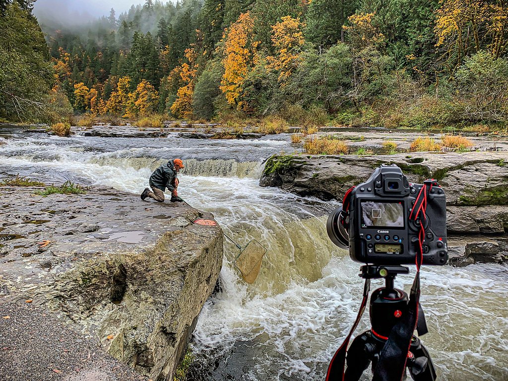
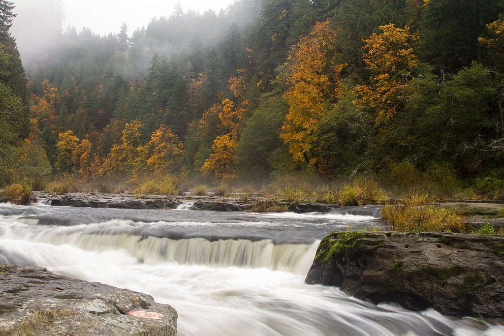
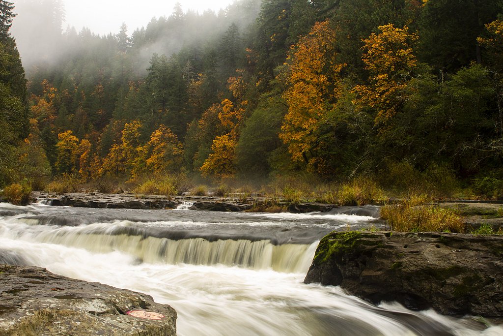
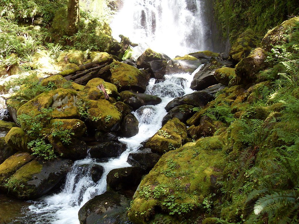
About Smith River Falls
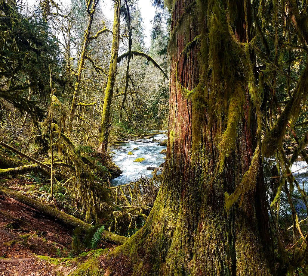
Smith River Falls is a picturesque waterfall in Oregon, tucked into a quiet, forested setting that makes it a favorite for hikers and photographers looking for a peaceful nature escape. The falls present a lovely focal point after a short hike and are often enjoyed as a half-day outing for visitors exploring the surrounding woodlands. The falls are accessed via a 2.4-mile out-and-back trail that gains about 350 feet in elevation and is typically rated moderate. The route threads through shaded forest and opens to viewpoints at the falls, making it a satisfying option for hikers comfortable with steady, moderate climbs and looking for a rewarding waterfall destination.
The Setting
Smith River Falls sits at 171 feet along the Siuslaw River, in the coastal lowlands of Oregon.
Trail & Hike Details
The Approach
The moderate 2.4-mile out-and-back trail gains 350 feet of elevation on the way to the falls.
Trail Description
This is a 2.4-mile out-and-back trail with approximately 350 feet of elevation gain and a moderate difficulty rating. The path is a clear forest route with some steady uphill sections; expect the surface to be natural tread and potentially slick or muddy in wet weather. Proper footwear is recommended, and the trail is suitable for hikers prepared for moderate climbs and short downhill returns.
What to Expect
Dogs are welcome.
Accessibility
The trail is not wheelchair accessible. Uneven terrain and elevation changes require steady footing.
Frequently Asked Questions
🐶 Are Dogs Allowed at Smith River Falls?
✅ Dogs are allowed
Are There Any Fees or Permits Required?
🆖 No fees required
🏊 Is There Swimming at Smith River Falls?
❌ Swimming is not allowed
When to Visit
Spring and early summer are the best times to visit, as the water flow is typically strongest during these seasons.
Seasonal Access
The best time to visit is Spring, Summer, and Fall. Winter access may be limited.
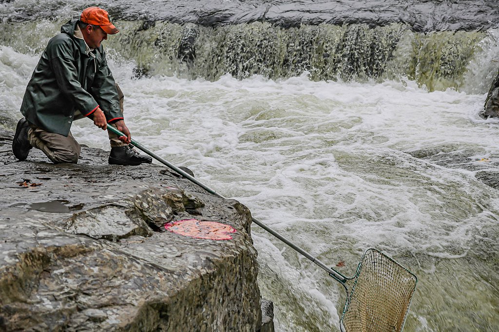
Safety Information
Visitors should exercise caution near the water, as rocks can be slippery. Be aware of changing weather conditions and avoid visiting during heavy rain, as the trail may become hazardous.
Current Water Conditions
35 ft³/s
Current discharge — how much water is flowing
About average for this time of year
10.14 ft
Water depth at gauge
64°F
CoolRefreshing for swimming
7-Day Discharge Trend
What does this mean for your visit?
Flow is about average for this time of year. Water temperature is a refreshing 64 degrees F, good for a quick swim.
About This Gauge
This gauge is on a nearby waterway and may not reflect exact conditions at the falls.
7-Day Flow Outlook
Based on the USGS gauge SIUSLAW RIVER NEAR ALMA, OR (22 km away).
Today
Moderate
35 cfs
9/10Tomorrow
Moderate
35 cfs
9/10Fri
Moderate
35 cfs
9/10Sat
Moderate
35 cfs
9/10Sun
Moderate
35 cfs
9/10Mon
Moderate
35 cfs
9/10Tue
Moderate
35 cfs
9/10Best window: Today — moderate flow, mostly sunny (trip score 9/10).
How we calculate this
This is a transparent outlook, not a precise forecast. We take the waterfall's current flow strength (how it ranks against its historical normal for today, from the nearest USGS stream gauge), carry that ranking forward along the gauge's seasonal curve, and nudge it for forecast rain. Confidence is highest for the next day or two and falls further out. Always check official conditions and your own judgment before visiting — high flows can be dangerous.
Know when to go.
Get a free email alert when waterfalls near Mapleton hit peak flow. We only send when conditions are worth the trip — no weekly newsletters, no spam.
Weather Forecast
Location & Access
Getting There
Smith River Falls is located along the Smith River in Douglas County, Oregon. It can be accessed via Smith River Road, which is a gravel road. Visitors should check local conditions as the road may be rough in some areas.
Get Directions on Google MapsParking
There is a small parking area near the falls, but space may be limited. Visitors should plan to arrive early during peak seasons.
Elevation
171 feet above sea level
Coordinates
43.788174° N, -123.818715° W
Visitor Tips & Gear
Bring sturdy shoes, especially during wet seasons, as the trail can be slippery. Arrive early to secure parking and enjoy the falls without crowds. Cell service may be limited, so plan accordingly.
As an Amazon Associate, we earn from qualifying purchases.
With 2.4 miles and 350 ft of elevation gain, sturdy boots and trekking poles will help on this moderate trail. Sun exposure on the trail makes good sun protection a must in summer.

Polarized Sunglasses (Knockaround)
Cuts glare off the water so you actually see the falls — and your photos turn out better too.

Columbia Watertight II Rain Jacket
Packs into its own pocket, seam-sealed, and keeps you dry from spray and surprise rain.

Earth Pak Waterproof Dry Bag
Keeps your phone and gear dry when waterfall mist soaks everything else.

Waterproof Phone Pouch (AiRunTech)
Cheap insurance — take photos right next to the falls without killing your phone.

Timberland Euro Sprint Mid Waterproof
Trusted waterproof boot with premium leather and grippy rubber sole — reliable on rocky, wet trails.

TrailBuddy Trekking Poles
Lightweight aluminum, cork grips, and flip-locks that actually hold — a best-seller for good reason.
Where to Stay

Park Motel and Cabins

The Florentine Waterfront Hotel

Quality Inn Florence

Ocean Breeze Motel
Browse vacation cabins and private rentals nearby
Unique outdoor stays — tents, yurts, and treehouses
Rent a campervan or RV for your waterfall road trip
Some links are affiliate links. We may earn a commission at no extra cost to you.
Nearby Campground
LOON LAKE RECREATION SITE
13.2 miles away · 52 sites
Overview The Bureau of Land Management's Loon Lake Recreation Site is located in the heart of Oregon's Coast Range at an elevation of 392 feet, just 20 miles east-southeast of Reedsport, Oregon. Loon Lake Recreation Site is one of the Coast Range's few recreation areas with a warm, sandy beach. The lake is perfect for swimming, fishing, boating, and other water activities. The site offers a campground and day use area. Loon Lake Recreation Site's operating season is from Memorial Day weekend to S
Book on Recreation.govAdditional Information
Nearby Attractions
Nearby attractions include the Umpqua River and the Oregon Dunes National Recreation Area, both of which offer additional outdoor activities.
Wildlife
The area is home to a variety of wildlife, including birds, deer, and small mammals. Visitors should be cautious of ticks and other insects.
Cities near Smith River Falls
Nearby Waterfalls

Other waterfalls named Smith River Falls
1 other waterfall shares this name across the U.S.
Writing about Smith River Falls? Embed this waterfall on your site for free.