Photo Credits (5)
Difficulty
Moderate
Trail Length
3.0 miles
Trail Type
Out And Back
Elevation Gain
600 ft
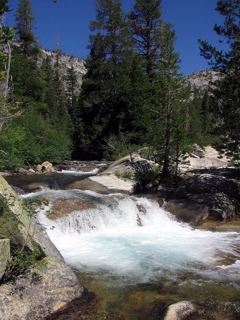
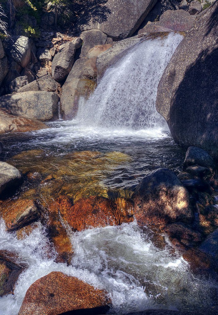
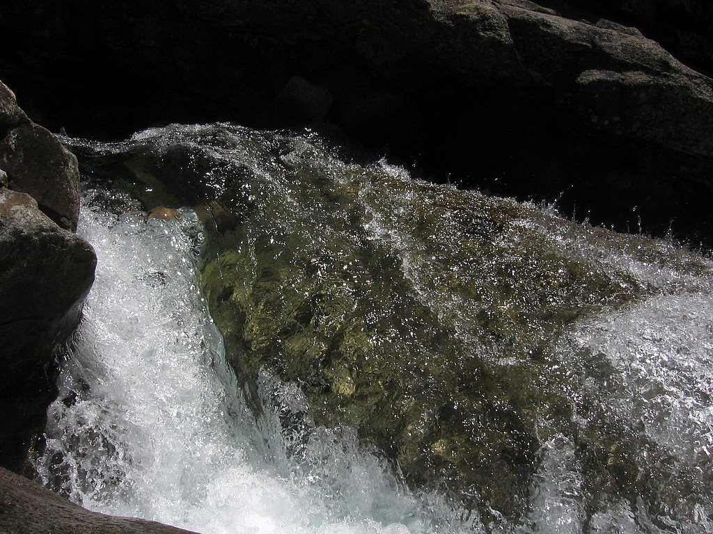
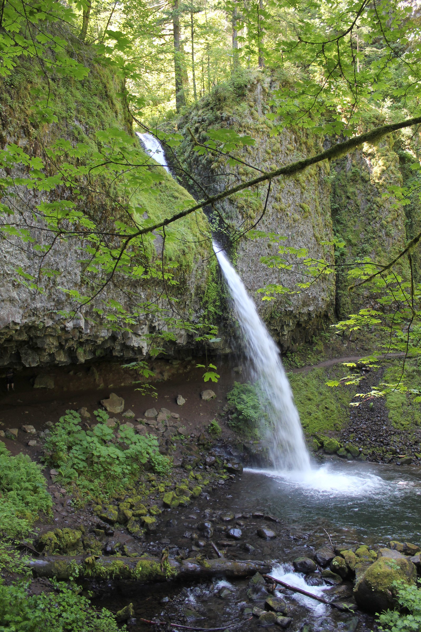
About Horsetail Falls
Horsetail Falls is a scenic cascade located on National Forest System land within the Klamath National Forest in northern California. Managed by the U.S. Forest Service, the waterfall is accessed from the WEST FORK SEIAD CREEK trail (Trail #5246), which brings visitors into a quiet forested setting where the sound of falling water is the highlight of the outing. The setting is intentionally left natural—this is USFS-managed backcountry, so expect a more rustic, outdoorsy experience rather than developed infrastructure. Reaching the falls is a rewarding half-day outing: the route is an out-and-back of roughly 3.0 miles round trip with about 600 feet of elevation gain and a moderate difficulty rating. Hikers who enjoy a short climb and a pleasant forest walk will find Horsetail Falls a satisfying destination; the USFS trail designation (WEST FORK SEIAD CREEK, Trail #5246) is useful to reference when checking current conditions or maps from the Forest Service.
The Setting
Horsetail Falls sits at 4,186 feet within Klamath National Forest, fed by the Elliott Creek, in the mountains of California.
Trail & Hike Details
The Approach
The moderate hike follows West Fork Seiad Creek (#5246), a 3.0-mile out-and-back trail over natural surface. Expect 600 feet of elevation gain with grades of 12-20%. The trail is moderately developed (Class 2).
USFS Trail
WEST FORK SEIAD CREEK #5246
Trail Class
Moderately Developed
Surface
Avg Grade
USFS Segment
2.98 miTrail Description
Trail: WEST FORK SEIAD CREEK (USFS Trail #5246). Length: ~3.0 miles round-trip (GIS miles 2.98). Type: out-and-back. Elevation gain: ~600 ft. Difficulty: moderate. USFS class: 2. Surface: NAT - native material. Typical grade: 12–20%. The tread is natural (dirt/rock) and the grade can be moderately steep in sections, so expect uneven footing and short climbs rather than constructed or paved trail segments. Standard backcountry precautions (sturdy shoes, water, map) are recommended; consult Klamath National Forest/USFS resources for current trail conditions before you go.
What to Expect
Dogs are welcome.
Accessibility
The trail is not wheelchair accessible. Uneven terrain and elevation changes require steady footing.
Frequently Asked Questions
🐶 Are Dogs Allowed at Horsetail Falls?
✅ Dogs are allowed
Are There Any Fees or Permits Required?
🤑 Fee: $5.00
Permit required
A day-use permit is required for hiking in the Desolation Wilderness. Permits can be obtained at the trailhead or online through the U.S. Forest Service.
🏊 Is There Swimming at Horsetail Falls?
❌ Swimming is not allowed
When to Visit
The best time to visit Horsetail Falls is in the spring or early summer when the snowmelt creates a powerful flow. Fall can also be a good time to visit for cooler weather and fewer crowds.
Seasonal Access
The best time to visit is Spring, Summer, and Fall. Winter access may be limited. Check with Klamath National Forest for seasonal road closures.
Safety Information
The trail can be slippery, especially near the waterfall. Watch your footing and avoid getting too close to the edge. Be prepared for sudden weather changes in the Sierra Nevada mountains.
Current Water Conditions
4.69 ft
Water depth at gauge
About This Gauge
This gauge is on a nearby waterway and may not reflect exact conditions at the falls.
7-Day Flow Outlook
Based on the USGS gauge ELLIOTT CREEK NEAR COPPER, OR (8 km away).
Best time of year: this gauge typically runs highest from early April to early June, peaking in March.
How we calculate this
This is a transparent outlook, not a precise forecast. We take the waterfall's current flow strength (how it ranks against its historical normal for today, from the nearest USGS stream gauge), carry that ranking forward along the gauge's seasonal curve, and nudge it for forecast rain. Confidence is highest for the next day or two and falls further out. Always check official conditions and your own judgment before visiting — high flows can be dangerous.
Know when to go.
Get a free email alert when waterfalls near Happy Camp hit peak flow. We only send when conditions are worth the trip — no weekly newsletters, no spam.
Weather Forecast
Location & Access
Getting There
Horsetail Falls is accessed via the Pyramid Creek Trailhead, located off Highway 50 near Twin Bridges, California. The trailhead is well-marked and has a parking area.
Get Directions on Google MapsParking
There is a parking lot at the Pyramid Creek Trailhead. A fee or parking pass may be required, as this area is managed by the U.S. Forest Service.
Elevation
4,186 feet above sea level
Coordinates
41.928953° N, -123.129822° W
Land Management
Managed by USFS
Visitor Tips & Gear
Start your hike early to avoid crowds and ensure you have enough daylight for the return trip. Bring plenty of water, as the trail can be exposed to the sun in some sections. Be prepared for rocky and uneven terrain.
As an Amazon Associate, we earn from qualifying purchases.
With 3.0 miles and 600 ft of elevation gain, sturdy boots and trekking poles will help on this moderate trail. Sun exposure on the trail makes good sun protection a must in summer.

Polarized Sunglasses (Knockaround)
Cuts glare off the water so you actually see the falls — and your photos turn out better too.

Columbia Watertight II Rain Jacket
Packs into its own pocket, seam-sealed, and keeps you dry from spray and surprise rain.

Earth Pak Waterproof Dry Bag
Keeps your phone and gear dry when waterfall mist soaks everything else.

Waterproof Phone Pouch (AiRunTech)
Cheap insurance — take photos right next to the falls without killing your phone.

Timberland Euro Sprint Mid Waterproof
Trusted waterproof boot with premium leather and grippy rubber sole — reliable on rocky, wet trails.

TrailBuddy Trekking Poles
Lightweight aluminum, cork grips, and flip-locks that actually hold — a best-seller for good reason.
Where to Stay

Ravens Myth - Luxury Glamping - Sleeps 2

Diggins Cabin 2

Riverfront Relaxation Secluded Jacksonville Home

Sky Spirit -Luxury Glamping Tipi - Sleeps 2
Browse vacation cabins and private rentals nearby
Unique outdoor stays — tents, yurts, and treehouses
Rent a campervan or RV for your waterfall road trip
Some links are affiliate links. We may earn a commission at no extra cost to you.
Nearby Campground
Harr Point Campground
7.4 miles away · 0 sites
Campground is on the east shore of Applegate Lake and is accessible only by the Payette Trail #970 or by boat. Persons accessing this site by boat may find current information about lake levels helpful. This is a semi-primitive site.Facilities5 campsites (tent-sites) with picnic tables, and fire pitsNo drinking waterVault toiletNo garbage disposal - Please pack it out
Book on Recreation.govNearby Hot Springs
Hot springs near Happy Camp, California
Sulphur Springs
Sulphur Springs flows at a impressive 84°F in Siskiyou County's temperate forest, reaching 29.5 degrees above the cool ambient ...
Jackson Hot Springs
Jackson Hot Springs registers 95°F with highly alkaline chemistry, posting pH 9.3 in sodium-dominated waters containing 95 mg/L...
Bogus Soda Springs
Bogus Soda Springs flows at 76°F from Siskiyou County's volcanic landscape at 2,801 feet elevation. The name suggests early ske...
Klamath Hot Spring
Klamath Hot Spring discharges at 156°F just 27 feet from the nearest road near Montague in Siskiyou County, making it extraordi...

Hot Spring, Fumaroles
Hot Spring with fumaroles on Mount Shasta at 14,000 feet elevation represents one of California's highest thermal features, wit...
Looking for a soak after your hike? Explore more hot springs near Happy Camp, California on SoakingSprings.
Explore California springsAdditional Information
Nearby Attractions
Nearby attractions include Echo Lake, Lake Tahoe, and other trails within the Desolation Wilderness.
Wildlife
The area is home to a variety of wildlife, including deer, squirrels, and birds. Be cautious of bears, which may be present in the region.
Cities near Horsetail Falls
Nearby Waterfalls
Other waterfalls named Horsetail Falls
7 other waterfalls share this name across the U.S.
Writing about Horsetail Falls? Embed this waterfall on your site for free.