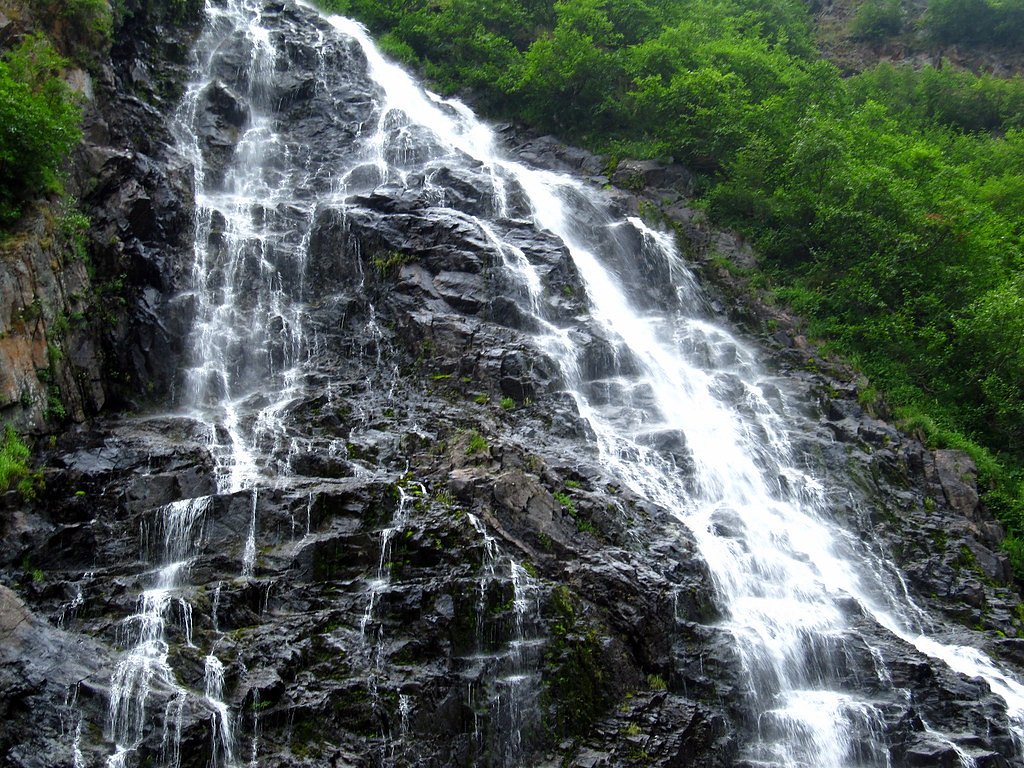
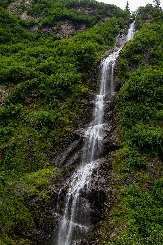
Horsetail Falls
By Armen Suny · Last verified Mar 2026
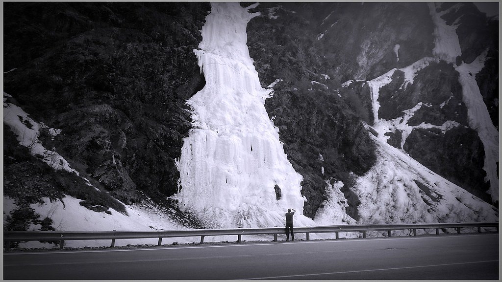
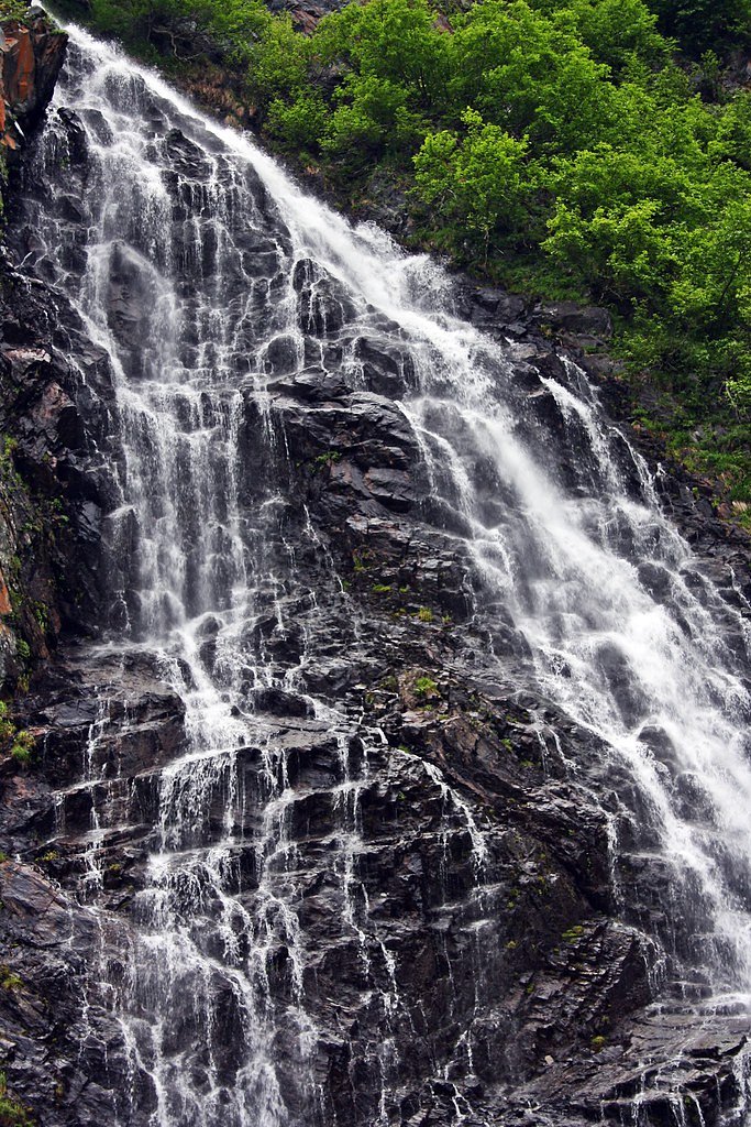
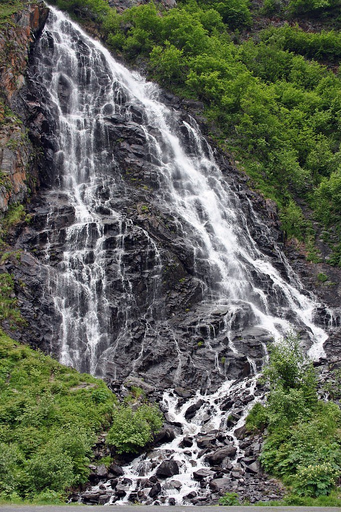
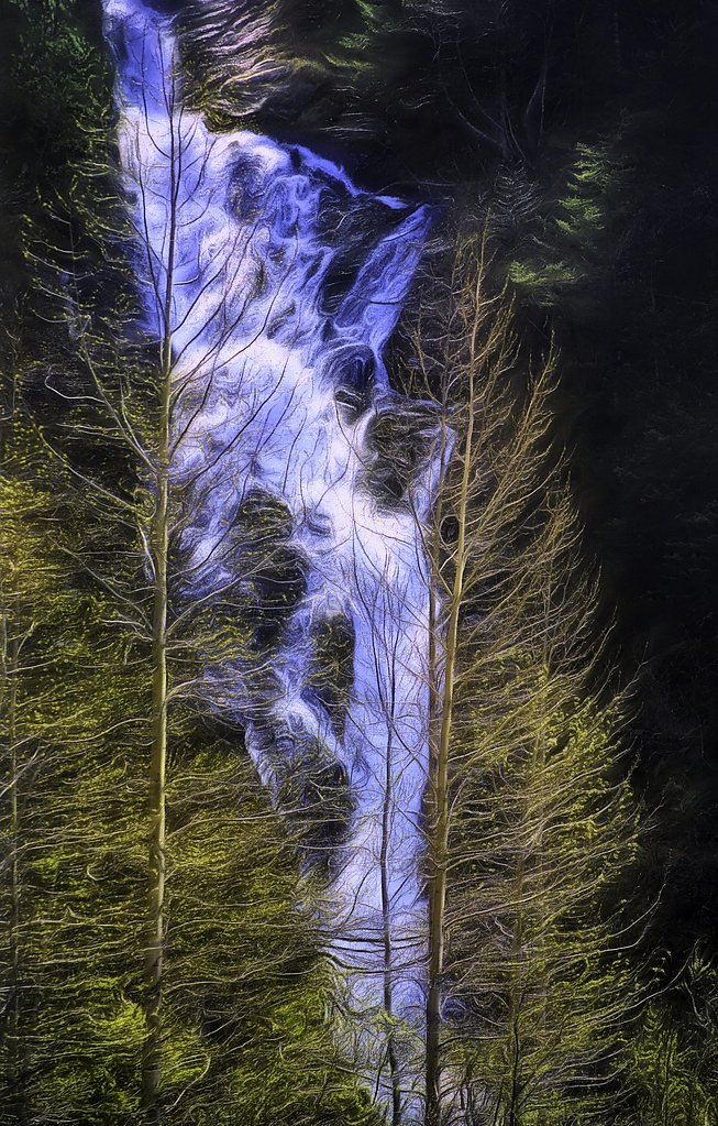

Photo Credits (5)
Difficulty
Moderate
Trail Length
2.4 miles
Trail Type
Out And Back
Elevation Gain
350 ft
About Horsetail Falls
Horsetail Falls spills down the rocky walls of Keystone Canyon just outside Valdez, its thread-like cascades earning the name that evokes a horse’s flowing tail. The falls sit amid the canyon’s dramatic cliffs and are a favorite stop for visitors driving the scenic approach into Valdez—an easy-to-enjoy natural highlight that photographs beautifully in all seasons. The waterfall and access sit on State Patented land with an SOTH designation and are managed by SDNR. For hikers looking to move beyond a quick viewpoint, the established route to Horsetail Falls offers a compact outing that balances accessible scenery with a bit of uphill work—making it a satisfying option for a half-day adventure in the canyon.
The Setting
Horsetail Falls sits at 482 feet within State Patented, in the coastal lowlands of Alaska.
Trail & Hike Details
The Approach
The moderate 2.4-mile out-and-back trail gains 350 feet of elevation on the way to the falls.
Trail Description
Trail type: out-and-back. Length: 2.4 miles (round-trip). Elevation gain: approximately 350 feet. Difficulty: moderate. The trail is a defined route that leads to views of Horsetail Falls and back to the trailhead; specific surface, grade, or technical class details are not specified in the available data.
What to Expect
Dogs are welcome.
Accessibility
The trail is not wheelchair accessible. Uneven terrain and elevation changes require steady footing.
Frequently Asked Questions
🐶 Are Dogs Allowed at Horsetail Falls?
✅ Dogs are allowed
Are There Any Fees or Permits Required?
🆖 No fees required
🏊 Is There Swimming at Horsetail Falls?
❌ Swimming is not allowed
When to Visit
Summer is the best time to visit for easy access and vibrant scenery, but the frozen waterfall in winter offers a unique and breathtaking sight.
Seasonal Access
The best time to visit is Spring, Summer, Fall, and Winter.
Safety Information
Be cautious of slippery rocks near the falls and icy conditions in winter. Always stay on designated paths and avoid getting too close to the water.
Current Water Conditions
3,050 ft³/s
Current discharge — how much water is flowing
Lower than usual for this time of year
Based on 12 years of record
7.09 ft
Water depth at gauge
7-Day Discharge Trend
What does this mean for your visit?
Flow is lower than usual for this time of year.
About This Gauge
7-Day Flow Outlook
Based on the USGS gauge LOWE R AB HORSETAIL FALLS NR VALDEZ AK (0 km away).
Today
Moderate
3208 cfs
6/10Tomorrow
Moderate
3044 cfs
6/10Sun
Moderate
3037 cfs
6/10Mon
Moderate
3044 cfs
6/10Tue
Moderate
3052 cfs
6/10Wed
Moderate
2726 cfs
9/10Thu
Moderate
2602 cfs
9/10Best window: Wed — moderate flow, partly sunny (trip score 9/10).
Best time of year: this gauge typically runs highest from early June to late August, peaking in August.
How we calculate this
This is a transparent outlook, not a precise forecast. We take the waterfall's current flow strength (how it ranks against its historical normal for today, from the nearest USGS stream gauge), carry that ranking forward along the gauge's seasonal curve, and nudge it for forecast rain. Confidence is highest for the next day or two and falls further out. Always check official conditions and your own judgment before visiting — high flows can be dangerous.
Know when to go.
Get a free email alert when waterfalls near Valdez hit peak flow. We only send when conditions are worth the trip — no weekly newsletters, no spam.
Weather Forecast
Location & Access
Getting There
Horsetail Falls is located along the Richardson Highway, approximately 13 miles east of Valdez, Alaska. It is easily accessible by car and visible from the highway.
Get Directions on Google MapsParking
There is a small parking area near the falls along the highway, but availability may be limited during peak seasons.
Elevation
482 feet above sea level
Coordinates
61.068056° N, -145.905556° W
Land Management
Managed by SDNR
Visitor Tips & Gear
Visit during the summer for the best views and easier access. In winter, ensure your vehicle is equipped for icy road conditions. Bring a camera to capture the scenic beauty.
As an Amazon Associate, we earn from qualifying purchases.
With 2.4 miles and 350 ft of elevation gain, sturdy boots and trekking poles will help on this moderate trail. Icy conditions are common in winter — traction cleats are a smart addition.

Columbia Watertight II Rain Jacket
Packs into its own pocket, seam-sealed, and keeps you dry from spray and surprise rain.

Polarized Sunglasses (Knockaround)
Cuts glare off the water so you actually see the falls — and your photos turn out better too.

Earth Pak Waterproof Dry Bag
Keeps your phone and gear dry when waterfall mist soaks everything else.

Waterproof Phone Pouch (AiRunTech)
Cheap insurance — take photos right next to the falls without killing your phone.

Timberland Euro Sprint Mid Waterproof
Trusted waterproof boot with premium leather and grippy rubber sole — reliable on rocky, wet trails.

TrailBuddy Trekking Poles
Lightweight aluminum, cork grips, and flip-locks that actually hold — a best-seller for good reason.
Where to Stay

Glacier Hotel

Best Western Valdez Harbor Inn

House on the Rock B&B

Valdez Loft View Apartment
Browse vacation cabins and private rentals nearby
Unique outdoor stays — tents, yurts, and treehouses
Rent a campervan or RV for your waterfall road trip
Some links are affiliate links. We may earn a commission at no extra cost to you.
Nearby Campground
JACK BAY CABIN
20.8 miles away · 1 sites
Overview Jack Bay Cabin is located at the east end of Jack Bay in the Chugach National Forest. Visitors to the cabin will find many opportunities for recreation and relaxation in the vicinity. Access to the site is by float plane or boat only. The flight is typically 15 minutes from Valdez or 30 minutes from Cordova. It is 20 miles from Valdez by boat and 70 miles from Cordova. Tides affect access to this cabin, so it is important to check local tide information. Visitors are responsible for thei
Book on Recreation.govAdditional Information
Nearby Attractions
Other waterfalls in Keystone Canyon, such as Bridal Veil Falls, and the town of Valdez.
Wildlife
The area may have wildlife such as birds, bears, and moose. Exercise caution and follow wildlife safety guidelines.
Cities near Horsetail Falls
Nearby Waterfalls
Other waterfalls named Horsetail Falls
7 other waterfalls share this name across the U.S.
Writing about Horsetail Falls? Embed this waterfall on your site for free.