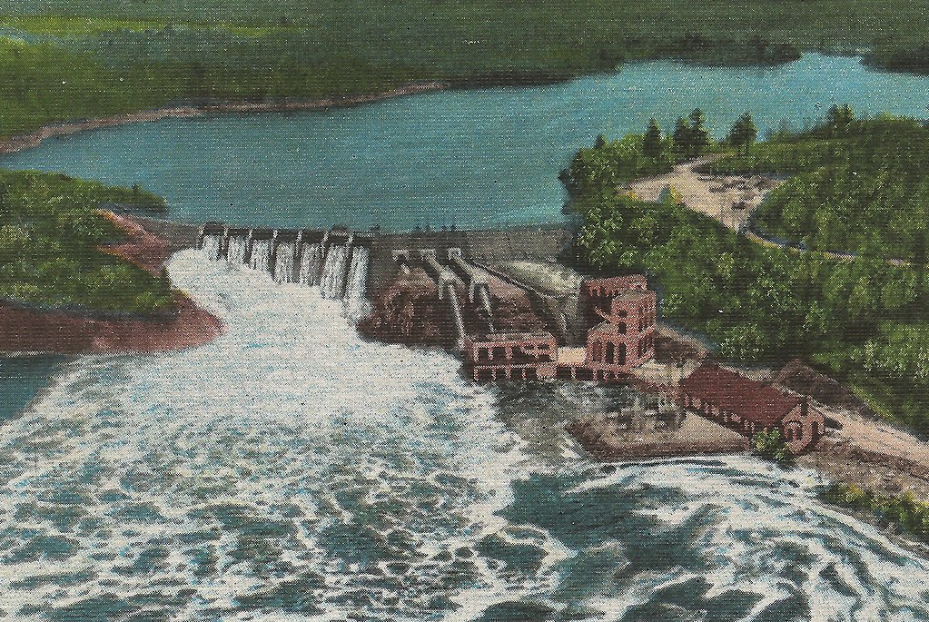
Big Quinnesec Falls (historical)
By Armen Suny · Last verified May 2026

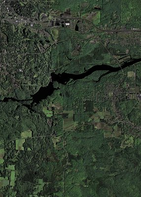
Photo Credits (3)
Difficulty
Moderate
Trail Length
2.4 miles
Trail Type
Out And Back
Elevation Gain
350 ft
About Big Quinnesec Falls (historical)
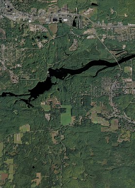
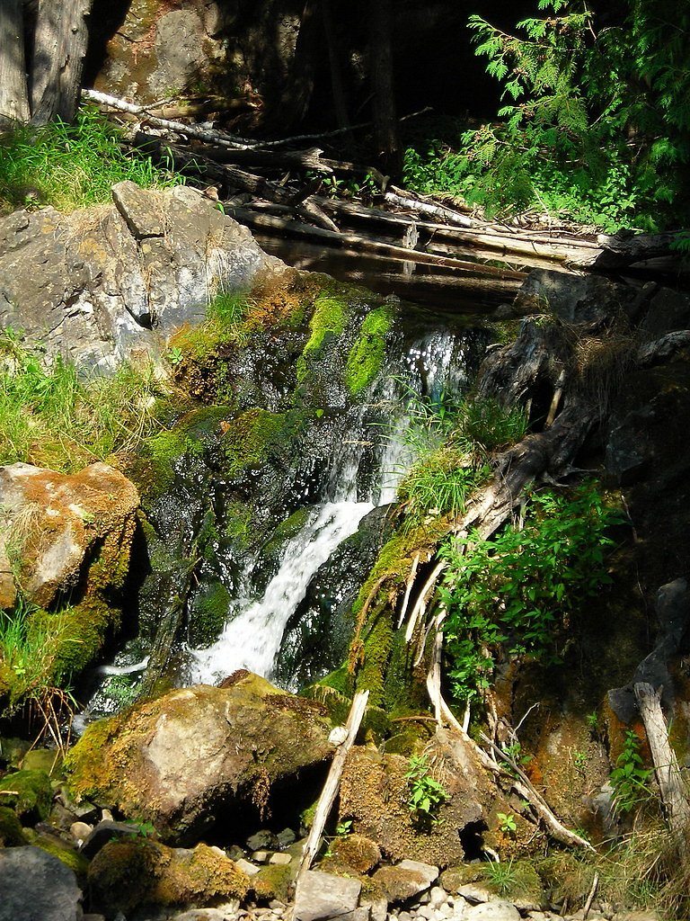
Big Quinnesec Falls (historical) sits on the Menominee River along the Wisconsin–Michigan border, but the cascade you may see in older photos no longer exists in its original form. A hydroelectric dam reshaped the river here, and today the stretch reveals a mix of exposed rockwork, seasonal flows and industrial infrastructure that hint at the waterfall that once was. Visitors often come for riverside scenery, changing water levels and the contrasting textures of river and machinery rather than a preserved plunge. There is no developed visitor area dedicated to the original falls, so trips tend to be low-key and exploratory. Many people access the river via an informal out-and-back route of about 2.4 miles round trip with roughly 350 feet of elevation gain, typically rated moderate — a short hike that rewards photographers and river-watchers with close views from publicly accessible points where permitted. Expect limited signage and informal access; observe posted restrictions around dam facilities and keep a respectful distance from any operational infrastructure.
The Setting
Big Quinnesec Falls (historical) sits at 1,033 feet along the Menominee River, in the foothills of Wisconsin.
Trail & Hike Details
The Approach
The moderate 2.4-mile out-and-back trail gains 350 feet of elevation on the way to the falls.
Trail Description
There is no official USFS trail to Big Quinnesec Falls and no published USFS trail name, number, surface, grade or class data for this route. The common approach is an informal out-and-back of about 2.4 miles round trip with approximately 350 feet of elevation gain, generally rated moderate. The route follows unmarked or lightly used paths across natural terrain — expect mixed surfaces (dirt, roots, rock), variable grade with short steep sections, and uneven footing. Treat it as backcountry walking: wear sturdy footwear, bring water, plan for limited wayfinding, and obey any signage or barriers around the hydroelectric facilities.
What to Expect
Visitors should expect to see a hydroelectric dam and altered river flow rather than a natural waterfall. The area may still offer scenic views of the river and surrounding landscape.
Accessibility
The trail is not wheelchair accessible. Uneven terrain and elevation changes require steady footing.
Frequently Asked Questions
🐶 Are Dogs Allowed at Big Quinnesec Falls (historical)?
❌ Dogs are not allowed
Are There Any Fees or Permits Required?
🆖 No fees required
🏊 Is There Swimming at Big Quinnesec Falls (historical)?
❌ Swimming is not allowed
When to Visit
Spring and summer may offer the best weather for exploring the area, but the site can be visited year-round.
Seasonal Access
The best time to visit is Spring, Summer, Fall, and Winter.
Safety Information
Exercise caution near the dam and river. Water levels and flow can change rapidly, creating hazardous conditions. Follow all posted signs and warnings.
Current Water Conditions
1,960 ft³/s
Current discharge — how much water is flowing
About average for this time of year
Based on 33 years of record
6.31 ft
Water depth at gauge
7-Day Discharge Trend
What does this mean for your visit?
Flow is about average for this time of year.
About This Gauge
7-Day Flow Outlook
Based on the USGS gauge MENOMINEE RIVER AT NIAGARA, WI (5 km away).
Today
Moderate
2234 cfs
4/10Tomorrow
Moderate
2384 cfs
4/10Wed
Moderate
2211 cfs
4/10Thu
Moderate
2162 cfs
4/10Fri
Moderate
2199 cfs
4/10Sat
Moderate
2008 cfs
5/10Sun
Moderate
1967 cfs
5/10Best window: Sat — moderate flow, chance rain showers (trip score 5/10).
Best time of year: this gauge typically runs highest from late March to early June, peaking in April.
How we calculate this
This is a transparent outlook, not a precise forecast. We take the waterfall's current flow strength (how it ranks against its historical normal for today, from the nearest USGS stream gauge), carry that ranking forward along the gauge's seasonal curve, and nudge it for forecast rain. Confidence is highest for the next day or two and falls further out. Always check official conditions and your own judgment before visiting — high flows can be dangerous.
Know when to go.
Get a free email alert when waterfalls near Niagara hit peak flow. We only send when conditions are worth the trip — no weekly newsletters, no spam.
Weather Forecast
Location & Access
Getting There
Big Quinnesec Falls is located near the border of Wisconsin and Michigan, along the Menominee River. The area can be accessed via local roads, but specific directions depend on the desired viewing point or access to the dam.
Get Directions on Google MapsParking
Parking availability is unclear, but there may be parking near the dam or along nearby roads. Visitors should check local signage for restrictions.
Elevation
1,033 feet above sea level
Coordinates
45.786901° N, -88.040681° W
Visitor Tips & Gear
Check local regulations and signage before visiting. Be cautious around the dam and river, as water levels and flow can change rapidly due to dam operations.
As an Amazon Associate, we earn from qualifying purchases.
With 2.4 miles and 350 ft of elevation gain, sturdy boots and trekking poles will help on this moderate trail. Icy conditions are common in winter — traction cleats are a smart addition.

Columbia Watertight II Rain Jacket
Packs into its own pocket, seam-sealed, and keeps you dry from spray and surprise rain.

Polarized Sunglasses (Knockaround)
Cuts glare off the water so you actually see the falls — and your photos turn out better too.

Earth Pak Waterproof Dry Bag
Keeps your phone and gear dry when waterfall mist soaks everything else.

Waterproof Phone Pouch (AiRunTech)
Cheap insurance — take photos right next to the falls without killing your phone.

Timberland Euro Sprint Mid Waterproof
Trusted waterproof boot with premium leather and grippy rubber sole — reliable on rocky, wet trails.

TrailBuddy Trekking Poles
Lightweight aluminum, cork grips, and flip-locks that actually hold — a best-seller for good reason.
Where to Stay

Mountain Host Motor Inn

Pine Mountain Resort

Comfort Inn Iron Mountain North

Baymont by Wyndham Iron Mountain
Browse vacation cabins and private rentals nearby
Unique outdoor stays — tents, yurts, and treehouses
Rent a campervan or RV for your waterfall road trip
Some links are affiliate links. We may earn a commission at no extra cost to you.
Nearby Campground
LAURA LAKE CAMPGROUND
23.2 miles away · 41 sites
Overview With two beautiful clear water lakes, undeveloped shoreline, and restricted motor use, Laura Lake Campground provides an exceptional camping opportunity. Recreation The Chequamegon-Nicolet National Forest has an abundance of outdoor recreation opportunities. Those most enjoyed at Laura Lake are fishing, swimming, kayaking, canoeing, and hiking the trail that goes around the lake. The area also provides a bike trail that runs along the old Lake 9 railroad grade. Facilities Laura Lake Camp
Book on Recreation.govAdditional Information
Nearby Attractions
Nearby attractions may include other sections of the Menominee River, local parks, and small towns in both Wisconsin and Michigan.
Wildlife
The area around the river may host a variety of wildlife, including birds, fish, and small mammals.
Cities near Big Quinnesec Falls (historical)
Nearby Waterfalls
Writing about Big Quinnesec Falls (historical)? Embed this waterfall on your site for free.