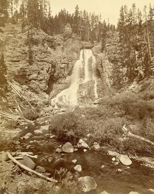
Linville Falls
North Carolina • 90 ft
By Armen Suny · Last verified Mar 2026
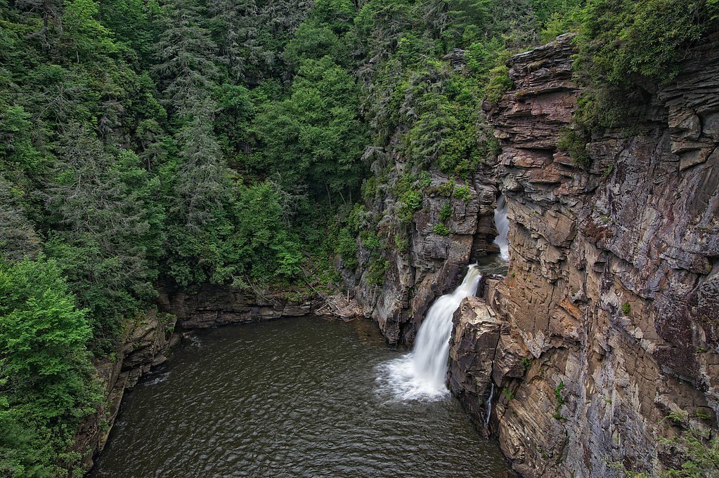
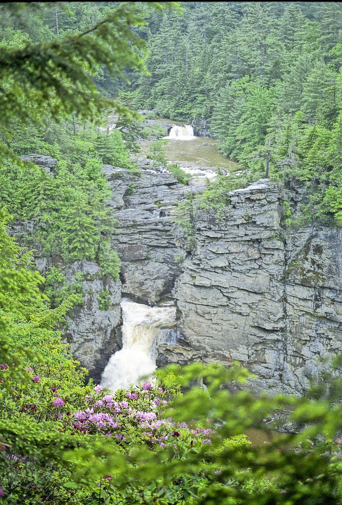

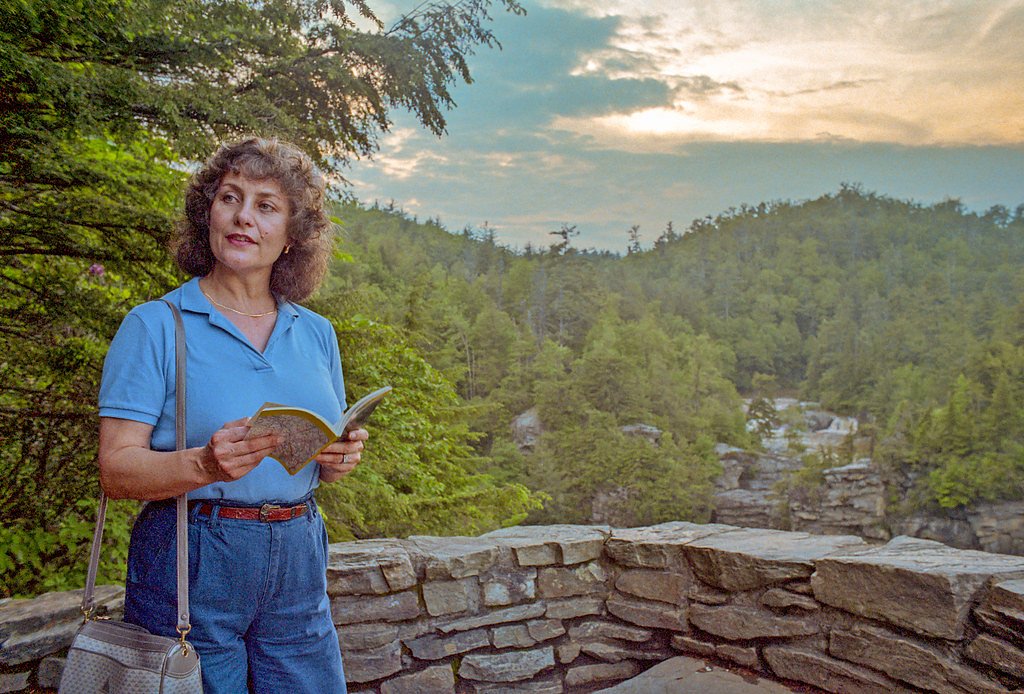

Photo Credits (5)
Difficulty
Moderate
Trail Length
1.6 miles
Trail Type
Out And Back
Elevation Gain
250 ft
About Linville Falls
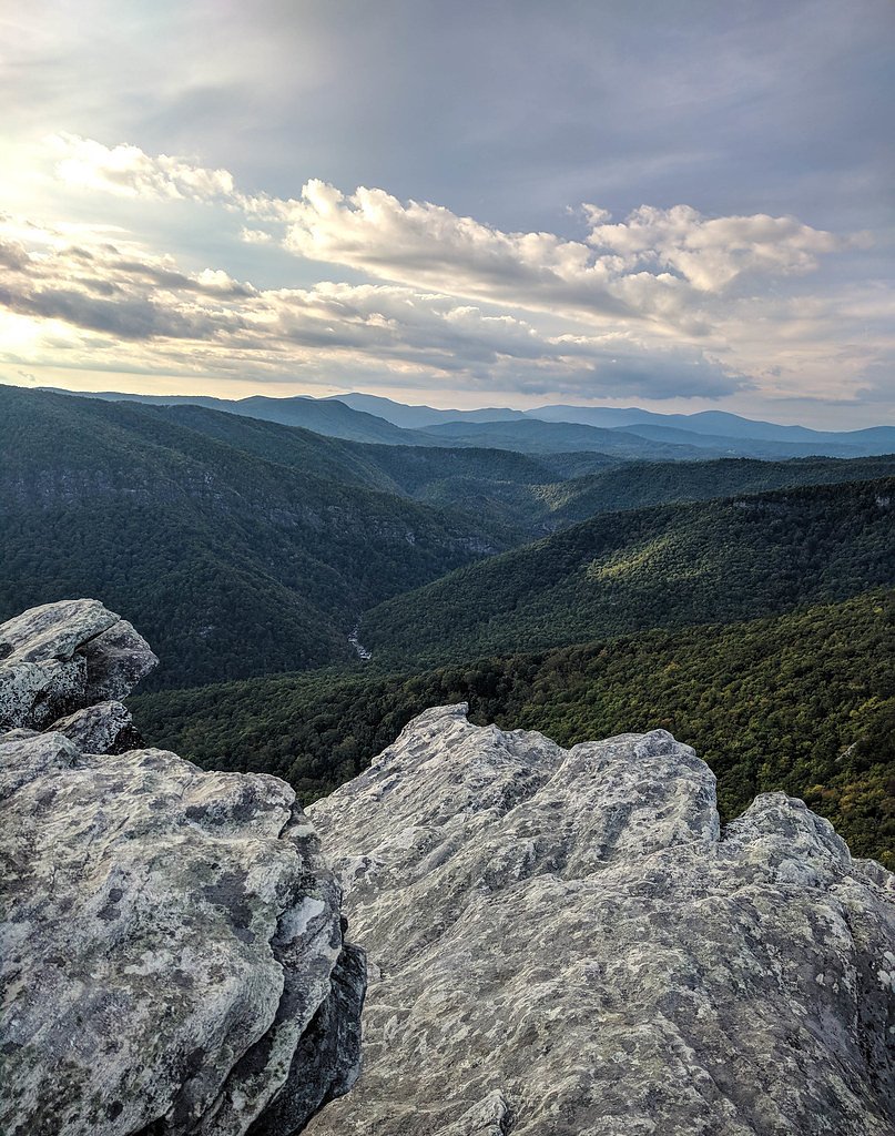
Linville Falls, managed by the National Park Service along the Blue Ridge Parkway (designated SDA), is a dramatic multi-step cascade on the Linville River in North Carolina's Blue Ridge Mountains. The falls move through a twin set of upper drops, tumble down a short gorge and culminate in a high-volume 45-foot (14 m) plunge — with the whole series of drops adding up to roughly 90 feet. Linville Falls is noted for having the highest water volume of any waterfall on the northern edge of the Blue Ridge Mountains, making its viewpoints especially impressive after rains and in spring runoff. The parkway area around the falls offers several established viewing areas that frame different angles of the cascade and gorge. Hikes to the overlooks are moderate and family-friendly, and Linville Falls Campground sits just 2.1 km away for convenient overnight options. Whether you’re after quick photo stops or a short loop to stretch your legs, the combination of accessible overlooks and NPS stewardship makes Linville Falls a quintessential Blue Ridge outing.
The Setting
Linville Falls sits at 3,084 feet within Blue Ridge Parkway, fed by the Linville River, in the mountains of North Carolina. The falls drop 90 feet.
Height: 90 feet
Trail & Hike Details
The Approach
The moderate 1.6-mile out-and-back trail gains 250 feet of elevation on the way to the falls.
Trail Description
The main hiking option to see Linville Falls is an out-and-back route about 1.6 miles round trip with roughly 250 feet of elevation gain; difficulty is rated moderate. The trail serves multiple official viewpoints — including the Upper Falls, Chimney View and Erwin’s View — and is generally well-maintained, but expect some steep and rocky sections, particularly near the gorge and the closer overlooks. Trails are managed by the National Park Service as part of the Blue Ridge Parkway corridor; the short distance and multiple viewing platforms make this a popular, accessible hike with nearby campground access (Linville Falls Campground, ~2.1 km).
What to Expect
The falls cascade 90 feet. Dogs are welcome.
Accessibility
The trail is not wheelchair accessible. Uneven terrain and elevation changes require steady footing.
Frequently Asked Questions
🐶 Are Dogs Allowed at Linville Falls?
✅ Dogs are allowed
Are There Any Fees or Permits Required?
🆖 No fees required
🏊 Is There Swimming at Linville Falls?
❌ Swimming is not allowed
When to Visit
Fall is particularly popular for its vibrant foliage, but spring and summer also offer beautiful views with lush greenery. Winter visits may provide a quieter experience, though trails can be icy.
Seasonal Access
The best time to visit is Spring, Summer, and Fall. Winter access may be limited. Check the National Park Service website for current conditions.
Safety Information
Stay on marked trails and avoid getting too close to the edge of the gorge. Rocks can be slippery, especially after rain. Be prepared for changing weather conditions.
Current Water Conditions
46 ft³/s
Current discharge — how much water is flowing
Lower than usual for this time of year
Based on 103 years of record
2.02 ft
Water depth at gauge
7-Day Discharge Trend
What does this mean for your visit?
Flow is lower than usual for this time of year.
About This Gauge
This gauge is on a nearby waterway and may not reflect exact conditions at the falls.
7-Day Flow Outlook
Based on the USGS gauge LINVILLE RIVER NEAR NEBO, NC (17 km away).
Today
Strong
46 cfs
9/10Tomorrow
Roaring
49 cfs
6/10Tue
Roaring
49 cfs
6/10Wed
Roaring
44 cfs
9/10Thu
Roaring
45 cfs
6/10Fri
Roaring
51 cfs
6/10Sat
Roaring
50 cfs
6/10Best window: Today — strong flow, patchy fog (trip score 9/10).
Best time of year: this gauge typically runs highest from early February to late April, peaking in March.
How we calculate this
This is a transparent outlook, not a precise forecast. We take the waterfall's current flow strength (how it ranks against its historical normal for today, from the nearest USGS stream gauge), carry that ranking forward along the gauge's seasonal curve, and nudge it for forecast rain. Confidence is highest for the next day or two and falls further out. Always check official conditions and your own judgment before visiting — high flows can be dangerous.
Know when to go.
Get a free email alert when waterfalls near Crossnore hit peak flow. We only send when conditions are worth the trip — no weekly newsletters, no spam.
Weather Forecast
Location & Access
Getting There
Linville Falls is located off the Blue Ridge Parkway at Milepost 316.4. The visitor center provides parking and trail access.
Get Directions on Google MapsParking
There is a designated parking area at the Linville Falls Visitor Center, which is free of charge. Parking can fill up quickly during peak seasons.
Elevation
3,084 feet above sea level
Coordinates
35.949721° N, -81.926714° W
Land Management
Managed by NPS
Visitor Tips & Gear
Arrive early to secure parking and avoid crowds. Wear sturdy shoes, as some sections of the trail can be uneven. Bring water and snacks, especially during warmer months.
As an Amazon Associate, we earn from qualifying purchases.
With 1.6 miles and 250 ft of elevation gain, sturdy boots and trekking poles will help on this moderate trail. Sun exposure on the trail makes good sun protection a must in summer.
America the Beautiful Annual Pass
Covers entrance fees at 2,000+ federal recreation sites — required at most National Parks.

Polarized Sunglasses (Knockaround)
Cuts glare off the water so you actually see the falls — and your photos turn out better too.

Columbia Watertight II Rain Jacket
Packs into its own pocket, seam-sealed, and keeps you dry from spray and surprise rain.

Earth Pak Waterproof Dry Bag
Keeps your phone and gear dry when waterfall mist soaks everything else.

Waterproof Phone Pouch (AiRunTech)
Cheap insurance — take photos right next to the falls without killing your phone.

Timberland Euro Sprint Mid Waterproof
Trusted waterproof boot with premium leather and grippy rubber sole — reliable on rocky, wet trails.

TrailBuddy Trekking Poles
Lightweight aluminum, cork grips, and flip-locks that actually hold — a best-seller for good reason.
Where to Stay

The Embers Hotel

Boxwood Lodge Blowing Rock near Boone-University

scenic and romantic cabin- 20 min to Blowing Rock

Graystone Lodge, an Ascend Collection Hotel
Browse vacation cabins and private rentals nearby
Unique outdoor stays — tents, yurts, and treehouses
Rent a campervan or RV for your waterfall road trip
Some links are affiliate links. We may earn a commission at no extra cost to you.
Nearby Campground
Linville Falls Campground
1.3 miles away · 66 sites
Overview Located in a dense pine canopy, within hiking distance of Linville Gorge, and along the famous Blue Ridge Parkway, Linville Falls Campground is an ideal location for your next family camping excursion. Linville River, which winds beside the campground, is stocked for fishing, and the location is central to many area attractions including the Linville Falls waterfall, which has three waterfall overlooks in a one-mile hike. Recreation The Linville Falls area is a hiker's paradise, and the
Book on Recreation.govAdditional Information
Nearby Attractions
Nearby attractions include the Linville Gorge Wilderness Area, Grandfather Mountain, and the Blue Ridge Parkway.
Wildlife
The area is home to a variety of wildlife, including deer, black bears, and numerous bird species. Visitors should exercise caution and avoid feeding wildlife.
Cities near Linville Falls
Nearby Waterfalls

Writing about Linville Falls? Embed this waterfall on your site for free.