Fall Creek Falls
Tennessee • 256 ft
By Armen Suny · Last verified Mar 2026
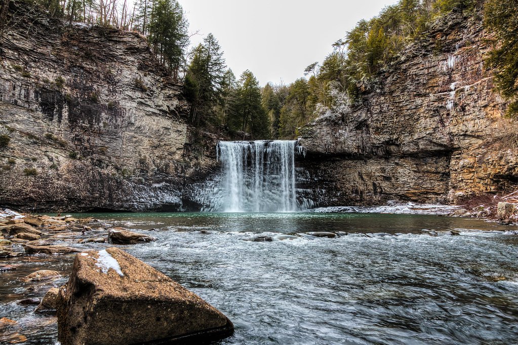
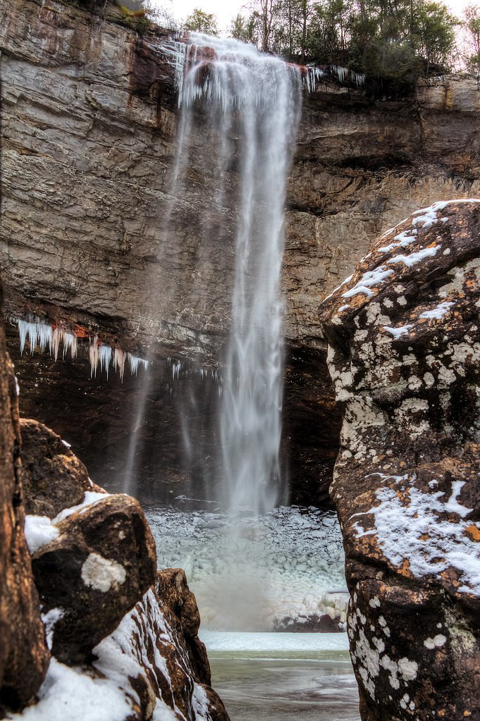
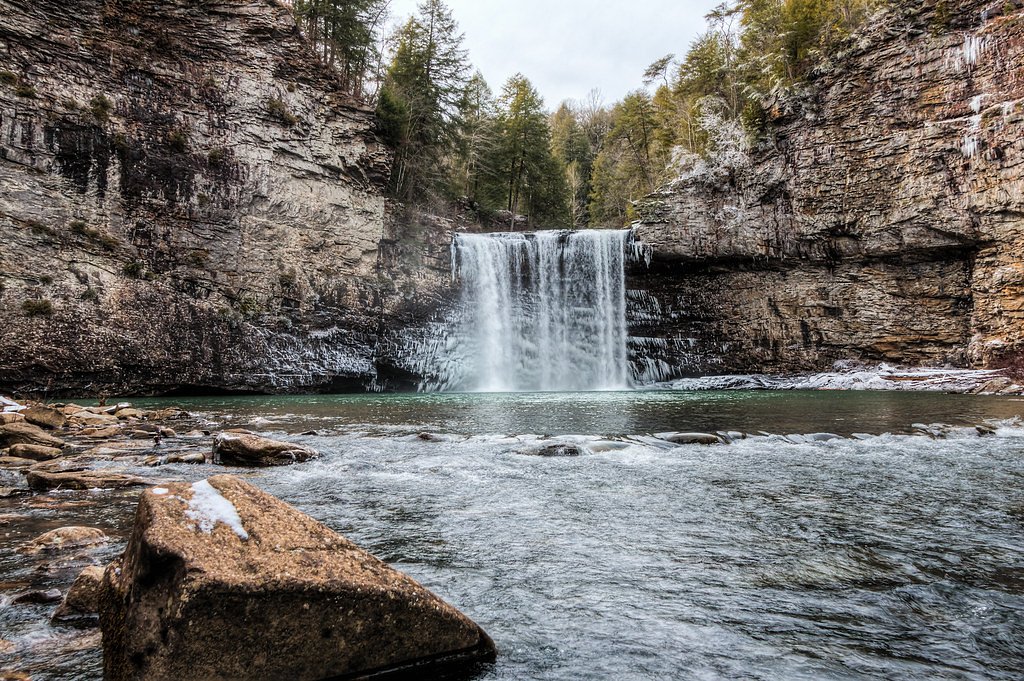
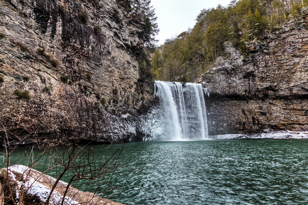

Photo Credits (5)
Difficulty
Moderate
Trail Length
2.4 miles
Trail Type
Out And Back
Elevation Gain
300 ft
About Fall Creek Falls
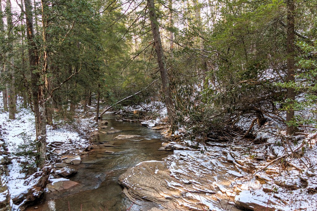
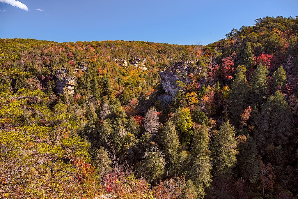
Fall Creek Falls tumbles 256 feet (78 m) into a forested gorge in Fall Creek Falls State Park near Spencer, Tennessee, making it one of the most dramatic sheer‑drop waterfalls in the eastern United States. That full vertical plunge is the tallest of its kind east of the Mississippi River, and the waterfall’s misty amphitheater and plunging curtain make it a favorite for photographers and hikers seeking a classic Appalachian spectacle. When water levels are high, neighboring Coon Creek Falls also pours into the same plungepool, adding to the display. Access is straightforward: a short trail from the parking area atop the plateau drops down to the base and plungepool, while park trails provide viewpoints from the rim. The primary route to the falls is an out‑and‑back of about 2.4 miles round trip with roughly 300 feet of elevation change and a moderate difficulty rating, so expect rewarding views with some steady descents and climbs along the way. The falls sit within Fall Creek Falls State Park, offering a true park‑managed natural highlight in central Tennessee.
The Setting
Fall Creek Falls sits at 1,411 feet along the Calfkiller River, in the foothills of Tennessee. At 256 feet, it is among the taller waterfalls in Tennessee.
Height: 256 feet
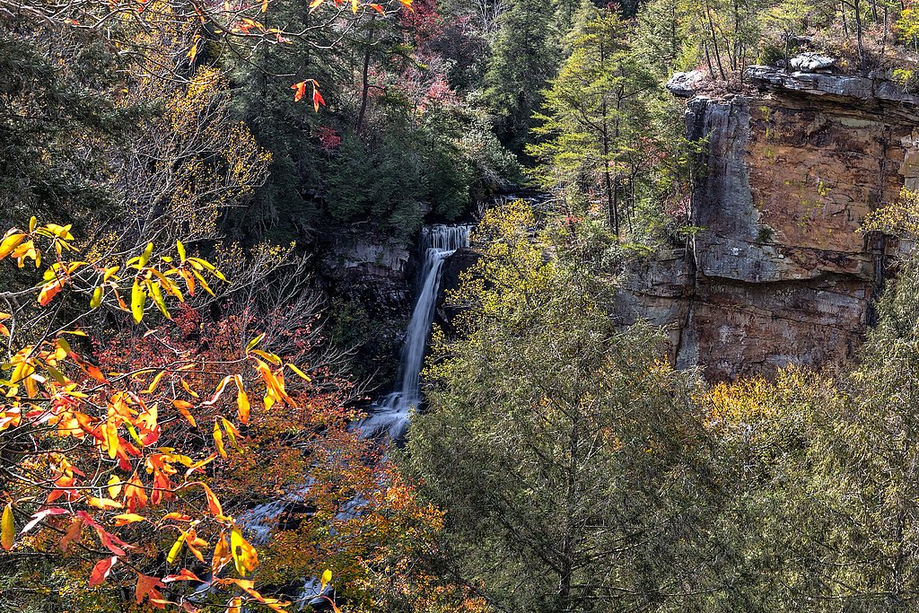
Nearby Falls Worth Visiting
Piney Creek Falls (95 ft) lies 1.7 miles to the west. Also nearby: Cane Creek Falls (85 ft, 0.4 mi).
Trail & Hike Details
The Approach
The moderate 2.4-mile out-and-back trail gains 300 feet of elevation on the way to the falls.
Trail Description
This out‑and‑back route is about 2.4 miles round trip with approximately 300 feet of elevation gain and is rated moderate. The trail follows forested paths and descends from the plateau into the gorge; you’ll encounter some steep, rocky sections on the descent and return, so steady footing is recommended. A short spur leads from the parking area at the rim down to the base and plungepool, and there are overlooks at the top for those who prefer a shorter visit. Non‑technical but moderately strenuous in spots—plan for uneven terrain and a fairly brisk climb back to the parking area.
What to Expect
The falls plunge 256 feet. Dogs are welcome.
Accessibility
The trail is not wheelchair accessible. Uneven terrain and elevation changes require steady footing.
Frequently Asked Questions
🐶 Are Dogs Allowed at Fall Creek Falls?
✅ Dogs are allowed
Are There Any Fees or Permits Required?
🤑 Fee: $0.00
🏊 Is There Swimming at Fall Creek Falls?
❌ Swimming is not allowed
When to Visit
Spring and early summer are ideal for visiting, as the waterfall is typically at its fullest due to seasonal rainfall. Fall offers beautiful foliage, while winter provides a quieter experience with potential ice formations on the falls.
Seasonal Access
The best time to visit is Spring, Summer, Fall, and Winter.
Safety Information
The trail to the base of the falls can be steep and slippery, especially after rain. Stay on marked trails and avoid getting too close to the edge of the gorge. Carry plenty of water and be cautious of wildlife.
Current Water Conditions
Based on a USGS gauge 19.1 miles away
54 ft³/s
Current discharge — how much water is flowing
Much lower than usual for this time of year
Based on 9 years of record
4.24 ft
Water depth at gauge
7-Day Discharge Trend
What does this mean for your visit?
Flow is well below normal for this time of year, so the waterfall may be a trickle.
About This Gauge
This gauge is on a regional waterway. Conditions at the falls may differ, especially after local rain.
7-Day Flow Outlook
Based on the USGS gauge CALFKILLER RIVER AT HWY 70 AT SPARTA, TN (31 km away).
Today
Moderate
54 cfs
8/10Tomorrow
Moderate
90 cfs
6/10Fri
Moderate
84 cfs
6/10Sat
Moderate
63 cfs
6/10Sun
Moderate
60 cfs
6/10Mon
Moderate
60 cfs
6/10Tue
Moderate
59 cfs
6/10Best window: Today — moderate flow, sunny (trip score 8/10).
Best time of year: this gauge typically runs highest from early February to early April, peaking in February.
How we calculate this
This is a transparent outlook, not a precise forecast. We take the waterfall's current flow strength (how it ranks against its historical normal for today, from the nearest USGS stream gauge), carry that ranking forward along the gauge's seasonal curve, and nudge it for forecast rain. Confidence is highest for the next day or two and falls further out. Always check official conditions and your own judgment before visiting — high flows can be dangerous.
Know when to go.
Get a free email alert when waterfalls near Spencer hit peak flow. We only send when conditions are worth the trip — no weekly newsletters, no spam.
Weather Forecast
Location & Access
Getting There
Fall Creek Falls is located within Fall Creek Falls State Park in Spencer, Tennessee. The park is accessible via Highway 30 or Highway 111, with clear signage leading to the main entrance. The waterfall is a short drive from the park's visitor center.
Get Directions on Google MapsParking
Ample parking is available near the Fall Creek Falls overlook and trailheads. Parking is free but may fill up during peak seasons.
Elevation
1,411 feet above sea level
Coordinates
35.665900° N, -85.355802° W
Visitor Tips & Gear
Arrive early during weekends or holidays to secure parking and avoid crowds. Bring water and wear sturdy shoes for the hike. Check the weather forecast, as trails can become slippery after rain.
As an Amazon Associate, we earn from qualifying purchases.
With 2.4 miles and 300 ft of elevation gain, sturdy boots and trekking poles will help on this moderate trail. Icy conditions are common in winter — traction cleats are a smart addition.

Columbia Watertight II Rain Jacket
Packs into its own pocket, seam-sealed, and keeps you dry from spray and surprise rain.

Polarized Sunglasses (Knockaround)
Cuts glare off the water so you actually see the falls — and your photos turn out better too.

Earth Pak Waterproof Dry Bag
Keeps your phone and gear dry when waterfall mist soaks everything else.

Waterproof Phone Pouch (AiRunTech)
Cheap insurance — take photos right next to the falls without killing your phone.

Timberland Euro Sprint Mid Waterproof
Trusted waterproof boot with premium leather and grippy rubber sole — reliable on rocky, wet trails.

TrailBuddy Trekking Poles
Lightweight aluminum, cork grips, and flip-locks that actually hold — a best-seller for good reason.
Where to Stay

The Way Inn by OYO Spencer

Gas fireplace, firepit, and cedar Adirondack chair

Holiday Inn Express & Suites Crossville by IHG

Comfort Suites Crossville
Browse vacation cabins and private rentals nearby
Unique outdoor stays — tents, yurts, and treehouses
Rent a campervan or RV for your waterfall road trip
Some links are affiliate links. We may earn a commission at no extra cost to you.
Additional Information
Nearby Attractions
Other waterfalls in the park include Piney Falls, Cane Creek Falls, and Cane Creek Cascades. The park also offers a nature center, suspension bridge, and several scenic overlooks.
Wildlife
The park is home to deer, raccoons, birds, and other wildlife. Visitors may also spot various plant species native to the region.
Cities near Fall Creek Falls
Nearby Waterfalls
Other waterfalls named Fall Creek Falls
4 other waterfalls share this name across the U.S.
Writing about Fall Creek Falls? Embed this waterfall on your site for free.