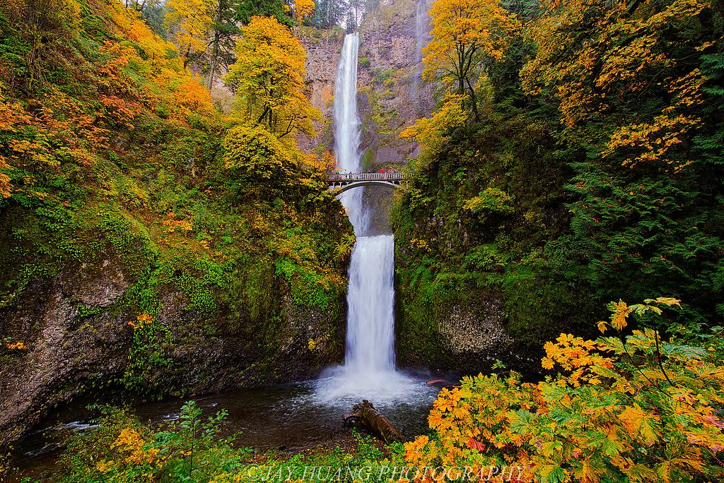
Fall Creek Falls
By Armen Suny · Last verified Mar 2026
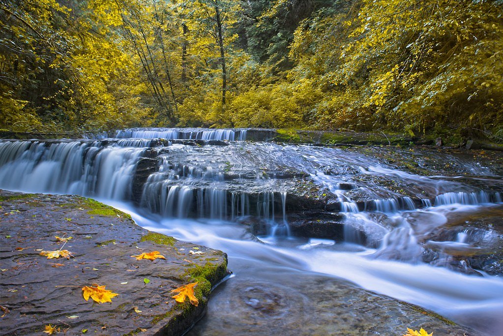
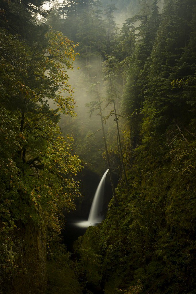
Photo Credits (5)
Difficulty
Easy
Trail Length
1.2 miles
Trail Type
Out And Back
Elevation Gain
200 ft
About Fall Creek Falls
Fall Creek Falls is a tucked-away cascade on the Fall Creek - Salem land unit in Oregon, sitting on land owned by DESG and managed as part of a Wild and Scenic River (WSR) by the Bureau of Land Management (BLM). The falls reward a short approach with a peaceful, forested setting and a compact viewing zone that’s popular with day hikers and photographers looking for an easy nature escape. The hike to the waterfall is ideal for families or anyone after a short outdoor outing, and you can extend a trip into an overnight adventure: River Edge campground lies about 2.21 km from the trailhead. Because the site is administered by the BLM within the Fall Creek - Salem WSR corridor, visitors will find an emphasis on conserving the creek’s natural character—check with the BLM for any seasonal access notes before you go.
The Setting
Fall Creek Falls sits at 174 feet within Fall Creek - Salem, fed by the Alsea River, in the coastal lowlands of Oregon.
Trail & Hike Details
The Approach
The easy 1.2-mile out-and-back trail gains 200 feet of elevation on the way to the falls.
Trail Description
This is a short, easy 1.2-mile out-and-back trail with roughly 200 feet of elevation gain, making it suitable for most visitors and families. The route follows Fall Creek to a developed viewing area at the falls; difficulty is listed as easy and the trail type is out-and-back. Official surface, grade, and trail class details were not provided in the available data—consult the BLM Fall Creek - Salem unit for current conditions, access information, and any advisories before hiking.
What to Expect
Dogs are welcome.
Accessibility
The trail is not wheelchair accessible. Uneven terrain and elevation changes require steady footing.
Frequently Asked Questions
🐶 Are Dogs Allowed at Fall Creek Falls?
✅ Dogs are allowed
Are There Any Fees or Permits Required?
🆖 No fees required
🏊 Is There Swimming at Fall Creek Falls?
❌ Swimming is not allowed
When to Visit
Spring and early summer are ideal times to visit, as the waterfall is typically at its fullest due to snowmelt and seasonal rains.
Seasonal Access
The best time to visit is Spring, Summer, and Fall. Winter access may be limited.
Safety Information
Exercise caution near the waterfall, as rocks can be slippery. Be aware of changing weather conditions, especially in winter, as snow and ice may make the trail hazardous.
Current Water Conditions
141 ft³/s
Current discharge — how much water is flowing
Much lower than usual for this time of year
Based on 86 years of record
1.62 ft
Water depth at gauge
69°F
CoolRefreshing for swimming
7-Day Discharge Trend
What does this mean for your visit?
Flow is well below normal for this time of year, so the waterfall may be a trickle. Water temperature is a refreshing 69 degrees F, good for a quick swim.
About This Gauge
7-Day Flow Outlook
Based on the USGS gauge ALSEA RIVER NEAR TIDEWATER, OR (7 km away).
Today
Barely Flowing
152 cfs
3/10Tomorrow
Low
156 cfs
4/10Sun
Low
155 cfs
4/10Mon
Low
150 cfs
4/10Tue
Low
145 cfs
4/10Wed
Low
140 cfs
4/10Thu
Low
139 cfs
4/10Best window: Tomorrow — low flow, rain showers (trip score 4/10).
Best time of year: this gauge typically runs highest from mid December to early February, peaking in January.
How we calculate this
This is a transparent outlook, not a precise forecast. We take the waterfall's current flow strength (how it ranks against its historical normal for today, from the nearest USGS stream gauge), carry that ranking forward along the gauge's seasonal curve, and nudge it for forecast rain. Confidence is highest for the next day or two and falls further out. Always check official conditions and your own judgment before visiting — high flows can be dangerous.
Know when to go.
Get a free email alert when waterfalls near Alsea hit peak flow. We only send when conditions are worth the trip — no weekly newsletters, no spam.
Weather Forecast
Location & Access
Getting There
Fall Creek Falls is located off Highway 138, also known as the Rogue-Umpqua Scenic Byway. From Roseburg, head east on Highway 138 for approximately 30 miles. Look for signs indicating the trailhead parking area.
Get Directions on Google MapsParking
There is a small parking area near the trailhead, but it may fill up quickly during peak seasons.
Elevation
174 feet above sea level
Coordinates
44.391802° N, -123.739773° W
Land Management
Managed by BLM
Visitor Tips & Gear
Arrive early to secure parking, especially during weekends and holidays. Wear sturdy shoes as the trail may be muddy or slippery, particularly after rain. Bring a camera to capture the beautiful scenery.
As an Amazon Associate, we earn from qualifying purchases.
This easy 1.2 miles hike is straightforward — comfortable trail shoes and plenty of water should do. Sun exposure on the trail makes good sun protection a must in summer.

Polarized Sunglasses (Knockaround)
Cuts glare off the water so you actually see the falls — and your photos turn out better too.

Columbia Watertight II Rain Jacket
Packs into its own pocket, seam-sealed, and keeps you dry from spray and surprise rain.

Earth Pak Waterproof Dry Bag
Keeps your phone and gear dry when waterfall mist soaks everything else.

Waterproof Phone Pouch (AiRunTech)
Cheap insurance — take photos right next to the falls without killing your phone.

JOBY GorillaPod Starter Kit
Wraps around railings and rocks for long-exposure waterfall shots — no flat surface needed.

Osprey Daylite Daypack
Light, organized, and just the right size for a day hike — fits water, snacks, and layers.
Where to Stay

Hallmark Resort - Newport

Allred Hotel

Elizabeth Oceanfront Suites, an Ascend Collection Hotel

Inn at Nye Beach
Browse vacation cabins and private rentals nearby
Unique outdoor stays — tents, yurts, and treehouses
Rent a campervan or RV for your waterfall road trip
Some links are affiliate links. We may earn a commission at no extra cost to you.
Nearby Campground
RIVER EDGE
1.4 miles away · 1 sites
Overview River Edge is a group campground nestled on the banks of the Alsea River, surrounded by large Sitka spruce, Douglas fir, alder trees and blackberries. Groups of families and friends enjoy the area for its great fishing opportunities, as well as its scenic beauty.Recreation The campground's open play field is ideal for games like Frisbee and soccer, so campers are encouraged to bring sports equipment to make use of the space. The river beckons visitors for canoeing and swimming. Anglers c
Book on Recreation.govAdditional Information
Nearby Attractions
Nearby attractions include Toketee Falls, Watson Falls, and the Umpqua Hot Springs, all located within a short drive.
Wildlife
The area is home to a variety of wildlife, including birds, deer, and small mammals. Keep an eye out for native flora and fauna along the trail.
Cities near Fall Creek Falls
Nearby Waterfalls
Other waterfalls named Fall Creek Falls
4 other waterfalls share this name across the U.S.
Writing about Fall Creek Falls? Embed this waterfall on your site for free.