


Photo Credits (5)
Difficulty
Hard
Trail Length
8.6 miles
Trail Type
Out And Back
Elevation Gain
1,200 ft
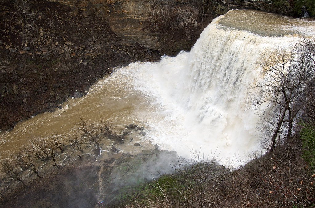
About Double Falls
Double Falls is a picturesque twin cascade tucked into the forested gorge of the Big South Fork National River and Recreation Area. Managed by the National Park Service (NPS) and located within a unit with a WSR designation, the falls split into two graceful streams before dropping into a shaded pool—an inviting subject for photographers and hikers who appreciate a more remote, scenic stop on the trail. The most common approach is along the Virgin Falls Trail, an 8.6-mile out-and-back route with about 1,200 feet of elevation gain that’s rated hard. Hikers should expect rocky tread, steep climbs and creek crossings; Double Falls comes up at roughly 1.6 miles into the route and makes a satisfying turnaround for day visitors. For overnight stays, Bandy Creek Campground lies nearby (about 9.43 km away).
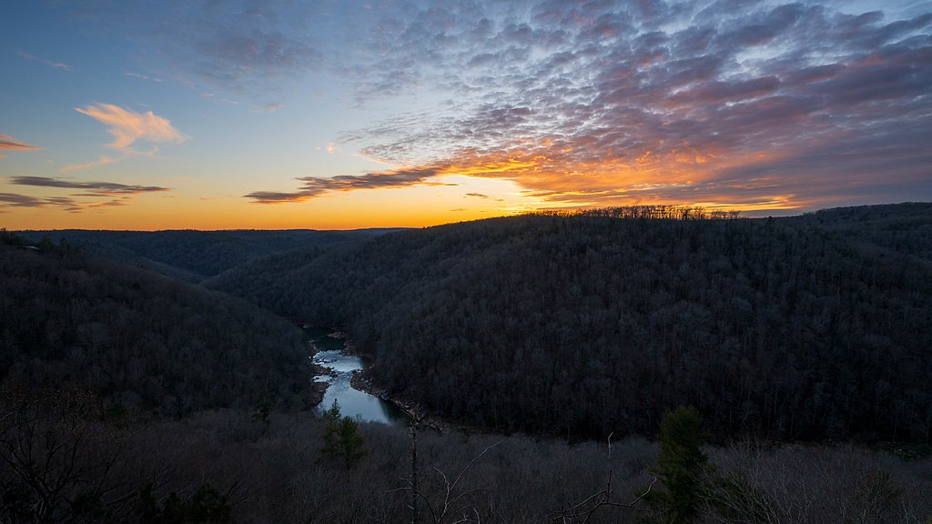
The Setting
Double Falls sits at 997 feet within Big South Fork National River and Recreation Area, fed by the Clear Fork, in the foothills of Tennessee.
Trail & Hike Details
The Approach
The hard 8.6-mile out-and-back trail gains 1,200 feet of elevation on the way to the falls.
Trail Description
The route to Double Falls follows the Virgin Falls Trail through Big South Fork National River and Recreation Area (managed by the NPS). This is an 8.6-mile out-and-back with approximately 1,200 feet of cumulative elevation gain and a "hard" difficulty rating. Trail tread is natural and often rocky, with steep grades and several creek crossings—expect uneven footing, exposed roots and occasional ledges. Double Falls is encountered at about 1.6 miles into the trail and serves as a common stopping point for hikers who do not continue on to Virgin Falls.
What to Expect
Dogs are welcome.
Accessibility
The trail involves steep, uneven terrain with significant elevation change and is not accessible to mobility devices.
Frequently Asked Questions
🐶 Are Dogs Allowed at Double Falls?
✅ Dogs are allowed
Are There Any Fees or Permits Required?
🆖 No fees required
🏊 Is There Swimming at Double Falls?
❌ Swimming is not allowed
When to Visit
Spring and fall are the best times to visit due to cooler temperatures and vibrant foliage. The waterfall flow is typically strongest in spring after rainfall.
Seasonal Access
The best time to visit is Spring, Summer, and Fall. Winter access may be limited. Check the National Park Service website for current conditions.
Safety Information
The trail can be slippery and muddy after rain. Watch for loose rocks and roots. Cell phone service may be limited, so inform someone of your plans before heading out.
Current Water Conditions
24 ft³/s
Current discharge — how much water is flowing
About average for this time of year
1.44 ft
Water depth at gauge
78°F
ComfortablePleasant for swimming
7-Day Discharge Trend
What does this mean for your visit?
Flow is about average for this time of year. The water is a comfortable 78 degrees F, pleasant for swimming. Expect low dissolved oxygen levels. Mineral content is typical.
Water Quality
Dissolved Oxygen
PoorLow oxygen — stressed ecosystem
Conductance
Dissolved minerals in the water
About This Gauge
7-Day Flow Outlook
Based on the USGS gauge CLEAR FORK NEAR ROBBINS, TN (4 km away).
Today
Strong
27 cfs
7/10Tomorrow
Strong
22 cfs
10/10Tue
Moderate
23 cfs
9/10Wed
Moderate
26 cfs
9/10Thu
Moderate
21 cfs
9/10Fri
Strong
25 cfs
7/10Sat
Roaring
26 cfs
6/10Best window: Tomorrow — strong flow, mostly sunny (trip score 10/10).
Best time of year: this gauge typically runs highest from late January to early April, peaking in February.
How we calculate this
This is a transparent outlook, not a precise forecast. We take the waterfall's current flow strength (how it ranks against its historical normal for today, from the nearest USGS stream gauge), carry that ranking forward along the gauge's seasonal curve, and nudge it for forecast rain. Confidence is highest for the next day or two and falls further out. Always check official conditions and your own judgment before visiting — high flows can be dangerous.
Know when to go.
Get a free email alert when waterfalls near Helenwood hit peak flow. We only send when conditions are worth the trip — no weekly newsletters, no spam.
Weather Forecast
Location & Access
Getting There
Double Falls is located within the Virgin Falls State Natural Area in Tennessee. The trailhead can be accessed from the Virgin Falls parking area, which is off Scott Gulf Road near Sparta, TN.
Get Directions on Google MapsParking
Parking is available at the Virgin Falls trailhead. The lot may fill up during peak seasons, so arriving early is recommended.
Elevation
997 feet above sea level
Coordinates
36.427021° N, -84.625496° W
Land Management
Managed by NPS
Visitor Tips & Gear
Start early to avoid crowds and ensure you have enough daylight for the hike. Bring plenty of water, snacks, and sturdy hiking boots. Be prepared for uneven terrain and potential muddy sections, especially after rain.
As an Amazon Associate, we earn from qualifying purchases.
This challenging 8.6 miles trail gains 1,200 ft in elevation — come prepared with proper hiking boots and trekking poles. Sun exposure on the trail makes good sun protection a must in summer.
America the Beautiful Annual Pass
Covers entrance fees at 2,000+ federal recreation sites — required at most National Parks.

Sawyer Squeeze Water Filter
The backcountry standard — filters 99.9% of bacteria and weighs just 3 oz.

Polarized Sunglasses (Knockaround)
Cuts glare off the water so you actually see the falls — and your photos turn out better too.

Columbia Watertight II Rain Jacket
Packs into its own pocket, seam-sealed, and keeps you dry from spray and surprise rain.

Earth Pak Waterproof Dry Bag
Keeps your phone and gear dry when waterfall mist soaks everything else.

Waterproof Phone Pouch (AiRunTech)
Cheap insurance — take photos right next to the falls without killing your phone.

Timberland Euro Sprint Mid Waterproof
Trusted waterproof boot with premium leather and grippy rubber sole — reliable on rocky, wet trails.
Where to Stay

Big South Fork Lodge

The Scarlet A-Frame

Hampton Inn Caryville-I-75/Cove Lake-State Park

Royal Inn
Browse vacation cabins and private rentals nearby
Unique outdoor stays — tents, yurts, and treehouses
Rent a campervan or RV for your waterfall road trip
Some links are affiliate links. We may earn a commission at no extra cost to you.
Nearby Campground
BANDY CREEK
5.9 miles away · 145 sites
Overview Bandy Creek is a spacious and modern campground, situated in The Big South Fork National River and Recreation Area--a vast and scenic expanse of land that offers visitors countless recreational activities.Recreation Numerous trails snake through the Recreation Area, offering mountain biking, hiking and horseback riding for visitors. A swimming pool, along with on-site volleyball court, playgrounds and ball fields, make Bandy Creek an ideal spot for families. The main river of the Big Sou
Book on Recreation.govAdditional Information
Nearby Attractions
Virgin Falls, Big Laurel Falls, and the Caney Fork River are nearby attractions worth exploring.
Wildlife
The area is home to a variety of wildlife, including deer, birds, and small mammals. Be cautious of snakes, especially during warmer months.
Cities near Double Falls
Nearby Waterfalls
Other waterfalls named Double Falls
3 other waterfalls share this name across the U.S.
Writing about Double Falls? Embed this waterfall on your site for free.