
Photo Credits (3)
Difficulty
Moderate
Trail Length
2.4 miles
Trail Type
Out And Back
Elevation Gain
350 ft
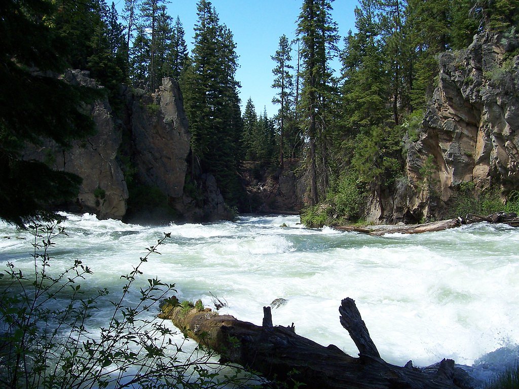
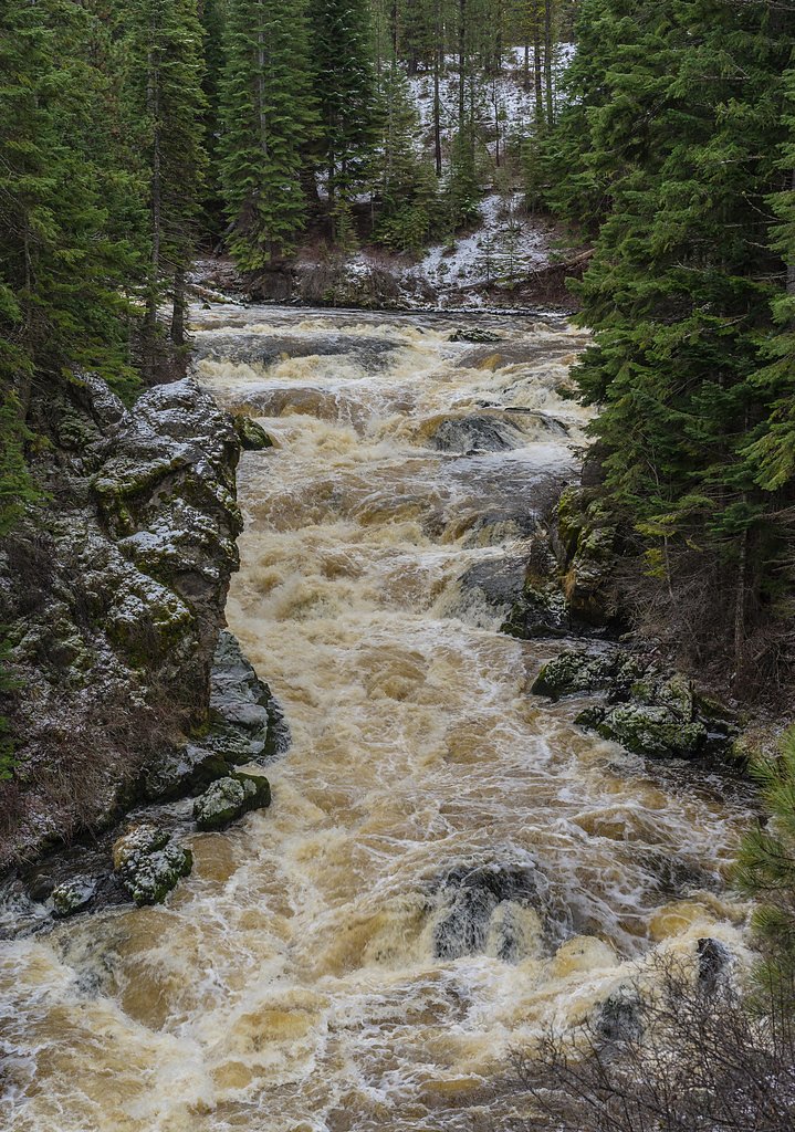
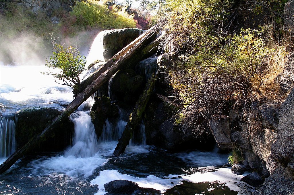
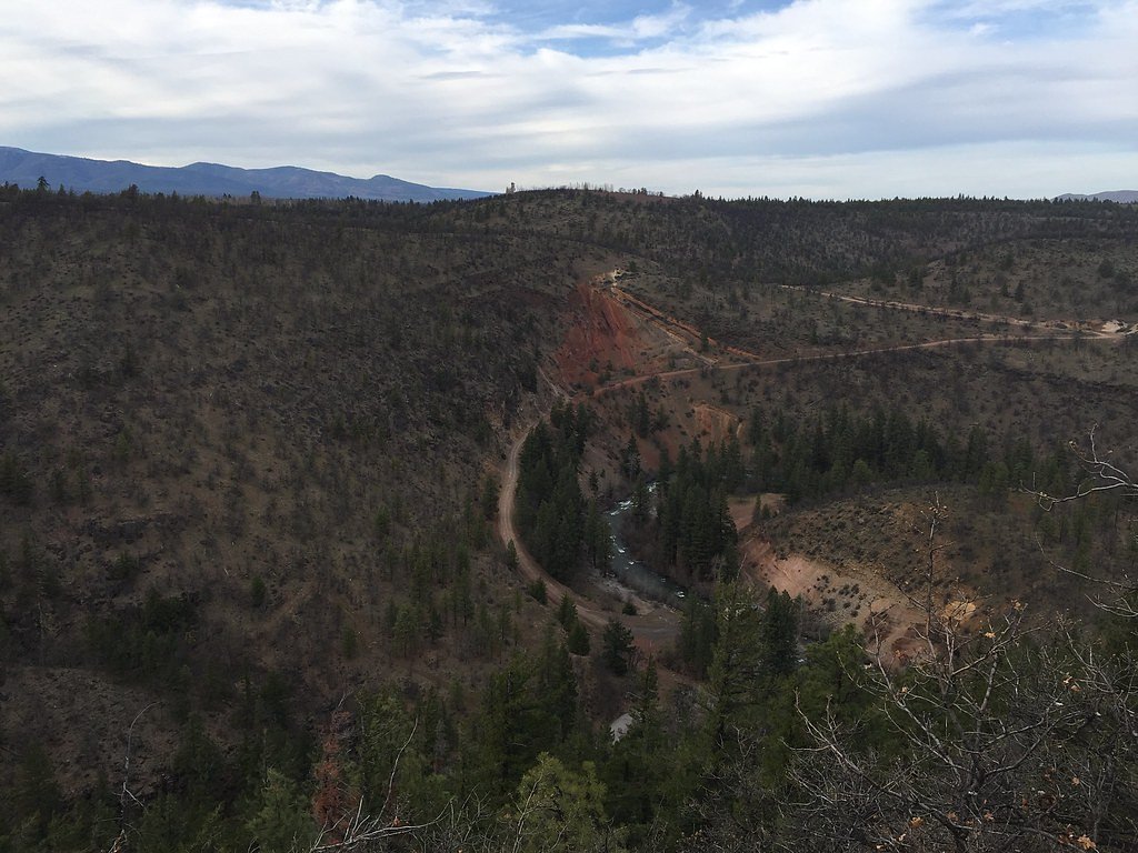
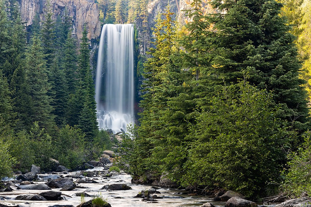
About Benham Falls
Benham Falls sits on the Deschutes River between the resort community of Sunriver and the town of Bend, Oregon, and is managed by the U.S. Forest Service as part of the Deschutes National Forest. Rather than a single vertical drop, Benham Falls are a powerful set of rapids — the largest falls on the upper Deschutes — formed about 6,000 years ago when lava from nearby Lava Butte dammed the river and created what was once called Lake Benham. The river here pitches about 22.5°, and the rapids are rated Class 5 for watercraft, making the stretch both dramatic to watch and hazardous to run. The site is a favorite for day hikers and sightseers drawn to its churning water, basalt-lined channel, and riverside forest. The Forest Service maintains a short overlook trail (BENHAM FALLS OVERLOOK, Trail #2.15) that delivers clear views of the rapids; beyond the overlook, trails along the Deschutes offer a pleasant out-and-back route through classic Central Oregon scenery. Visitors should respect posted safety signs and the force of the river when viewing the falls.
The Setting
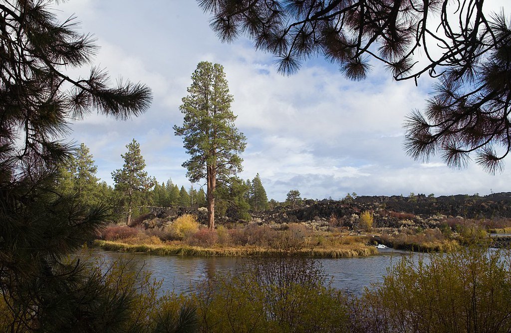
Benham Falls sits at 4,131 feet within Deschutes National Forest, fed by the Bridge Creek, in the mountains of Oregon.
Trail & Hike Details
The Approach
The moderate hike follows Benham Falls Overlook (#2.15), a 2.4-mile out-and-back trail over natural surface. Expect 350 feet of elevation gain. The trail is developed (Class 3).
USFS Trail
BENHAM FALLS OVERLOOK #2.15
Trail Class
Developed
Surface
USFS Segment
0.16 miTrail Description
This outing is commonly done as a 2.4-mile out-and-back hike with about 350 feet of elevation gain (moderate difficulty). The final spur to the viewpoint is the USFS BENHAM FALLS OVERLOOK (Trail #2.15): a 0.16-mile segment recorded in GIS data, constructed on native material and rated Class 3. The short overlook trail is the maintained approach to the main viewing area; the overall route gains moderate elevation and provides river views and access to the Deschutes corridor. Follow USFS signage for the trailhead and stay on designated paths for safety.
What to Expect
Dogs are welcome.
Accessibility
The trail is not wheelchair accessible. Uneven terrain and elevation changes require steady footing.
Frequently Asked Questions
🐶 Are Dogs Allowed at Benham Falls?
✅ Dogs are allowed
Are There Any Fees or Permits Required?
🆖 No fees required
🏊 Is There Swimming at Benham Falls?
❌ Swimming is not allowed
When to Visit
Spring and early summer are ideal for visiting, as the water flow is typically at its peak due to snowmelt. However, the falls are accessible and enjoyable year-round.
Seasonal Access
The best time to visit is Spring, Summer, Fall, and Winter. Check with Deschutes National Forest for seasonal road closures.
Safety Information
Water temperature is currently 46°F — cold enough to cause numbness quickly. Avoid prolonged water contact and use caution near the falls.
Stay on designated trails and avoid getting too close to the river, as the currents are strong and can be dangerous. Be cautious of slippery rocks near the falls.
Current Water Conditions
17 ft³/s
Current discharge — how much water is flowing
About average for this time of year
Based on 8 years of record
0.22 ft
Water depth at gauge
46°F
Very coldExpect numbness within minutes
7-Day Discharge Trend
What does this mean for your visit?
Flow is about average for this time of year. Water temperature is very cold at 46 degrees F, expect numbness within minutes.
About This Gauge
This gauge is on a nearby waterway and may not reflect exact conditions at the falls.
7-Day Flow Outlook
Based on the USGS gauge BRIDGE CREEK BELOW INTAKE, NEAR BEND, OR (16 km away).
Today
Moderate
18 cfs
6/10Tomorrow
Moderate
19 cfs
6/10Sun
Moderate
16 cfs
9/10Mon
Moderate
15 cfs
9/10Tue
Moderate
14 cfs
9/10Wed
Moderate
14 cfs
9/10Thu
Moderate
13 cfs
9/10Best window: Sun — moderate flow, partly sunny (trip score 9/10).
Best time of year: this gauge typically runs highest from early April to mid June, peaking in May.
How we calculate this
This is a transparent outlook, not a precise forecast. We take the waterfall's current flow strength (how it ranks against its historical normal for today, from the nearest USGS stream gauge), carry that ranking forward along the gauge's seasonal curve, and nudge it for forecast rain. Confidence is highest for the next day or two and falls further out. Always check official conditions and your own judgment before visiting — high flows can be dangerous.
Know when to go.
Get a free email alert when waterfalls near Sunriver hit peak flow. We only send when conditions are worth the trip — no weekly newsletters, no spam.
Weather Forecast
Location & Access
Getting There
Benham Falls is located near Bend, Oregon, and can be accessed via the Cascade Lakes Highway. From Bend, take the Cascade Lakes Highway to Forest Road 41, then follow signs to the Benham Falls Day Use Area.
Get Directions on Google MapsParking
There is a parking area at the Benham Falls Day Use Area, which provides access to the trail leading to the falls.
Elevation
4,131 feet above sea level
Coordinates
43.937832° N, -121.411660° W
Land Management
Managed by USFS
Visitor Tips & Gear
Visit early in the morning or on weekdays to avoid crowds, especially during the summer. Wear sturdy shoes as the trail can be uneven in some areas. Bring water and sunscreen, especially during warmer months.
As an Amazon Associate, we earn from qualifying purchases.
With 2.4 miles and 350 ft of elevation gain, sturdy boots and trekking poles will help on this moderate trail. Icy conditions are common in winter — traction cleats are a smart addition.

Columbia Watertight II Rain Jacket
Packs into its own pocket, seam-sealed, and keeps you dry from spray and surprise rain.

Polarized Sunglasses (Knockaround)
Cuts glare off the water so you actually see the falls — and your photos turn out better too.

Earth Pak Waterproof Dry Bag
Keeps your phone and gear dry when waterfall mist soaks everything else.

Waterproof Phone Pouch (AiRunTech)
Cheap insurance — take photos right next to the falls without killing your phone.

Timberland Euro Sprint Mid Waterproof
Trusted waterproof boot with premium leather and grippy rubber sole — reliable on rocky, wet trails.

TrailBuddy Trekking Poles
Lightweight aluminum, cork grips, and flip-locks that actually hold — a best-seller for good reason.
Where to Stay

Loft home with private hot tub deck grill fireplace & 10 SHARC passes

Cabin with Private Hot Tub Near the Deschutes River - Free SHARC access

2 Tennis Village..

Dog-Friendly Condo Steps from the Village with Balcony WiFi & Gas Fireplace
Browse vacation cabins and private rentals nearby
Unique outdoor stays — tents, yurts, and treehouses
Rent a campervan or RV for your waterfall road trip
Some links are affiliate links. We may earn a commission at no extra cost to you.
Nearby Campground
BIG RIVER
9.3 miles away · 13 sites
Overview Big River Campground is located along the Deschutes River south of the town of Sunriver. Large, open group sites offer a perfect setting for family reunions or group gatherings. Recreation Popular activities in the area include hiking, fishing and rafting in the summer months and cross-country skiing and snowshoeing in the winter. Big River provides the perfect place to launch a canoe or kayak into the Deschutes River. Only non-motorized boating is permitted on the river, and the water i
Book on Recreation.govNearby Hot Springs
Hot springs near Sunriver, Oregon
Paulina Springs
Paulina Springs emerges at 70°F within Newberry National Volcanic Monument in Deschutes County, flowing at 6,338 feet elevation...

East Lake Hot Springs
East Lake Hot Springs emerges at 144°F on the shore of East Lake within the Newberry Volcano caldera, flowing 103.8°F above the...
Belknap Springs
Belknap Springs flows at 160°F along the McKenzie River in the Cascade Range, emerging just 510 feet from North Belknap Springs...
Foley Springs
Foley Springs emerges at 178°F in the Cascade Range of Lane County, making it one of Oregon's hottest thermal features with rec...

Cougar Reservoir Hot Springs
Cougar Reservoir Hot Springs, widely known as Terwilliger Hot Springs, flows at 111 degrees Fahrenheit with roadside access req...

Bigelow Hot Springs
Bigelow Hot Springs, also called Deer Creek Hot Springs, emerges at 142°F just 400 feet from Deer Creek Road in the Willamette ...
Looking for a soak after your hike? Explore more hot springs near Sunriver, Oregon on SoakingSprings.
Explore Oregon springsAdditional Information
Nearby Attractions
Lava Lands Visitor Center, Lava Butte, Sunriver Resort, and the Deschutes River Trail.
Wildlife
The area is home to a variety of wildlife, including birds, deer, and small mammals. Keep an eye out for osprey and bald eagles near the river.
Cities near Benham Falls
Nearby Waterfalls
Writing about Benham Falls? Embed this waterfall on your site for free.