Clifty Falls
By Armen Suny · Last verified Mar 2026
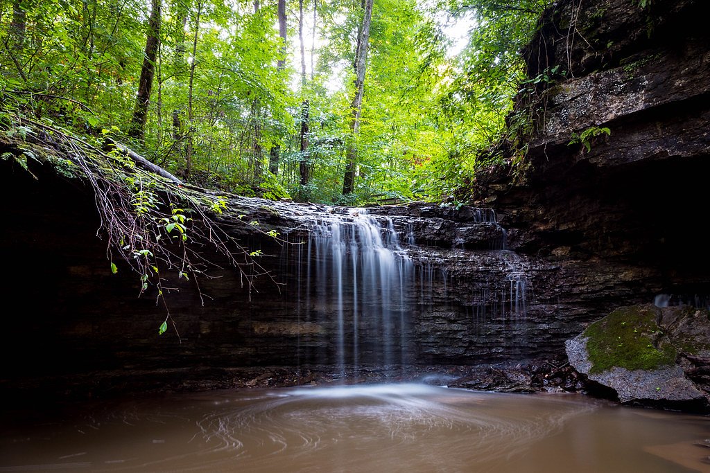
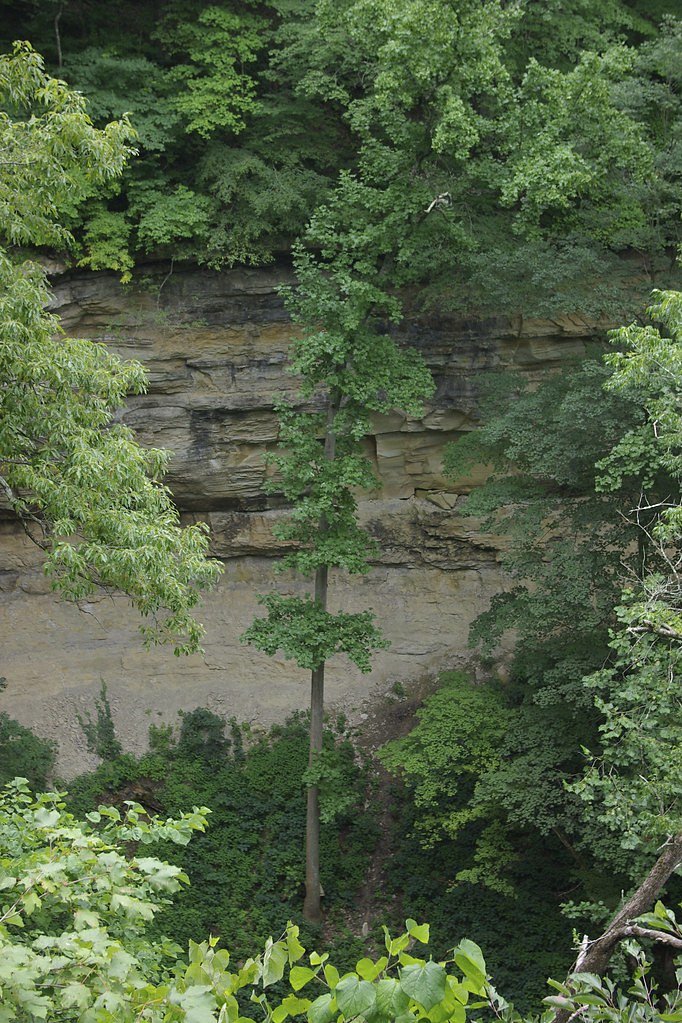
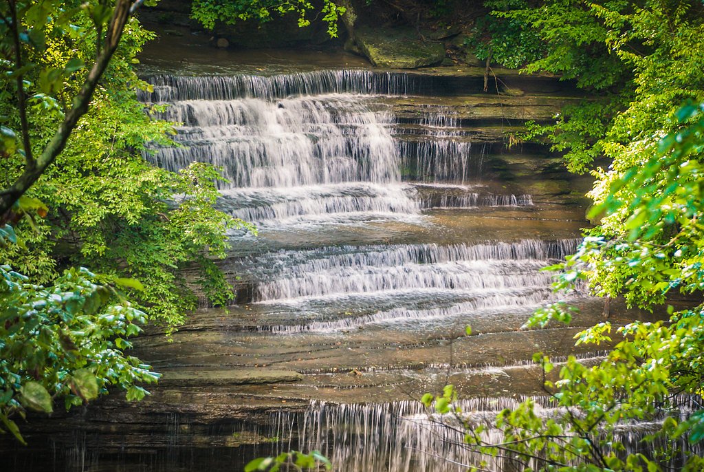
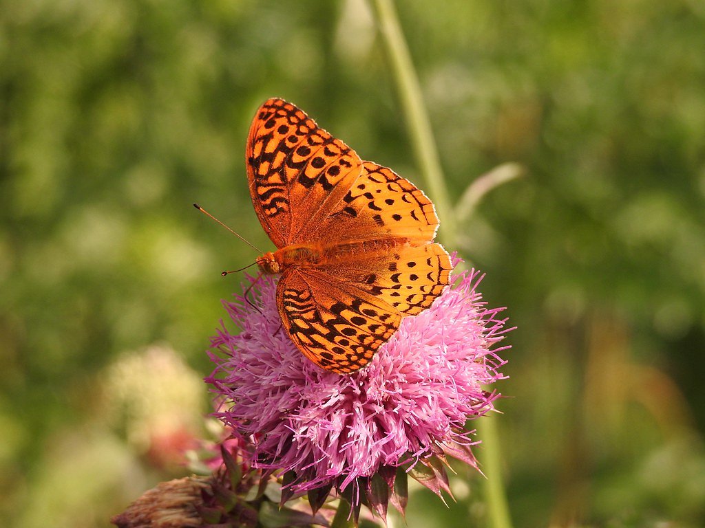

Photo Credits (5)
Difficulty
Moderate
Trail Length
2.4 miles
Trail Type
Out And Back
Elevation Gain
350 ft
About Clifty Falls
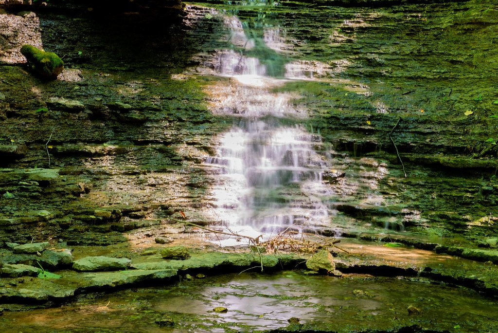
Clifty Falls plunges through a rugged limestone gorge in Clifty Falls State Park, offering a series of dramatic cascades—most notably Big Clifty Falls, Little Clifty Falls, Hoffman Falls, and Tunnel Falls—that look their best after heavy rains or spring snowmelt. The waterfalls sit within the Clifty Canyon Nature Preserve and are managed by SPR, giving hikers a chance to explore steep, wooded canyon walls and scenic overlooks carved by the creek. The park’s compact, canyoned setting makes for intimate waterfall views that draw photographers and families alike. The falls are part of Clifty Falls State Park’s roughly 1,416 acres in Jefferson County, Indiana, about 46 miles northeast of Louisville, Kentucky. The park attracts roughly 370,000 visitors annually and traces its origins to an October 27, 1920 gift of 570 acres from citizens of Madison at the suggestion of Richard Lieber. Visitors should come prepared for uneven terrain and bring good footwear to fully enjoy the cascades and canyon scenery preserved here by SPR.
The Setting
Clifty Falls sits at 709 feet within Clifty Canyon Nature Preserve, fed by the Indian Kentuck Creek, in the foothills of Indiana.
Trail & Hike Details
The Approach
The moderate 2.4-mile out-and-back trail gains 350 feet of elevation on the way to the falls.
Trail Description
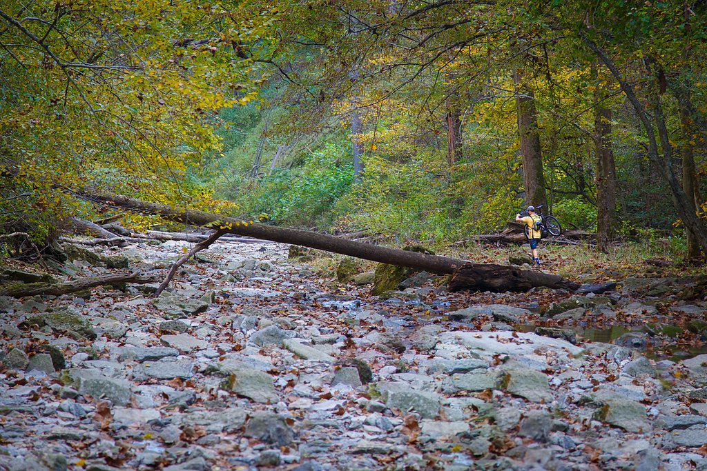
This is a 2.4-mile out-and-back route with about 350 feet of elevation gain; it’s rated moderate and features mixed surfaces—rocky dirt paths, steep inclines, and wooded singletrack—so expect some uneven footing and short, steep sections. The trail follows the canyon toward the falls with several viewpoints and shorter spur trails that get you closer to the water; Trail 2 and Trail 5 are popular options for up-close waterfall access. Managed within the Clifty Canyon Nature Preserve (SPR), the route is best suited to hikers comfortable with moderate grades and variable trail surfaces.
What to Expect
Dogs are welcome.
Accessibility
The trail is not wheelchair accessible. Uneven terrain and elevation changes require steady footing.
Frequently Asked Questions
🐶 Are Dogs Allowed at Clifty Falls?
✅ Dogs are allowed
Are There Any Fees or Permits Required?
🤑 Fee: $7.00
🏊 Is There Swimming at Clifty Falls?
❌ Swimming is not allowed
When to Visit
Spring and early summer are the best times to visit, as the waterfalls are typically at their fullest due to rain and snowmelt.
Seasonal Access
The best time to visit is Spring, Summer, Fall, and Winter.
Safety Information
Trails can be slippery, especially after rain. Stay on marked trails and avoid getting too close to the edge of cliffs or waterfalls. Poison ivy is common in the area.
Current Water Conditions
333 ft³/s
Current discharge — how much water is flowing
Much higher than usual for this time of year
Based on 56 years of record
5.09 ft
Water depth at gauge
7-Day Discharge Trend
What does this mean for your visit?
The water is flowing much higher than usual, expect an impressive display.
About This Gauge
This gauge is on a nearby waterway and may not reflect exact conditions at the falls.
7-Day Flow Outlook
Based on the USGS gauge INDIAN-KENTUCK CREEK NEAR CANAAN, IN (20 km away).
Today
Roaring
17 cfs
6/10Tomorrow
Roaring
13 cfs
8/10Mon
Strong
14 cfs
10/10Tue
Strong
11 cfs
10/10Wed
Strong
12 cfs
10/10Thu
Strong
12 cfs
10/10Fri
Roaring
14 cfs
6/10Best window: Mon — strong flow, sunny (trip score 10/10).
Best time of year: this gauge typically runs highest from mid February to late April, peaking in April.
How we calculate this
This is a transparent outlook, not a precise forecast. We take the waterfall's current flow strength (how it ranks against its historical normal for today, from the nearest USGS stream gauge), carry that ranking forward along the gauge's seasonal curve, and nudge it for forecast rain. Confidence is highest for the next day or two and falls further out. Always check official conditions and your own judgment before visiting — high flows can be dangerous.
Know when to go.
Get a free email alert when waterfalls near Madison hit peak flow. We only send when conditions are worth the trip — no weekly newsletters, no spam.
Weather Forecast
Location & Access
Getting There
Clifty Falls State Park is located near Madison, Indiana. The park entrance is accessible via State Road 62. Visitors can follow park signage to reach the main parking areas and trailheads.
Get Directions on Google MapsParking
Parking is available at multiple locations within the park, including near the main trailheads and picnic areas.
Elevation
709 feet above sea level
Coordinates
38.766448° N, -85.436348° W
Land Management
Managed by SPR
Visitor Tips & Gear
Arrive early to secure parking, especially on weekends. Bring water and wear sturdy shoes, as some trails can be rocky or uneven. Check the weather forecast and trail conditions before visiting.
As an Amazon Associate, we earn from qualifying purchases.
With 2.4 miles and 350 ft of elevation gain, sturdy boots and trekking poles will help on this moderate trail. Icy conditions are common in winter — traction cleats are a smart addition.

Columbia Watertight II Rain Jacket
Packs into its own pocket, seam-sealed, and keeps you dry from spray and surprise rain.

Polarized Sunglasses (Knockaround)
Cuts glare off the water so you actually see the falls — and your photos turn out better too.

Earth Pak Waterproof Dry Bag
Keeps your phone and gear dry when waterfall mist soaks everything else.

Waterproof Phone Pouch (AiRunTech)
Cheap insurance — take photos right next to the falls without killing your phone.

Timberland Euro Sprint Mid Waterproof
Trusted waterproof boot with premium leather and grippy rubber sole — reliable on rocky, wet trails.

TrailBuddy Trekking Poles
Lightweight aluminum, cork grips, and flip-locks that actually hold — a best-seller for good reason.
Where to Stay

Comfort Inn Madison near Clifty Falls

Clifty Inn

Holiday Inn Express Hotel & Suites Madison by IHG

The Chandler Hotel
Browse vacation cabins and private rentals nearby
Unique outdoor stays — tents, yurts, and treehouses
Rent a campervan or RV for your waterfall road trip
Some links are affiliate links. We may earn a commission at no extra cost to you.
Additional Information
Nearby Attractions
Historic downtown Madison, Indiana; Lanier Mansion State Historic Site; Ohio River Scenic Byway.
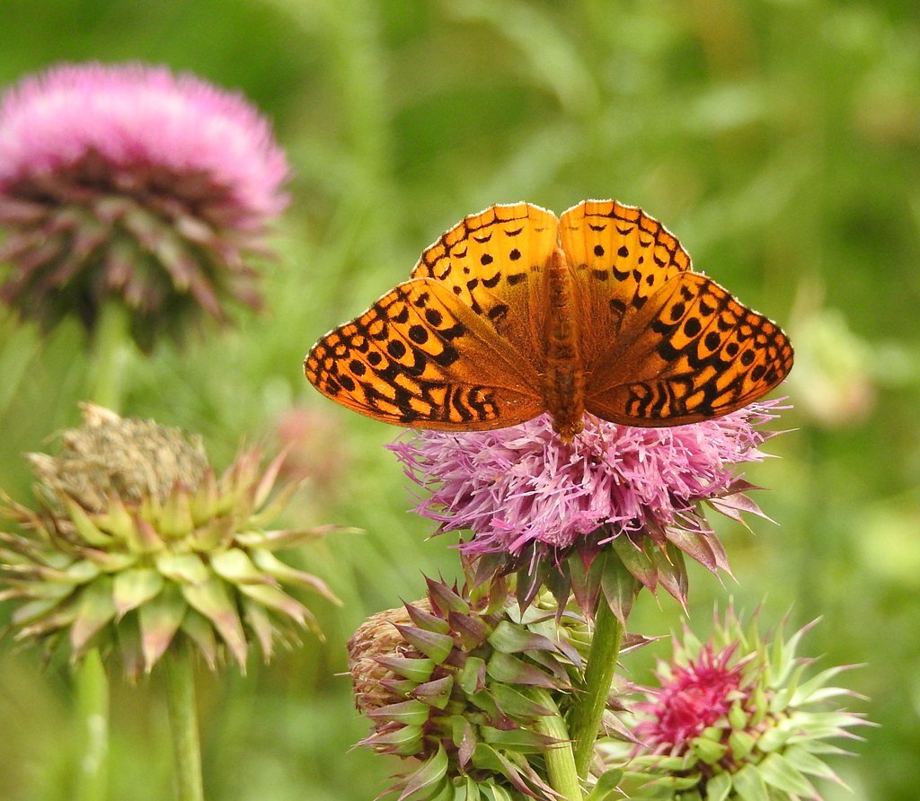
Wildlife
The park is home to deer, raccoons, squirrels, and a variety of bird species, including woodpeckers and hawks.
Cities near Clifty Falls
Nearby Waterfalls

Writing about Clifty Falls? Embed this waterfall on your site for free.