
Photo Credits (5)
Difficulty
Moderate
Trail Length
2.4 miles
Trail Type
Out And Back
Elevation Gain
350 ft
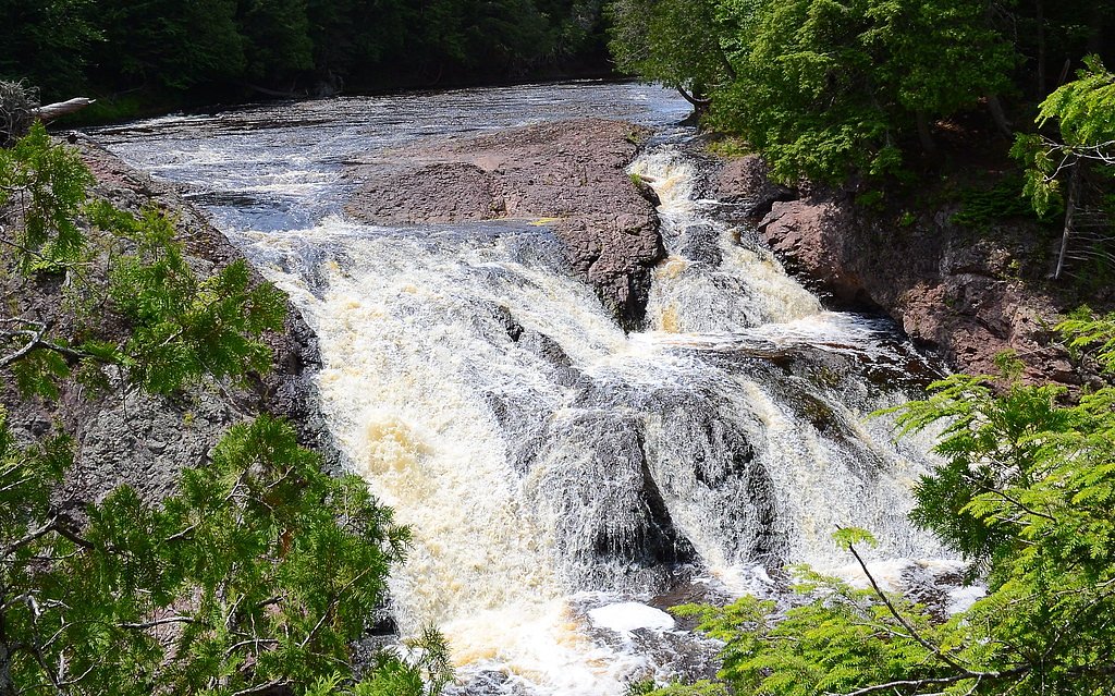
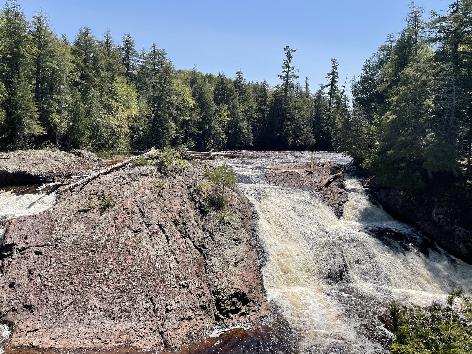
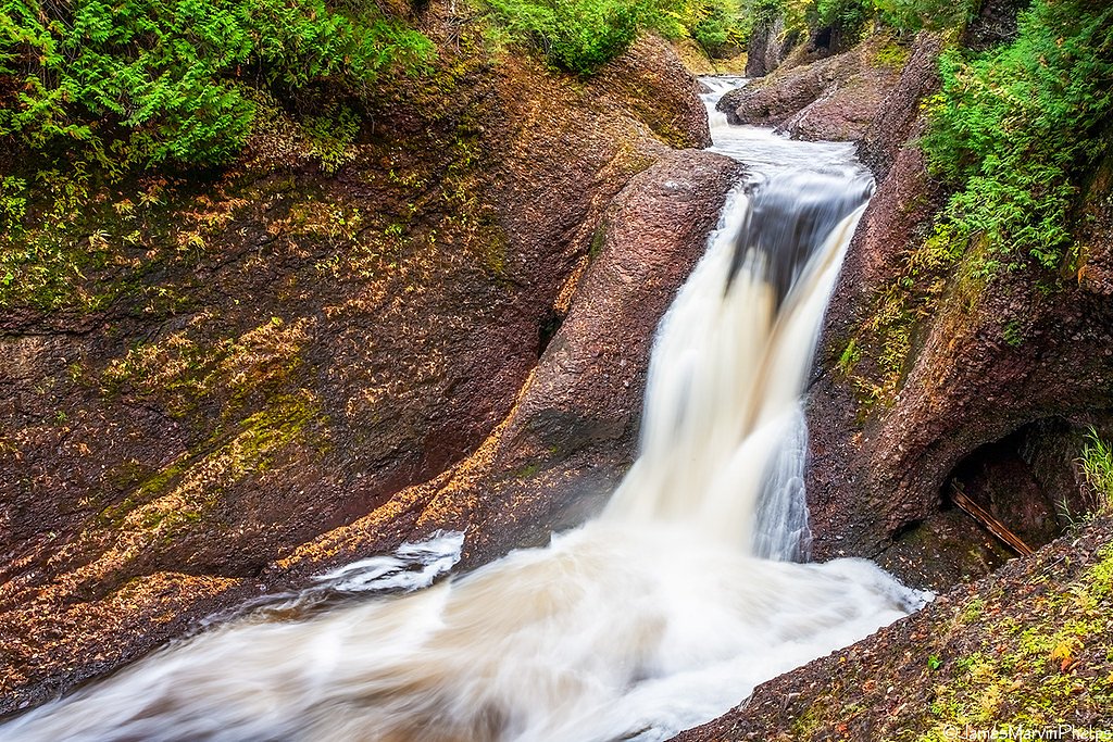
About Chippewa Falls
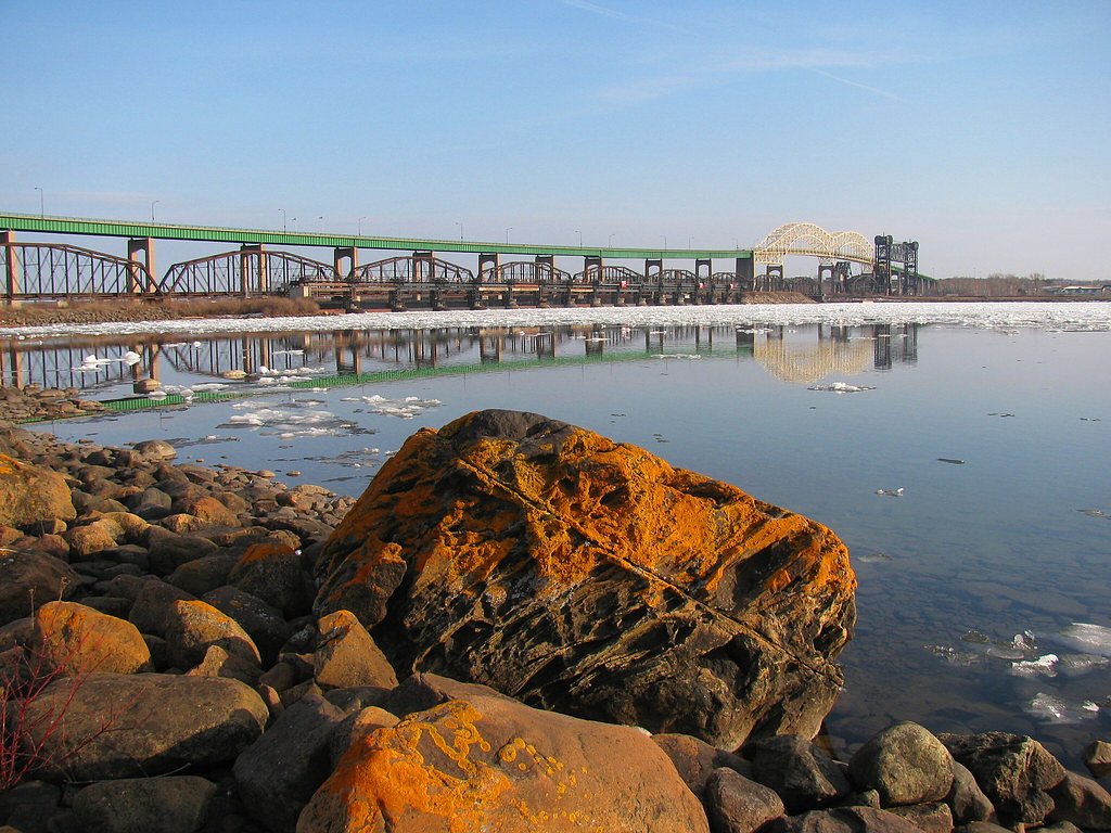
Chippewa Falls is a compact, scenic cascade on the Chippewa River tucked into the forested hills of Michigan’s Upper Peninsula. Nestled within the Ottawa National Forest and managed by the U.S. Forest Service, the falls give a peaceful, intimate encounter with flowing water and mixed northern hardwood forest—an easy reward for hikers and photographers who prefer quieter, less-developed spots. Access to the viewing area follows USFS trail NFST-129-A (Trail #T129-A), a short forest approach that many visitors combine with a longer out-and-back route through the surrounding woods. The full outing is commonly about 2.4 miles with roughly 350 feet of elevation gain and is rated moderate; for overnight stays, Black River Harbor Pavilion campground is nearby (about 8.32 km away) and serves as a convenient base for exploring this part of the Ottawa National Forest.
The Setting
Chippewa Falls sits at 1,050 feet within Ottawa National Forest, fed by the Black River, in the foothills of Michigan.
Trail & Hike Details
The Approach
The moderate hike follows Nfst 129 A (#T129-A), a 2.4-mile out-and-back trail over natural surface. Expect 350 feet of elevation gain with grades of 0-5%. The trail is developed (Class 3).
USFS Trail
NFST-129-A #T129-A
Trail Class
Developed
Surface
Avg Grade
USFS Segment
0.13 miTrail Description
Primary access is via USFS NFST-129-A (Trail #T129-A). According to USFS trail data this segment has a GIS length of 0.13 miles, is classified as Class 3, and the tread is native material with a typical grade of 0–5%. Hikers commonly combine the short NFST-129-A approach into a longer out-and-back hike totaling about 2.4 miles with approximately 350 feet of elevation gain; the overall route is rated moderate.
What to Expect
Dogs are welcome.
Accessibility
The trail is not wheelchair accessible. Uneven terrain and elevation changes require steady footing.
Frequently Asked Questions
🐶 Are Dogs Allowed at Chippewa Falls?
✅ Dogs are allowed
Are There Any Fees or Permits Required?
🆖 No fees required
🏊 Is There Swimming at Chippewa Falls?
❌ Swimming is not allowed
When to Visit
Spring and early summer are the best times to visit, as the water flow is typically strongest during these seasons. Fall offers beautiful foliage, while winter provides a serene, snowy landscape.
Seasonal Access
The best time to visit is Spring, Summer, and Fall. Winter access may be limited. Check with Ottawa National Forest for seasonal road closures.
Safety Information
Exercise caution near the water, as rocks may be slippery. During winter, the area may be icy and require extra care.
Current Water Conditions
34 ft³/s
Current discharge — how much water is flowing
Lower than usual for this time of year
Based on 53 years of record
2.07 ft
Water depth at gauge
7-Day Discharge Trend
What does this mean for your visit?
Flow is lower than usual for this time of year.
About This Gauge
This gauge is on a nearby waterway and may not reflect exact conditions at the falls.
7-Day Flow Outlook
Based on the USGS gauge BLACK RIVER NEAR BESSEMER, MI (10 km away).
Today
Low
34 cfs
6/10Tomorrow
Low
37 cfs
4/10Mon
Moderate
44 cfs
4/10Tue
Moderate
44 cfs
4/10Wed
Moderate
45 cfs
4/10Thu
Moderate
35 cfs
4/10Fri
Moderate
36 cfs
4/10Best window: Today — low flow, mostly sunny (trip score 6/10).
Best time of year: this gauge typically runs highest from late March to late May, peaking in April.
How we calculate this
This is a transparent outlook, not a precise forecast. We take the waterfall's current flow strength (how it ranks against its historical normal for today, from the nearest USGS stream gauge), carry that ranking forward along the gauge's seasonal curve, and nudge it for forecast rain. Confidence is highest for the next day or two and falls further out. Always check official conditions and your own judgment before visiting — high flows can be dangerous.
Know when to go.
Get a free email alert when waterfalls near Bessemer hit peak flow. We only send when conditions are worth the trip — no weekly newsletters, no spam.
Weather Forecast
Location & Access
Getting There
Chippewa Falls is located along Highway 123, near the town of Paradise, Michigan. It is easily accessible by car and is a short distance from Tahquamenon Falls State Park.
Get Directions on Google MapsParking
There is a small parking area near the falls, located just off the highway.
Elevation
1,050 feet above sea level
Coordinates
46.598835° N, -90.082118° W
Land Management
Managed by USFS
Visitor Tips & Gear
Bring bug spray during the summer months as mosquitoes can be prevalent. Wear sturdy shoes if visiting during wet conditions, as the trail may be slippery.
As an Amazon Associate, we earn from qualifying purchases.
With 2.4 miles and 350 ft of elevation gain, sturdy boots and trekking poles will help on this moderate trail. Sun exposure on the trail makes good sun protection a must in summer.

Polarized Sunglasses (Knockaround)
Cuts glare off the water so you actually see the falls — and your photos turn out better too.

Columbia Watertight II Rain Jacket
Packs into its own pocket, seam-sealed, and keeps you dry from spray and surprise rain.

Earth Pak Waterproof Dry Bag
Keeps your phone and gear dry when waterfall mist soaks everything else.

Waterproof Phone Pouch (AiRunTech)
Cheap insurance — take photos right next to the falls without killing your phone.

Timberland Euro Sprint Mid Waterproof
Trusted waterproof boot with premium leather and grippy rubber sole — reliable on rocky, wet trails.

TrailBuddy Trekking Poles
Lightweight aluminum, cork grips, and flip-locks that actually hold — a best-seller for good reason.
Where to Stay

North Ironwood Acres - Black River Lodge

Snow Otter Haus - 1

Snow Otter Haus - 2

Quality Inn Ironwood
Browse vacation cabins and private rentals nearby
Unique outdoor stays — tents, yurts, and treehouses
Rent a campervan or RV for your waterfall road trip
Some links are affiliate links. We may earn a commission at no extra cost to you.
Nearby Campground
BLACK RIVER HARBOR PAVILION
5.2 miles away · 1 sites
Overview Planning a visit to the Black River Harbor Pavilion? Watch for Alerts at the top of the page for any Alerts regarding this facility. The Black River Harbor Pavilion is located within the Black Harbor Recreation Area on Lake Superior in Michigans Upper Peninsula. The historic stone and wood pavilion was constructed by the Civilian Conservation Corps in the 1930s. Recreation Lake Superior offers great opportunities for boating, fishing, and swimming. The North Country National Scenic Trail
Book on Recreation.govAdditional Information
Nearby Attractions
Tahquamenon Falls State Park, Whitefish Point Lighthouse, and the Great Lakes Shipwreck Museum.
Wildlife
The area is home to a variety of wildlife, including deer, birds, and small mammals. Be cautious of mosquitoes and other insects during warmer months.
Cities near Chippewa Falls
Nearby Waterfalls
Other waterfalls named Chippewa Falls
1 other waterfall shares this name across the U.S.
Writing about Chippewa Falls? Embed this waterfall on your site for free.