
Photo Credits (5)
Difficulty
Moderate
Trail Length
2.4 miles
Trail Type
Out And Back
Elevation Gain
350 ft
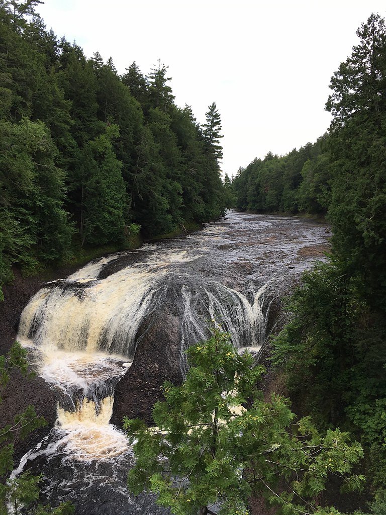
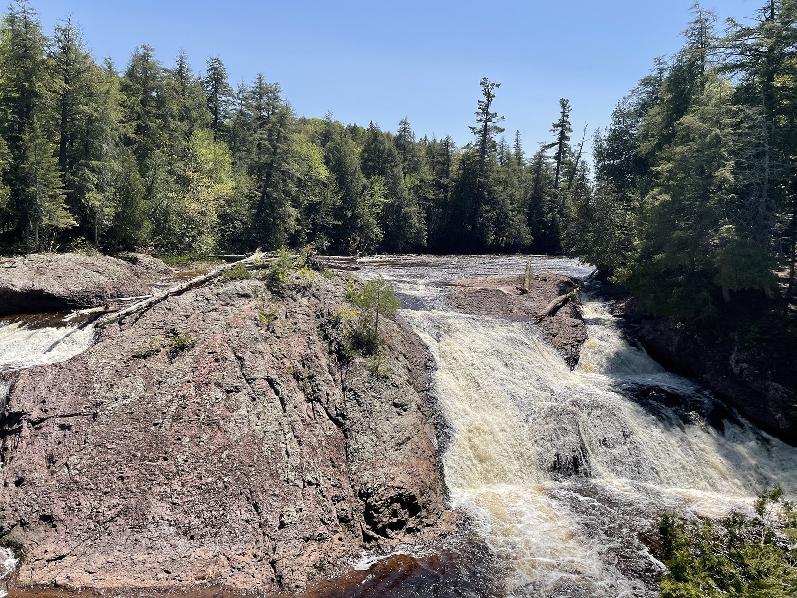
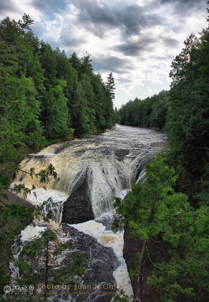
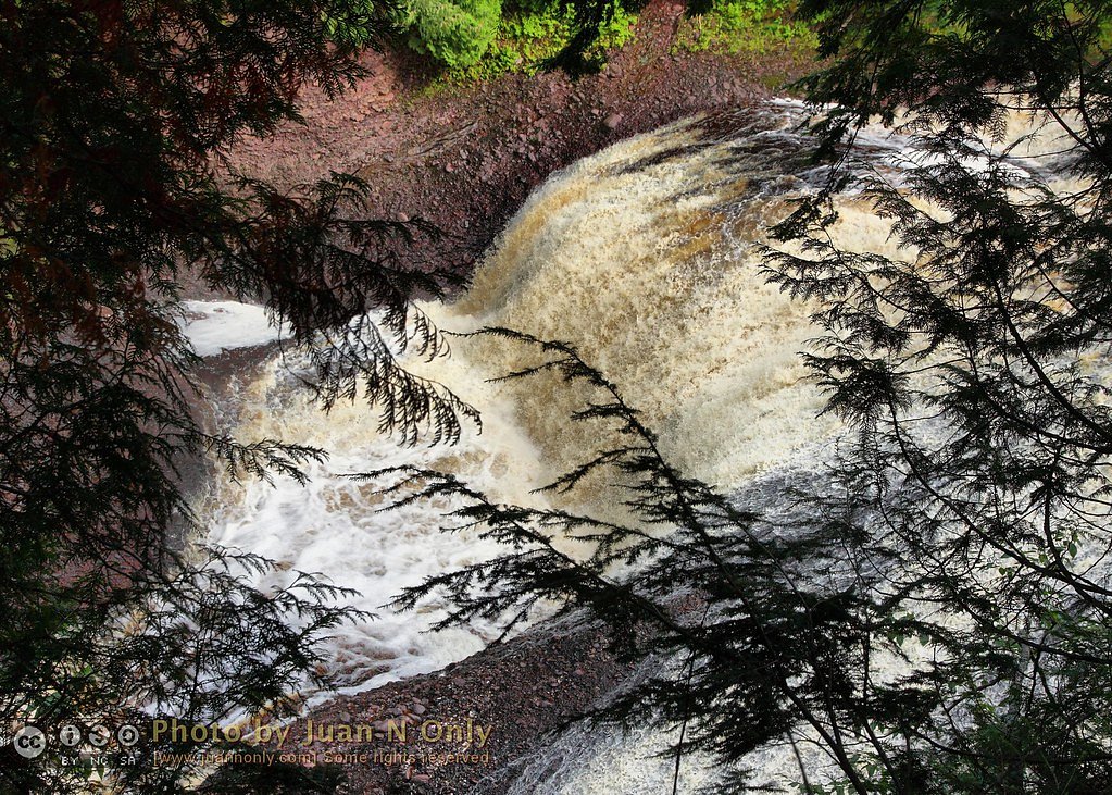
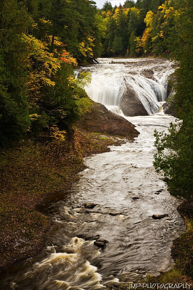
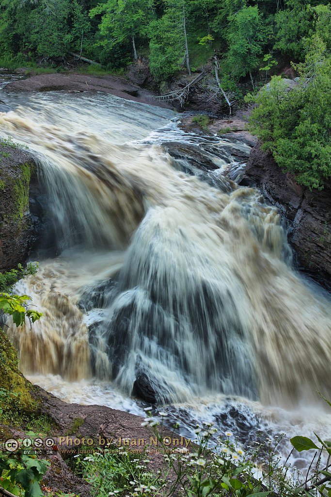
About Potawatomi Falls
Potawatomi Falls tumbles along the Black River in Michigan’s Upper Peninsula, a scenic stop often visited from the Black River Scenic Byway. Nestled within the Ottawa National Forest and managed by the U.S. Forest Service, the falls are framed by a short, easy-to-reach viewpoint that makes them a popular photo and picnic destination for day hikers and sightseers alike. The USFS maintains a named spur to the falls (POTOWATOMI FALLS, Trail #60004-A) that provides direct access to the cascade. For hikers who want a little more time on the trail, the approach is commonly done as a 2.4-mile out-and-back with roughly 350 feet of elevation gain and a moderate difficulty rating. If you’re planning an overnight trip, Black River Harbor Pavilion campground is nearby (about 3.65 km), making it convenient to combine an evening by the river with a morning visit to the falls.
The Setting
Potawatomi Falls sits at 866 feet within Ottawa National Forest, fed by the Presque Isle River, in the foothills of Michigan.
Trail & Hike Details
The Approach
The moderate hike follows Potowatomi Falls (#60004-A), a 2.4-mile out-and-back trail over other. Expect 350 feet of elevation gain with grades of 0-5%. The trail is highly developed (Class 4).
USFS Trail
POTOWATOMI FALLS #60004-A
Trail Class
Highly Developed
Surface
Avg Grade
USFS Segment
0.01 miTrail Description
The official USFS listing for POTOWATOMI FALLS (Trail #60004-A) describes a very short, Class 4 spur (GIS length 0.01 miles) with the surface recorded as “OTHER” and a typical grade of 0–5%. That short spur provides the immediate access to the falls’ viewing area; many visitors approach as part of a longer 2.4-mile out-and-back route with about 350 feet of elevation gain, rated moderate overall. Trail type: out-and-back.
What to Expect
Dogs are welcome.
Accessibility
The trail is not wheelchair accessible. Uneven terrain and elevation changes require steady footing.
Frequently Asked Questions
🐶 Are Dogs Allowed at Potawatomi Falls?
✅ Dogs are allowed
Are There Any Fees or Permits Required?
🆖 No fees required
🏊 Is There Swimming at Potawatomi Falls?
❌ Swimming is not allowed
When to Visit
Spring and fall are ideal for visiting Potawatomi Falls due to higher water levels and scenic surroundings.
Seasonal Access
The best time to visit is Spring, Summer, Fall, and Winter. Check with Ottawa National Forest for seasonal road closures.
Safety Information
Exercise caution near the observation deck and riverbanks, as they may be slippery, especially in wet or icy conditions. Stay on designated paths and do not attempt to climb on rocks near the falls.
Current Water Conditions
88 ft³/s
Current discharge — how much water is flowing
About average for this time of year
Based on 3 years of record
5.49 ft
Water depth at gauge
66°F
CoolRefreshing for swimming
7-Day Discharge Trend
What does this mean for your visit?
Flow is about average for this time of year. Water temperature is a refreshing 66 degrees F, good for a quick swim. Expect excellent dissolved oxygen levels. Mineral content is typical.
Water Quality
Dissolved Oxygen
ExcellentSupports aquatic life
Conductance
Dissolved minerals in the water
About This Gauge
This gauge is on a nearby waterway and may not reflect exact conditions at the falls.
7-Day Flow Outlook
Based on the USGS gauge PRESQUE ISLE RIVER NEAR CONNORVILLE, MI (9 km away).
Today
Barely Flowing
88 cfs
5/10Tomorrow
Barely Flowing
88 cfs
5/10Sun
Low
95 cfs
4/10Mon
Low
103 cfs
3/10Tue
Low
106 cfs
3/10Wed
Low
106 cfs
3/10Thu
Low
106 cfs
3/10Best window: Today — barely flowing flow, partly sunny (trip score 5/10).
How we calculate this
This is a transparent outlook, not a precise forecast. We take the waterfall's current flow strength (how it ranks against its historical normal for today, from the nearest USGS stream gauge), carry that ranking forward along the gauge's seasonal curve, and nudge it for forecast rain. Confidence is highest for the next day or two and falls further out. Always check official conditions and your own judgment before visiting — high flows can be dangerous.
Know when to go.
Get a free email alert when waterfalls near Bessemer hit peak flow. We only send when conditions are worth the trip — no weekly newsletters, no spam.
Weather Forecast
Location & Access
Getting There
Potawatomi Falls is located near Bessemer, Michigan, along the Black River Scenic Byway. It is accessible via a short drive from US-2, with clear signage leading to the falls.
Get Directions on Google MapsParking
There is a designated parking area near the trailhead for Potawatomi Falls, which is shared with the nearby Gorge Falls.
Elevation
866 feet above sea level
Coordinates
46.637446° N, -90.051562° W
Land Management
Managed by USFS
Visitor Tips & Gear
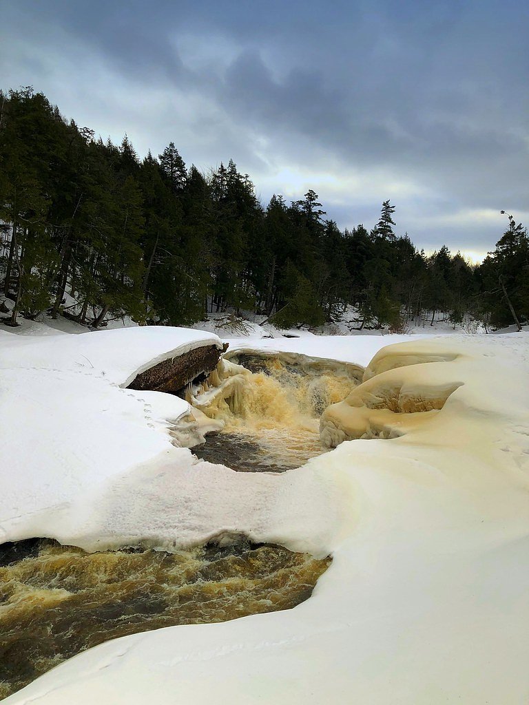
Visit in the spring for the most dramatic water flow, or in the fall to enjoy vibrant foliage. Wear sturdy shoes, especially if visiting in winter when the path may be icy.
As an Amazon Associate, we earn from qualifying purchases.
With 2.4 miles and 350 ft of elevation gain, sturdy boots and trekking poles will help on this moderate trail. Icy conditions are common in winter — traction cleats are a smart addition.

Columbia Watertight II Rain Jacket
Packs into its own pocket, seam-sealed, and keeps you dry from spray and surprise rain.

Polarized Sunglasses (Knockaround)
Cuts glare off the water so you actually see the falls — and your photos turn out better too.

Earth Pak Waterproof Dry Bag
Keeps your phone and gear dry when waterfall mist soaks everything else.

Waterproof Phone Pouch (AiRunTech)
Cheap insurance — take photos right next to the falls without killing your phone.

Timberland Euro Sprint Mid Waterproof
Trusted waterproof boot with premium leather and grippy rubber sole — reliable on rocky, wet trails.

TrailBuddy Trekking Poles
Lightweight aluminum, cork grips, and flip-locks that actually hold — a best-seller for good reason.
Where to Stay

North Ironwood Acres - Black River Lodge

Snow Otter Haus - 1

Snow Otter Haus - 2

Quality Inn Ironwood
Browse vacation cabins and private rentals nearby
Unique outdoor stays — tents, yurts, and treehouses
Rent a campervan or RV for your waterfall road trip
Some links are affiliate links. We may earn a commission at no extra cost to you.
Nearby Campground
BLACK RIVER HARBOR PAVILION
2.3 miles away · 1 sites
Overview Planning a visit to the Black River Harbor Pavilion? Watch for Alerts at the top of the page for any Alerts regarding this facility. The Black River Harbor Pavilion is located within the Black Harbor Recreation Area on Lake Superior in Michigans Upper Peninsula. The historic stone and wood pavilion was constructed by the Civilian Conservation Corps in the 1930s. Recreation Lake Superior offers great opportunities for boating, fishing, and swimming. The North Country National Scenic Trail
Book on Recreation.govAdditional Information
Nearby Attractions
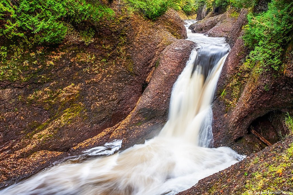
Nearby attractions include Gorge Falls, Sandstone Falls, and Rainbow Falls, all located along the Black River Scenic Byway.
Wildlife
The area is home to a variety of wildlife, including deer, birds, and small mammals. Visitors may also spot bald eagles near the river.
Cities near Potawatomi Falls
Nearby Waterfalls
Writing about Potawatomi Falls? Embed this waterfall on your site for free.