Chippewa Falls
By Armen Suny · Last verified Jun 2026
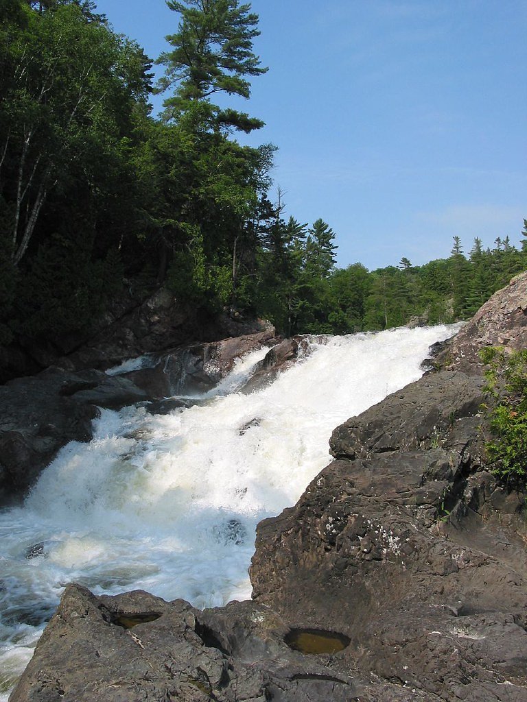
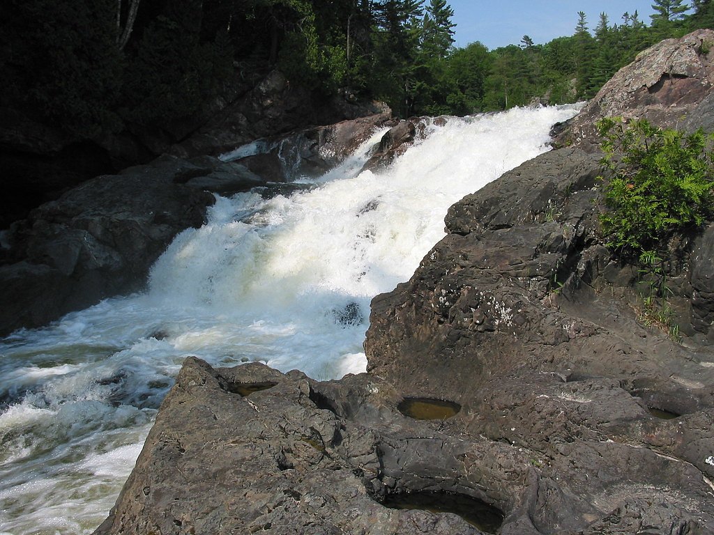
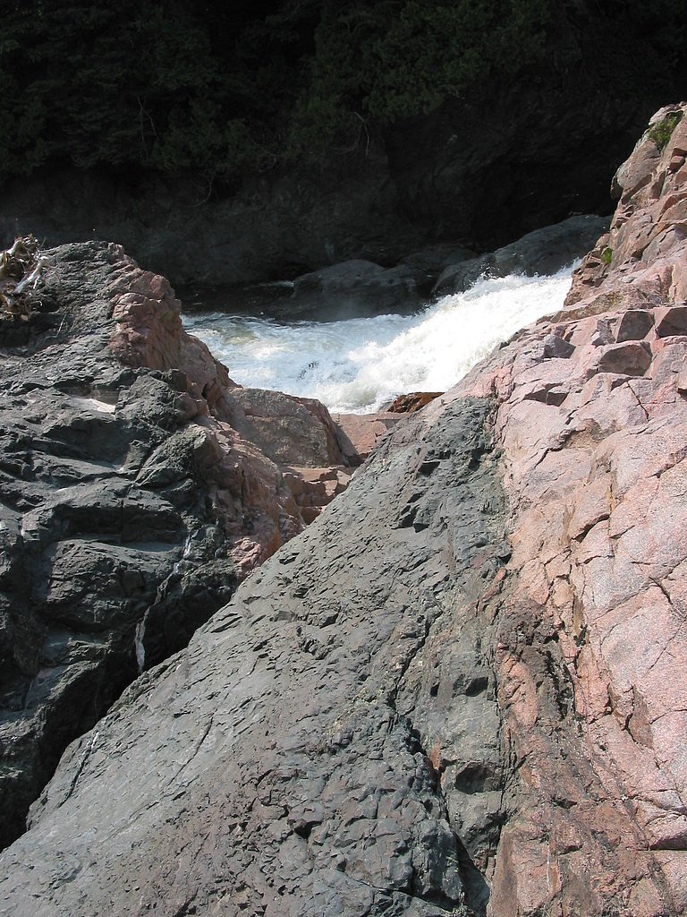
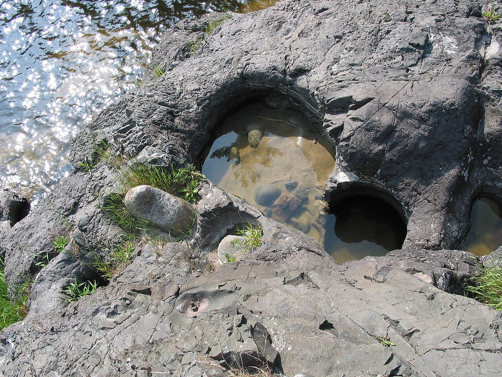
Photo Credits (5)
Difficulty
Easy
Trail Length
0.5 km
Trail Type
Out And Back
About Chippewa Falls
Chippewa Falls is a small to moderate cascade on a Chippewa-named watercourse north of Sault Ste. Marie, Ontario (coordinates: 46.9299, -84.4255). The falls sit in a mixed boreal/deciduous forest and are best described as a roadside-to-short-hike natural waterfall rather than a developed day-use site. Flow and appearance vary seasonally, with highest flows in spring snowmelt and lower flows in late summer. Facilities and formal infrastructure (boardwalks/railings) are likely minimal or absent.
Why This Waterfall Exists
Chippewa Falls flows over hard intrusive rock, primarily granodiorite and granite, laid down over 2.5-3.2 billion years ago. These resistant rocks form a durable ledge that water cannot easily wear away, creating the falls where softer material downstream has already eroded.
Trail & Hike Details
Trail Description
Approach commonly involves a short walk from a roadside pulloff down a forested bank to the river. The path may be faint, uneven, and include roots, rocks, and wet or muddy sections. Reaching ideal photo/composition points may require careful scrambling over rocks near the river; there are likely no constructed viewpoints or barriers. Trail markers and signage may be minimal or absent.
What to Expect
Expect a natural, undeveloped waterfall setting in a mixed forest and rocky river channel. Water levels vary by season, high and powerful in spring, reduced in late summer. There are likely no maintained facilities (toilets, picnic tables, visitor center). Cell service may be spotty in remote sections. Wildlife in the area can include deer, moose, black bear, small mammals, and typical northern Ontario birds.
Accessibility
The trail is short and relatively flat, but the surface may be uneven. Contact the managing agency for accessibility details.
Frequently Asked Questions
🐶 Are Dogs Allowed at Chippewa Falls?
❌ Dogs are not allowed
Are There Any Fees or Permits Required?
🆖 No fees required
🏊 Is There Swimming at Chippewa Falls?
❌ Swimming is not allowed
When to Visit
Late spring and early summer for the fullest flows; fall for foliage color; winter can offer dramatic frozen features but is hazardous and requires winter hiking skills and traction devices.
Seasonal Access
The best time to visit is Spring, Summer, Fall, and Winter. Check with the managing park or local authority for current conditions.
Safety Information
Hazards include slippery rocks, loose footing, steep banks, swift currents close to the falls, cold water, and limited rescue access. Cell coverage may be unreliable. If visiting in winter, watch for ice hazards and avalanche risk on steep slopes near banks (where applicable). Always stay back from the lip of the falls, avoid climbing on wet rocks, and never enter fast-moving water. Let someone know your plans and estimated return time.
Current Water Conditions
3.1 m³/s
Current discharge — how much water is flowing
Much lower than usual for this time of year
Based on 57 years of record
2.12 m
Water depth at gauge
7-Day Discharge Trend
What does this mean for your visit?
Flow is well below normal for this time of year, so the waterfall may be a trickle.
About This Gauge
This gauge is on a nearby waterway and may not reflect exact conditions at the falls.
7-Day Flow Outlook
Based on the WSC gauge BATCHAWANA RIVER NEAR BATCHAWANA (11 km away).
Today
Barely Flowing
3.1 m³/s
4/10Tomorrow
Barely Flowing
3.4 m³/s
3/10Tue
Low
3.8 m³/s
4/10Wed
Barely Flowing
3.4 m³/s
4/10Thu
Barely Flowing
3.3 m³/s
3/10Fri
Barely Flowing
3.1 m³/s
4/10Sat
Barely Flowing
2.9 m³/s
4/10Best window: Today — barely flowing flow, cloudy (trip score 4/10).
Best time of year: this gauge typically runs highest from early April to late May, peaking in April.
How we calculate this
This is a transparent outlook, not a precise forecast. We take the waterfall's current flow strength (how it ranks against its historical normal for today, from the nearest WSC stream gauge), carry that ranking forward along the gauge's seasonal curve, and nudge it for forecast rain. Confidence is highest for the next day or two and falls further out. Always check official conditions and your own judgment before visiting — high flows can be dangerous.
Know when to go.
Get a free email alert when waterfalls near Thessalon hit peak flow. We only send when conditions are worth the trip — no weekly newsletters, no spam.
Weather Forecast
Location & Access
Getting There
The falls are approximately 24 miles (north) of Sault Ste. Marie (per provided context). Use the coordinates (46.9299, -84.4255) in a GPS device or mapping app to locate the access point. Expect to travel on secondary/rural roads; final approach may be on a gravel or logging road. Confirm local road conditions before traveling, especially in spring thaw or after heavy rain.
Get Directions on Google MapsParking
There may be only informal parking (pulloffs or small cleared areas) near the access point. No formal parking lot, restrooms, or developed trailhead are expected. Park well off the travel lane and avoid blocking gates or private driveways.
Elevation
204 metres above sea level
Coordinates
46.929857° N, -84.425468° W
Visitor Tips & Gear
• Use the provided GPS coordinates and confirm local access/road conditions before you go. • Wear grippy, waterproof footwear; river rocks can be very slippery. • Bring insect repellent in summer and be prepared for muddy conditions in spring/fall. • Park safely off the road; avoid blocking any gates or driveways. • There may be no trash services, pack out what you bring in. • Check land status (Crown land vs. private) if accessing via side roads; obtain permission if crossing private property.
Where to Stay
Browse vacation cabins and private rentals nearby
Unique outdoor stays — tents, yurts, and treehouses
Rent a campervan or RV for your waterfall road trip
Some links are affiliate links. We may earn a commission at no extra cost to you.
Nearby Campground
Sunset Shoes Resort
7.6 km away
Additional Information
Nearby Attractions
Sault Ste. Marie (regional services and attractions), Lake Superior shoreline and beaches, local provincial parks and access points on the North Shore. Verify exact nearby named attractions based on your chosen route.
Wildlife
Typical northern Ontario species: white-tailed deer, moose, black bear, beaver, otter, small mammals, and a variety of songbirds and raptors. Practice bear-aware protocols in bear country.
Cities near Chippewa Falls
Other waterfalls named Chippewa Falls
1 other waterfall shares this name across Canada.
Writing about Chippewa Falls? Embed this waterfall on your site for free.