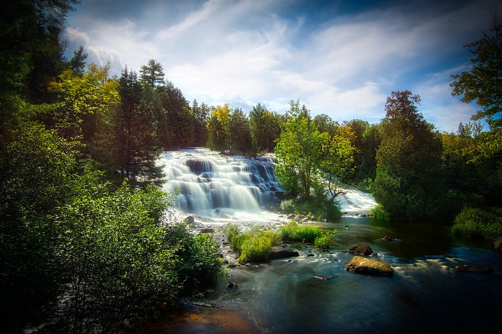
Bond Falls
Michigan • 50 ft
By Armen Suny · Last verified Mar 2026
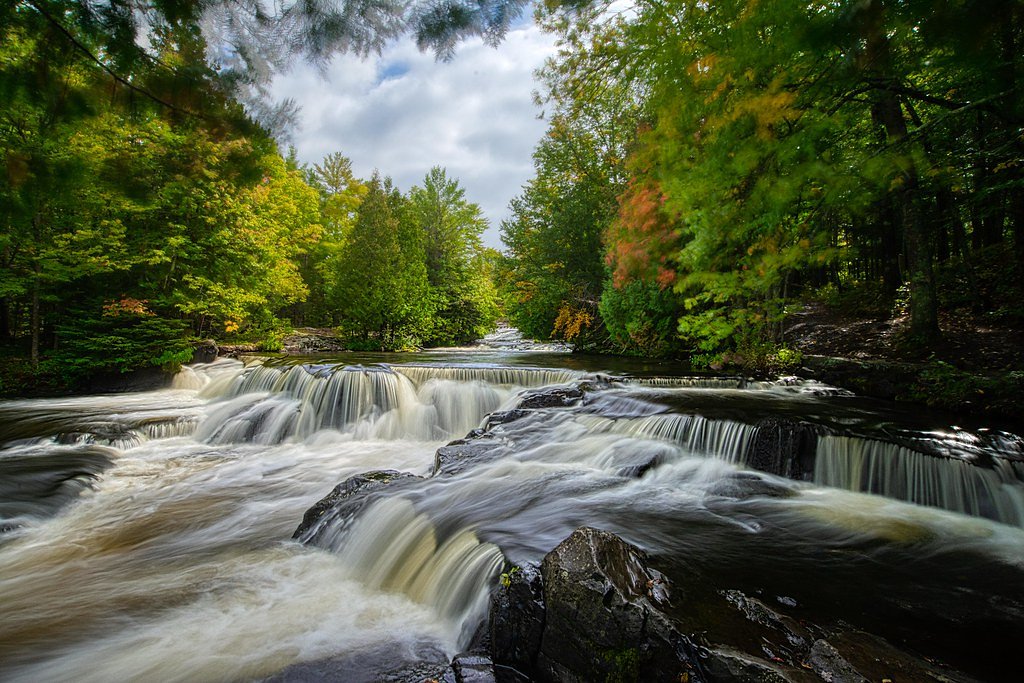
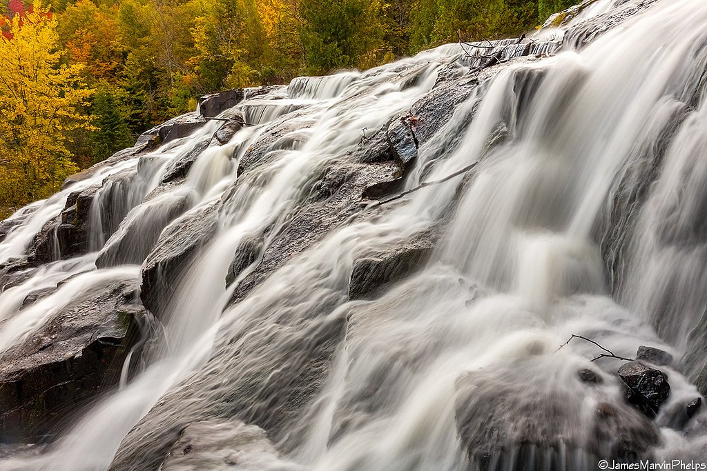
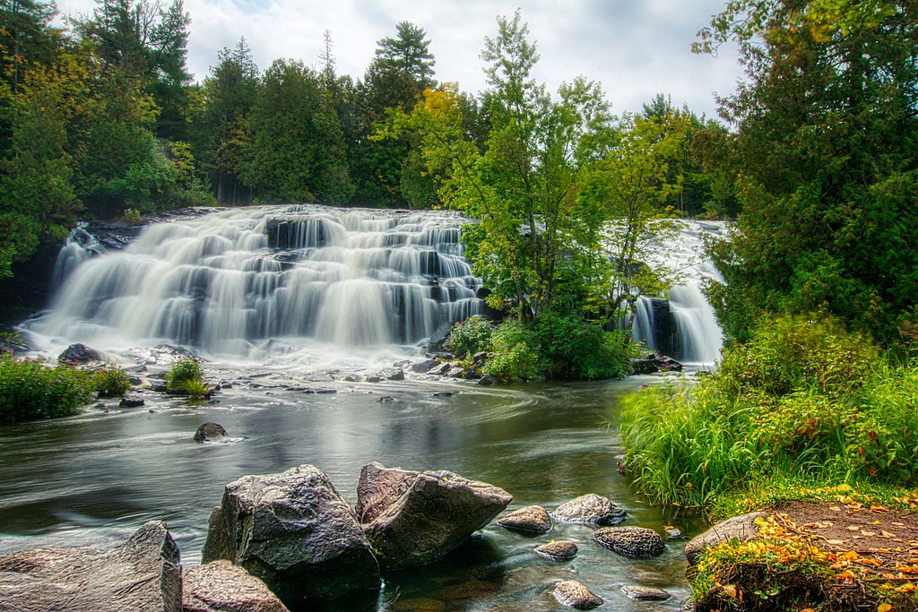
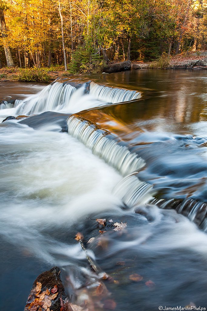

Photo Credits (5)
Difficulty
Drive Up
Trail Length
0.1 miles
Trail Type
Out And Back
Elevation Gain
50 ft
About Bond Falls
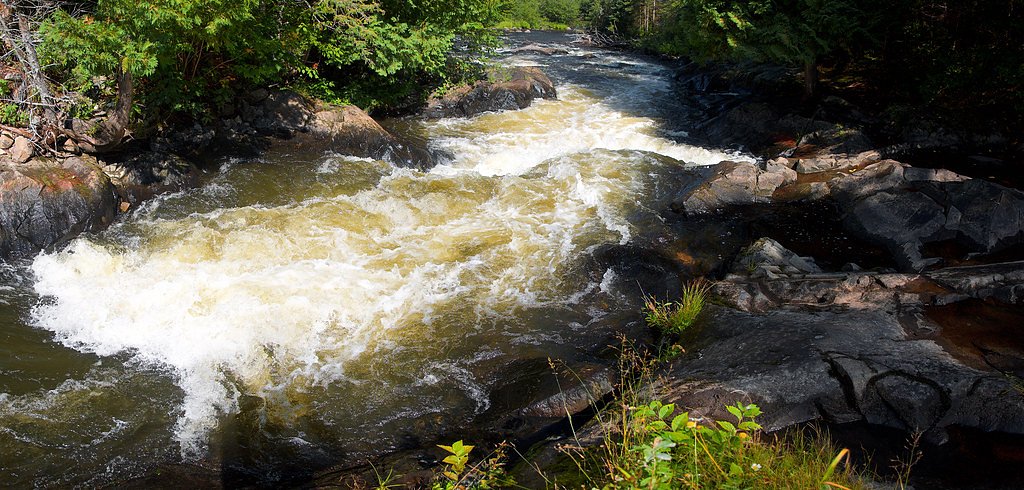
Bond Falls plunges about 50 feet along the middle branch of the Ontonagon River a few miles east of Paulding in Haight Township, in southern Ontonagon County of Michigan’s western Upper Peninsula. The falls are part of the state-listed Bond Falls Scenic Site, located near U.S. Highway 45, and are owned by SDNR (land unit: Bond Falls Scenic Site) with the site designated SREC and managed by SPR. The wide, tree-framed cascade and layered rock steps make it a year-round favorite for photographers and casual visitors. Access is straightforward from the roadside and the site’s short approach features a boardwalk and several viewing platforms that frame the falls from multiple angles. Visitors can enjoy crisp river views with only a brief stroll from parking, making Bond Falls an easy stop on a U.P. drive while still delivering dramatic scenery and seasonal variety.
The Setting
Bond Falls sits at 1,339 feet within Bond Falls Scenic Site, fed by the Middle Branch Ontonagon River, in the foothills of Michigan. The falls drop 50 feet.
Height: 50 feet
Trail & Hike Details
The Approach
No hiking required. Bond Falls is accessible by vehicle with a roadside viewing area.
Trail Description
Trail type: out-and-back. Length: 0.1 miles with approximately 50 feet of elevation gain; listed difficulty: drive_up. The route is a very short, well-maintained approach that includes a boardwalk and multiple viewing platforms; the surface is primarily boardwalk and maintained path. Expect a brief climb from the parking area to the overlooks—an easy, family-friendly walk to reach the main viewpoints of the 50-foot cascade.
What to Expect
The falls drop 50 feet. Dogs are welcome.
Accessibility
This waterfall is viewable from a vehicle-accessible area. No hiking is required.
Frequently Asked Questions
🐶 Are Dogs Allowed at Bond Falls?
✅ Dogs are allowed
Are There Any Fees or Permits Required?
🤑 Fee: $5.00
🏊 Is There Swimming at Bond Falls?
❌ Swimming is not allowed
When to Visit
The best time to visit Bond Falls is during the spring when water flow is at its peak, or in the fall when the surrounding foliage creates a stunning backdrop. Winter visits are also popular for those who enjoy snow-covered landscapes.
Seasonal Access
The best time to visit is Spring, Summer, Fall, and Winter.
Safety Information
Be cautious of slippery rocks and wet surfaces near the waterfall. Stay on designated paths and viewing platforms to ensure safety. During winter, trails may be icy and require extra caution.
Current Water Conditions
177 ft³/s
Current discharge — how much water is flowing
About average for this time of year
Based on 78 years of record
4.66 ft
Water depth at gauge
7-Day Discharge Trend
What does this mean for your visit?
Flow is about average for this time of year.
About This Gauge
7-Day Flow Outlook
Based on the USGS gauge MIDDLE BRANCH ONTONAGON RIVER NEAR PAULDING, MI (7 km away).
Today
Moderate
180 cfs
8/10Tomorrow
Moderate
197 cfs
5/10Mon
Moderate
214 cfs
6/10Tue
Moderate
210 cfs
6/10Wed
Moderate
209 cfs
6/10Thu
Moderate
210 cfs
6/10Fri
Moderate
203 cfs
6/10Best window: Today — moderate flow, sunny (trip score 8/10).
Best time of year: this gauge typically runs highest from late March to mid June, peaking in April.
How we calculate this
This is a transparent outlook, not a precise forecast. We take the waterfall's current flow strength (how it ranks against its historical normal for today, from the nearest USGS stream gauge), carry that ranking forward along the gauge's seasonal curve, and nudge it for forecast rain. Confidence is highest for the next day or two and falls further out. Always check official conditions and your own judgment before visiting — high flows can be dangerous.
Know when to go.
Get a free email alert when waterfalls near Bruce Crossing hit peak flow. We only send when conditions are worth the trip — no weekly newsletters, no spam.
Weather Forecast
Location & Access
Getting There
Bond Falls is located off Bond Falls Road, which is accessible via US Highway 45. It is approximately 10 miles south of the town of Bruce Crossing, Michigan.
Get Directions on Google MapsParking
There is a designated parking area near the waterfall, which includes accessible parking spaces. A small fee may be required for parking.
Elevation
1,339 feet above sea level
Coordinates
46.409673° N, -89.132654° W
Land Management
Managed by SPR
Visitor Tips & Gear
Arrive early during peak seasons (summer and fall) to secure parking and avoid crowds. Bring a camera to capture the scenic views, and wear sturdy shoes if you plan to explore beyond the boardwalk. Be cautious of slippery surfaces near the water.
As an Amazon Associate, we earn from qualifying purchases.
For this easy 0.1 miles trail, lightweight trail shoes and a water bottle are usually sufficient. Icy conditions are common in winter — traction cleats are a smart addition.

Columbia Watertight II Rain Jacket
Packs into its own pocket, seam-sealed, and keeps you dry from spray and surprise rain.

Polarized Sunglasses (Knockaround)
Cuts glare off the water so you actually see the falls — and your photos turn out better too.

Earth Pak Waterproof Dry Bag
Keeps your phone and gear dry when waterfall mist soaks everything else.

Waterproof Phone Pouch (AiRunTech)
Cheap insurance — take photos right next to the falls without killing your phone.

Kahtoola MICROspikes
Cult-favorite traction cleats that grip ice and wet rock — essential for winter waterfall hikes.

JOBY GorillaPod Starter Kit
Wraps around railings and rocks for long-exposure waterfall shots — no flat surface needed.
Where to Stay

Boulder Bear Motor Lodge

Two Rivers Motel and Cabins of Kenton, MI

AmericInn by Wyndham Iron River

Phelps Cabin on 26 Acres with Fire Pit!
Browse vacation cabins and private rentals nearby
Unique outdoor stays — tents, yurts, and treehouses
Rent a campervan or RV for your waterfall road trip
Some links are affiliate links. We may earn a commission at no extra cost to you.
Nearby Campground
MARION LAKE GROUP SITE
10 miles away · 1 sites
Overview The sparkling Marion Lake offers breathtaking and exciting camping for your next family trip. Live it up on the water with your jet skis or wake board, or tone down the pace with a full day of fishing. The Marion Lake Group Site is an ideal way to spend time with friends and family for all the water activities you can imagine. Marion Lake is in the Ottawa National Forest, a protected area in the Western Upper Peninsula of Michigan. It stretches from the Lake Superior shoreline to the Wis
Book on Recreation.govAdditional Information
Nearby Attractions
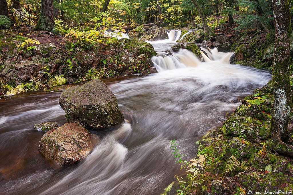
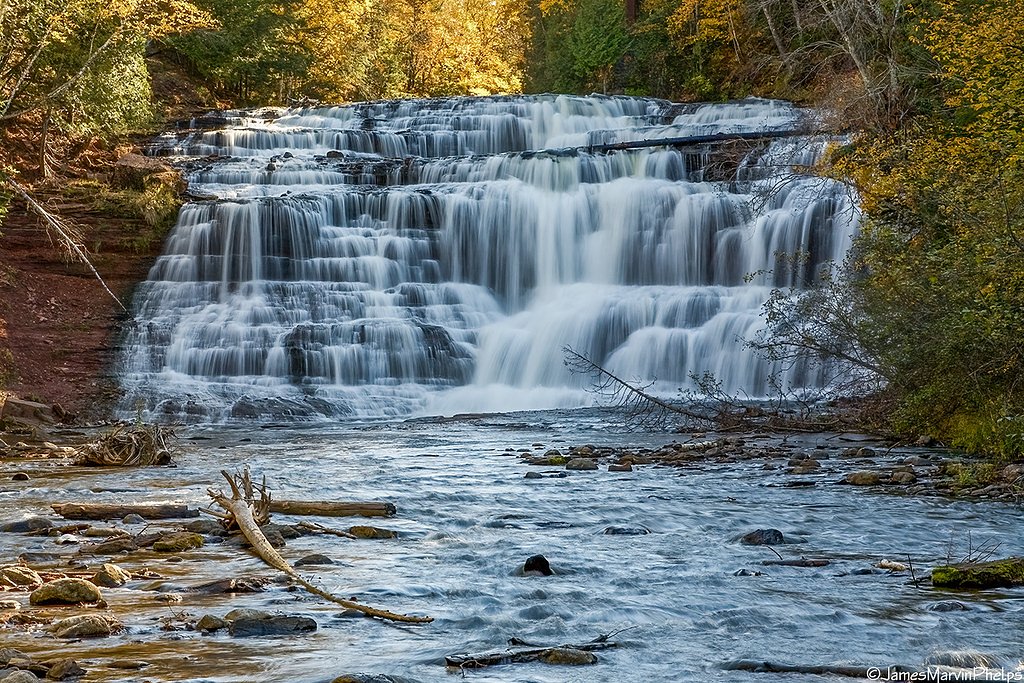
Nearby attractions include Agate Falls, the Porcupine Mountains Wilderness State Park, and Lake Gogebic.
Wildlife
The area around Bond Falls is home to a variety of wildlife, including deer, birds, and small mammals. Visitors may also spot fish in the Ontonagon River.
Cities near Bond Falls
Nearby Waterfalls
Writing about Bond Falls? Embed this waterfall on your site for free.