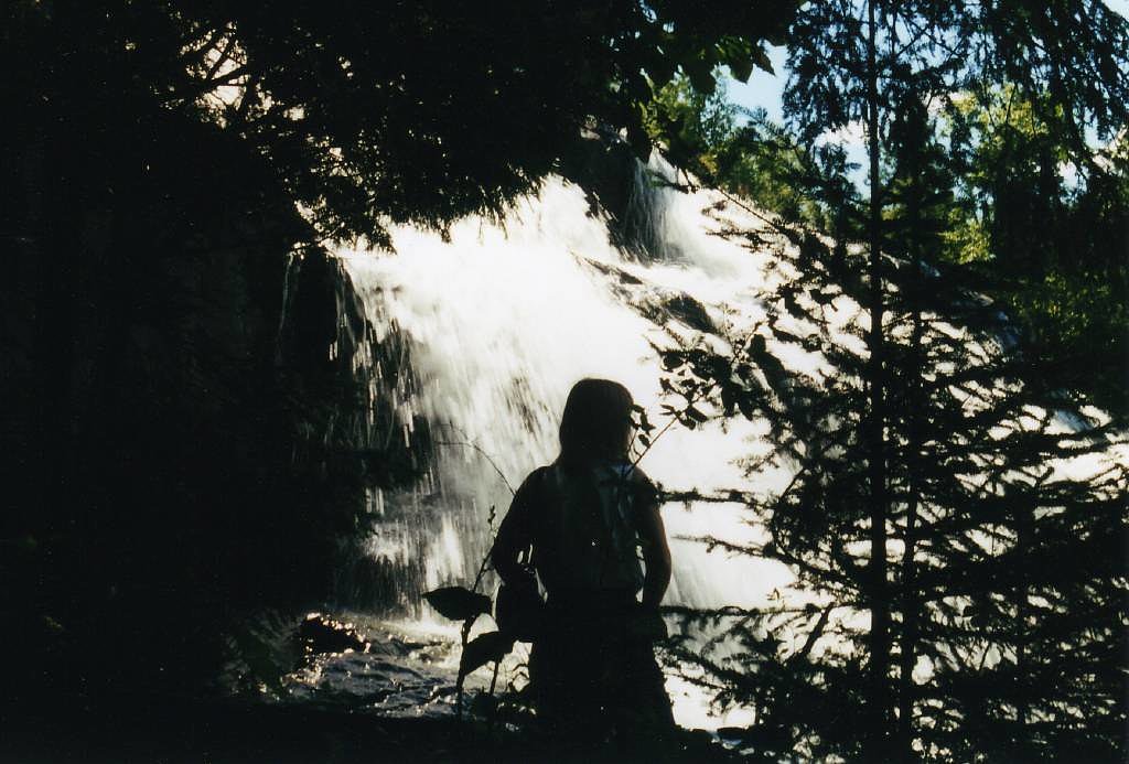
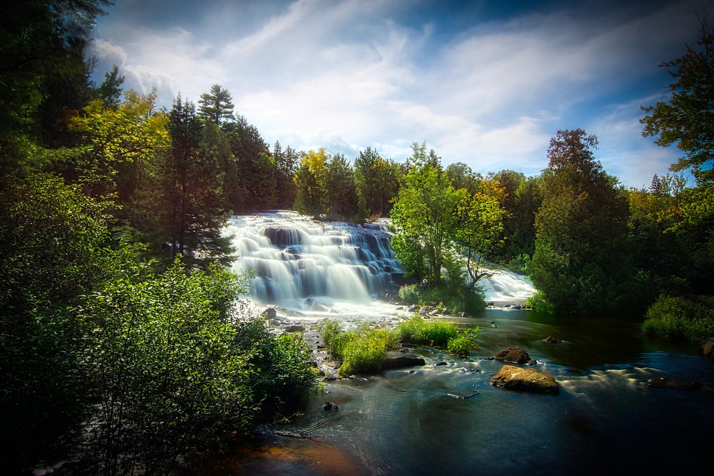
Agate Falls
Michigan • 39 ft
By Armen Suny · Last verified Mar 2026
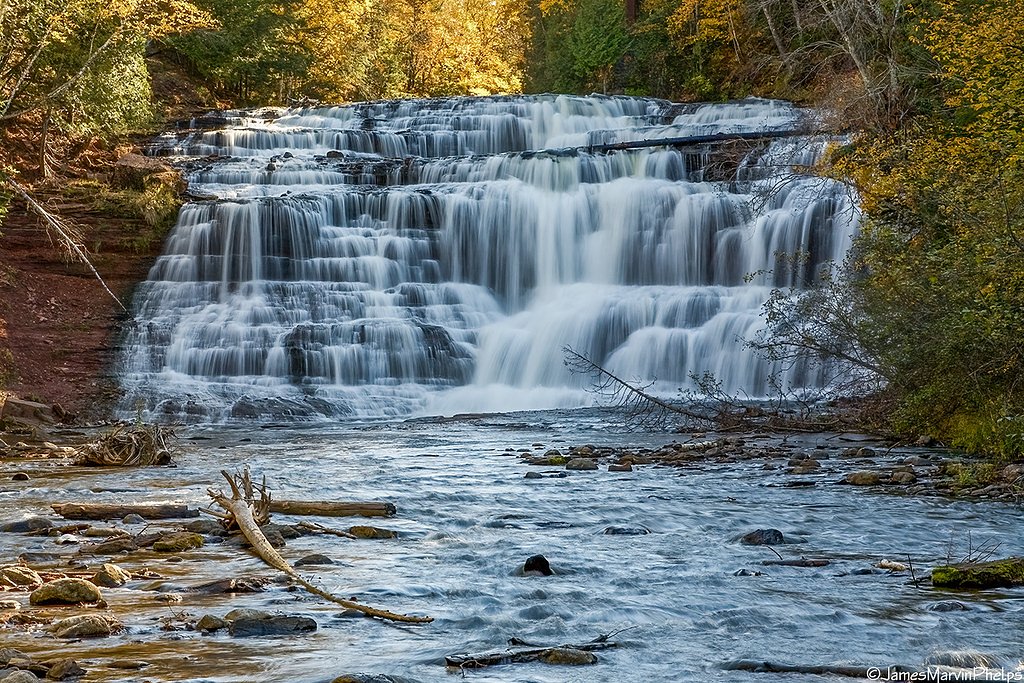
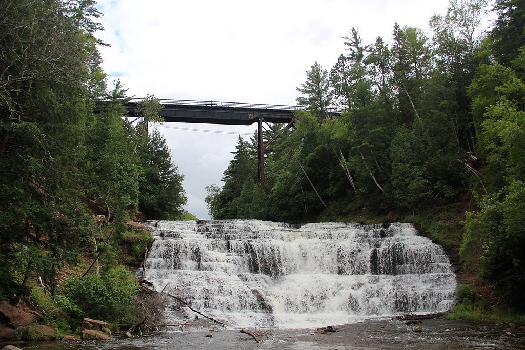


Photo Credits (5)
Difficulty
Drive Up
Trail Length
0.1 miles
Trail Type
Out And Back
Elevation Gain
50 ft
About Agate Falls
Agate Falls Scenic Site is a compact, highly photogenic roadside cascade where the Middle Branch of the Ontonagon River drops about 39 feet over a broad rock ledge into a wooded gorge. Located in Interior Township in southeastern Ontonagon County, Michigan, the falls sit right along state highway M‑28 about 7 miles (11 km) southeast of Bruce Crossing. The mix of rushing water, exposed bedrock and mature northern forest makes Agate Falls an easy, scenic stop on an Upper Peninsula drive and a favorite subject for photographers and families alike.
The Setting
Agate Falls sits at 1,093 feet along the Middle Branch Ontonagon River, in the foothills of Michigan. The falls drop 39 feet.
Height: 39 feet
Trail & Hike Details
The Approach
No hiking required. Agate Falls is accessible by vehicle with a roadside viewing area.
Trail Description
The access is a very short out‑and‑back (about 0.1 miles round trip) with roughly 50 feet of elevation change—commonly treated as a drive‑up stop (difficulty: drive_up). From the parking area a maintained viewing path leads directly to a dedicated overlook framing the 39‑foot cascade on the Middle Branch Ontonagon River; the route is brief, straightforward and suitable for most visitors. Note that developed camping is limited nearby—the closest developed campground is at the Kenton Ranger District, approximately 15.23 km away—so Agate Falls is often enjoyed as a daytime stop or a scenic break on a longer UP itinerary.
What to Expect
The falls drop 39 feet. Dogs are welcome.
Accessibility
This waterfall is viewable from a vehicle-accessible area. No hiking is required.
Frequently Asked Questions
🐶 Are Dogs Allowed at Agate Falls?
✅ Dogs are allowed
Are There Any Fees or Permits Required?
🆖 No fees required
🏊 Is There Swimming at Agate Falls?
❌ Swimming is not allowed
When to Visit
Spring and early summer are ideal for visiting Agate Falls, as the water flow is typically at its peak due to snowmelt and rainfall.
Seasonal Access
The best time to visit is Spring, Summer, and Fall. Winter access may be limited.
Safety Information
Stay on designated trails and viewing platforms. The rocks near the waterfall can be slippery and dangerous. Be cautious of ticks and other insects in the area.
Current Water Conditions
165 ft³/s
Current discharge — how much water is flowing
About average for this time of year
Based on 78 years of record
4.57 ft
Water depth at gauge
7-Day Discharge Trend
What does this mean for your visit?
Flow is about average for this time of year.
About This Gauge
This gauge is on a nearby waterway and may not reflect exact conditions at the falls.
7-Day Flow Outlook
Based on the USGS gauge MIDDLE BRANCH ONTONAGON RIVER NEAR PAULDING, MI (14 km away).
Today
Low
165 cfs
5/10Tomorrow
Low
159 cfs
6/10Fri
Low
160 cfs
6/10Sat
Moderate
187 cfs
4/10Sun
Moderate
201 cfs
4/10Mon
Moderate
200 cfs
4/10Tue
Moderate
191 cfs
4/10Best window: Tomorrow — low flow, mostly sunny (trip score 6/10).
Best time of year: this gauge typically runs highest from late March to mid June, peaking in April.
How we calculate this
This is a transparent outlook, not a precise forecast. We take the waterfall's current flow strength (how it ranks against its historical normal for today, from the nearest USGS stream gauge), carry that ranking forward along the gauge's seasonal curve, and nudge it for forecast rain. Confidence is highest for the next day or two and falls further out. Always check official conditions and your own judgment before visiting — high flows can be dangerous.
Know when to go.
Get a free email alert when waterfalls near Bruce Crossing hit peak flow. We only send when conditions are worth the trip — no weekly newsletters, no spam.
Weather Forecast
Location & Access
Getting There
Agate Falls is located near Bruce Crossing, Michigan, along Highway M-28. The waterfall is easily accessible via a short trail from the roadside parking area.
Get Directions on Google MapsParking
There is a designated parking area near the trailhead off Highway M-28, which is free of charge.
Elevation
1,093 feet above sea level
Coordinates
46.480777° N, -89.090289° W
Visitor Tips & Gear
Wear sturdy shoes as the trail may be muddy after rain. Bring insect repellent during the summer months. Visit early in the day to avoid crowds.
As an Amazon Associate, we earn from qualifying purchases.
For this easy 0.1 miles trail, lightweight trail shoes and a water bottle are usually sufficient. Sun exposure on the trail makes good sun protection a must in summer.

Polarized Sunglasses (Knockaround)
Cuts glare off the water so you actually see the falls — and your photos turn out better too.

Columbia Watertight II Rain Jacket
Packs into its own pocket, seam-sealed, and keeps you dry from spray and surprise rain.

Earth Pak Waterproof Dry Bag
Keeps your phone and gear dry when waterfall mist soaks everything else.

Waterproof Phone Pouch (AiRunTech)
Cheap insurance — take photos right next to the falls without killing your phone.

JOBY GorillaPod Starter Kit
Wraps around railings and rocks for long-exposure waterfall shots — no flat surface needed.

OR Sombriolet Sun Hat
UPF 50+ sun protection with vents so your head doesn't cook on exposed trail sections.
Where to Stay

Two Rivers Motel and Cabins of Kenton, MI

Bergland Bay Bungalow

AJ's Lodge and Oven

Sauna and Game Room! Tranquil Retreat on Grace Lake
Browse vacation cabins and private rentals nearby
Unique outdoor stays — tents, yurts, and treehouses
Rent a campervan or RV for your waterfall road trip
Some links are affiliate links. We may earn a commission at no extra cost to you.
Nearby Campground
Kenton Ranger District
9.5 miles away · 0 sites
The Kenton Ranger District is the largest and oldest district on the Ottawa, dating back to 1931, when the forest had only one district. The recreation program includes a wide variety of dispersed activities including hunting, fishing, remote camping and hiking including two wildernesses, snowmobiling on numerous maintained trails, recreational driving with a variety of potential destinations including lakes, waterfalls and other scenic attractions. Developed recreation includes 7 campgrounds (3
Book on Recreation.govAdditional Information
Nearby Attractions
Bond Falls, Porcupine Mountains Wilderness State Park, Lake Gogebic State Park
Wildlife
The area is home to various bird species, deer, and other small wildlife. Be cautious of insects such as mosquitoes and ticks.
Cities near Agate Falls
Nearby Waterfalls

Writing about Agate Falls? Embed this waterfall on your site for free.