Ajibikika Falls
By Armen Suny · Last verified May 2026
Difficulty
Moderate
Trail Length
2.4 miles
Trail Type
Out And Back
Elevation Gain
350 ft
About Ajibikika Falls
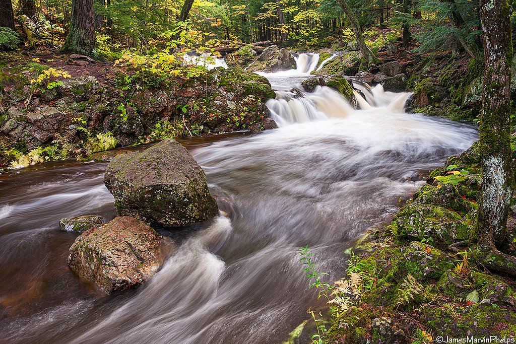
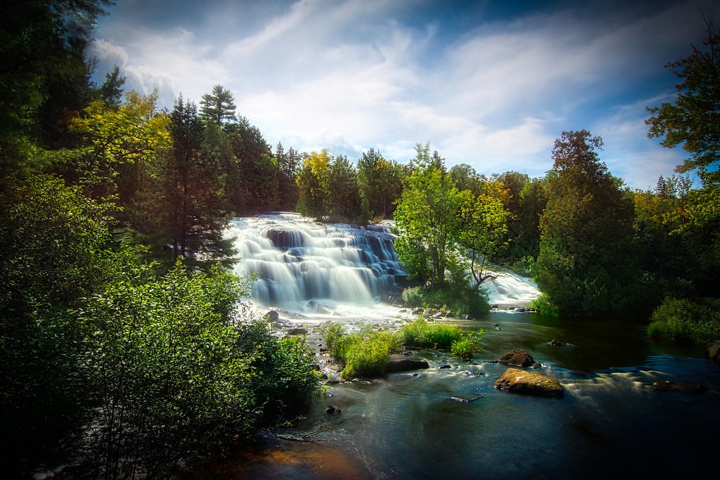
Ajibikika Falls is a quietly scenic waterfall in Michigan managed by the U.S. Forest Service and located within the Ottawa National Forest (National Forest designation). The falls are a rewarding destination for hikers looking for a peaceful woodland cascade on public USFS land; the setting feels intimate and forested rather than developed, making it a great choice for a shorter day outing. The primary route to the falls follows USFS Trail NFST-5109-F1 (Trail #T5109-F1). Expect a moderate 2.4-mile out-and-back hike with about 350 feet of elevation gain — enough climb to keep things interesting but still accessible for fit families and most day hikers. If you plan to camp, the Iron River Ranger District campground is nearby (about 9.02 km), making an overnight visit convenient for those who want to enjoy the falls in the quieter hours of morning or evening.
The Setting
Ajibikika Falls sits at 1,555 feet within Ottawa National Forest, fed by the Middle Branch Ontonagon River, in the hills of Michigan.
Trail & Hike Details
The Approach
The moderate hike follows Nfst 5109 F1 (#T5109-F1), a 2.4-mile out-and-back trail over natural surface. Expect 350 feet of elevation gain with grades of 0-5%. The trail is developed (Class 3).
USFS Trail
NFST-5109-F1 #T5109-F1
Trail Class
Developed
Surface
Avg Grade
USFS Segment
0.12 miTrail Description
The official approach uses USFS Trail NFST-5109-F1 (Trail #T5109-F1). The USFS lists this trail segment as Class 3 with a native-material surface and a typical grade of 0–5%. The full outing is a 2.4-mile out-and-back route with roughly 350 feet of elevation gain and is rated moderate in difficulty. Note that the mapped USFS segment length for NFST-5109-F1 is 0.12 miles (GIS miles), which ties into the longer trail route to the falls; expect natural tread underfoot, some modest pitches, and classic forest singletrack conditions rather than paved or hardened surfaces.
What to Expect
Dogs are welcome.
Accessibility
The trail is not wheelchair accessible. Uneven terrain and elevation changes require steady footing.
Frequently Asked Questions
🐶 Are Dogs Allowed at Ajibikika Falls?
✅ Dogs are allowed
Are There Any Fees or Permits Required?
🤑 Fee: $9.00
🏊 Is There Swimming at Ajibikika Falls?
❌ Swimming is not allowed
When to Visit
Spring and early summer are ideal for visiting Ajibikika Falls, as the water flow is typically strongest during these seasons. Fall offers beautiful foliage, while winter provides a unique view of the frozen falls.
Seasonal Access
The best time to visit is Spring, Summer, and Fall. Winter access may be limited. Check with Ottawa National Forest for seasonal road closures.
Safety Information
Be cautious near the water, as rocks can be slippery and currents strong. Stay on marked trails to avoid getting lost or encountering hazardous areas.
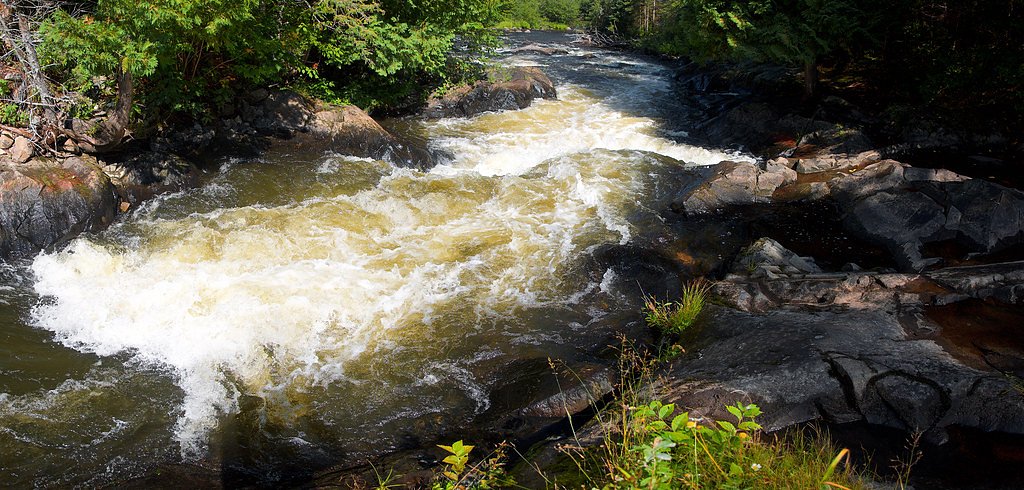
Current Water Conditions
206 ft³/s
Current discharge — how much water is flowing
Higher than usual for this time of year
Based on 78 years of record
4.86 ft
Water depth at gauge
7-Day Discharge Trend
What does this mean for your visit?
The water is flowing higher than usual for this time of year.
About This Gauge
This gauge is on a nearby waterway and may not reflect exact conditions at the falls.
7-Day Flow Outlook
Based on the USGS gauge MIDDLE BRANCH ONTONAGON RIVER NEAR PAULDING, MI (13 km away).
Today
Roaring
206 cfs
9/10Tomorrow
Roaring
210 cfs
9/10Sun
Roaring
230 cfs
6/10Mon
Roaring
250 cfs
6/10Tue
Roaring
246 cfs
6/10Wed
Roaring
244 cfs
6/10Thu
Roaring
246 cfs
6/10Best window: Today — roaring flow, partly sunny (trip score 9/10).
Best time of year: this gauge typically runs highest from late March to mid June, peaking in April.
How we calculate this
This is a transparent outlook, not a precise forecast. We take the waterfall's current flow strength (how it ranks against its historical normal for today, from the nearest USGS stream gauge), carry that ranking forward along the gauge's seasonal curve, and nudge it for forecast rain. Confidence is highest for the next day or two and falls further out. Always check official conditions and your own judgment before visiting — high flows can be dangerous.
Know when to go.
Get a free email alert when waterfalls near Watersmeet hit peak flow. We only send when conditions are worth the trip — no weekly newsletters, no spam.
Weather Forecast
Location & Access
Getting There
Ajibikika Falls is located within Porcupine Mountains Wilderness State Park, near the Presque Isle River. Visitors can access the falls by following trails within the park. The falls are situated downstream of Manido Falls and upstream of Nawadaha Falls.
Get Directions on Google MapsParking
Parking is available at the Presque Isle River parking area within the state park.
Elevation
1,555 feet above sea level
Coordinates
46.330490° N, -89.237906° W
Land Management
Managed by USFS
Visitor Tips & Gear
Wear sturdy shoes as the trail may be muddy or slippery, especially after rain. Bring insect repellent during the summer months. Consider visiting early in the morning or late in the afternoon to avoid crowds.
As an Amazon Associate, we earn from qualifying purchases.
With 2.4 miles and 350 ft of elevation gain, sturdy boots and trekking poles will help on this moderate trail. Sun exposure on the trail makes good sun protection a must in summer.

Columbia Watertight II Rain Jacket
Packs into its own pocket, seam-sealed, and keeps you dry from spray and surprise rain.

Earth Pak Waterproof Dry Bag
Keeps your phone and gear dry when waterfall mist soaks everything else.

Waterproof Phone Pouch (AiRunTech)
Cheap insurance — take photos right next to the falls without killing your phone.

Timberland Euro Sprint Mid Waterproof
Trusted waterproof boot with premium leather and grippy rubber sole — reliable on rocky, wet trails.

TrailBuddy Trekking Poles
Lightweight aluminum, cork grips, and flip-locks that actually hold — a best-seller for good reason.

Polarized Sunglasses (Knockaround)
Cuts glare off the water so you actually see the falls — and your photos turn out better too.
Where to Stay

Phelps Cabin on 26 Acres with Fire Pit!

AmericInn by Wyndham Iron River

Two Rivers Motel and Cabins of Kenton, MI

Lakeshore Motel Ice Lake
Browse vacation cabins and private rentals nearby
Unique outdoor stays — tents, yurts, and treehouses
Rent a campervan or RV for your waterfall road trip
Some links are affiliate links. We may earn a commission at no extra cost to you.
Nearby Campground
Iron River Ranger District
5.6 miles away · 0 sites
Iron River is located in Iron County, in the western portion of Michigan's Upper Peninsula, just seven miles from the Wisconsin border. The border is shared with the Nicolet National forest. The Iron River Ranger District is 138,000 acres in size. Recreation opportunities include two camping for fee campgrounds and two rustic campgrounds. Three wilderness areas are located on adjacent districts. The area's climate is truly unique for each season of the year. The weather is summarized as follows:
Book on Recreation.govAdditional Information
Nearby Attractions
Nearby attractions include Manido Falls, Nawadaha Falls, and the Lake Superior shoreline. The Porcupine Mountains Wilderness State Park also offers numerous hiking trails and scenic overlooks.
Wildlife
The area is home to a variety of wildlife, including deer, black bears, and numerous bird species. Visitors should exercise caution and follow park guidelines to avoid wildlife encounters.
Cities near Ajibikika Falls
Nearby Waterfalls

Writing about Ajibikika Falls? Embed this waterfall on your site for free.