Photo Credits (4)
Difficulty
Moderate
Trail Length
2.4 miles
Trail Type
Out And Back
Elevation Gain
350 ft
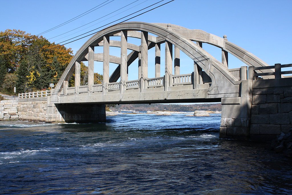
About Basin Falls
Basin Falls is a picturesque waterfall located in Maine, known for its serene surroundings and natural beauty. It is part of the Basin Preserve and offers visitors a tranquil escape into nature. The waterfall is surrounded by lush forest, making it a popular spot for hikers and nature enthusiasts.
The Setting
Basin Falls sits at 472 feet along the Little Androscoggin River, in the coastal lowlands of Maine.
Trail & Hike Details
The Approach
The moderate 2.4-mile out and back trail gains 350 feet of elevation on the way to the falls.
Trail Description
The trail to Basin Falls is relatively short and easy, making it accessible to most visitors. It winds through a forested area with gentle terrain, leading to the waterfall. The path may be uneven in some spots, so sturdy footwear is recommended.
What to Expect
Dogs are welcome.
Accessibility
The trail is not wheelchair accessible. Uneven terrain and elevation changes require steady footing.
Frequently Asked Questions
🐶 Are Dogs Allowed at Basin Falls?
✅ Dogs are allowed
Are There Any Fees or Permits Required?
🆖 No fees required
🏊 Is There Swimming at Basin Falls?
❌ Swimming is not allowed
When to Visit
Spring and early summer are the best times to visit Basin Falls, as the water flow is typically at its peak due to snowmelt and rainfall. Fall is also a great time to visit, as the surrounding foliage turns vibrant colors.
Seasonal Access
The best time to visit is Spring, Summer, and Fall. Winter access may be limited.
Safety Information
Visitors should exercise caution near the waterfall, as rocks may be slippery. Always stay on marked trails and avoid venturing too close to the edge of the falls. Be prepared for changing weather conditions.
Current Water Conditions
78 ft³/s
Current discharge — how much water is flowing
About average for this time of year
Based on 104 years of record
2.93 ft
Water depth at gauge
7-Day Discharge Trend
What does this mean for your visit?
Flow is about average for this time of year.
About This Gauge
This gauge is on a nearby waterway and may not reflect exact conditions at the falls.
7-Day Flow Outlook
Based on the USGS gauge Little Androscoggin River near South Paris, Maine (11 km away).
Today
Moderate
89 cfs
4/10Tomorrow
Moderate
95 cfs
4/10Mon
Moderate
84 cfs
8/10Tue
Moderate
77 cfs
5/10Wed
Moderate
84 cfs
4/10Thu
Moderate
78 cfs
4/10Fri
Moderate
66 cfs
5/10Best window: Mon — moderate flow, sunny (trip score 8/10).
Best time of year: this gauge typically runs highest from mid March to late May, peaking in April.
How we calculate this
This is a transparent outlook, not a precise forecast. We take the waterfall's current flow strength (how it ranks against its historical normal for today, from the nearest USGS stream gauge), carry that ranking forward along the gauge's seasonal curve, and nudge it for forecast rain. Confidence is highest for the next day or two and falls further out. Always check official conditions and your own judgment before visiting — high flows can be dangerous.
Know when to go.
Get a free email alert when waterfalls near Turner hit peak flow. We only send when conditions are worth the trip — no weekly newsletters, no spam.
Weather Forecast
Location & Access
Getting There
Basin Falls is located within the Basin Preserve in Maine. Access to the falls typically involves driving to a nearby parking area and then hiking a short trail to reach the waterfall. Specific directions may vary depending on the starting point, so it is recommended to consult a map or GPS for accurate navigation.
Get Directions on Google MapsParking
Parking is available near the trailhead, but spaces may be limited during peak seasons. Visitors are advised to arrive early to secure a spot.
Hours
Elevation
472 feet above sea level
Coordinates
44.293125° N, -70.400892° W
Visitor Tips & Gear
Arrive early to avoid crowds, especially during weekends and peak seasons. Wear sturdy shoes, as the trail may have uneven sections. Bring water and snacks, and pack out all trash to help preserve the area.
As an Amazon Associate, we earn from qualifying purchases.
With 2.4 miles and 350 ft of elevation gain, sturdy boots and trekking poles will help on this moderate trail. Sun exposure on the trail makes good sun protection a must in summer.

Polarized Sunglasses (Knockaround)
Cuts glare off the water so you actually see the falls — and your photos turn out better too.

Columbia Watertight II Rain Jacket
Packs into its own pocket, seam-sealed, and keeps you dry from spray and surprise rain.

Earth Pak Waterproof Dry Bag
Keeps your phone and gear dry when waterfall mist soaks everything else.

Waterproof Phone Pouch (AiRunTech)
Cheap insurance — take photos right next to the falls without killing your phone.

Timberland Euro Sprint Mid Waterproof
Trusted waterproof boot with premium leather and grippy rubber sole — reliable on rocky, wet trails.

TrailBuddy Trekking Poles
Lightweight aluminum, cork grips, and flip-locks that actually hold — a best-seller for good reason.
Where to Stay

Cozy Retreat with Private Backyard Oasis

Charming Home Near Ski Areas

New host! Exceptional Sunday River Ski In Ski Out Condo

Comfort Inn & Suites Wilton
Browse vacation cabins and private rentals nearby
Unique outdoor stays — tents, yurts, and treehouses
Rent a campervan or RV for your waterfall road trip
Some links are affiliate links. We may earn a commission at no extra cost to you.
Additional Information
Nearby Attractions
The Basin Preserve offers additional hiking trails and scenic spots to explore. Nearby towns may have local shops and restaurants for visitors to enjoy.
Wildlife
The area is home to a variety of wildlife, including birds, deer, and small mammals. Visitors should respect the natural habitat and avoid disturbing the animals.
Cities near Basin Falls
Nearby Waterfalls
Other waterfalls named Basin Falls
2 other waterfalls share this name across the U.S.
Writing about Basin Falls? Embed this waterfall on your site for free.