Difficulty
Moderate
Trail Length
2.4 miles
Trail Type
Out And Back
Elevation Gain
350 ft
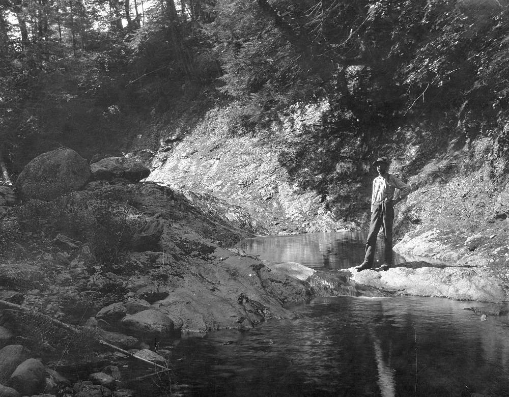
About Bisco Falls
Bisco Falls is a quiet, lesser-known cascade tucked into Maine’s forested hills, rewarding visitors with a shaded, mossy setting and the simple pleasure of falling water framed by mature woods. The falls feel intentionally tucked away — a peaceful spot for photographers, birders, or anyone looking to trade busier parks for a more solitary nature stop. Because measurements and formal signage are limited, the experience is more about the forested ambiance than a dramatic, highly developed attraction. Most hikers reach Bisco Falls via a moderate 2.4-mile out-and-back route that climbs roughly 350 feet, making it an easy half-day outing for people comfortable on uneven trails. The approach follows a natural forest tread with roots, rocks, and a few short steeper pitches, and there’s no documented USFS trail name or number or developed viewing infrastructure, so sturdy shoes and basic navigation are recommended. Note that the nearest developed campground (Hastings Campground) is roughly 36.4 km away, so plan accordingly if you hoped to camp nearby.
The Setting
Bisco Falls sits at 384 feet along the Little Androscoggin River, in the coastal lowlands of Maine.
Trail & Hike Details
The Approach
The moderate 2.4-mile out and back trail gains 350 feet of elevation on the way to the falls.
Trail Description
Trail type: out-and-back. Distance: 2.4 miles (round trip). Elevation gain: about 350 feet. Difficulty: moderate. Surface: natural forest tread with exposed roots, rocks, and occasional muddy sections. Grade/class: generally moderate with several short, steeper pitches; non-technical hiking (no scrambling or climbing required). Trail infrastructure: minimal — no documented USFS trail name/number, boardwalks, or railings; expect an unimproved trail and come prepared with appropriate footwear, water, and basic navigation tools.
What to Expect
Visitors can expect a tranquil natural setting with a cascading waterfall surrounded by dense forest. The area may be less crowded due to its relative obscurity.
Accessibility
The trail is not wheelchair accessible. Uneven terrain and elevation changes require steady footing.
Frequently Asked Questions
🐶 Are Dogs Allowed at Bisco Falls?
❌ Dogs are not allowed
Are There Any Fees or Permits Required?
🆖 No fees required
🏊 Is There Swimming at Bisco Falls?
❌ Swimming is not allowed
When to Visit
Spring and early summer are ideal for visiting, as the water flow is typically stronger during these seasons.
Seasonal Access
The best time to visit is Spring, Summer, and Fall. Winter access may be limited.
Safety Information
Be cautious of slippery rocks near the falls. Cell service may be limited in the area, so plan accordingly.
Current Water Conditions
73 ft³/s
Current discharge — how much water is flowing
About average for this time of year
Based on 104 years of record
2.89 ft
Water depth at gauge
7-Day Discharge Trend
What does this mean for your visit?
Flow is about average for this time of year.
About This Gauge
7-Day Flow Outlook
Based on the USGS gauge Little Androscoggin River near South Paris, Maine (2 km away).
Today
Low
77 cfs
3/10Tomorrow
Moderate
80 cfs
4/10Sun
Moderate
80 cfs
4/10Mon
Low
71 cfs
6/10Tue
Low
65 cfs
4/10Wed
Moderate
71 cfs
4/10Thu
Moderate
66 cfs
4/10Best window: Mon — low flow, sunny (trip score 6/10).
Best time of year: this gauge typically runs highest from mid March to late May, peaking in April.
How we calculate this
This is a transparent outlook, not a precise forecast. We take the waterfall's current flow strength (how it ranks against its historical normal for today, from the nearest USGS stream gauge), carry that ranking forward along the gauge's seasonal curve, and nudge it for forecast rain. Confidence is highest for the next day or two and falls further out. Always check official conditions and your own judgment before visiting — high flows can be dangerous.
Know when to go.
Get a free email alert when waterfalls near South Paris hit peak flow. We only send when conditions are worth the trip — no weekly newsletters, no spam.
Weather Forecast
Location & Access
Getting There
The exact location of Bisco Falls is not widely publicized. Visitors may need to consult local resources or hiking guides for precise directions. It is likely accessed via a forest trail.
Get Directions on Google MapsParking
Parking availability is unclear. Visitors should prepare for limited or roadside parking near the trailhead.
Hours
Elevation
384 feet above sea level
Coordinates
44.285069° N, -70.536172° W
Visitor Tips & Gear
Bring a map or GPS device as the trail may not be well-marked. Wear sturdy footwear and be prepared for potentially muddy or uneven terrain.
As an Amazon Associate, we earn from qualifying purchases.
With 2.4 miles and 350 ft of elevation gain, sturdy boots and trekking poles will help on this moderate trail. Sun exposure on the trail makes good sun protection a must in summer.

Columbia Watertight II Rain Jacket
Packs into its own pocket, seam-sealed, and keeps you dry from spray and surprise rain.

Earth Pak Waterproof Dry Bag
Keeps your phone and gear dry when waterfall mist soaks everything else.

Waterproof Phone Pouch (AiRunTech)
Cheap insurance — take photos right next to the falls without killing your phone.

Timberland Euro Sprint Mid Waterproof
Trusted waterproof boot with premium leather and grippy rubber sole — reliable on rocky, wet trails.

TrailBuddy Trekking Poles
Lightweight aluminum, cork grips, and flip-locks that actually hold — a best-seller for good reason.

Polarized Sunglasses (Knockaround)
Cuts glare off the water so you actually see the falls — and your photos turn out better too.
Where to Stay

Charming Home Near Ski Areas

Cozy Retreat with Private Backyard Oasis

New host! Exceptional Sunday River Ski In Ski Out Condo

Comfort Inn & Suites Wilton
Browse vacation cabins and private rentals nearby
Unique outdoor stays — tents, yurts, and treehouses
Rent a campervan or RV for your waterfall road trip
Some links are affiliate links. We may earn a commission at no extra cost to you.
Nearby Campground
HASTINGS CAMPGROUND
22.6 miles away · 25 sites
Overview Hastings Campground is located on Route 113 near the shore of Evans Brook in western Maine. It is situated in a rustic and remote part of White Mountain National Forest, not far from the towns of Gilead Me and Gorham, New Hampshire. Activities include fishing, hiking and mountain biking. The White Mountains boast pristine forests, clear mountain streams and rivers and the tallest peaks in the Northeast. The forest encompasses nearly 800,000 acres in New Hampshire and western Maine, and i
Book on Recreation.govAdditional Information
Nearby Attractions
Other natural attractions in Maine, such as Acadia National Park, may be worth exploring.
Wildlife
The area may host typical Maine wildlife, including birds, deer, and small mammals.
Cities near Bisco Falls
Nearby Waterfalls
Writing about Bisco Falls? Embed this waterfall on your site for free.