Photo Credits (5)
Difficulty
Moderate
Trail Length
2.4 miles
Trail Type
Out And Back
Elevation Gain
350 ft
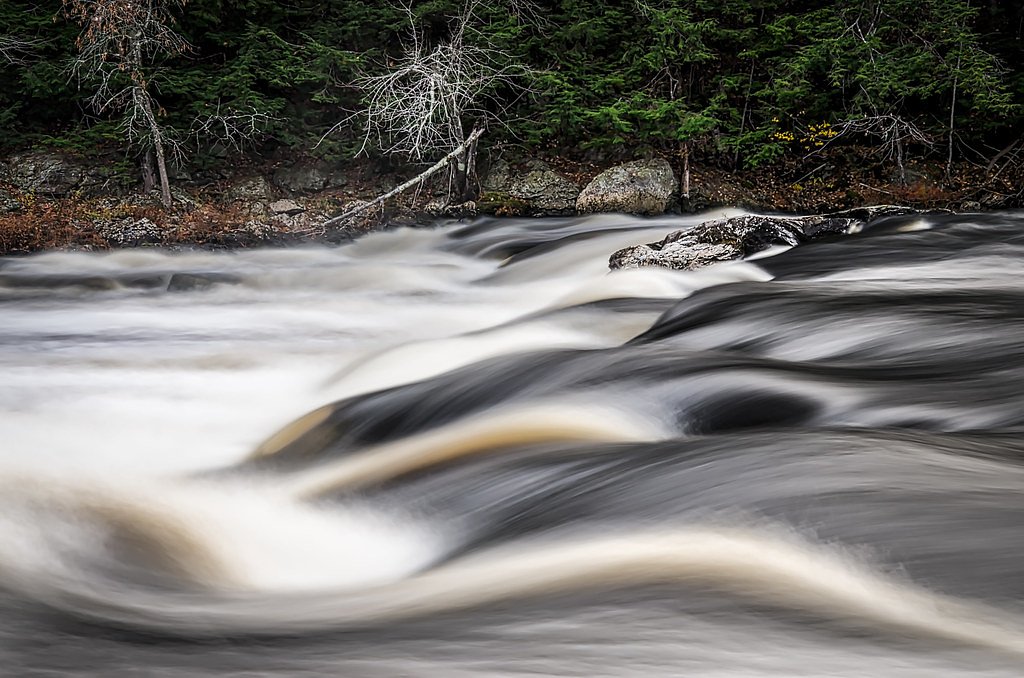
About Steep Falls
Steep Falls sits on the Presumpscot River in Standish, Maine, and packs a lot of scenic charm into a compact riverside setting. The cascade is beloved by locals for its tranquil pools and photo-ready rock ledges, making it an easy stop for anyone exploring the region’s waterways. Visitors often combine a brief riverside stroll with time on the rocks to soak up the sound of falling water and the surrounding forested backdrop. For those wanting a bit more of a hike, Steep Falls is also the highlight of a 2.4-mile out-and-back route that gains about 350 feet and is rated moderate. That trail offers a more immersive woodland approach to the river and is a nice option for hikers who want a short, satisfying outing rather than just the quick roadside view.
The Setting
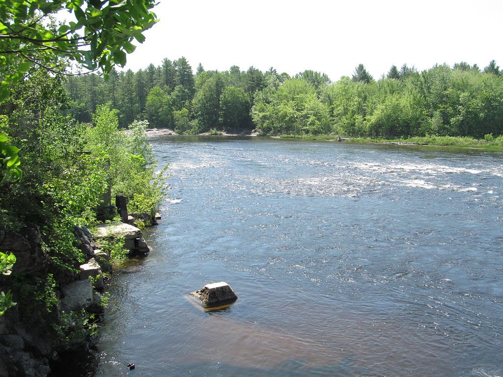
Steep Falls sits at 381 feet along the Little Androscoggin River, in the coastal lowlands of Maine.
Trail & Hike Details
The Approach
The moderate 2.4-mile out-and-back trail gains 350 feet of elevation on the way to the falls.
Trail Description
Two common approaches: a short, informal riverside access from a nearby parking spot for minimal walking, or a designated 2.4-mile out-and-back hike (moderate difficulty) that climbs roughly 350 feet. The out-and-back route provides a steadier, more forested approach to the falls and is well suited to hikers looking for a brief but rewarding trek; expect mixed natural tread and some steeper sections given the elevation gain. No formal USFS trail number or surface data is provided for this site.
What to Expect
Dogs are welcome.
Accessibility
The trail is not wheelchair accessible. Uneven terrain and elevation changes require steady footing.
Frequently Asked Questions
🐶 Are Dogs Allowed at Steep Falls?
✅ Dogs are allowed
Are There Any Fees or Permits Required?
🆖 No fees required
🏊 Is There Swimming at Steep Falls?
❌ Swimming is not allowed
When to Visit
Spring and early summer are the best times to visit, as the water flow is typically strongest during these seasons.
Seasonal Access
The best time to visit is Spring, Summer, and Fall. Winter access may be limited.
Safety Information
Exercise caution near the water, as rocks can be slippery and currents may be strong. Keep children and pets supervised at all times.
Current Water Conditions
62 ft³/s
Current discharge — how much water is flowing
About average for this time of year
Based on 104 years of record
2.79 ft
Water depth at gauge
7-Day Discharge Trend
What does this mean for your visit?
Flow is about average for this time of year.
About This Gauge
This gauge is on a nearby waterway and may not reflect exact conditions at the falls.
7-Day Flow Outlook
Based on the USGS gauge Little Androscoggin River near South Paris, Maine (11 km away).
Today
Low
71 cfs
3/10Tomorrow
Barely Flowing
65 cfs
4/10Sun
Low
69 cfs
3/10Mon
Barely Flowing
65 cfs
5/10Tue
Barely Flowing
59 cfs
3/10Wed
Low
62 cfs
4/10Thu
Low
59 cfs
3/10Best window: Mon — barely flowing flow, mostly sunny (trip score 5/10).
Best time of year: this gauge typically runs highest from mid March to late May, peaking in April.
How we calculate this
This is a transparent outlook, not a precise forecast. We take the waterfall's current flow strength (how it ranks against its historical normal for today, from the nearest USGS stream gauge), carry that ranking forward along the gauge's seasonal curve, and nudge it for forecast rain. Confidence is highest for the next day or two and falls further out. Always check official conditions and your own judgment before visiting — high flows can be dangerous.
Know when to go.
Get a free email alert when waterfalls near South Paris hit peak flow. We only send when conditions are worth the trip — no weekly newsletters, no spam.
Weather Forecast
Location & Access
Getting There
Steep Falls is located near the village of Steep Falls in Standish, Maine. It can be accessed via Route 113, with parking available nearby.
Get Directions on Google MapsParking
There is a small parking area near the falls, but availability may be limited during peak times.
Elevation
381 feet above sea level
Coordinates
44.207014° N, -70.532004° W
Visitor Tips & Gear
Visit during the spring or after heavy rains for the best water flow. Be cautious on wet or slippery rocks near the falls.
As an Amazon Associate, we earn from qualifying purchases.
With 2.4 miles and 350 ft of elevation gain, sturdy boots and trekking poles will help on this moderate trail. Sun exposure on the trail makes good sun protection a must in summer.

Polarized Sunglasses (Knockaround)
Cuts glare off the water so you actually see the falls — and your photos turn out better too.

Columbia Watertight II Rain Jacket
Packs into its own pocket, seam-sealed, and keeps you dry from spray and surprise rain.

Earth Pak Waterproof Dry Bag
Keeps your phone and gear dry when waterfall mist soaks everything else.

Waterproof Phone Pouch (AiRunTech)
Cheap insurance — take photos right next to the falls without killing your phone.

Timberland Euro Sprint Mid Waterproof
Trusted waterproof boot with premium leather and grippy rubber sole — reliable on rocky, wet trails.

TrailBuddy Trekking Poles
Lightweight aluminum, cork grips, and flip-locks that actually hold — a best-seller for good reason.
Where to Stay

Oxford Casino Hotel

Noble House Inn

Hampton Inn by Hilton Oxford, ME

Quality Inn & Suites Auburn I-95
Browse vacation cabins and private rentals nearby
Unique outdoor stays — tents, yurts, and treehouses
Rent a campervan or RV for your waterfall road trip
Some links are affiliate links. We may earn a commission at no extra cost to you.
Nearby Campground
COLD RIVER
24.2 miles away · 14 sites
Overview Cold River Campground is located in a rustic, remote part of White Mountain National Forest in New Hampshire, about 15 miles north of Fryeburg, Maine. It is a small facility with access to hiking and mountain biking trails and proximity to a small pond for fishing and canoeing. The White Mountains boast pristine forests, clear mountain streams and rivers and the tallest peaks in the Northeast. The forest encompasses nearly 800,000 acres in New Hampshire and western Maine, and is one of t
Book on Recreation.govAdditional Information
Nearby Attractions
Sebago Lake is located nearby and offers additional recreational opportunities such as boating, fishing, and swimming.
Wildlife
The area around Steep Falls may feature common Maine wildlife such as birds, squirrels, and deer.
Cities near Steep Falls
Nearby Waterfalls
Writing about Steep Falls? Embed this waterfall on your site for free.