Angel Falls
Maine • 90 ft
By Armen Suny · Last verified Mar 2026

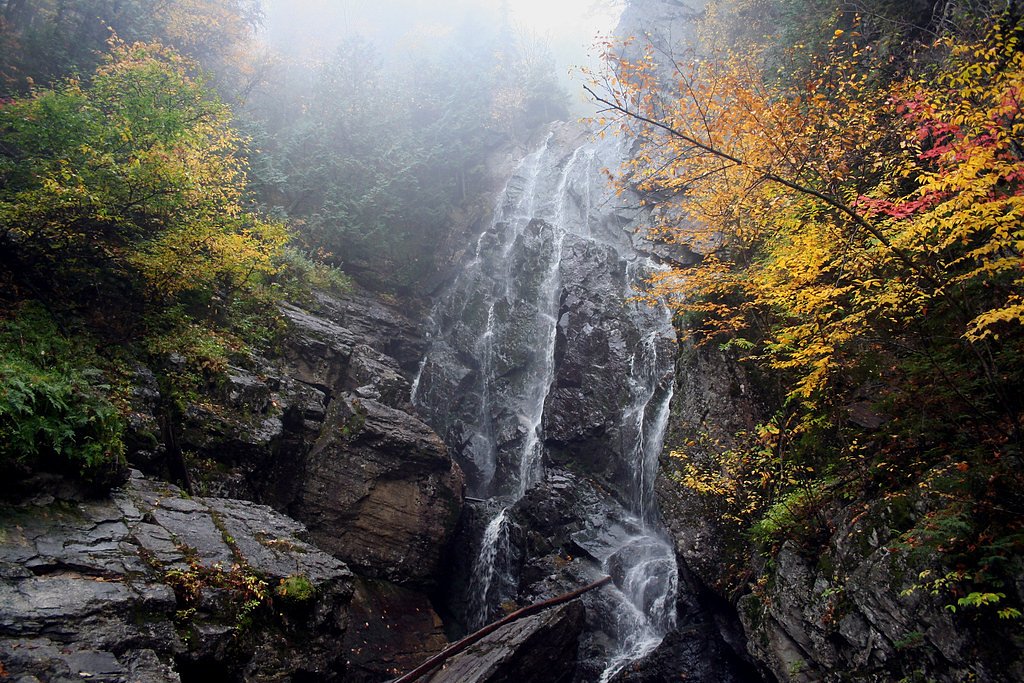
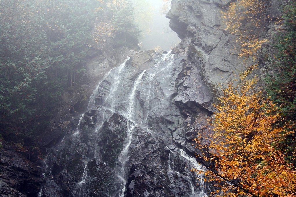
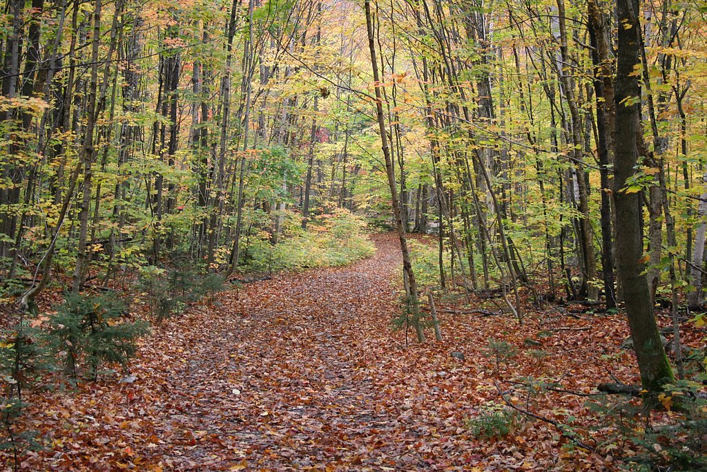
Photo Credits (5)
Difficulty
Easy
Trail Length
1.8 miles
Trail Type
Out And Back
Elevation Gain
200 ft
About Angel Falls
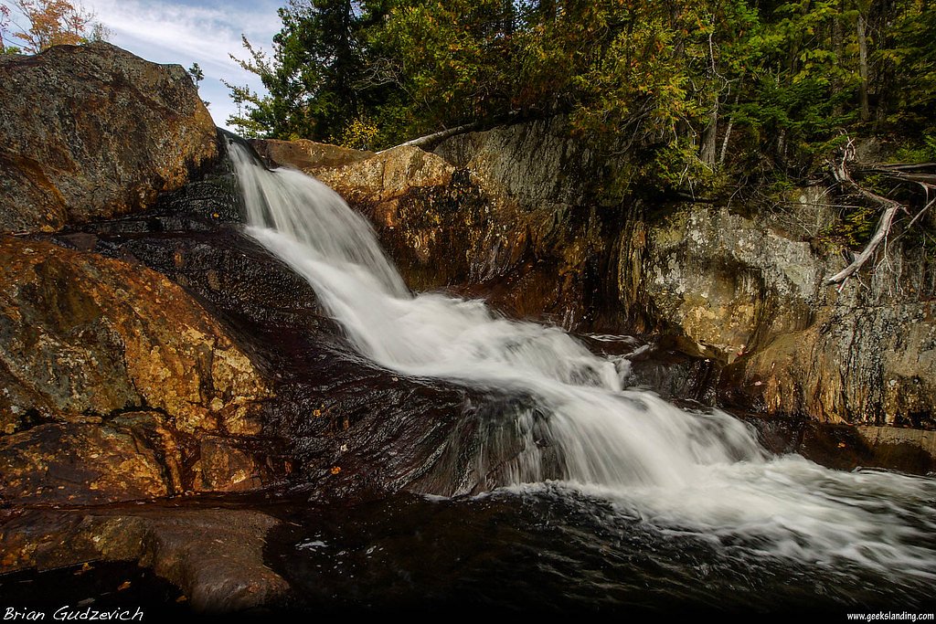
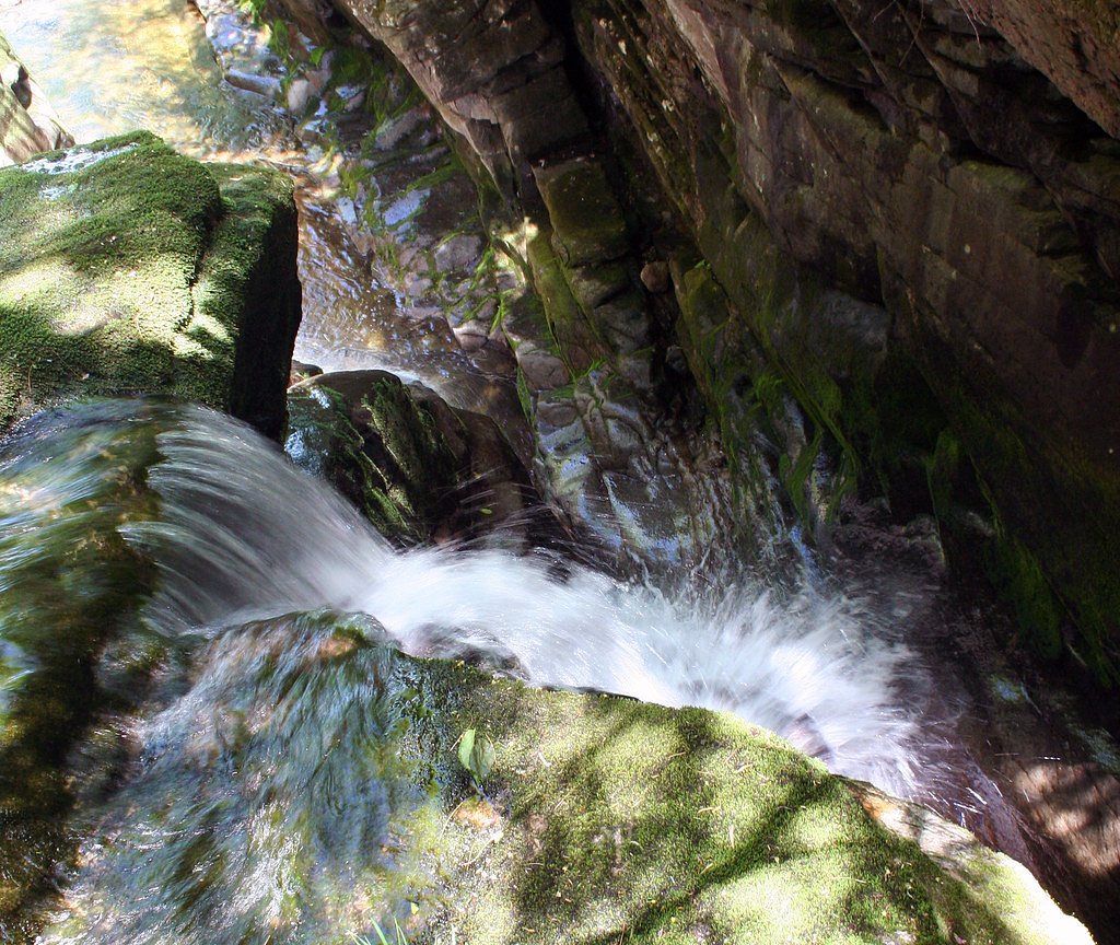
Angel Falls is one of Maine's most picturesque waterfalls, known for its dramatic 90-foot drop and unique setting in a forested area. It is often considered one of the most beautiful waterfalls in the state.
The Setting
Angel Falls sits at 1,555 feet along the Swift River, in the hills of Maine. The falls drop 90 feet.
Height: 90 feet
Trail & Hike Details
The Approach
The easy 1.8-mile out-and-back trail gains 200 feet of elevation on the way to the falls.
Trail Description
The trail to Angel Falls is a relatively short and easy hike through a forested area. It involves crossing a few small streams, so waterproof footwear is recommended. The trail is well-marked and suitable for most visitors.
What to Expect
The falls cascade 90 feet. Dogs are welcome.
Accessibility
The trail is not wheelchair accessible. Uneven terrain and elevation changes require steady footing.
Frequently Asked Questions
🐶 Are Dogs Allowed at Angel Falls?
✅ Dogs are allowed
Are There Any Fees or Permits Required?
🆖 No fees required
🏊 Is There Swimming at Angel Falls?
❌ Swimming is not allowed
When to Visit
The best time to visit Angel Falls is in late spring or early summer when water flow is at its peak. Fall is also a popular time due to the vibrant foliage.
Seasonal Access
The best time to visit is Spring, Summer, and Fall. Winter access may be limited.
Safety Information
Exercise caution when crossing streams, especially after heavy rain. The rocks near the falls can be slippery, so proper footwear is essential.
Current Water Conditions
141 ft³/s
Current discharge — how much water is flowing
About average for this time of year
Based on 97 years of record
1.99 ft
Water depth at gauge
7-Day Discharge Trend
What does this mean for your visit?
Flow is about average for this time of year.
About This Gauge
This gauge is on a nearby waterway and may not reflect exact conditions at the falls.
7-Day Flow Outlook
Based on the USGS gauge Swift River near Roxbury, Maine (18 km away).
Today
Low
152 cfs
4/10Tomorrow
Low
152 cfs
5/10Sun
Moderate
159 cfs
4/10Mon
Low
133 cfs
6/10Tue
Low
134 cfs
4/10Wed
Moderate
132 cfs
5/10Thu
Moderate
126 cfs
5/10Best window: Mon — low flow, mostly sunny (trip score 6/10).
Best time of year: this gauge typically runs highest from late March to early June, peaking in May.
How we calculate this
This is a transparent outlook, not a precise forecast. We take the waterfall's current flow strength (how it ranks against its historical normal for today, from the nearest USGS stream gauge), carry that ranking forward along the gauge's seasonal curve, and nudge it for forecast rain. Confidence is highest for the next day or two and falls further out. Always check official conditions and your own judgment before visiting — high flows can be dangerous.
Know when to go.
Get a free email alert when waterfalls near Rangeley hit peak flow. We only send when conditions are worth the trip — no weekly newsletters, no spam.
Weather Forecast
Location & Access
Getting There
Angel Falls is located near the town of Byron, Maine. To reach the trailhead, take Route 17 and follow signs for the Bemis Road. The trailhead is accessible via a dirt road, which may be rough in certain conditions.
Get Directions on Google MapsParking
There is a small parking area near the trailhead, but space may be limited during peak seasons.
Elevation
1,555 feet above sea level
Coordinates
44.783113° N, -70.710070° W
Visitor Tips & Gear
Visit early in the day to avoid crowds, especially during peak foliage season in the fall. Bring bug spray during the summer months, as mosquitoes can be prevalent.
As an Amazon Associate, we earn from qualifying purchases.
This easy 1.8 miles hike is straightforward — comfortable trail shoes and plenty of water should do. Sun exposure on the trail makes good sun protection a must in summer.

Polarized Sunglasses (Knockaround)
Cuts glare off the water so you actually see the falls — and your photos turn out better too.

Columbia Watertight II Rain Jacket
Packs into its own pocket, seam-sealed, and keeps you dry from spray and surprise rain.

Earth Pak Waterproof Dry Bag
Keeps your phone and gear dry when waterfall mist soaks everything else.

Waterproof Phone Pouch (AiRunTech)
Cheap insurance — take photos right next to the falls without killing your phone.

JOBY GorillaPod Starter Kit
Wraps around railings and rocks for long-exposure waterfall shots — no flat surface needed.

Osprey Daylite Daypack
Light, organized, and just the right size for a day hike — fits water, snacks, and layers.
Where to Stay

Rangeley Town & Lake

Rangeley Saddleback Inn

Rangeley Lake Resort a Ramada by Wyndham

Deer Mountain Lodge & Wilderness Resort
Browse vacation cabins and private rentals nearby
Unique outdoor stays — tents, yurts, and treehouses
Rent a campervan or RV for your waterfall road trip
Some links are affiliate links. We may earn a commission at no extra cost to you.
Additional Information
Nearby Attractions
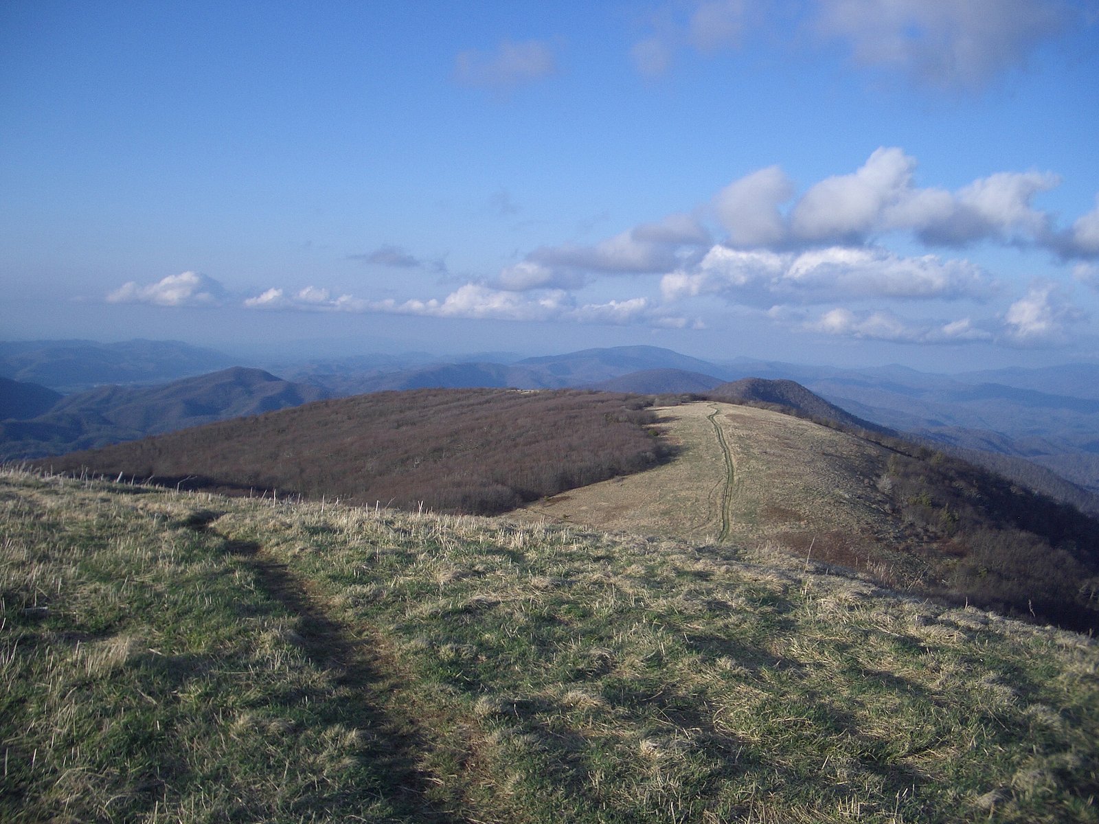
Coos Canyon, Rangeley Lakes, and the Appalachian Trail are nearby attractions worth exploring.
Wildlife
The area is home to a variety of wildlife, including birds, deer, and small mammals. Moose sightings are also possible.
Cities near Angel Falls
Nearby Waterfalls
Other waterfalls named Angel Falls
3 other waterfalls share this name across the U.S.
Writing about Angel Falls? Embed this waterfall on your site for free.