Photo Credits (5)
Difficulty
Drive Up
Trail Length
0.1 miles
Trail Type
Out And Back
Elevation Gain
50 ft
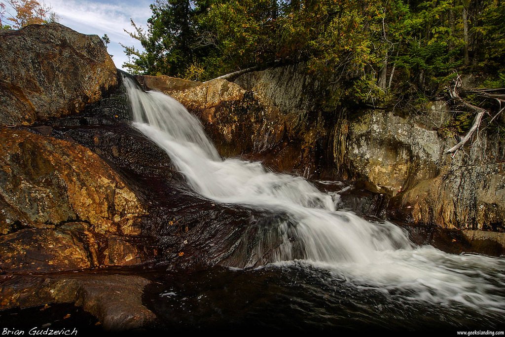
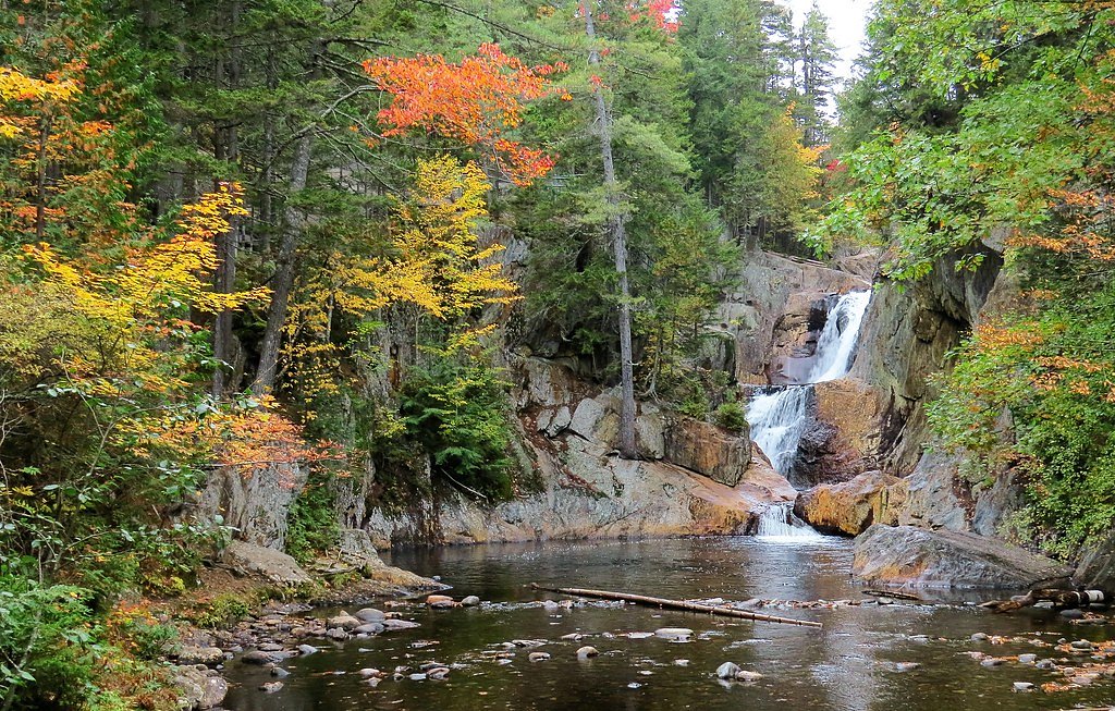
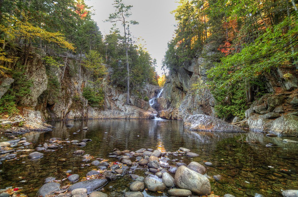
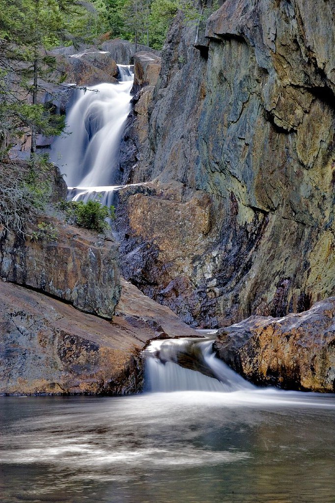
About Smalls Falls
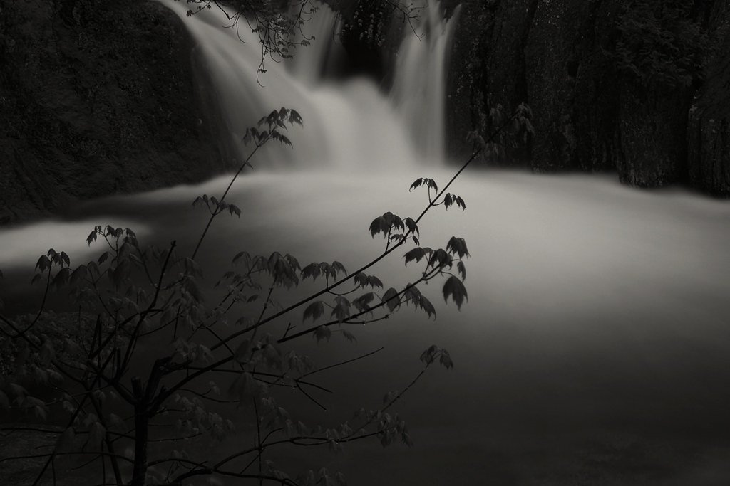
Smalls Falls is a picturesque series of waterfalls located in western Maine, near the town of Rangeley. The falls cascade through a gorge, with multiple tiers and pools surrounded by lush forest. It is a popular spot for picnicking, photography, and enjoying the natural beauty of the area.
The Setting
Smalls Falls sits at 1,115 feet within Smalls Falls, fed by the Sandy River, in the foothills of Maine.
Trail & Hike Details
The Approach
No hiking required. Smalls Falls is accessible by vehicle with a roadside viewing area.
Trail Description
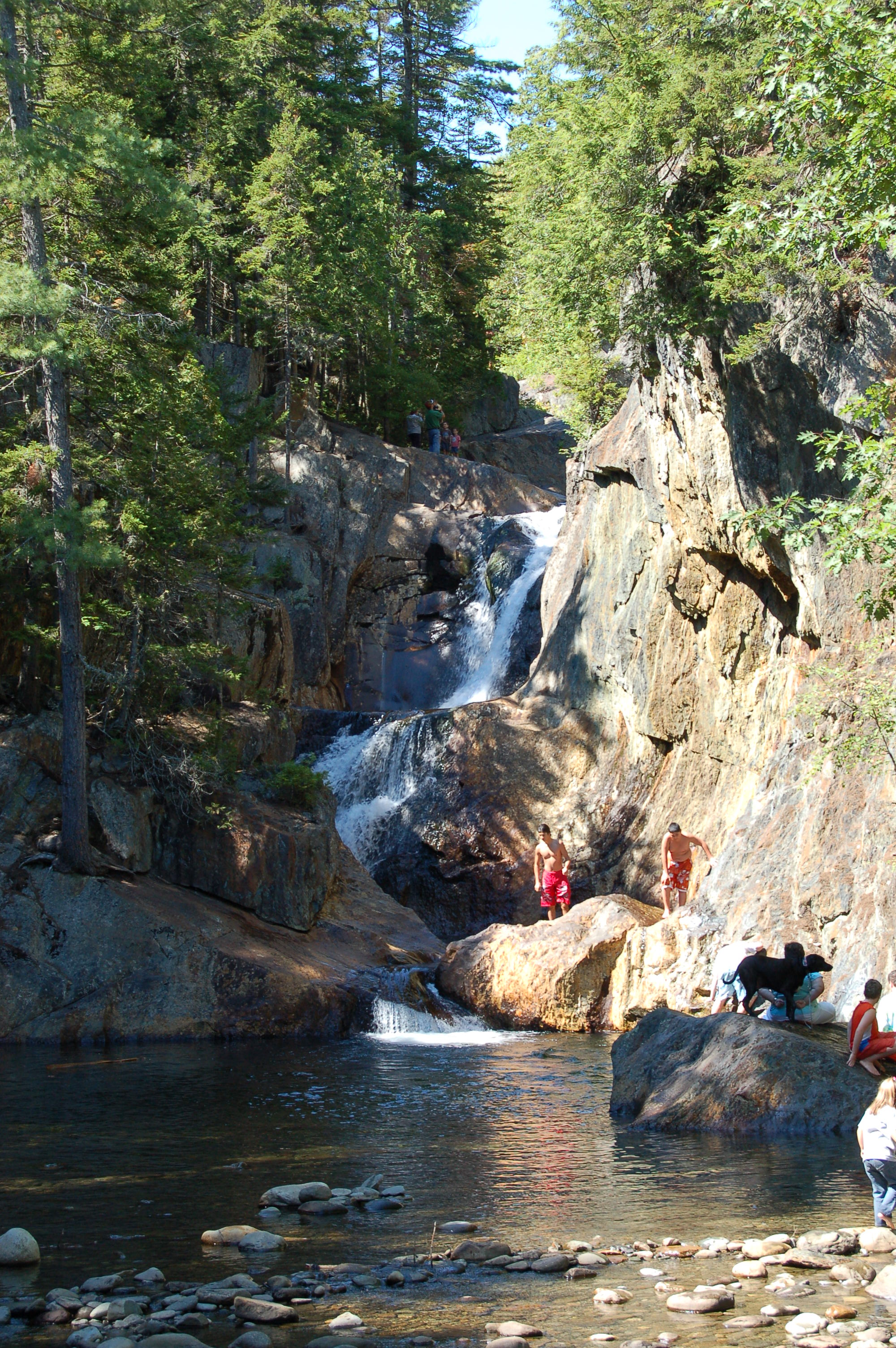
The trail to Smalls Falls is very short and easy, leading directly from the parking area to the base of the falls. There are additional paths that allow visitors to explore the upper tiers of the falls, but these may involve uneven terrain and should be approached with caution.
What to Expect
Swimming is permitted. Dogs are welcome.
Accessibility
This waterfall is viewable from a vehicle-accessible area. No hiking is required.
Frequently Asked Questions
🐶 Are Dogs Allowed at Smalls Falls?
✅ Dogs are allowed
Are There Any Fees or Permits Required?
🆖 No fees required
🏊 Is There Swimming at Smalls Falls?
✅ Swimming is allowed
When to Visit
The best time to visit is during late spring through early fall when the weather is pleasant, and the water flow is strong. Fall offers stunning foliage views, while summer is ideal for picnicking and wading in the pools.
Seasonal Access
The best time to visit is Spring, Summer, and Fall. Winter access may be limited.
Safety Information
Rocks around the falls can be slippery, especially when wet. Exercise caution when exploring the upper tiers. During winter, trails may be icy or snow-covered, requiring appropriate footwear.
Current Water Conditions
66 ft³/s
Current discharge — how much water is flowing
About average for this time of year
Based on 16 years of record
5.50 ft
Water depth at gauge
7-Day Discharge Trend
What does this mean for your visit?
Flow is about average for this time of year.
About This Gauge
7-Day Flow Outlook
Based on the USGS gauge Sandy River near Madrid, Maine (2 km away).
Today
Moderate
73 cfs
4/10Tomorrow
Moderate
109 cfs
6/10Mon
Moderate
80 cfs
8/10Tue
Moderate
105 cfs
4/10Wed
Moderate
95 cfs
5/10Thu
Moderate
79 cfs
6/10Fri
Moderate
77 cfs
5/10Best window: Mon — moderate flow, sunny (trip score 8/10).
Best time of year: this gauge typically runs highest from late March to late May, peaking in April.
How we calculate this
This is a transparent outlook, not a precise forecast. We take the waterfall's current flow strength (how it ranks against its historical normal for today, from the nearest USGS stream gauge), carry that ranking forward along the gauge's seasonal curve, and nudge it for forecast rain. Confidence is highest for the next day or two and falls further out. Always check official conditions and your own judgment before visiting — high flows can be dangerous.
Know when to go.
Get a free email alert when waterfalls near Rangeley hit peak flow. We only send when conditions are worth the trip — no weekly newsletters, no spam.
Weather Forecast
Location & Access
Getting There
Smalls Falls is located off Route 4, about 12 miles south of Rangeley, Maine. There is a well-marked parking area near the falls.
Get Directions on Google MapsParking
There is a designated parking lot near the falls, which is free to use. It is easily accessible from Route 4.
Elevation
1,115 feet above sea level
Coordinates
44.858946° N, -70.516734° W
Land Management
Managed by UNK
Visitor Tips & Gear
Arrive early during summer weekends to secure parking, as the area can get busy. Wear sturdy shoes if you plan to explore the upper tiers of the falls. Bring bug spray during warmer months.
As an Amazon Associate, we earn from qualifying purchases.
For this easy 0.1 miles trail, lightweight trail shoes and a water bottle are usually sufficient. Sun exposure on the trail makes good sun protection a must in summer.

Polarized Sunglasses (Knockaround)
Cuts glare off the water so you actually see the falls — and your photos turn out better too.

Columbia Watertight II Rain Jacket
Packs into its own pocket, seam-sealed, and keeps you dry from spray and surprise rain.

Earth Pak Waterproof Dry Bag
Keeps your phone and gear dry when waterfall mist soaks everything else.

Waterproof Phone Pouch (AiRunTech)
Cheap insurance — take photos right next to the falls without killing your phone.

JOBY GorillaPod Starter Kit
Wraps around railings and rocks for long-exposure waterfall shots — no flat surface needed.

OR Sombriolet Sun Hat
UPF 50+ sun protection with vents so your head doesn't cook on exposed trail sections.
Where to Stay

Rangeley Saddleback Inn

Rangeley Lake Resort a Ramada by Wyndham

Rangeley Town & Lake

Mountain-View Maine Cabin: Ski, Hike & Bike!
Browse vacation cabins and private rentals nearby
Unique outdoor stays — tents, yurts, and treehouses
Rent a campervan or RV for your waterfall road trip
Some links are affiliate links. We may earn a commission at no extra cost to you.
Additional Information
Nearby Attractions
Rangeley Lake, Height of Land scenic overlook, and Coos Canyon are nearby attractions worth visiting.
Wildlife
The area is home to various bird species, small mammals, and occasionally deer. Be cautious of insects like mosquitoes and black flies during warmer months.
Cities near Smalls Falls
Nearby Waterfalls

Writing about Smalls Falls? Embed this waterfall on your site for free.