
Photo Credits (4)
Difficulty
Moderate
Trail Length
2.4 miles
Trail Type
Out And Back
Elevation Gain
350 ft
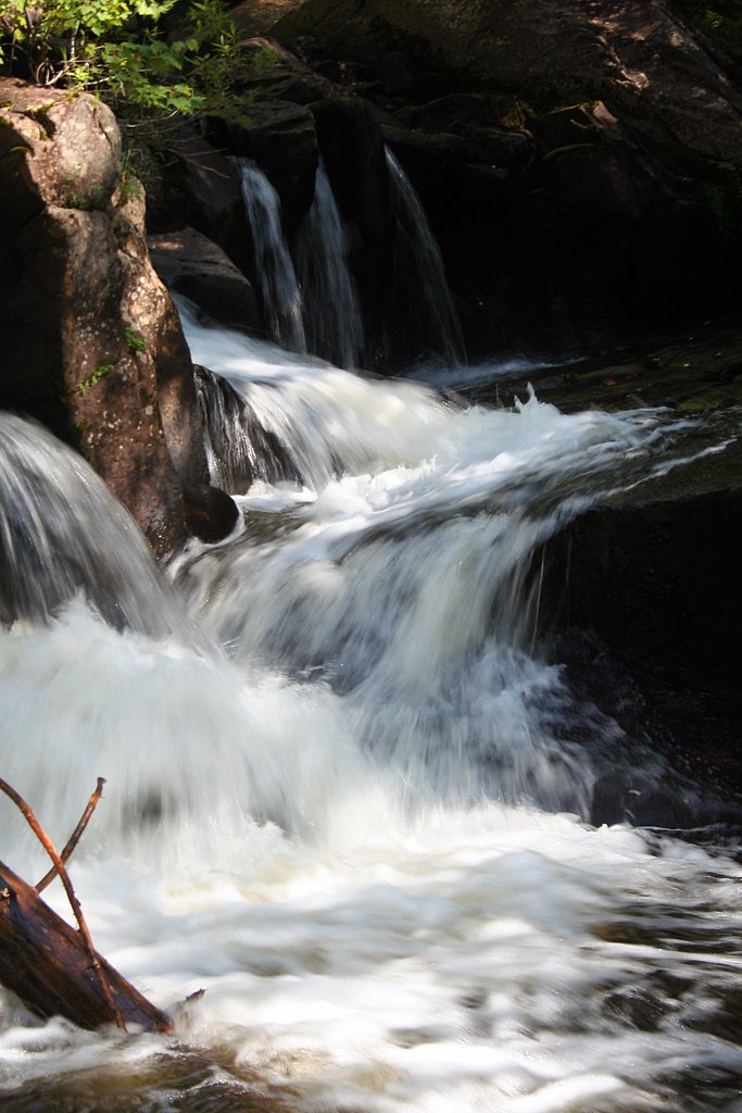
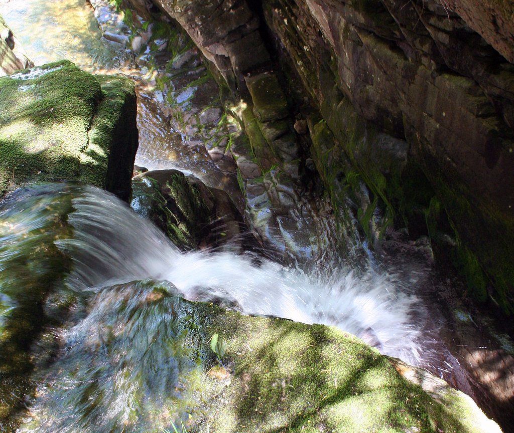
About Ellis Falls
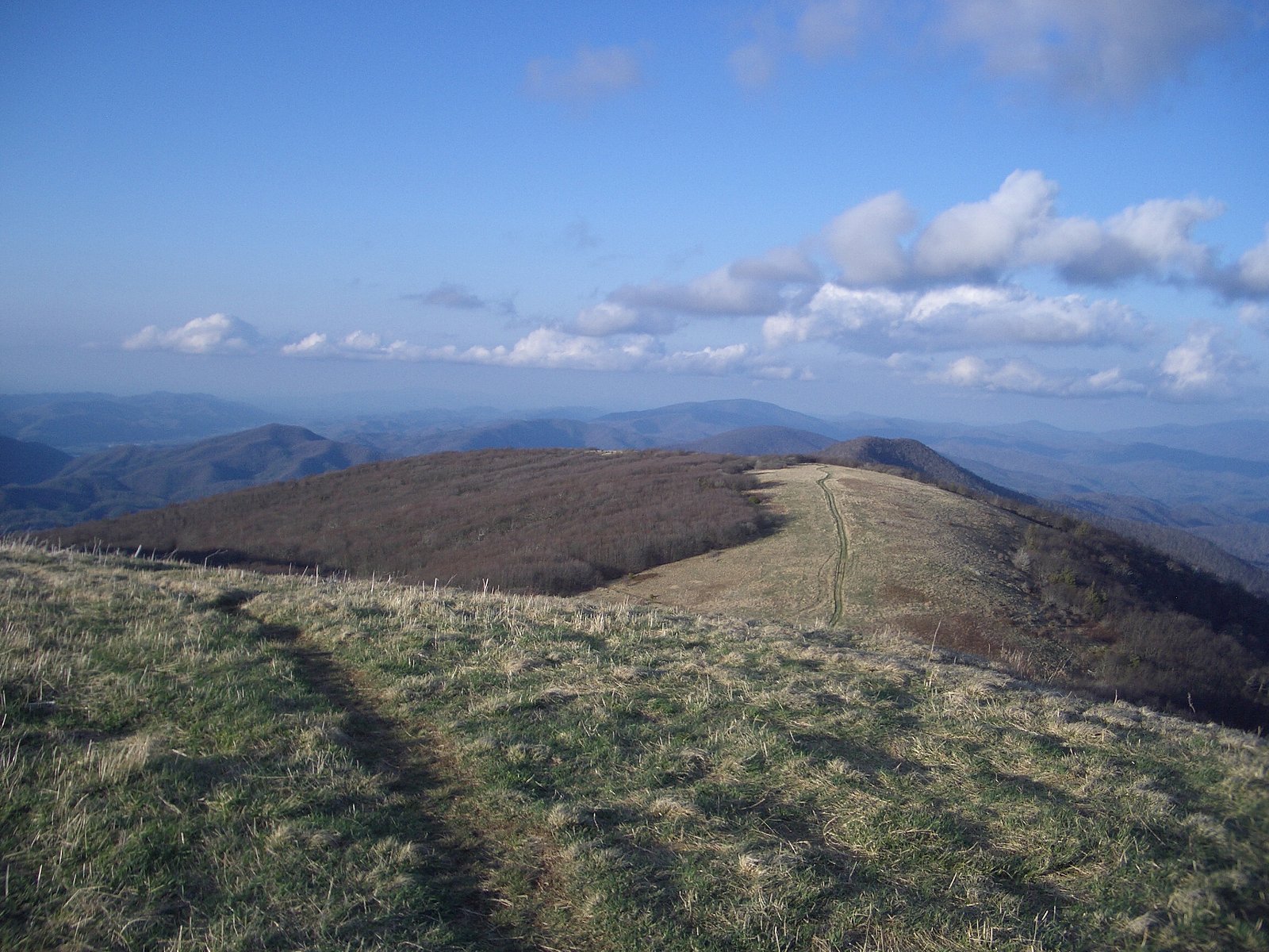
Ellis Falls sits just outside the village of Andover, Maine, offering a charming series of cascading drops framed by mature forest. The falls make for a peaceful destination year-round—photographers and day-hikers often come for the layered rock ledges and the quiet woodland setting that surrounds the stream. Reaching the main viewing area involves a moderate out-and-back hike: the trail is listed at 2.4 miles with about 350 feet of elevation gain. The route winds through typical Maine forest and rewards hikers with a scenic waterfall viewpoint, so bring sturdy shoes and allow time to enjoy the cascades and nearby woods.
The Setting
Ellis Falls sits at 755 feet along the Ellis River, in the foothills of Maine.
Nearby Falls Worth Visiting
Rumford Falls, the tallest waterfall in Maine at 176 feet, lies 10.7 miles to the southeast. Also nearby: Angel Falls (90 ft, 9.6 mi).
Trail & Hike Details
The Approach
The moderate 2.4-mile out-and-back trail gains 350 feet of elevation on the way to the falls.
Trail Description
Out-and-back trail, 2.4 miles total with approximately 350 feet of elevation gain; rated moderate. Trail surface and official USFS trail class/grade data are not provided in the available information. Expect a moderate hike through forest to reach the falls' primary viewing spot.
What to Expect
Dogs are welcome.
Accessibility
The trail is not wheelchair accessible. Uneven terrain and elevation changes require steady footing.
Frequently Asked Questions
🐶 Are Dogs Allowed at Ellis Falls?
✅ Dogs are allowed
Are There Any Fees or Permits Required?
🆖 No fees required
🏊 Is There Swimming at Ellis Falls?
❌ Swimming is not allowed
When to Visit
Spring and early summer are the best times to visit, as the water flow is typically strongest during these seasons.
Seasonal Access
The best time to visit is Spring, Summer, and Fall. Winter access may be limited.
Safety Information
The rocks around the falls can be slippery, especially after rain. Exercise caution and supervise children closely.
Current Water Conditions
240 ft³/s
Current discharge — how much water is flowing
About average for this time of year
Based on 45 years of record
6.48 ft
Water depth at gauge
7-Day Discharge Trend
What does this mean for your visit?
Flow is about average for this time of year.
About This Gauge
7-Day Flow Outlook
Based on the USGS gauge Ellis River at South Andover, Maine (6 km away).
Today
Barely Flowing
259 cfs
3/10Tomorrow
Low
267 cfs
4/10Sun
Low
255 cfs
3/10Mon
Barely Flowing
231 cfs
5/10Tue
Low
259 cfs
3/10Wed
Low
255 cfs
4/10Thu
Low
242 cfs
3/10Best window: Mon — barely flowing flow, mostly sunny (trip score 5/10).
Best time of year: this gauge typically runs highest from late March to early June, peaking in April.
How we calculate this
This is a transparent outlook, not a precise forecast. We take the waterfall's current flow strength (how it ranks against its historical normal for today, from the nearest USGS stream gauge), carry that ranking forward along the gauge's seasonal curve, and nudge it for forecast rain. Confidence is highest for the next day or two and falls further out. Always check official conditions and your own judgment before visiting — high flows can be dangerous.
Know when to go.
Get a free email alert when waterfalls near Bethel hit peak flow. We only send when conditions are worth the trip — no weekly newsletters, no spam.
Weather Forecast
Location & Access
Getting There
Ellis Falls is located off Route 120 in Andover, Maine. The falls are easily accessible with a short walk from the roadside.
Get Directions on Google MapsParking
There is a small roadside parking area near the falls, but space may be limited.
Elevation
755 feet above sea level
Coordinates
44.644228° N, -70.705625° W
Visitor Tips & Gear
Visit during the spring or after rainfall for the best water flow. The area can be slippery, so wear sturdy footwear. Parking is limited, so arrive early during peak seasons.
As an Amazon Associate, we earn from qualifying purchases.
With 2.4 miles and 350 ft of elevation gain, sturdy boots and trekking poles will help on this moderate trail. Sun exposure on the trail makes good sun protection a must in summer.

Polarized Sunglasses (Knockaround)
Cuts glare off the water so you actually see the falls — and your photos turn out better too.

Columbia Watertight II Rain Jacket
Packs into its own pocket, seam-sealed, and keeps you dry from spray and surprise rain.

Earth Pak Waterproof Dry Bag
Keeps your phone and gear dry when waterfall mist soaks everything else.

Waterproof Phone Pouch (AiRunTech)
Cheap insurance — take photos right next to the falls without killing your phone.

Timberland Euro Sprint Mid Waterproof
Trusted waterproof boot with premium leather and grippy rubber sole — reliable on rocky, wet trails.

TrailBuddy Trekking Poles
Lightweight aluminum, cork grips, and flip-locks that actually hold — a best-seller for good reason.
Where to Stay

Grand Summit Hotel

Charming Home Near Ski Areas

Jordan Hotel

New host! Exceptional Sunday River Ski In Ski Out Condo
Browse vacation cabins and private rentals nearby
Unique outdoor stays — tents, yurts, and treehouses
Rent a campervan or RV for your waterfall road trip
Some links are affiliate links. We may earn a commission at no extra cost to you.
Nearby Campground
HASTINGS CAMPGROUND
24.4 miles away · 25 sites
Overview Hastings Campground is located on Route 113 near the shore of Evans Brook in western Maine. It is situated in a rustic and remote part of White Mountain National Forest, not far from the towns of Gilead Me and Gorham, New Hampshire. Activities include fishing, hiking and mountain biking. The White Mountains boast pristine forests, clear mountain streams and rivers and the tallest peaks in the Northeast. The forest encompasses nearly 800,000 acres in New Hampshire and western Maine, and i
Book on Recreation.govAdditional Information
Nearby Attractions
Nearby attractions include Screw Auger Falls and the Appalachian Trail, both of which are within driving distance.
Wildlife
The area is home to a variety of birds and small mammals. Keep an eye out for wildlife while visiting.
Cities near Ellis Falls
Nearby Waterfalls

Writing about Ellis Falls? Embed this waterfall on your site for free.