Sweat Team Falls
British Columbia • Pinecone Burke Park
By Armen Suny · Last verified Jun 2026
Difficulty
Hard
Trail Type
Out And Back
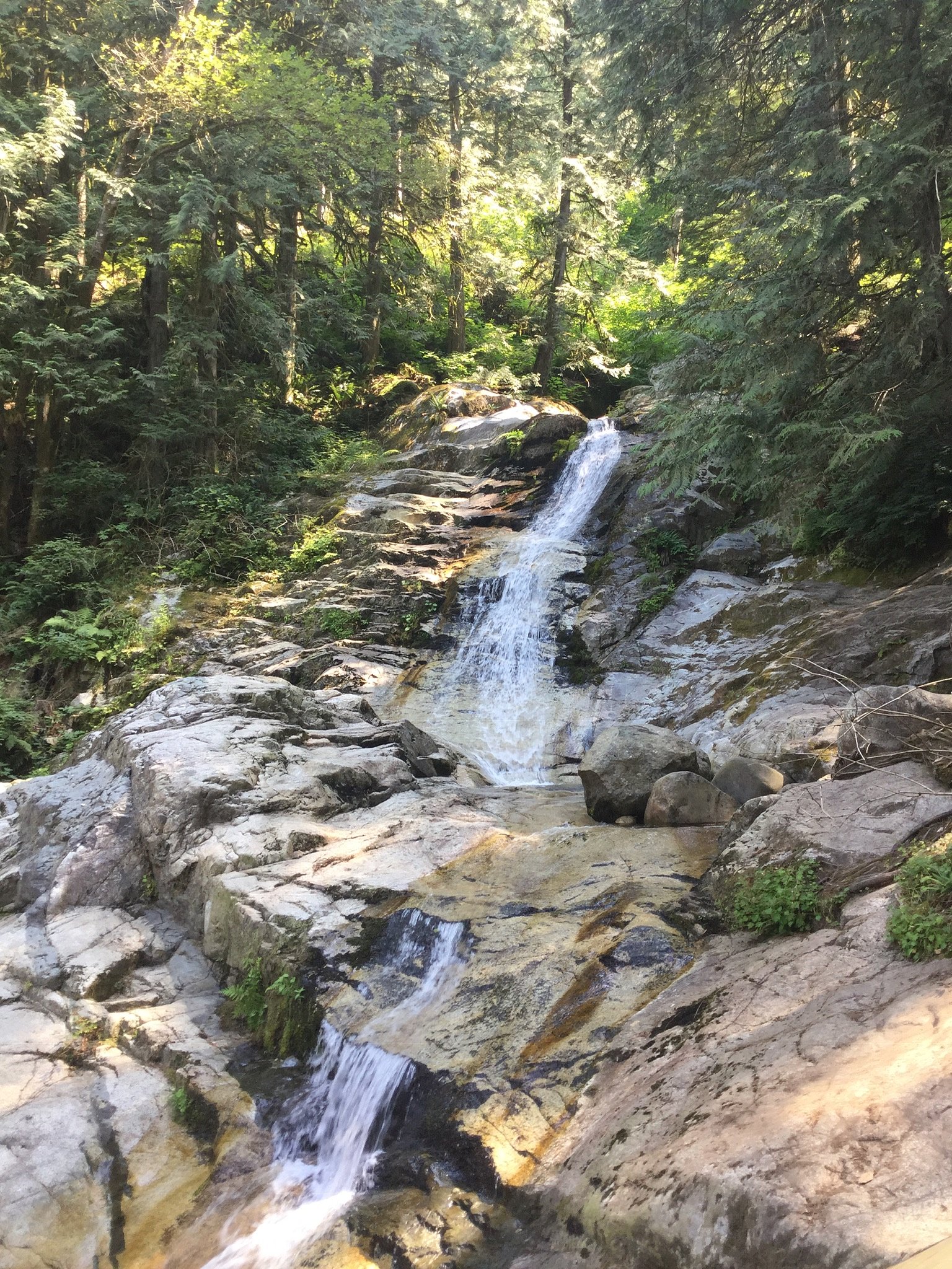
About Sweat Team Falls
Sweat Team Falls appears to be a small, relatively obscure cascade located near the Canada–US border in the Abbotsford/Langley area of British Columbia (coords: 49.3422, -122.7272). Available information about the feature is limited; it may be a seasonal or low-volume fall on a small creek and is not widely documented on major park maps. Access routes and formal facilities are not well established in public sources, so visits often involve unmaintained paths or short off-trail approaches. Treat descriptions here as conservatively phrased guidance rather than definitive directions.
The Setting
Sweat Team Falls sits at 871 metres within Pinecone Burke Park, in the hills of British Columbia.
Why This Waterfall Exists
Sweat Team Falls flows over hard intrusive rock laid down about 145-162 million years ago. These resistant rocks form a durable ledge that water cannot easily wear away, creating the falls where softer material downstream has already eroded.
Nearby Falls Worth Visiting
Crystal Falls (12 m) lies 3.9 kilometres to the southwest.
Trail & Hike Details
Trail Description
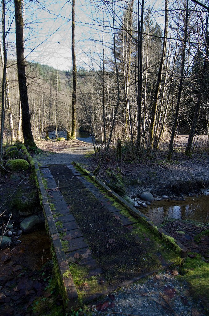
There is no widely published, maintained trail to Sweat Team Falls in major trail databases. Visiting likely involves following a logging/secondary road to a nearby creek, then a short bushwhack to the stream. Terrain may include muddy/steep banks, dense understory (brambles/blackberry), and fallen logs. Expect route-finding and hands-on scrambling near the stream; approach times will vary depending on exact access point.
What to Expect
A small, possibly seasonal cascade on a minor creek. Flow is likely highest in spring and after heavy rain; midsummer flows may be low. The site is unlikely to have infrastructure (lookouts, railings, trail signs). Surroundings may be rural or semi-forested with mixed second-growth forest, blackberry and brush, and nearby agricultural or logged land. Cell service may be intermittent in some spots.
Accessibility
The trail involves steep, uneven terrain with significant elevation change and is not accessible to mobility devices.
Frequently Asked Questions
🐶 Are Dogs Allowed at Sweat Team Falls?
❌ Dogs are not allowed
Are There Any Fees or Permits Required?
🆖 No fees required
🏊 Is There Swimming at Sweat Team Falls?
❌ Swimming is not allowed
When to Visit
Late spring to early summer for highest flows and greener surroundings; fall after rains can also show good flow. Winter visits are possible but expect icy, muddy and hazardous conditions; use extra caution or avoid in freeze-thaw conditions.
Seasonal Access
The best time to visit is Spring, Summer, Fall, and Winter. Check with Pinecone Burke Park for current conditions.
Safety Information
Exercise caution: unstable banks and slippery rocks near the falls can cause falls or serious injury. High flows in spring or after heavy rain increase hazard; avoid getting too close to edges. Brush and blackberry thickets can cause cuts and obscure footing. Portions of any approach may cross private property, trespassing can result in confrontation or legal issues. Cell service may be spotty; carry navigation aids and emergency supplies. If uncertain about route or safety, choose a better-documented waterfall with maintained trails.
Current Water Conditions
0.1 m³/s
Current discharge — how much water is flowing
Much lower than usual for this time of year
Based on 16 years of record
3.12 m
Water depth at gauge
7-Day Discharge Trend
What does this mean for your visit?
Flow is well below normal for this time of year, so the waterfall may be a trickle.
About This Gauge
7-Day Flow Outlook
Based on the WSC gauge OR CREEK NEAR COQUITLAM (2 km away).
Today
Barely Flowing
0.1 m³/s
4/10Tomorrow
Barely Flowing
0.1 m³/s
4/10Tue
Barely Flowing
0.1 m³/s
4/10Wed
Barely Flowing
0.1 m³/s
4/10Thu
Barely Flowing
0.1 m³/s
4/10Fri
Barely Flowing
0.1 m³/s
4/10Sat
Barely Flowing
0.1 m³/s
3/10Best window: Today — barely flowing flow, cloudy (trip score 4/10).
Best time of year: this gauge typically runs highest from mid April to late May, peaking in November.
How we calculate this
This is a transparent outlook, not a precise forecast. We take the waterfall's current flow strength (how it ranks against its historical normal for today, from the nearest WSC stream gauge), carry that ranking forward along the gauge's seasonal curve, and nudge it for forecast rain. Confidence is highest for the next day or two and falls further out. Always check official conditions and your own judgment before visiting — high flows can be dangerous.
Know when to go.
Get a free email alert when waterfalls near Vancouver hit peak flow. We only send when conditions are worth the trip — no weekly newsletters, no spam.
Weather Forecast
Location & Access
Getting There
The waterfall is located near the coordinates 49.3422, -122.7272, roughly 18–22 miles from Blaine, Birch Bay and Vancouver by road. Because this waterfall is not served by a named, maintained trail in widely available sources, use detailed mapping (GPS) and check local land ownership before approaching. Access may require driving on secondary roads and a short unmarked approach; some routes in the area cross privately owned farmland or timberlands.
Get Directions on Google MapsParking
No confirmed formal parking area. Visitors should expect limited roadside parking on secondary roads if legal and safe. Do not block gates or farm access roads. If unsure, park in a legal public area and walk in.
Elevation
871 metres above sea level
Coordinates
49.342182° N, -122.727205° W
Land Management
Managed by Government of British Columbia
Visitor Tips & Gear
1) Confirm land status before entering, some nearby lands may be private or managed for timber. 2) Wear waterproof hiking boots and long pants (blackberry and bramble common). 3) Use GPS coordinates rather than relying on signs. 4) Go in a group when bushwhacking and tell someone your plan. 5) Avoid approaching the edge of wet or vegetated banks, they can be unstable. 6) Pack out all trash and follow Leave No Trace. 7) Check local trail reports or community forums for recent visitor updates.
Where to Stay
Browse vacation cabins and private rentals nearby
Unique outdoor stays — tents, yurts, and treehouses
Rent a campervan or RV for your waterfall road trip
Some links are affiliate links. We may earn a commission at no extra cost to you.
Nearby Campground
Widgeon Creek Campsite
7.2 km away
Nearby Hot Springs
Hot springs near Vancouver, British Columbia
Dorr Fumarole Field
Dorr Fumarole Field reaches 194 degrees at 8,168 feet elevation on Mount Baker's active volcanic slopes, producing superheated ...

Sherman Crater Fumaroles
Sherman Crater Fumaroles register 266 degrees Fahrenheit at 9,463 feet elevation within the active volcanic crater atop Mount B...
Baker Hot Spring
Baker Hot Spring emerges at 108 degrees Fahrenheit on US Forest Service land in Mt. Baker National Forest, flowing 59.5 degrees...
Looking for a soak after your hike? Explore more hot springs near Vancouver, British Columbia on SoakingSprings.
Explore British Columbia springsAdditional Information
Nearby Attractions
Nearby population centers include the communities around Abbotsford/Langley and border-area attractions such as Peace Arch/Peace Arch Provincial Park and coastal parks near Birch Bay. Local parks and trails in the Fraser Valley offer more reliably maintained hikes; consider established sites if you prefer marked trails.
Wildlife
Typical low-elevation Fraser Valley wildlife may be present: black-tailed deer, small mammals, a variety of songbirds and waterfowl. Rattlesnakes are not typical here, but ticks, thorny vegetation and occasional larger mammals (e.g., coyotes) can occur. Be bear-aware in spring/summer in more wooded sections, though significant bear activity is less common in heavily developed/low-elevation farmland.
Cities near Sweat Team Falls
Nearby Waterfalls
Writing about Sweat Team Falls? Embed this waterfall on your site for free.