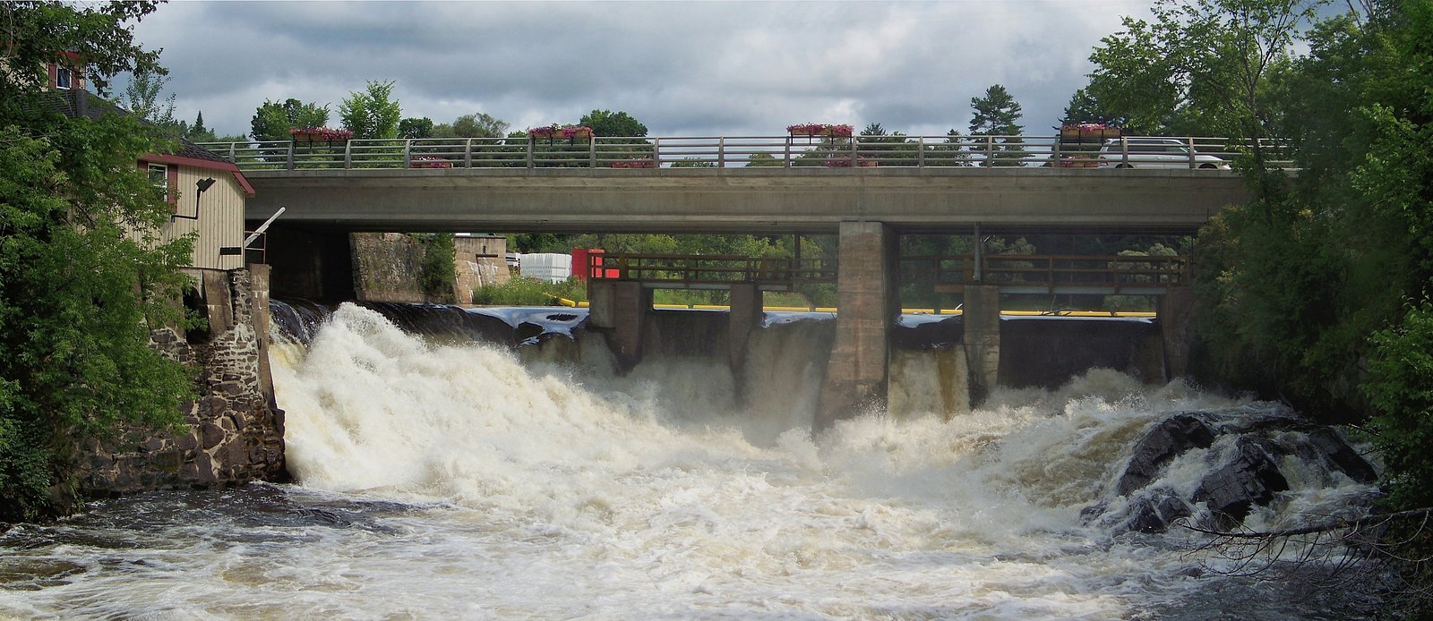
Wilsons Falls
Ontario • 10 m
By Armen Suny · Last verified Jun 2026
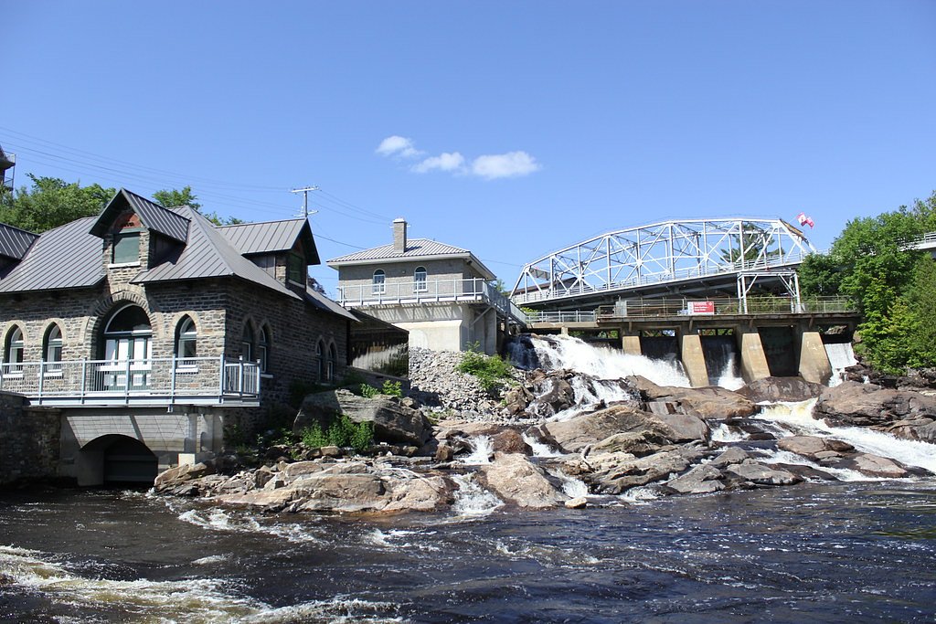
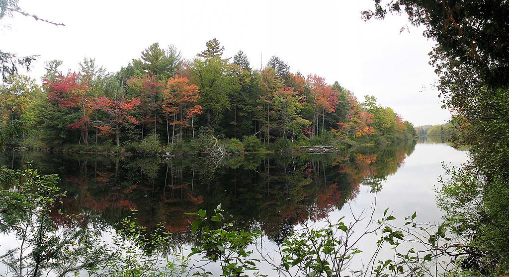
Photo Credits (3)
Difficulty
Easy
Trail Length
0.5 km
Trail Type
Out And Back
Elevation Gain
8 m
About Wilsons Falls
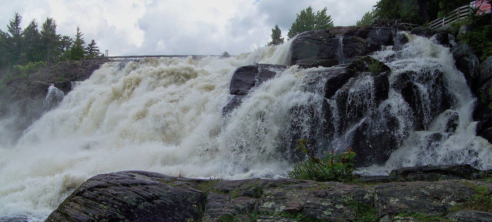
Wilsons Falls is a small cascade-style waterfall located in central Ontario (coordinates 45.0604, -79.3088), within the broader region between Orillia, Parry Sound and Barrie. The fall appears to be a modest, forest-surrounded drop on a local stream or river tributary. Flow is likely seasonal and can vary widely with spring runoff and after heavy rain. Precise official park designation and published height information appear to be limited or not widely documented; verify access and conditions with local authorities or trail reports before visiting.
The Setting
Wilsons Falls sits at 257 metres in the foothills of Ontario. The falls drop 10 metres.
Why This Waterfall Exists
Wilsons Falls flows over hard crystalline rock laid down over 1.4-1.6 billion years ago. These resistant rocks form a durable ledge that water cannot easily wear away, creating a 33-foot drop where softer material downstream has already eroded.
Nearby Falls Worth Visiting
Trethewey Falls (11 m) lies 8.5 kilometres to the southeast. Also nearby: Bracebridge Falls (10 m, 2.3 km).
Trail & Hike Details
The Approach
The easy 0.5-km out-and-back trail gains 8 metres of elevation on the way to the falls.
Trail Description
Publicly available trail information is limited. Reports suggest the falls are reached by a short, possibly unmaintained path through mixed forest and over natural terrain. Trails may include roots, rocks, wet and muddy sections, and limited or no signage. Approach routes could involve scrambling near the stream; exercise caution and wear sturdy footwear. If visiting in winter expect snow/ice and possibly steep icy approaches.
What to Expect
The falls drop 10 metres over hard crystalline rock.
Accessibility
The trail is short and relatively flat, but the surface may be uneven. Contact the managing agency for accessibility details.
Frequently Asked Questions
🐶 Are Dogs Allowed at Wilsons Falls?
❌ Dogs are not allowed
Are There Any Fees or Permits Required?
🆖 No fees required
🏊 Is There Swimming at Wilsons Falls?
❌ Swimming is not allowed
When to Visit
Spring (high flow) is best to see the falls at fuller volume. Fall offers good foliage color for photography. Summer is fine for warm-weather visits but flow may be lower. Winter can be scenic if frozen but icy approaches can be hazardous, only attempt with appropriate gear.
Seasonal Access
The best time to visit is Spring, Summer, Fall, and Winter. Check with the managing park or local authority for current conditions.
Safety Information
Hazards include slippery and unstable rock and river edges, variable water flow, fast currents after heavy rain or during spring melt, ticks, and limited cell coverage. Winter ice can be fragile, frozen falls can be dangerous. Use caution near water, avoid high-risk photography stunts near edges, and check recent trip reports or local authorities for current conditions before visiting.
Current Water Conditions
9.8 m³/s
Current discharge — how much water is flowing
About average for this time of year
Based on 109 years of record
0.85 m
Water depth at gauge
7-Day Discharge Trend
What does this mean for your visit?
Flow is about average for this time of year.
About This Gauge
This gauge is on a nearby waterway and may not reflect exact conditions at the falls.
7-Day Flow Outlook
Based on the WSC gauge NORTH BRANCH MUSKOKA RIVER AT PORT SYDNEY (17 km away).
Today
Moderate
9.9 m³/s
8/10Tomorrow
Moderate
8.8 m³/s
8/10Tue
Moderate
10 m³/s
6/10Wed
Moderate
10 m³/s
6/10Thu
Moderate
9.4 m³/s
8/10Fri
Moderate
9.3 m³/s
6/10Sat
Moderate
9.7 m³/s
8/10Best window: Today — moderate flow, partly cloudy (trip score 8/10).
Best time of year: this gauge typically runs highest from mid March to late May, peaking in April.
How we calculate this
This is a transparent outlook, not a precise forecast. We take the waterfall's current flow strength (how it ranks against its historical normal for today, from the nearest WSC stream gauge), carry that ranking forward along the gauge's seasonal curve, and nudge it for forecast rain. Confidence is highest for the next day or two and falls further out. Always check official conditions and your own judgment before visiting — high flows can be dangerous.
Know when to go.
Get a free email alert when waterfalls near Orillia hit peak flow. We only send when conditions are worth the trip — no weekly newsletters, no spam.
Weather Forecast
Location & Access
Getting There
Use the provided GPS coordinates (45.0604, -79.3088) to navigate. The site is in the central Ontario lake/forest region north of Orillia and southwest of Parry Sound. Access is likely via local secondary roads and may require driving on paved rural roads and then a short walk on an unmarked or lightly marked path. Cell service may be intermittent near the falls; download offline directions or carry a map.
Get Directions on Google MapsParking
Parking details are not well-documented. Expect limited roadside parking or a small informal pullout near the trail access. Do not block driveways or private property; if parking is not obvious, find a designated turnout or park in a nearby town and hike in. Confirm parking rules locally.
Elevation
257 metres above sea level
Coordinates
45.060445° N, -79.308818° W
Visitor Tips & Gear
1) Confirm public access before visiting, some small falls in the region can be on or adjacent to private land. 2) Wear sturdy, waterproof footwear with good traction; rocks are slippery. 3) Stay back from the edge; banks may be unstable. 4) Bring bug spray in warm months and check for ticks after your visit. 5) Respect posted signs and leave no trace. 6) Expect limited cell service; tell someone your plans. 7) Do not attempt to climb wet rock faces or jump into pools unless you are certain of depth and hazards.
As an Amazon Associate, we earn from qualifying purchases.
For this easy 0.5 km trail, lightweight trail shoes and a water bottle are usually sufficient. Icy conditions are common in winter — traction cleats are a smart addition.

Columbia Watertight II Rain Jacket
Packs into its own pocket, seam-sealed, and keeps you dry from spray and surprise rain.

Polarized Sunglasses (Knockaround)
Cuts glare off the water so you actually see the falls — and your photos turn out better too.

Earth Pak Waterproof Dry Bag
Keeps your phone and gear dry when waterfall mist soaks everything else.

Waterproof Phone Pouch (AiRunTech)
Cheap insurance — take photos right next to the falls without killing your phone.

Kahtoola MICROspikes
Cult-favorite traction cleats that grip ice and wet rock — essential for winter waterfall hikes.

JOBY GorillaPod Starter Kit
Wraps around railings and rocks for long-exposure waterfall shots — no flat surface needed.
Where to Stay
Browse vacation cabins and private rentals nearby
Unique outdoor stays — tents, yurts, and treehouses
Rent a campervan or RV for your waterfall road trip
Some links are affiliate links. We may earn a commission at no extra cost to you.
Nearby Campground
Ontario Pioneer Camp
16 km away
Additional Information
Nearby Attractions
Nearest larger communities: Orillia (~27 miles), Parry Sound (~44 miles), Barrie (~50 miles). The general region contains many lakes, provincial parks and cottage country recreation areas; verify specific nearby parks or attractions locally.
Wildlife
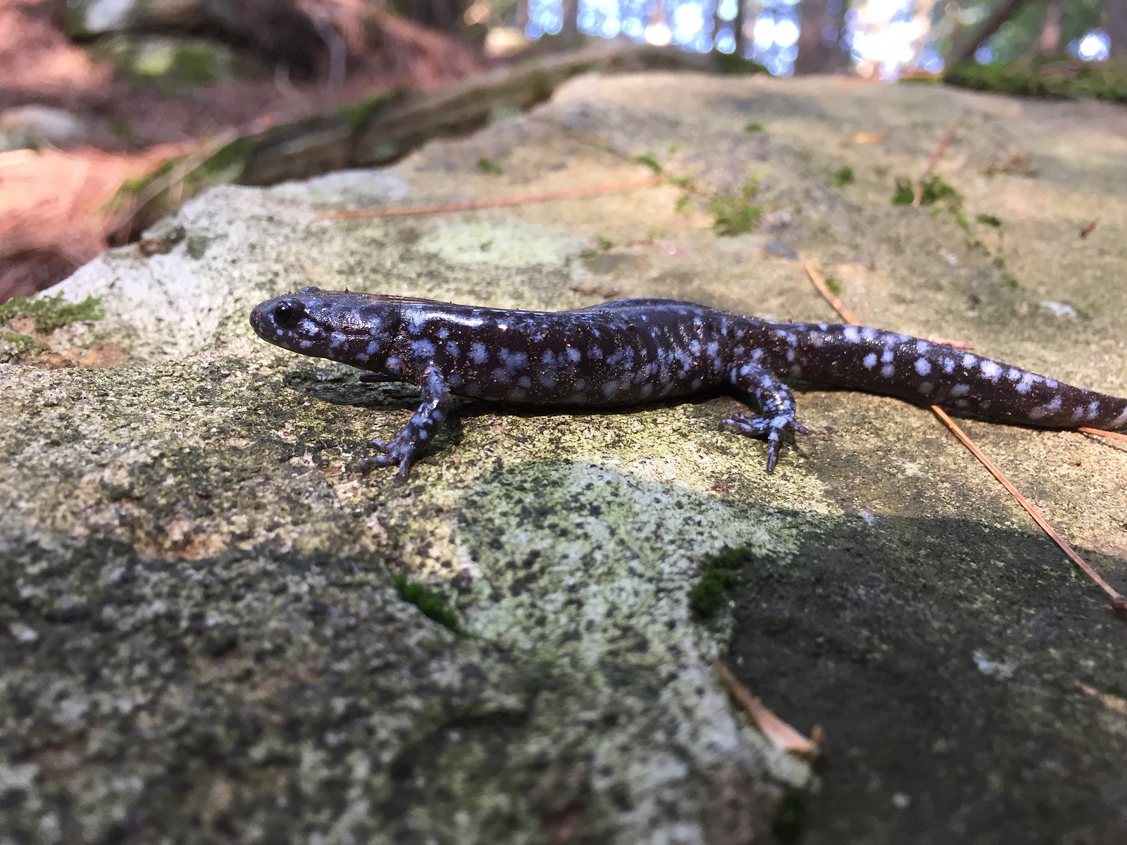
Typical central Ontario wildlife may include white-tailed deer, beavers, various waterfowl and songbirds, raccoons, and small mammals. Black bears may occur in the broader region; practice bear-aware precautions where appropriate.
Cities near Wilsons Falls
Nearby Waterfalls

Writing about Wilsons Falls? Embed this waterfall on your site for free.