

Photo Credits (4)
Difficulty
Easy
Trail Length
0.6 km
Trail Type
Out And Back
Elevation Gain
9 m
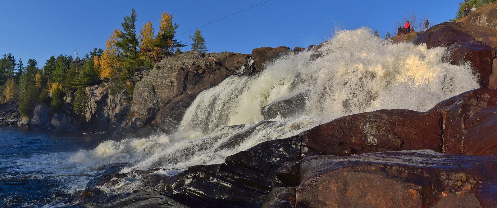
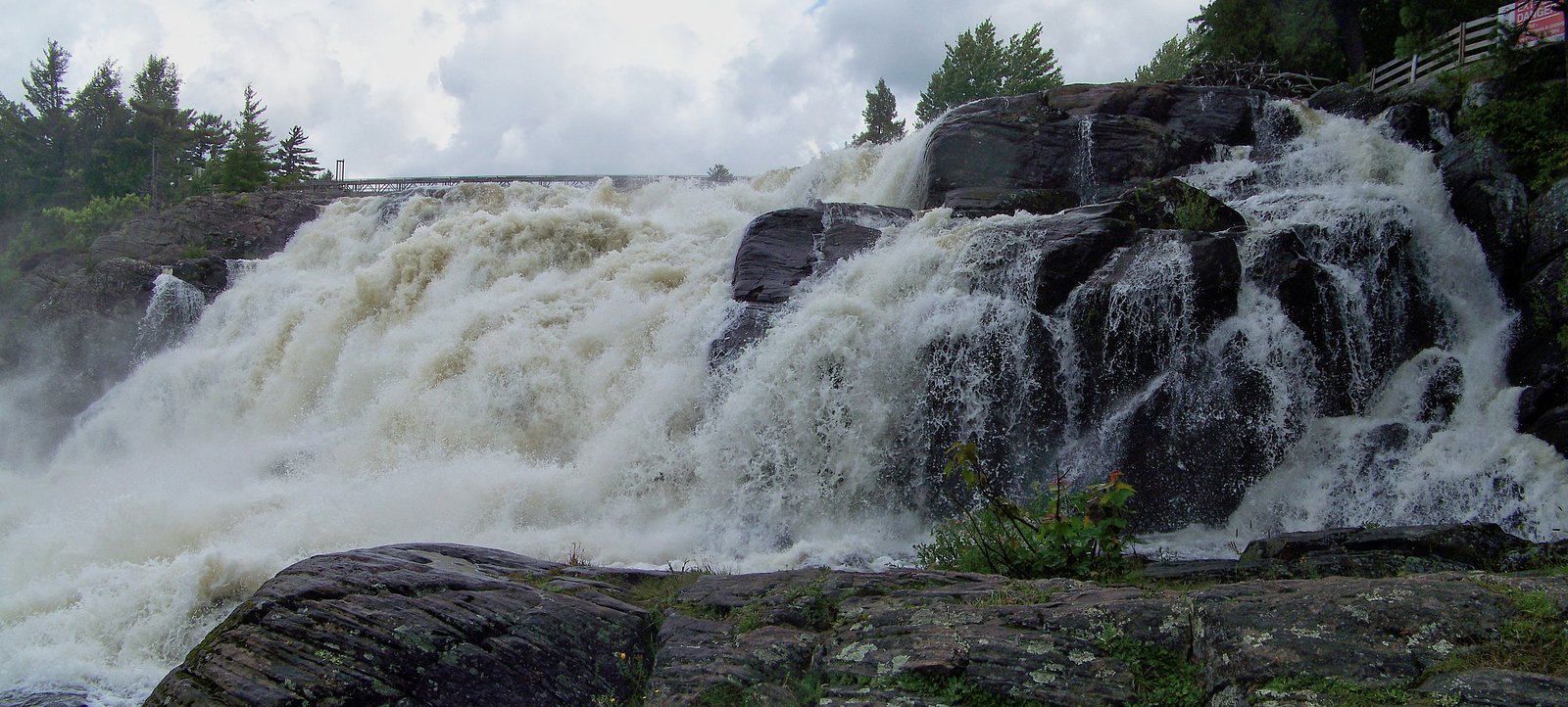
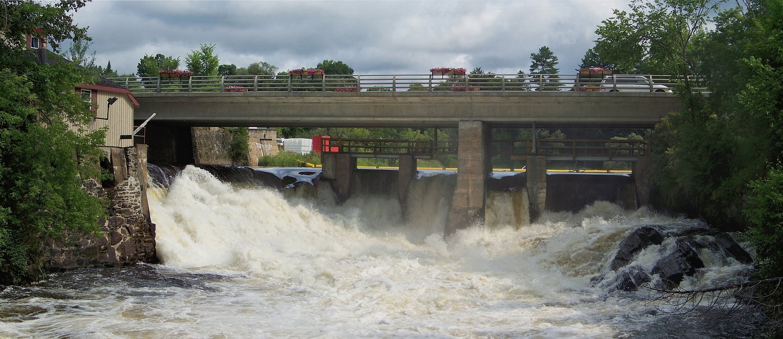
About Little High Falls
Little High Falls is a small, multi-step cascade located in central Ontario (coords 45.0875, -79.3023) roughly 28.7 miles from Orillia, 42.9 miles from Parry Sound and 51.2 miles from Barrie. The falls sit on a forested river/stream corridor and are most dramatic in spring runoff. Access appears to be via local secondary/forest roads with a short walk to the creek; signage and formal infrastructure are limited or absent. Some details about land ownership and formal access points are unclear, so visitors should approach cautiously and respect any private property or posted closures.
Why This Waterfall Exists
Little High Falls flows over hard crystalline rock laid down over 1.4-1.6 billion years ago. These resistant rocks form a durable ledge that water cannot easily wear away, creating the falls where softer material downstream has already eroded.
Nearby Falls Worth Visiting
Trethewey Falls (11 m) lies 11.3 kilometres to the south. Also nearby: Wilsons Falls (10 m, 3.1 km) and Bracebridge Falls (10 m, 5.3 km).
Trail & Hike Details
The Approach
The easy 0.6-km out-and-back trail gains 9 metres of elevation on the way to the falls.
Trail Description
The approach is typically a short, out-and-back walk over a narrow, possibly unmarked path through mixed hardwood and conifer forest. Terrain may include exposed roots, rocks and muddy sections. The final viewpoint is usually close to the waterline; there are likely no constructed viewpoints, railings or formal stairs. Trail is short but can be slippery near the stream.
What to Expect
A small, scenic cascade with multiple steps or drops, best in spring and after rains. Expect a natural, undeveloped setting, rock ledges, tree cover and limited clearings. Water levels vary seasonally. There may be only one main spot to view the falls; upstream and downstream sections offer additional cascades but can be harder to reach. Cell service may be spotty.
Accessibility
The trail is short and relatively flat, but the surface may be uneven. Contact the managing agency for accessibility details.
Frequently Asked Questions
🐶 Are Dogs Allowed at Little High Falls?
❌ Dogs are not allowed
Are There Any Fees or Permits Required?
🆖 No fees required
🏊 Is There Swimming at Little High Falls?
❌ Swimming is not allowed
When to Visit
Late March–May (spring melt) for highest flows and dramatic water. Early fall offers good foliage color and comfortable temperatures. Summer is fine but flows may be lower; winter can produce frozen falls but is icy and risky.
Seasonal Access
The best time to visit is Spring, Summer, Fall, and Winter. Check with the managing park or local authority for current conditions.
Safety Information
Hazards include slippery rock surfaces, fast or cold water, undercut ledges, unstable banks and limited or no cell service. Do not climb on wet ledges or attempt to stand near the edge for photos. In winter, icefall and hidden thin ice are significant risks. Respect posted signs and private property boundaries. If you are unfamiliar with the area or conditions, consider going with someone who knows the route.
Current Water Conditions
9.8 m³/s
Current discharge — how much water is flowing
About average for this time of year
Based on 109 years of record
0.85 m
Water depth at gauge
7-Day Discharge Trend
What does this mean for your visit?
Flow is about average for this time of year.
About This Gauge
This gauge is on a nearby waterway and may not reflect exact conditions at the falls.
7-Day Flow Outlook
Based on the WSC gauge NORTH BRANCH MUSKOKA RIVER AT PORT SYDNEY (14 km away).
Today
Moderate
9.9 m³/s
9/10Tomorrow
Moderate
8.8 m³/s
8/10Tue
Moderate
10 m³/s
6/10Wed
Moderate
10 m³/s
6/10Thu
Moderate
9.4 m³/s
8/10Fri
Moderate
9.3 m³/s
6/10Sat
Moderate
9.7 m³/s
8/10Best window: Today — moderate flow, mainly sunny (trip score 9/10).
Best time of year: this gauge typically runs highest from mid March to late May, peaking in April.
How we calculate this
This is a transparent outlook, not a precise forecast. We take the waterfall's current flow strength (how it ranks against its historical normal for today, from the nearest WSC stream gauge), carry that ranking forward along the gauge's seasonal curve, and nudge it for forecast rain. Confidence is highest for the next day or two and falls further out. Always check official conditions and your own judgment before visiting — high flows can be dangerous.
Know when to go.
Get a free email alert when waterfalls near Orillia hit peak flow. We only send when conditions are worth the trip — no weekly newsletters, no spam.
Weather Forecast
Location & Access
Getting There
Use the coordinates (45.0875, -79.3023) in a GPS device or mapping app. From Orillia/Parry Sound/Barrie follow local secondary roads and forest/seasonal roads toward the river valley indicated by the coordinates. Final access may be by an unmarked pullout or short forest road; there may be informal footpaths. Confirm route and land access locally before visiting and avoid crossing posted private property.
Get Directions on Google MapsParking
Parking is likely informal (small pullout or shoulder). Expect limited or no formal parking lot, no restroom facilities, and possibly uneven ground. Park well off the roadway and avoid blocking gates or drives.
Elevation
260 metres above sea level
Coordinates
45.087474° N, -79.302254° W
Visitor Tips & Gear
1) Wear sturdy, waterproof footwear with good traction; rocks near the falls are slippery. 2) Use GPS coordinates and confirm local access before you go, portions of the approach may cross private land. 3) Avoid going onto wet ledges; strong currents and undercut rocks can be hazardous. 4) Pack out all trash and follow Leave No Trace. 5) Bring insect repellent in summer and check for ticks. 6) If visiting in winter, expect ice and very slippery conditions, do not attempt without proper gear.
As an Amazon Associate, we earn from qualifying purchases.
For this easy 0.6 km trail, lightweight trail shoes and a water bottle are usually sufficient. Icy conditions are common in winter — traction cleats are a smart addition.

Columbia Watertight II Rain Jacket
Packs into its own pocket, seam-sealed, and keeps you dry from spray and surprise rain.

Polarized Sunglasses (Knockaround)
Cuts glare off the water so you actually see the falls — and your photos turn out better too.

Earth Pak Waterproof Dry Bag
Keeps your phone and gear dry when waterfall mist soaks everything else.

Waterproof Phone Pouch (AiRunTech)
Cheap insurance — take photos right next to the falls without killing your phone.

Kahtoola MICROspikes
Cult-favorite traction cleats that grip ice and wet rock — essential for winter waterfall hikes.

JOBY GorillaPod Starter Kit
Wraps around railings and rocks for long-exposure waterfall shots — no flat surface needed.
Where to Stay
Browse vacation cabins and private rentals nearby
Unique outdoor stays — tents, yurts, and treehouses
Rent a campervan or RV for your waterfall road trip
Some links are affiliate links. We may earn a commission at no extra cost to you.
Nearby Campground
Ontario Pioneer Camp
13 km away
Additional Information
Nearby Attractions
Georgian Bay and the larger Muskoka/Parry Sound recreational areas are within driving distance. Orillia and Barrie offer visitor services, parks and lake access. Specific nearby parks or trail systems should be checked on local tourism or municipal websites.
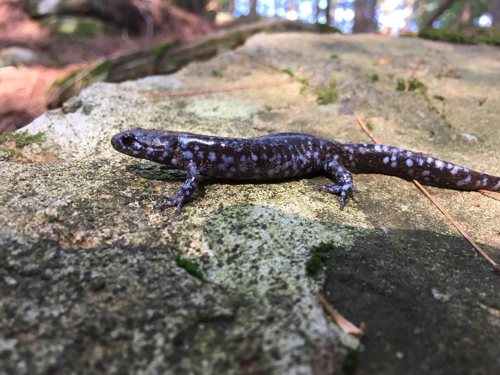
Wildlife
Expect typical central Ontario wildlife: white-tailed deer, beaver, raccoon, a variety of songbirds and waterfowl. Black bears and moose may occur in the wider region, practice standard wildlife safety and store food securely.
Cities near Little High Falls
Nearby Waterfalls
Writing about Little High Falls? Embed this waterfall on your site for free.