Upper Stotan Falls
By Armen Suny · Last verified Jun 2026
Difficulty
Drive Up
Trail Length
0.2 km
About Upper Stotan Falls
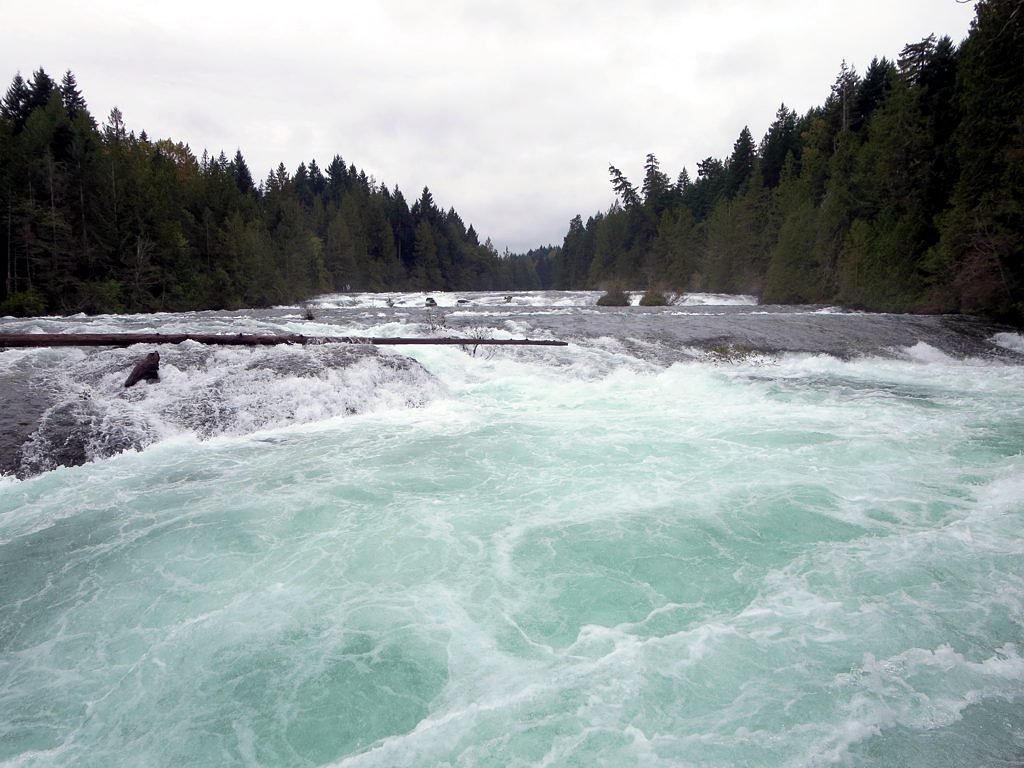
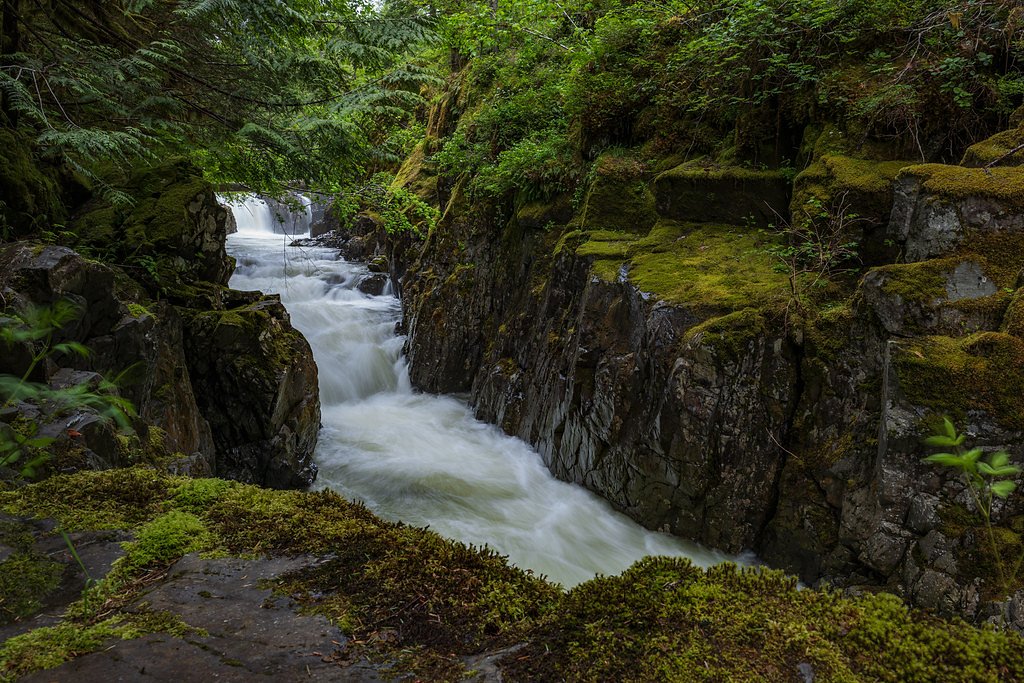
Upper Stotan Falls is a remote, likely multi-tiered waterfall on Vancouver Island near Courtenay, British Columbia (coordinates 49.6807, -125.0649). The feature is in a forested, rugged area commonly accessed by secondary/forestry roads and unmaintained trails. Specific published information about the falls (official park listing, maintained trail, or formal viewpoints) is limited; route-finding and off-trail travel may be required to reach the upper tiers. Visitors should treat details that follow as conservative, and check local sources (regional forestry maps, local hiking forums or AllTrails) before travel.
Why This Waterfall Exists
Upper Stotan Falls flows over layered sedimentary rock laid down about 66-101 million years ago. Over time, the stream has worn through these layers at different rates, creating the step that forms the waterfall.
Trail & Hike Details
The Approach
No hiking required. Upper Stotan Falls is accessible by vehicle with a roadside viewing area.
Trail Description
There does not appear to be a well-documented, maintained trail to Upper Stotan Falls. Expect route-finding on old logging roads, overgrown tracks, or off-trail travel through forest and steep terrain. Approaches near waterfalls are often steep, wet, and slippery; there may be short bushwhacks, stream crossings, and sections with loose rock or talus. If a lower or main Stotan Falls trail exists, the 'upper' falls are typically reached by continuing upstream from the main cascade on unmaintained terrain.
What to Expect
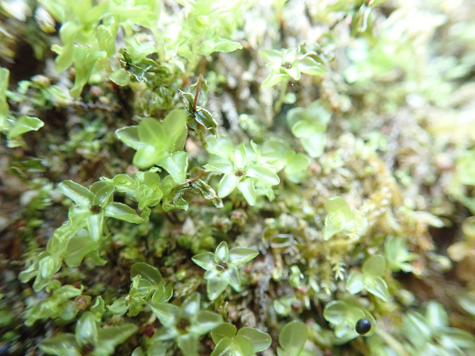
A remote, forested setting with moss-covered rocks, dense conifer trees, and typical coastal Vancouver Island undergrowth (ferns, salal, devil's club). Water flow will be highest in spring and after heavy rains; summer flow can be reduced. Expect limited cell service, possible muddy or washed-out sections on approach roads, and no facilities (no toilets, no marked viewpoints). Wildlife in the area may include black bear, deer, and small mammals; insects can be heavy in summer.
Accessibility
This waterfall is viewable from a vehicle-accessible area. No hiking is required.
Frequently Asked Questions
🐶 Are Dogs Allowed at Upper Stotan Falls?
❌ Dogs are not allowed
Are There Any Fees or Permits Required?
🆖 No fees required
🏊 Is There Swimming at Upper Stotan Falls?
❌ Swimming is not allowed
When to Visit
Late spring to early summer for the best combination of high water flow and generally accessible roads. Early fall can also offer good flows but watch for increased rainfall. Winter and heavy-rain periods can make access roads impassable and conditions hazardous.
Seasonal Access
The best time to visit is Spring, Summer, and Fall. Winter access may be limited. Check with the managing park or local authority for current conditions.
Safety Information
Hazards include unmaintained forestry roads, limited or no signage, slippery rocks and steep drops near the falls, fast cold water, potential for flashy stream flows after rain, limited cell coverage, and active forestry operations. Use caution near cliff edges, avoid wet and mossy rocks, and be prepared for sudden weather changes. Do not rely solely on cell phones for navigation; bring physical maps and a compass. If traveling in bear country, carry bear spray and store food securely. Always tell someone your planned route and expected return time.
Current Water Conditions
2.2 m³/s
Current discharge — how much water is flowing
Much higher than usual for this time of year
Based on 50 years of record
6.11 m
Water depth at gauge
7-Day Discharge Trend
What does this mean for your visit?
The water is flowing much higher than usual, expect an impressive display.
About This Gauge
7-Day Flow Outlook
Based on the WSC gauge BROWNS RIVER NEAR COURTENAY (1 km away).
Today
Roaring
2.5 m³/s
8/10Tomorrow
Roaring
2.3 m³/s
9/10Tue
Roaring
2.3 m³/s
8/10Wed
Roaring
2.1 m³/s
8/10Thu
Roaring
2.0 m³/s
6/10Fri
Roaring
1.9 m³/s
6/10Sat
Roaring
1.7 m³/s
8/10Best window: Tomorrow — roaring flow, sunny (trip score 9/10).
Best time of year: this gauge typically runs highest from early April to mid June, peaking in May.
How we calculate this
This is a transparent outlook, not a precise forecast. We take the waterfall's current flow strength (how it ranks against its historical normal for today, from the nearest WSC stream gauge), carry that ranking forward along the gauge's seasonal curve, and nudge it for forecast rain. Confidence is highest for the next day or two and falls further out. Always check official conditions and your own judgment before visiting — high flows can be dangerous.
Know when to go.
Get a free email alert when waterfalls near Courtenay hit peak flow. We only send when conditions are worth the trip — no weekly newsletters, no spam.
Weather Forecast
Location & Access
Getting There
Upper Stotan Falls is located at approximately 49.6807, -125.0649 on northern Vancouver Island. Nearest towns: Courtenay ~2.9 miles (as-the-crow-flies), Campbell River ~24.2 miles, Powell River ~31.7 miles (across water). Access likely involves driving on Highway 19 or local access roads and then on secondary/forestry logging roads; a high-clearance vehicle may be beneficial and some sections may require hiking from an informal pullout. Expect limited signage and little to no maintained trailhead infrastructure. Confirm current road conditions and closures with local authorities before heading out.
Get Directions on Google MapsParking
Parking is likely informal (small pullouts or at the end of a forestry road). There may be no official parking lot; park only where safe and legal. If you must park on a roadside pullout, avoid blocking gates or access for forestry operations.
Elevation
77 metres above sea level
Coordinates
49.680658° N, -125.064948° W
Visitor Tips & Gear
• Check up-to-date local maps, forestry road status, and recent trip reports (AllTrails, local hiking forums) before travel. • Use a high-clearance vehicle for forestry roads; chains or 4x4 may be needed in poor conditions. • Wear sturdy, waterproof boots and bring navigation tools (map, compass, GPS). • Expect low or no signage; route-finding skills are helpful. • Avoid approaching slippery cliff edges and wet rocks near the falls. • Respect private property and active logging operations; do not block gates. • Tell someone your plans and expected return time. Carry a first-aid kit and emergency gear.
Where to Stay
Browse vacation cabins and private rentals nearby
Unique outdoor stays — tents, yurts, and treehouses
Rent a campervan or RV for your waterfall road trip
Some links are affiliate links. We may earn a commission at no extra cost to you.
Nearby Campground
Camp Gilwell
1.5 km away
Additional Information
Nearby Attractions
Courtenay and Comox Valley (amenities, trails), Strathcona Provincial Park (to the west/southwest), Elk Falls Provincial Park (near Campbell River), local coastal viewpoints and hiking trails. Exact proximity to specific parks should be confirmed on maps.
Wildlife
Black bear, black-tailed deer, cougars (rare), small mammals, and numerous bird species. Typical coastal-Island insects (mosquitoes, blackflies, ticks) in warmer months. Practice bear awareness and food storage.
Cities near Upper Stotan Falls
Nearby Waterfalls

Writing about Upper Stotan Falls? Embed this waterfall on your site for free.