
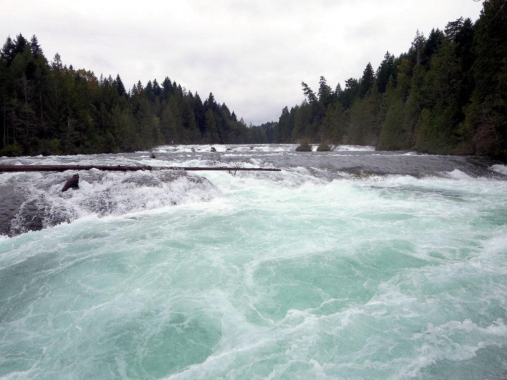
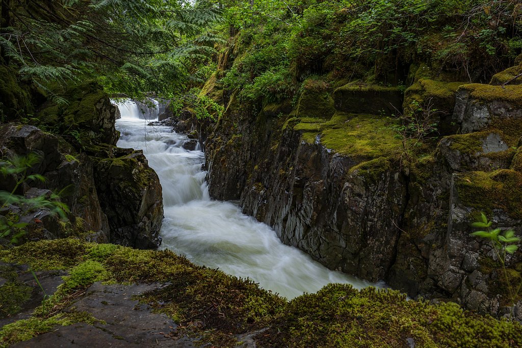
Browns River Falls
By Armen Suny · Last verified Jun 2026
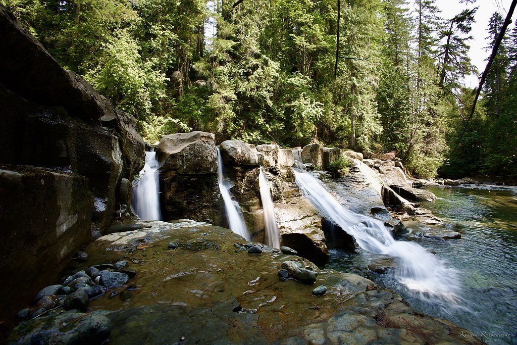
Photo Credits (5)
Difficulty
Moderate
Trail Length
1.3 km
Trail Type
Out And Back
Elevation Gain
64 m
About Browns River Falls
Browns River Falls is a small waterfall on Vancouver Island, British Columbia, located near Courtenay (coordinates: 49.6922, -125.0623). It appears to be a coastal-forest cascade on a smaller river/creek feeding into the Comox Valley drainage. Public information about the site is limited; access may be via a short forest/woods trail or informal roadside access. Flow is likely seasonal to year-round but higher in spring and after rain. Specifics such as exact height and formal trail infrastructure are not well-documented and may vary by source.
Why This Waterfall Exists
Browns River Falls flows over layered sedimentary rock laid down about 66-101 million years ago. Over time, the stream has worn through these layers at different rates, creating the step that forms the waterfall.
Trail & Hike Details
The Approach
The moderate 1.3-km out-and-back trail gains 64 metres of elevation on the way to the falls.
Trail Description
Detailed, mapped trail descriptions are not widely available for Browns River Falls. Expect an unmarked or lightly used path through coastal Douglas-fir and mixed forest that may include short steep or muddy sections and occasional rock scrambling near the stream. Trails may be informal and not maintained; route-finding skills and sturdy footwear are recommended. If there is a short access spur from a road, the approach may be under 2 miles round-trip, but this is not verified.
What to Expect
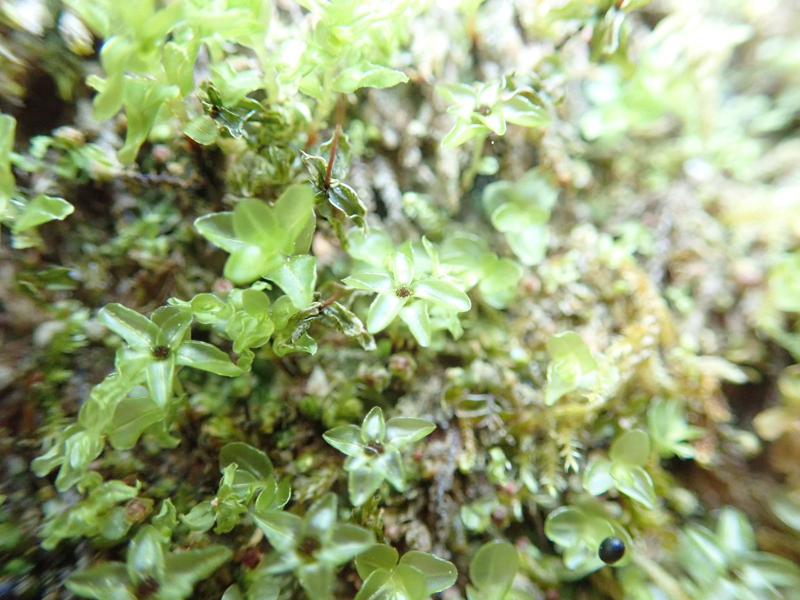
A small to medium cascade or tiered fall set in coastal forest. Surroundings are likely mossy, wet, and muddy, with fallen logs and native understory. Water levels will vary, highest in spring and after rain, lower in late summer. Facilities (toilets, benches, signage) are likely absent. Cell reception may be intermittent depending on carrier and exact location.
Accessibility
The trail is not wheelchair accessible. Uneven terrain and elevation changes require steady footing.
Frequently Asked Questions
🐶 Are Dogs Allowed at Browns River Falls?
❌ Dogs are not allowed
Are There Any Fees or Permits Required?
🆖 No fees required
🏊 Is There Swimming at Browns River Falls?
❌ Swimming is not allowed
When to Visit
Late spring and early summer for strongest flows and lush forest; fall can offer good color and still decent flow. Late summer may have reduced flow. Avoid visiting during or immediately after heavy storms unless experienced with wet, slippery terrain.
Seasonal Access
The best time to visit is Spring, Summer, and Fall. Winter access may be limited. Check with the managing park or local authority for current conditions.
Safety Information
Expect slippery rocks, unstable or eroding banks, and unmaintained footpaths. Cold water and undertows can be hazardous. Cell coverage may be unreliable; tell someone your plan and expected return time. Watch for wildlife and avoid surprising animals. Check for logging activity or private property, some access routes in the region can be on or adjacent to active forestry land and may be seasonally closed. Use caution during high water or storm conditions.
Current Water Conditions
2.2 m³/s
Current discharge — how much water is flowing
Much higher than usual for this time of year
Based on 50 years of record
6.11 m
Water depth at gauge
7-Day Discharge Trend
What does this mean for your visit?
The water is flowing much higher than usual, expect an impressive display.
About This Gauge
7-Day Flow Outlook
Based on the WSC gauge BROWNS RIVER NEAR COURTENAY (1 km away).
Today
Roaring
2.2 m³/s
8/10Tomorrow
Roaring
2.0 m³/s
9/10Tue
Roaring
2.0 m³/s
8/10Wed
Roaring
1.9 m³/s
8/10Thu
Roaring
1.8 m³/s
6/10Fri
Roaring
1.7 m³/s
6/10Sat
Roaring
1.5 m³/s
8/10Best window: Tomorrow — roaring flow, sunny (trip score 9/10).
Best time of year: this gauge typically runs highest from early April to mid June, peaking in May.
How we calculate this
This is a transparent outlook, not a precise forecast. We take the waterfall's current flow strength (how it ranks against its historical normal for today, from the nearest WSC stream gauge), carry that ranking forward along the gauge's seasonal curve, and nudge it for forecast rain. Confidence is highest for the next day or two and falls further out. Always check official conditions and your own judgment before visiting — high flows can be dangerous.
Know when to go.
Get a free email alert when waterfalls near Courtenay hit peak flow. We only send when conditions are worth the trip — no weekly newsletters, no spam.
Weather Forecast
Location & Access
Getting There
Browns River Falls is located on eastern Vancouver Island near Courtenay (approx. 3.1 miles from Courtenay city center, ~23.8 miles from Campbell River). Use the coordinates 49.6922, -125.0623 to locate the site. Approaches may require driving on local or forestry roads and then following an informal or unmaintained trail; exact public access points are not consistently documented. Visitors should consult local maps, recent trip reports, or local parks/forest service before going.
Get Directions on Google MapsParking
Parking is likely limited, possibly roadside or a small informal pullout. There may not be a formal parking lot, signage, or facilities. Park well off the travel lane and avoid blocking gates or driveways.
Elevation
97 metres above sea level
Coordinates
49.692203° N, -125.062309° W
Visitor Tips & Gear
• Use the provided coordinates and check recent trip reports or local guide resources before visiting. • Wear waterproof hiking boots with good traction; expect muddy, slippery approaches. • Bring a map, GPS or downloaded offline maps; trails may be unmarked. • Leave no trace: pack out all trash and avoid damaging vegetation or stream banks. • Park safely off the road and away from gates. • Check for seasonal logging activity or private property boundaries and respect closures.
As an Amazon Associate, we earn from qualifying purchases.
With 1.3 km and 64 m of elevation gain, sturdy boots and trekking poles will help on this moderate trail. Sun exposure on the trail makes good sun protection a must in summer.

Polarized Sunglasses (Knockaround)
Cuts glare off the water so you actually see the falls — and your photos turn out better too.

Columbia Watertight II Rain Jacket
Packs into its own pocket, seam-sealed, and keeps you dry from spray and surprise rain.

Earth Pak Waterproof Dry Bag
Keeps your phone and gear dry when waterfall mist soaks everything else.

Waterproof Phone Pouch (AiRunTech)
Cheap insurance — take photos right next to the falls without killing your phone.

Timberland Euro Sprint Mid Waterproof
Trusted waterproof boot with premium leather and grippy rubber sole — reliable on rocky, wet trails.

TrailBuddy Trekking Poles
Lightweight aluminum, cork grips, and flip-locks that actually hold — a best-seller for good reason.
Where to Stay
Browse vacation cabins and private rentals nearby
Unique outdoor stays — tents, yurts, and treehouses
Rent a campervan or RV for your waterfall road trip
Some links are affiliate links. We may earn a commission at no extra cost to you.
Nearby Campground
Camp Gilwell
0.9 km away
Additional Information
Nearby Attractions
Comox Valley (Courtenay, Comox), Mount Washington Provincial Park (alpine recreation), beaches along the eastern Vancouver Island shoreline, and regional trails and parks in the Comox Valley and Campbell River areas. Ferries provide access to nearby islands (Denman, Hornby) and mainland.
Wildlife
Typical coastal Vancouver Island wildlife may be present: black bear, cougar (rare), deer, small mammals, and many bird species including eagles and waterfowl. Salmon runs may occur in local streams seasonally, observe posted restrictions and avoid disturbing spawning fish.
Cities near Browns River Falls
Nearby Waterfalls
Writing about Browns River Falls? Embed this waterfall on your site for free.